
The GHT, the highest, most rugged trail in the world!
In search of a grand challenge
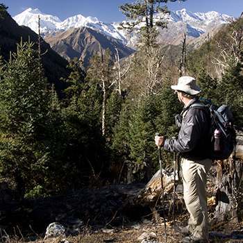
I first set my sights on the GHT after hearing how few people have done the traverse unguided, I was in search of a grand challenge. I believed beforehand that this was the most challenging trail in the world, and after completing it, I still do. My prior experience was exclusively on long distance North American trails. So I had done long hiking days, I could navigate, I knew I could last the duration of a multi month trip. But I had never done any mountaineering, never been to a country in the East, never come close to seeing mountains so big, and elevation gains so daunting. This was new, this was intense, and it lived up to everything I could have hoped for, plus more!
The journey began in early January, months before my plane was set to leave Colorado. Deciding the route, logistics planning, informing myself of the unfortunate permitting system, trying to find trip reports to read, gathering gear, and attaining new mountaineering skills were all in order. I began by checking on the monsoon season, you can trek anytime in Nepal, but the monsoon isn’t fun to walk through and best avoided. It typically begins sweeping the country starting in Kanchenjunga around early June, and ending sometime around late August. My schedule and finances I figured could be in sorted in time to make the Spring window, so the next step was to plan, and plan fast. The first thing I did for this was get the GHT guidebook and full set of maps sent to me, this was and still is the best place to start. If you don’t want to jump right into buying a full mapset, then start with the book alone, you can always use online maps to orient yourself during the planning phase. An important note on maps of Nepal, none of them can be considered wonderfully accurate by Western standards, thus the book I found is an invaluable resource for both planning and navigating.
Preparations Begin
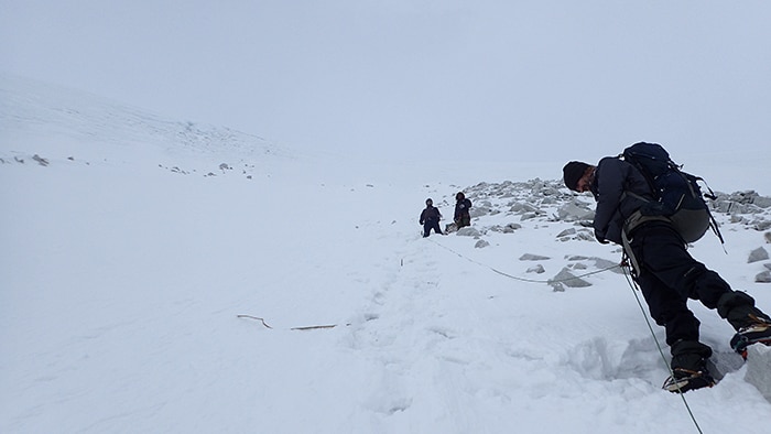
As I learned about the potential routes, I decided upon the one I would ideally be taking. It wasn’t too difficult a decision for me, I was going for a challenge so I would be taking the highest route possible. This meant I would need to learn to use crampons, an ice axe, learn to rappel, set anchors, tie knots, and educate myself on the hazards of glacial travel. It should not be looked over that learning this yourself in a short period of time is not recommended by anybody, including myself. But I used the Freedom of the Hills mountaineering textbook mixed with YouTube videos and found it adequate for my risk aversion levels, don’t die.
With the departure date closing in, I had a route, I had what I imagined were enough skills and had felt I had properly done my research. But I still had a couple of questions, questions I sent to Justin Lichter and Shawn Forry who paved the way by completing the first self-supported GHT back in 2011. They were kind enough to thoroughly answer what they could, noting that Nepal is a constantly fluctuating place and some info could be outdated. For future trekkers looking to get more recent beta, those of us who have done the trail more recently are similarly welcoming of questions to those who have done their research.
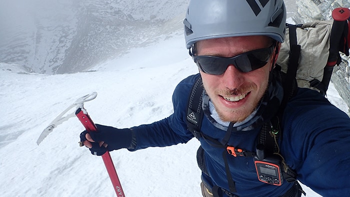
The last bits of planning seemed to drag on, how to get permits, transport options, attempting to put waypoints into my inReach, and trying to work out my timeline and resupply points. In short, the permits are hard depending on your situation, there is plenty of easy transport within the country, and waypoints can be found. I spent a fair bit of time trying to determine distances from the maps and compare it to past trips to base an itinerary off of, but distance is largely irrelevant, elevation gain and true elevation I found will be the best marker to base your speed off of. Lastly, there are more tea houses and tiny village shops than you would expect (or at least more than I did), perhaps something to keep in mind when deciding upon how much food to bring on the various sections.
I purchased my flight once work was over and planning was finalized. Mid-April I arrived in Kathmandu and began working on acquiring permits. With a mixture of luck and determination I found myself with the first of the two permit sets I would obtain, Kanchenjunga to Rolwaling. An iconically miserable 26 hour ‘local bus’ ride took me to Taplejung and the next day the journey properly began.
A GHT Christening
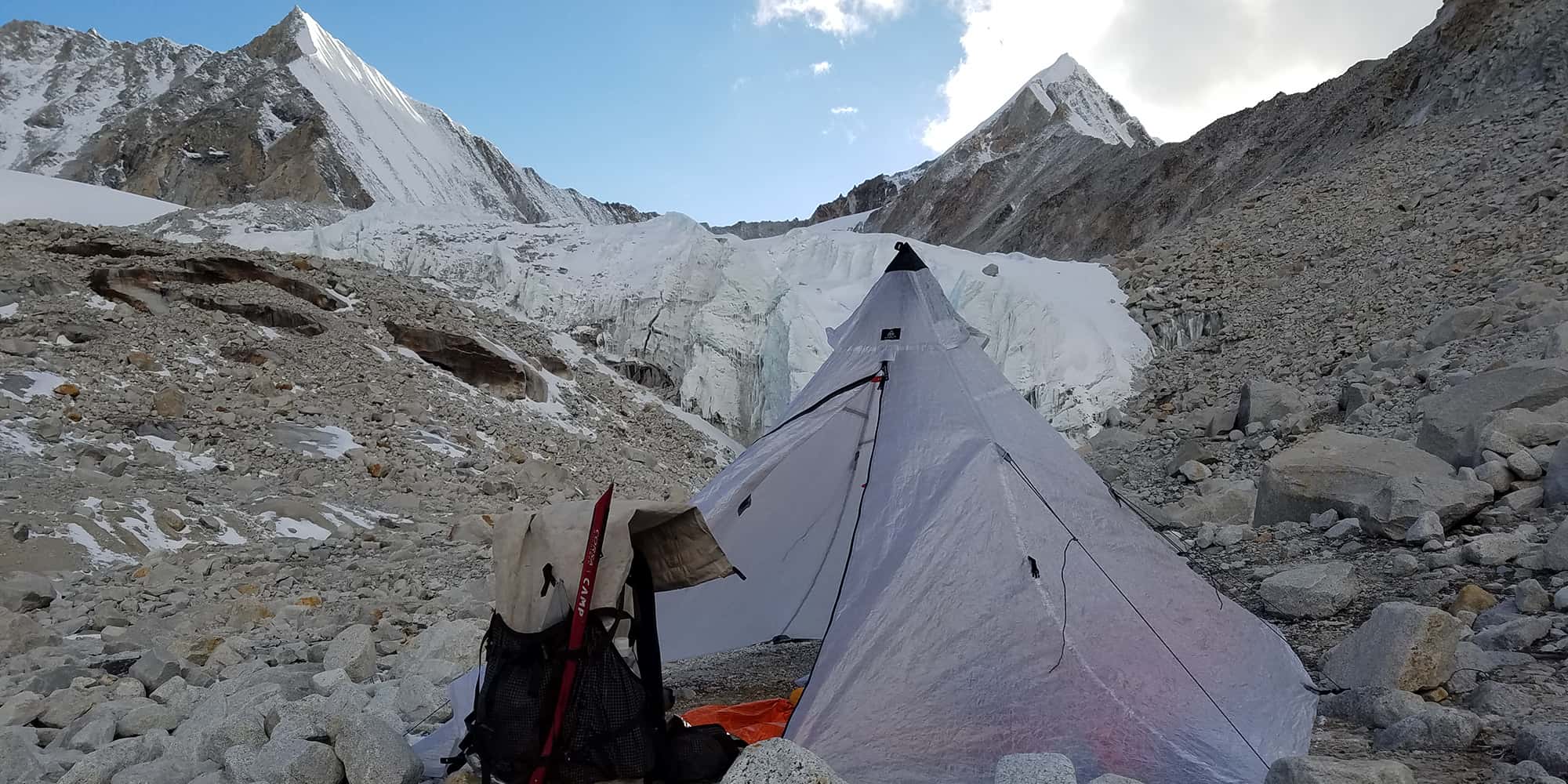
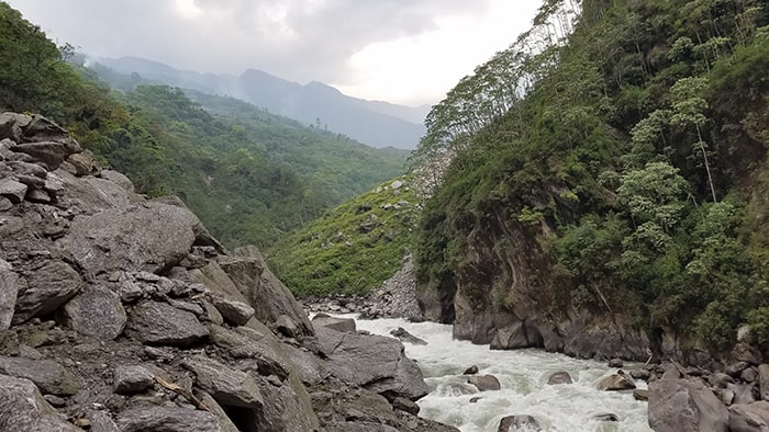
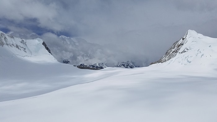
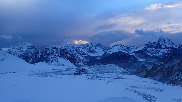
Pushing hard I was in Olanchungola in two days, and post holed over the snowy Lhumba Sambha Pass two days after that, electing to not go to Kanchenjunga Base Camp for a variety of reasons. The path over Lhumba Sambha was under deep snow and the navigation I found tricky. A mixture of questioning my route and postholing kept me at altitude longer than I should have been. It was a properly rough introduction to the Nepali alpine, one that left me with a chest infection and cough which lingered for the duration of the trip (mild altitude sickness). The terrain didn’t consider giving me a break in the lower elevations for the following days either. Steeper switchbacks than I could have imagined were possible ran into suspension bridges that sat at the bottom of 1000m climbs. When I began to feel confident, I was humbled by faint trails that disappeared in more snow on the high route, forcing me to take a low jungle route detour to get to Makalu Base Camp. Heading towards the Everest Region I was similarly humbled by the Himalaya when I nearly found myself in the bottom of a bergschrund on West Col while tagging along with a group I met the day before who did a fine job of freezing all our ropes to an icy section, of the wrong section of the pass. A useful note from both mine and others experiences, not all “guides” know what they are doing, even if they are nationally certified and swear they have been where your looking to go.
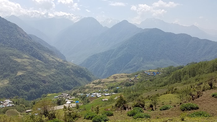
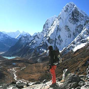
Another forced detour to Lukla via Mera La instead of Amphu Labsta had me sitting in my hotel room, exhausted, disappointed, but at least now on antibiotics for my chest and sinus infection from Lumbha Sambha. Not helping my mood, the monsoon had come early. It was early May and it had already arrived in force, cyclically clouding the valleys before 9 am. So after a guilty rest day, I charged to Everest Base Camp in a quick two days totally missing views of the giant. Was over Cho La the next day, Renjo La the one after that, throwing up the whole way after gaining a very unfortunate case of food poisoning the night before at Gokyo. It took me a solid three days to slug my depleted body over Tashi Labsta and into the village of Na. After descending the Rolwaling valley I made it to the border of Langtang. A bus brought me back to Kathmandu, it was time to get ready for round two!
Overcoming the Biggest Hurdle
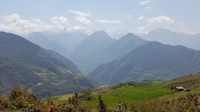
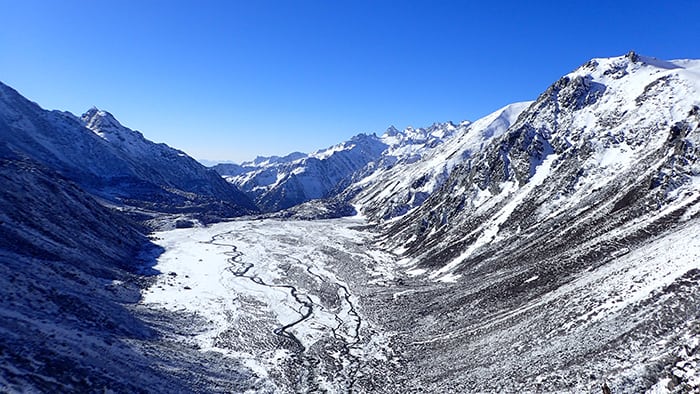
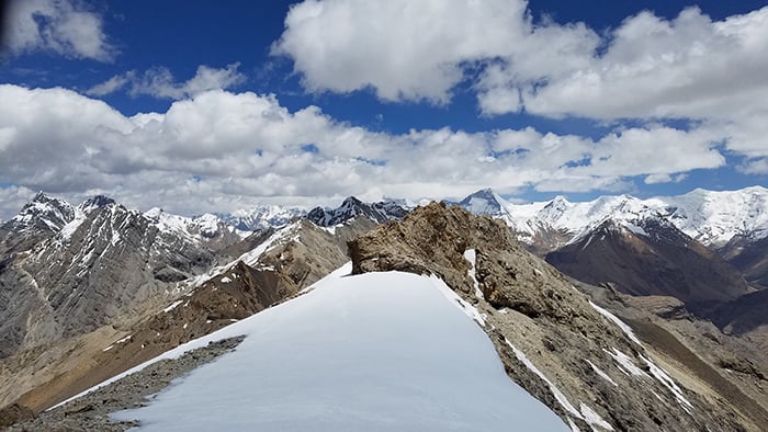
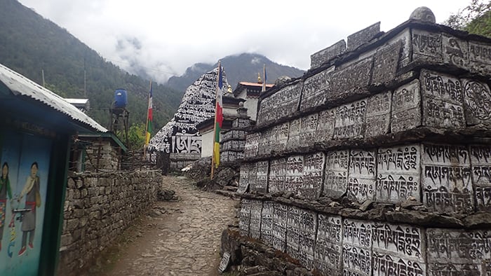
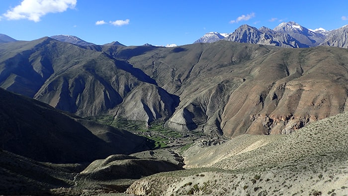
My rope was lost on West Col, and two other self-supported trekkers had gotten lost trying to find the way to it that season citing similar conditions to my unfortunate blunder before. So with my new set of permits, I decided to restart by doing the Gosaikunda Trek instead of attempting Tilmans Pass where I heard a rappel is necessary. I figured another let down would be quite the letdown, and I also just wanted to get to Annapurna where the monsoon conditions which had been a plague of viewless, snowy conditions were said to diminish in the shadow of the Annapurna Massif. Walking out of the Kathmandu valley I experienced the expected monsoonal rains all throughout Langtang. It was eye opening to be walking near the epicenter of the earthquake and to see the damage it had done. Homes, entire villages in fact, simply lay as rubble to be viewed through the eerie monsoonal mist. Nearing Manaslu, the trail had been mutilated by road construction, then when the end was reached, it became an indistinct maze of faint criss-crossing trails. Without a coating of snow, I managed to make my way in view of the Manaslu Circuit, taking more indistinct trails through tiny family farms to get to a bridge and the other side. Manaslu was beautiful, from under 1000m to over 5000m, you get to see the diversity of landscape Nepal has to offer. The only downside is the sheer volume of donkey trains that you must contend with on your way to Larkye La. The pass is as stunning as you will find, and after a handful of hours walking downhill quickly drops off onto the Annapurna Circuit, free of the monsoon! The hopeful tales didn’t lie, I had my first days of beautiful, bright blue sky as I made my way up the valley (and nothing but beautiful weather then on). Electing to detour off the main route, I took Mandala Pass to Jomsom via Tilicho Lake. Between Jomsom and Kagbeni, I took two days to collect food for Dolpo, to iron out my strategy, and get my game face on. I had now entered even more of a desertscape, I have never been to Tibet, but I felt as though this is what it must be like. The tan rugged mountains only had their monotonous color scheme broken by bright white glaciers and snow that capped them. It was beautiful, it was new, it was foreign. The trails in Dolpo are lacking to say the least, indistinct, vague, and never marked. They disappeared over the many high passes and led through river canyons crossing the icy blue torrents many times over. Temperatures were sweltering in the heat of the sun and bitter cold when it set. Remote expanses and passes that from afar look nothing short of impossible to cross without technical gear. Dolpo encapsulated every challenge I hoped to face in Nepal. The few villages that speckle the region are home to some of the most welcoming people I had the pleasure to come across, and all it takes is a couple weeks in Nepal to know how much saying that means. I traced my way through the tricky to find keyhole pass of Nyingma Gyzen La, and the following day was a long prance to Gamghadi.
The biggest hurdle, from a whole multitude of perspectives had been overcome!
I felt finished with the trip after Dolpo, and felt the urge to take a cheap bus from Gamghadi back to Kathmandu, but knew that if I didn’t go to Simikot I would regret it. The path to Simikot isn’t easy to navigate, the only saving grace is that there is an ample number of villages with locals to ask for directions from. Humbling in a different way, this section is one of the poorest regions in Nepal and there seemed to be an air of desperate hopeless. Along the way, I happily gave away all the extra food I could afford to, to a local family who was genuinely warm and welcoming. It took two and a half monstrous days, including one day with 4200m of elevation gain, to reach Simikot. I was accompanied into town by a local where we learned no flights had departed for four days. The town was full to the gills with Mt. Kailash pilgrims, fortunately my newfound friend found a restaurant where I could sleep in the back as no hotels were open.
Nepali People are Outstanding!
Even more fortunately I met Mr. Robert, owner of a tour company focusing on the Mt. Kailash pilgrimage. Here is a warning if our ever find yourself in Simikot: Airplane tickets are expensive, there is no atm, the airlines don’t take card, and there is no bank to withdraw money from. Thankfully I wasn’t stranded, Mr. Robert either knew it was my birthday, or the Universe was mistaking me for someone who deserves a miracle. Mr. Robert bought me a ticket, put me on one of the few planes that took off the next day with him and his high class guests. Then demanded I accompany them in one of their private jeeps to Nepalgunj where he organized my bus to Kathmandu, but after being treated to a dinner of course! When I attempted to repay him, I was declined. If this isn’t the best way to finish a trip and to spend a birthday, then I don’t know what is. If this doesn’t speak to the extreme hospitality and kindness you find from the people of Nepal, I don’t know what does.
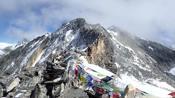
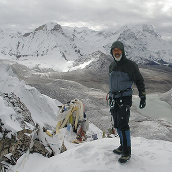
All in all, my traverse saw me cross 15 passes over 5000m with a high point of 6190m. Starting on April 23rd in Taplejung, and ending on June 20th in Simikot, it took a total of 55 days including one rest day in Lukla, one in Jomsom, and not including four in Kathmandu waiting to get the second permit set. An estimated 1,700 kilometers (1,050 miles) were covered, and an estimated 60,000+ meters (195,000+ feet) were climbed and I lost a total of 25lbs (~11kg).
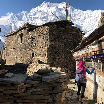
But more memorable than the accomplishment of completing the trail was the human experiences along the way. Farmers and shepherds inviting me into their humble homes for tea. Kids with smiles plastered on their faces merrily screaming “Namaste!” as I wandered by and returned the greeting. The locals all too happy to show you the way through their village, to walk with you and attempt conversation. The tea houses and owners that were honorable enough to charge me the same rate as the locals. The nights I was all too grateful to be welcomed into a warm home in the remote regions. Or when Mr. Robert saved me from being stranded, without cash, days from an extraction point. The people of Nepal are outstanding! When I think back to my time in the country I think of the mountains, the views, and the struggle of course. But I always drift back to and smile upon the memories with the people I was lucky enough to have met. It has shaped what I seek when I travel, it opened up my world and expanded my comfort zone. Most importantly, it gave me perspective, these people live out in their challenging day to day lives in what is simply a temporary challenge for those of us who wander by. Yet they smile, they are welcoming, and they are mindful. For both the highs and the lows I’ll always look back on the trip gratefully.
I’ll always have a place in my heart for Nepal.
Trevor
For more from Trev: https://www.minus33.com/blog/great-himalayan-trail-high-route/











admin
July 9, 2024 at 3:03 pm9th July, 2024
It is with great sadness that we share the news of Trevor’s passing while paragliding in Spiti, Northern India. He was an adventurous spirit who loved the mountains and we are sure he is flying high among them still.
Rest in peace.
Anonymous
July 6, 2024 at 10:34 amMay your soul rest in peace brother!
Trevor Bockstahler
January 2, 2022 at 9:32 amHey, Matt!
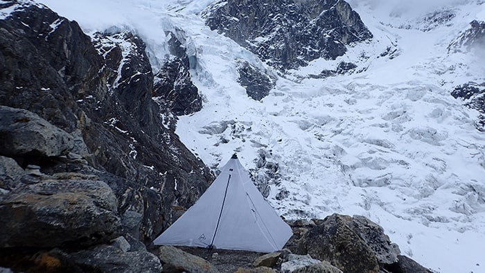
From memory it was about 75% of the time in tea houses. The popular regions had tea houses everywhere (Everest, Annapurna, Manaslu). Rowaling and Langtang I found plenty of tea houses as well, never needing to even consider pitching a tent out of necessity. It would vary based on your speed, how high your route is, and how you plan to manage the restricted regions.
Trevor Bockstahler on Facebook, you can send me a message on messenger if you want to chat about things more specific.
Best of luck,
Trevor
Matt Fioretti
January 1, 2022 at 5:59 amHello,
Can you tell me how many days you were able to eat in local homes or tea houses on the complete journey and how many days you had to carry your own food? Thank you.
Matt Fioretti