Top
 

Rara Lake

Nepal's largest lake is a wonderful trekking destination

Rara Lake

$2550 per person

Rara Lake

Nepal’s largest lake is a wonderful trekking destination

Rara Lake Trek

Rara Lake is an idyllic place; the astoundingly clear water surrounded by protected forest is a nature-lover’s dream. Add some medieval history and Chhetri and Khas culture and you have a pearl of a trek in remote west Nepal.

Is this tour for me?

Travel Style: Active with Guide in Teahouses

Hiking, trekking, adventure with a guide, and staying in teahouses.

Physical Rating: 3 - Energetic

Trail is sometimes on a rough track with obstacles and arduous sections with limited signage.

Service Level: Basic Teahouse

Comfy, family-owned teahouses with all meals provided along the trail.

Check Your Visa Requirements

Before booking, use our handy entry requirements tool so you know which documents you need to enter and travel through the countries on your trip.

Recommended Group Size

Small group experience; Max 12, Avg 2 to 8

Age requirement: 12+

All travellers under age 18 must be accompanied by an adult.

When to Trek to Rara Lake?

Nepal’s largest lake is at its prettiest during spring when wild flowers cover the forest floor. The monsoon is very unpredictable with extremely heavy rains, causing serious flooding, mixed with weeklong periods of relatively light rain. From October through to January, cold temperatures accompany clear skies for great photography. Migratory birds are common at the lake throughout the year, and there are some spotting-towers near the Park headquarters.

Rara Lake
From 10-15 days

Rara Lake

Difficulty

days

Postive Impacts

GHG Footprint of 15kg CO2e per day

Social Impacts: 60% of trek expenses support local communities directly

Why you will love this Trek

Trekking Grade: Grade 3 Energetic Stunning mountain views Super friendly villages Beautiful forests Enchanting cultures Comfy teahouses
Rara Lake Circuit Trek
Rara Lake

Rara Lake : Route Options

The Rara Lake loop trek from Jumla can be done in either direction, but is slightly easier if you start via Sinja. Connecting trails to Simikot (north, 5 days), Mugu (northeast, 3 days), Dhorpatan and Lower Dolpo (southeast, 10-12 days) and Khaptad (west, 6 days) mean you can link to many other trekking routes, including to Mt Kailash, and Saipal and Api Himals. A new dirt road runs from Jumla to Surkhet to the south if you want to explore the wild mid-hills of west Nepal.

Mugu and Far West Region Nepal Map

How can your Rara Lake Trek create positive impacts?

To help you budget and plan, we’ve made a comprehensive costing explanation on How Much Does the GHT Cost? But here’s a simplified breakdown.

Estimated Cost US$3,395

Trek cost per person (twin share)

Total GHGe per trekker

553kgCO2e

Total GHGe per trekker per day

18kgCO2e

Average per capita EU GHGe = 20kgCO2e per day (www.statistica.com)

Go Local equals positive impacts

What we do…

…make Positive Impacts

% of Trek Cost

Go Local Transport

Use Local Accommodation

Eat Local Meals

Waste Management

Highly Experienced Guide

Biodiversity

Locally supplied transport reduces drive times and fuel usage

Locally supplied accommodation reduces commissions

More nutritious, fresher ingredients, no packaging

Carry out ALL PLASTIC, avoid snacks and soda drinks

A knowledge bank for your peace and wellbeing

National Park entry fee for you and the team

Administrative and office costs

22%

38%


0%

20%

15.2%

4.8%

Do you have any questions about the trail, when to go or the costs? Please Get in Touch to ask an expert and for more details.

Bookings

Please note that www.greathimalayatrail.com does not handle bookings for treks. We are here to inform you about the trails and logistics, but you will need to book through a registered Local Operator LINK in Nepal. Get in Touch

Customisation is Normal

Want to do things a little differently? Maybe take some extra time, or go a bit faster? Or avoid the technical sections? Every GHT is different and that changes the impact and the price, but this it totally normal and your Local Operator will be able to adjust plans without problems. Get in Touch

Social and Environmental Impacts

The GHT has been designed around the principles of Responsible Sustainable Tourism and we do our very best to make sure that the GHT is good news for the locals and the environment along the trails. To walk the talk, we have pioneered the development of social impact assessment and Greenhouse Gas emissions, and environmental impacts like waste created for each trek. There is more information about how we calculate impacts at Impact of Your GHT Get in Touch

Itinerary

DAY 1: KATHMANDU – MACHHAKHOLA

After an early start, you should reach Machhakhola after lunchtime and have time to relax in the afternoon with views of the Budhi Gandaki river.

DAY 2: MACHHAKHOLA – JAGAT 6.5 HRS

We follow the dirt road north out of the village and soon reach Khorlabesi (970m, 1 hour) and then on to Tatopani (990m, 1 hour) where the waterspouts make a good washing stop. At the end of the village, cross a suspension bridge to the true left (east) bank and continue through sometimes dense forest to Dobhan (1070m, 1.5 hours), where there are teahouses.

Continue on a broad trail on the true left bank of the river to Yaruphant (1170m, 1 hour), where there are a few teashops on a broad grassy slope. From here, the trail climbs about 200m up what was once an enormous landslide that blocked the Budhi Gandaki. The trail descends a little from the top of the climb to the broad riverbed. In the trekking seasons, there are some temporary teashops (1.5 hours from Yaruphant) at the confluence of the Yara Khola.

Vertical cliffs rise on both sides of the valley as a spectacular trail continues on the true left (eastern) bank for 15 minutes to a bridge, which you cross to the true right bank and where the Budhi Gandaki has cut a narrow gorge. After a short climb and descent of 20 minutes, you reach a flat area where there is a teashop and two grassy campsites signposted ‘Jagat’. The village is 10 minutes further up the trail, behind a rocky spur. As you enter Jagat (1340m) on a good stone-paved trail, there is a community-owned campsite on your left and some teahouses before the Manaslu Conservation Area Project (MCAP) and police checkpost. Jagat is a common village name in the high mountains as it means ‘customs post’ and is the traditional tax collection point for trade to and from Tibet. 

DAY 3: JAGAT – DENG 6 HRS

Beyond the village is the Pangaur Khola, which is crossed using stepping stones and log bridges. The trail now climbs an easy gradient to a chautara (1 hour), where there are good views of Shringi Himal to the north. Descend to Sirdibas (1420m, 40 mins) and turn a sharp left turn at the end of the village to ascend a stream for about 50m before turning sharp right for the main trail. Continue to a suspension bridge, which you cross to the true left bank of the Budhi Gandaki (there is a police checkpost at the bridge), and then climb 200m to the village of Phillim (1570m, 40 minutes), another MCAP checkpost and teahouses.

This next section of trail is spectacular and well worth the effort of a long day’s walk. Ekla Bhatti (1650m) is about 45 minutes from Phillim, but take your time and admire the waterfalls on the west side of the valley. After the monsoon, there is a large waterfall beyond Ekla Bhatti, after which you enter a scrubby forest that gives way to large pine trees. Forty minutes from Ekla Bhatti you reach a trail junction, where you turn left (the right-hand trail goes to Tsum, see pp000-00). Descend (5 minutes) to and cross a bridge, where the trail begins a gradual climb as the valley turns westwards. After the initial climb away from the bridge there is a small trail junction where you turn right (the left trail climbs steeply to Nyak).
Another bridge across the Budhi Gandaki is reached in 45 minutes, which you cross to the true left (north) bank to avoid a steep cliff. In another 15 minutes, you cross back to the true right (south) bank using a suspension bridge. In 20 minutes, you will reach Pewa and the junction with the high trail from Nyak (this is where you join the Circuit trail from Rupina La). It’s a good campsite and teahouses at Deng (1860m), which is now 30 minutes away along a pleasant trail with good views of the narrow gorge cut by the Budhi Gandaki.

DAY 4: DENG – NAMRUNG 5 HRS

As the Manaslu Circuit trail turns westwards, the shape of the homes changes to squat, dry-stone structures to reflect the changing demands of climate and the architectural influences of Tibet. Mani walls, chorten, and kani are common along the trail. Rice and wheat are replaced by buckwheat, barley, and maize in the fields. The trail descends to a suspension bridge, which you cross to the true left (north) bank of the Budhi Gandaki and then climbs roughly 100m to Rana (1910m, 35 minutes).

The trail now climbs an easy gradient beneath the village of Umbaie (above which is Shringi Gompa) before winding through the Shringi Khola gorge to Bhi (1990m, 45 minutes). Follow an undulating trail through sparse pine trees and hamlets to a large kani (1½ hours) that marks the entry to the Prok and Ghap communities. The paintings and mani stones on this kani are in good condition. The fierce blue and red characters on the kani ceiling and walls are protectors who are meant to stop evil spirits from entering the villages beyond. There is a teahouse and campsite at Prok, only 10 minutes further on.

The trail now gradually swings back to the river, which you cross to the true right bank via a suspension bridge. It’s a slight climb to Ghap, where there are a couple of teashops. The valley narrows and you pass through fine broad-leaf forest to a spectacular canyon carved by the river (45 minutes), which you re-cross in another 15 minutes on a larger bridge.
Note: the Himal Chuli Base Camp trail veers left here and climbs the Sherang Khola valley.
From the second bridge, the trail climbs more steeply for almost an hour to Namrung (2630m), where there is a campsite and teahouses.

DAY 5: NAMRUNG – SAMA (RYO) 5.5 HRS

Leave Namrung by crossing Therang Khola along an easy trail that passes a waterfall on your left before entering the scattered village of Barchham (20 minutes). The trail now climbs a bit less than 300m on an easy gradient to Lihi (2920m, 50 minutes), where there is a campsite and teahouses. Descend and cross the Hinan Khola on the far side of the village and ascend an easy trail to Sho (2880m, 45 minutes). It is now an easy uphill gradient to Lho (3180m, 1 hour), where there is a campsite and teahouses, but take your time and enjoy the evolving mountain panorama around you.
Manaslu dominates the skyline at Lho and if you have the time explore the village’s mani walls, kani, and Ribang Gompa, which sits on a hill above the village. The trail descends to the Thusang Khola and then climbs a steady gradient for 300m to Shyala (80 minutes), a community of mainly log cabins where there is another campsite and teahouses. Next, the trail dips through the Numla Khola before descending slightly and then becoming flat to Sama (Ryo; 3520m, 70 minutes), where there are teahouses and campsites to choose from at the far end of the village.

DAY 6: SAMA (RYO) ALL DAY

It is a good idea to spend a day in Sama (Ryo) exploring the village and/or some of the surrounding viewpoints as part of an acclimatisation programme. One of the most popular places to visit is the Pung Gyen Gumba beneath the east face of Manaslu. To get there, backtrack on the Shyala trail to a junction before the Numla Khola, where you turn right and begin a long and sometimes steep climb for 2 hours and 20 minutes. Once you have crested the ridge above the river the gradient eases and ahead you will see the small gompa. You will be expected to provide a donation to the gompa if you visit it. Higher still is a cave gompa and hot springs, but relaxing in the grassy kharka near the gompa and enjoying the view of Manaslu is a popular pastime before returning to Sama in 1½ hours. Alternatively, explore the village and gompas of Sama, or take a local guide to Birendra Kund for reflections of Manaslu and its northern icefall. 

DAY 7: SAMA (RYO) – SAMDO 2.5 HRS

An easy day to Samdo can be combined with a side trip to Birendra Kund. Leave Sama on a broad trail that runs north from the village across grassy kharkas. Remain on the western side of the valley, following a trail that runs parallel to the Budhi Gandaki. After 45 minutes cross the outflow from Birendra Kund to the summer herding area of Kermo Kharka where there is an excellent view of Manaslu from the impressive mani wall.
The trail continues to climb an easy gradient for an hour before dropping to a bridge over the river. Climb to an impressive kani, which marks the entry to Samdo (3875m, 30 minutes). This is a Tibetan refugee settlement of about 40 homes, created after the Chinese occupation of Tibet. The border runs along the top of the hills above Samdo and makes an ideal side trip.

DAY 8: SAMDO – LARKYE LA DHARAMSALA 3 HRS

From Samdo the trail descends to a bridge across the Gyala Khola. Climb the trail on the far side to a large pile of mani stones (40 minutes), where you can look down on Larkye Bazaar, a trading ground (there are no buildings as such) where Tibetans sell large herds of goats before the Nepali festival of Dashain in October/November. The trail now climbs an easy gradient with views of Larkye Peak and the north face of Manaslu for 2 hours and 20 minutes to Larkye La Dharamsala (4460m), where there is a teahouse. Take some time to check that you are well prepared to cross the pass tomorrow.

DAY 9: LARKYE LA DHARAMSALA – LARKYE LA – BIMTANG 7 HRS

The longest and toughest section of the Manaslu Circuit now awaits, but also the most magnificent views – Himalayan majesty and grandeur all around. It is wise to start before sunrise and climb an ablation valley to view of Cho Danda. Although there are some prayer flags at the top of the Ablation Valley (4690m, 80 minutes) you are not at the top of the pass. The trail now crosses rough undulating moraines for 30 minutes to another dharamsala (4905m). From here the trail begins to climb more steeply to the top of Larkye La (5135m, 1¾ hours), where you will be greeted by magnificent views of the upper Bimtang valley and a roofless dharamsala. Views of Himlung and Cheo Himals, Gyagi Kang, Menjung, Kang Guru, and Annapurna II fill the horizon. Descend from the pass down a steep slope, which is often snow-covered and icy (and may require a handline), for 1½ hours. Beneath you are three glaciers spotted with numerous turquoise lakes; head for the ablation valley to the left of all the glaciers. An easy gradient then leads down to the campsite at Bimtang (3590m, 2 hours), which is serviced by four competing teashops staffed by pretty Gurung women.

DAY 10: BIMTANG – KHARCHE 5.5 HRS

Continue to follow the ablation valley south from Bimtang, which soon gives way to lateral moraine after 10 minutes. There are good views of the west face of Manaslu from here. Cross a branch of the glacial melt and then turn left, over some more moraine before crossing the main stream of glacial melt and then climbing a ridge of lateral moraine topped by some prayer flags (20 minutes).
The trail descends a little steeply through pine and rhododendron forest for 15 minutes before levelling to a gentle downhill gradient. As you descend towards the Dudh Khola through forest the trail passes through a few kharka. There is a lone teashop at Yak Kharka (aka Sangure Kharka, 3020m, 80 minutes) after a copse of mountain pepper trees. From here the trail can be a little difficult to follow across some large landslides and through scrubby forest to the scattered settlement of Kharche (1 hour).

DAY 11: KARCHE – DHARAPANI 4 HRS

The trail now climbs an imposing ridge that juts into the centre of the valley before a long descent to the many fields of Goa (2515m, 1.5 hours), where there are two teahouses. It is now a gentle downhill to the large Gurung village of Tilije (2300m, 50 minutes), where you cross a bridge pass a new school, and begin road-trekking again. After 20 minutes you come to a trail junction; turn right and descend to Thonje (1965m, 50 minutes), which you reach after crossing a long suspension bridge. Once at the village continue on the road to a T-junction in front of a teahouse. Turn left onto a dirt track and pass the school; after a short descent, cross a suspension bridge over the Marsyangdi river to Dharapani (1965m, 10 minutes), where there is a police checkpost and many comfortable teahouses. 

DAY 12: DHARAPANI – BESISAHAR – POKHARA/KATHMANDU

A road has been built from Besisahar to Manang, so you can take a jeep service from Dharapani and then you can transfer to a bus in Besisahar for services to Pokhara or Kathmandu. 

Trip Information

  • Trekking Grade: Grade 3 Energetic
  • Duration & distance: About 13 days total
  • Gradient: Short steep sections
  • Quality of path: Formed and rough track with some obstacles
  • Quality of markings: Signs at beginning, end and major intersections
  • Experience required: No experience required
  • Walking times: Less than 6¼ hours per day
  • Steps: Occasional steps on some days
  • Highest point: 3804m 
  • Best season: Apr-May/Oct-Dec
  • Accommodation: Camping and basic teahouses
  • Recommended Guide Book: Nepal Trekking and the Great Himalaya Trail, Trailblazer, 2020
  • Recommended map: NP110 GHT Series Far-West and NP109 GHT Series Dolpo & Mugu, Himalayan Map House, 2017

20-35 days

20-35 days

Tea – House Trekking with a Guide

Trekking with a Camping Crew

Make Sure You Include in Your Budget

Transportation

Private or Public Bus/Jeep,
plus walking conditions.

Accommodations

ask for GHT Check-In Point Teahouse
Lodges (6 nights).

Safety & Wellbeing

Does your guide have Wilderness First
Aid training?

Other things to consider:

  • Special care airport pickup
  • English or your preferred language speaking local guide for the trek and city tours
  • All necessary permits for trekking
  • Local porters could be included on the trek
  • All transport between destinations and to/from included activities

Choose Your Local Operator

  • Destination
  • Departure
    Kathmandu
  • Dress Code
    Low-altitude alpine clothing and camping equipment required
  • Included
    Rara Lake
  • Grade
    Grade 3
  • Idea Date Range
    15/10/2021
  • Style of Trek
    Camping and some teahouses
1
Day 1: Kathmandu–Nepalgunj all day
As the flight from Nepalgunj (150m) to Jumla (2540m) leaves before any flights from Kathmandu arrive, you will have to overnight in Nepalgunj. There are some hotels in town and a few, more basic places to stay near the airport. Whichever option you choose it is advisable to book in advance, as they are frequently busy. There isn’t much to see or do in Nepalgunj so most airlines recommend that you book a mid-afternoon flight.
2
Day 2: Nepalgunj–Jumla
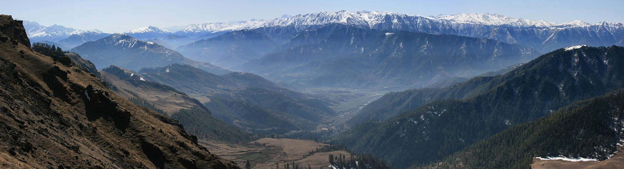
As if to make up for the inconvenience of having to overnight in Nepalgunj, the flight to Jumla (2540m) is terrific. First you cross the Nepali terai, covered in dense jungle, before climbing over the pahar of west Nepal. Vast forests pass under the wings; this is one of the least densely populated areas of the Himalaya, aside from the very highest mountain regions. The approach to Jumla involves a diving 180° turn over a forested ridge to the airstrip; it’s quite a thrill! Once outside the airport, there are a couple of teahouse-style hotels, or you can head into the main bazaar where there is more accommodation. To get to the main bazaar, head west (turn right out of the gate) and follow a large, dusty trail to Jumla, which is about 15 minutes away. The centre of town, called Khalanga Bazaar, is paved in large flagstones and is a busy trading post for the region. Beyond the many shops are two interesting Hindu temples, Chandan Nath, which commemorates the yogi who introduced rice farming to the valley some 900 years ago and is dedicated to Vishnu, and Bhairavnath, a newer temple dedicated to Shiva. These temples were built at the beginning of the Malla Empire, a Khas dynasty that dominated western Nepal, Tibet, Ladakh and Kashmir for centuries, see Khas People in Ethnic Groups. A strong wind blows through the valley in the afternoons, so if you arrive early enough it is a good idea to complete tomorrow’s trek.
3
Day 3: Jumla–Chere Chaur 4½hrs
Head due north from Khalanga Bazaar, following a large trail into a shallow valley and towards Karnali Technical College. The trail is lined by buildings for the first hour and remains on the true right (west) side of the valley. When you reach a section of trail with fields on either side you will come to a bridge to the true left (east) bank. Cross the bridge, turn left and continue towards a large tank of water before the technical college (30 mins). The trail winds around the college and then begins to climb an easy gradient on a trail with little shade for 3 hours to Chere Chaur (3055m). This is a large, grassy plateau and makes an excellent campsite with views back down the valley to Jumla.
4
Day 4: Chere Chaur–Chalachaur 5hrs
At the northern end of the plateau the trail forks; you need to turn left and enter a pine forest. Note: the right fork enters a short section of forest before climbing an exposed hillside to Danphe Lekh pass (3685m), which you will cross on the return to Jumla. Having turned left, the trail climbs steadily as it contours around the top of a small river basin to a couple of buildings at Chor Khola (3170m, 45 mins). From here, the trail climbs steeply through forest to the upper pastures of the Dori Lekh and Jaljala La (3585m, 2½hrs). An easy descent on the north side of the pass soon brings you to a broad grassy pasture, Jaljala Chaur (3420m, 30 mins). To reach the few buildings on the far side of the pasture continue along the northern treeline to a trail that crosses a small bridge over a stream. If you take any of the earlier, direct routes, you will have to wade a number of small streams and cross boggy ground. Camp on a patch of cleared ground in front of the buildings should you want to stay here. From the buildings the trail descends rapidly through forest into the Jaljala Khola valley, where there is a good campsite at Chalachaur (2980m, 1¼hrs).
5
Day 5: Chalachaur–Sinja 4½hrs
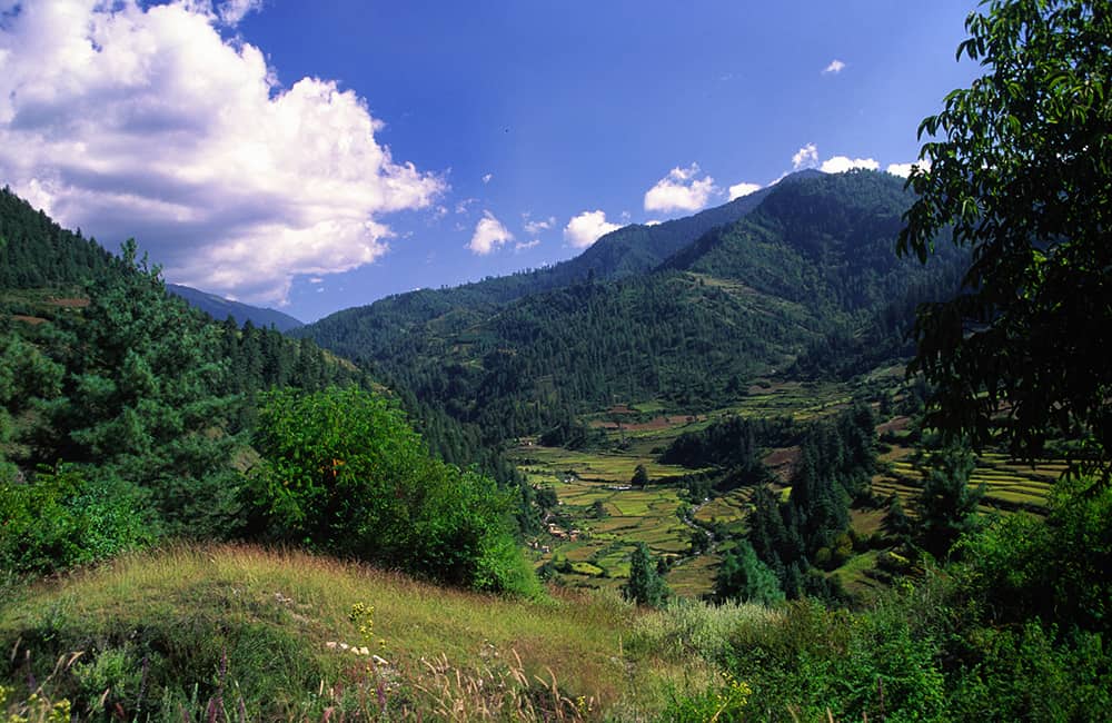
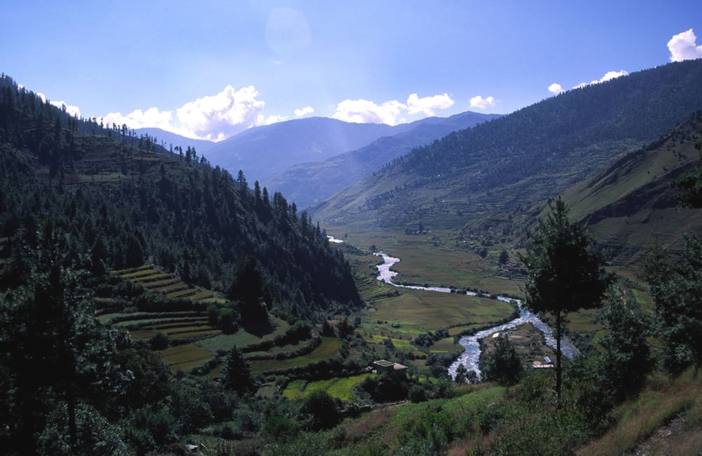
You are now in a fine deciduous forest with the sparkling Jaljala Khola leading the way. Cross the river several times, over bridges with traditional carvings on the handrail supports. After 45 minutes a large tributary valley merges from the right and the first small plots of farmland appear. The trail now remains on the true left (south) side of the valley, and climbs a small spur before continuing to descend an easy gradient. As the valley broadens the terraces of smallholdings appear and you pass through the scattered settlement of Garhigoth (2740m, 2hrs). The next settlement, Chauki (2500m, 1hr), is a larger Thakuri village with its distinctive red- and white-painted homes. Walking through the village you are able to see the end of the valley ahead, and a rocky promontory with commanding views. The trail winds around the southern base of the promontory and then drops to a bridge across the outflow of the Jaljala Khola to a peninsula with the Sinja Khola on the far side. Camp on the peninsula next to the health post (2405m, 45 mins), the main part of the village is on the far side of the valley and can be reached by another bridge.
6
Day 6: Sinja all day
The promontory that you passed the previous day is a very important site in medieval Nepali history. The western hills of Nepal were once the centre of the largest kingdom ever seen in the Himalaya, prior to the unification of Nepal: the first Malla Empire, and the winter capital was here, at Sinja. The only remains are some ruins of the royal palace and the ancient Hindu Kankasundri Temple on top of the promontory, called Lamathada. Two large stone lions at the entry of the temple are certainly from the right period, but identifying other artefacts within the temple is impossible. Throughout the region are many stone pillars, or stele, that declare land ownership changes, or places of historical interest, but they nearly all date from the 17th century onwards. From the top of Lamathada you look down into a deep ravine to the west, and some caves on the far bank, where the 5th Dalai Lama is said to have meditated. The old border with Tibet is not far away, in the Mugu Karnali Nadi valley, and local legends tell of a time when Sinja was the most important place in the Himalaya ranges. To the south-east, about 5 hours’ walk away is a large cave, where locals believe the five Pandava brothers (from the Hindu epic, the Mahabharata) were exiled. An annual horse race, in July, is held from Lamathada to the cave and back. The local people call themselves Thakuri, a noble Chhetri caste, which means you will probably not be invited into homes.
7
Day 7: Sinja–Ghorosingha 4hrs
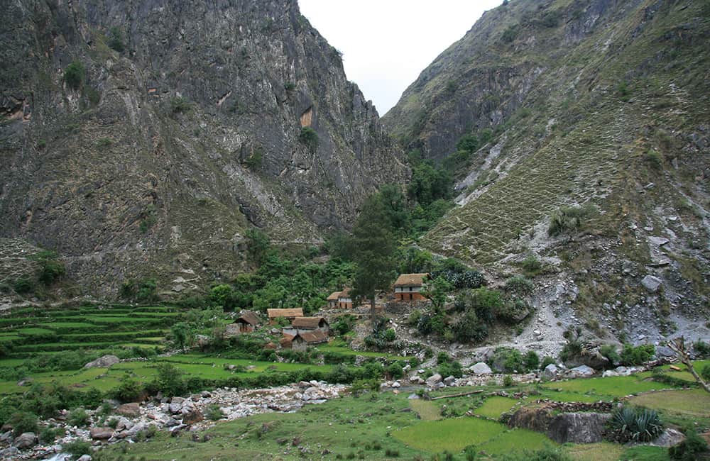
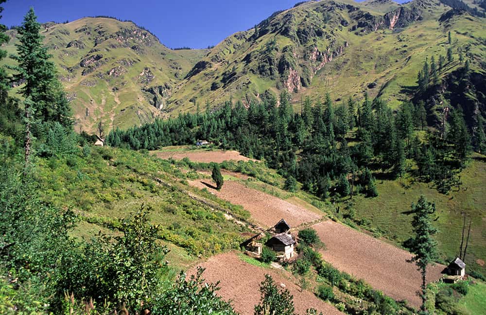
From the campsite, cross the suspension bridge to Sinja village but turn right (not left to the village) and follow a dirt trail that climbs a little as it heads through the gorge behind Lamathada. From the gorge it is easy to see why Lamathada was such an obvious choice for a fort palace, any attacker from here would have no chance of success. Continue on the north bank of the Sinja Khola along a trail that continues to climb, do not take any smaller routes that descend to the riverside. After 1½ hours you should reach the outlying homes of Bhota at the entrance of the Ghatta Khola valley (2600m). Unless you want to detour to the main part of the village stay on the true right (west) bank of the river. A detour to the village, which is on the true left (east) bank of the river, will add 45-60 minutes to your day. At the trail junction to Bhota take the left hand, smaller track and begin ascending the Ghatta Khola. The valley soon narrows and climbs steeply up an exposed trail that passes many grinding wheels. At the top of the ancient moraine wall (3050m, 2½hrs) you are greeted with a meandering stream flowing through a broad grassy valley, and perhaps one of the most inviting campsites you will ever come across, Ghorosingha.
8
Day 8: Ghorosingha–Rara Lake 6¼hrs
The trail now winds through beech and pine forest as it continues to ascend the valley. After 40 minutes you will pass some derelict buildings. Climbing further the valley forms a grassy basin and then the river turns sharply to the north-west (right) into a much narrower gorge. Continue along the true right (north) side of the boulder-filled valley to the bottom of a steep switchback trail that climbs to a saddle on the Chuchuemara Danda (3804m, 2¼hrs). Traverse the northern slope to your right on a small but defined trail to a ridge (3756m, 30 mins) overlooking Rara Lake, which makes an ideal lunch spot if the weather is clear. The trail now descends, slowly at first, but more steeply once you enter rhododendron forest for 1½ hours to the main track along the Khatyar Khola (2965m). Cross a wooden bridge to the true right bank of the river, where you turn right to Murma and then ascend an easy gradient to the western end of Rara Lake (3010m, 30 mins). The main campsite (45 mins) is beside the National Park office on the northern shore of the lake, you will have to register here as well.
9
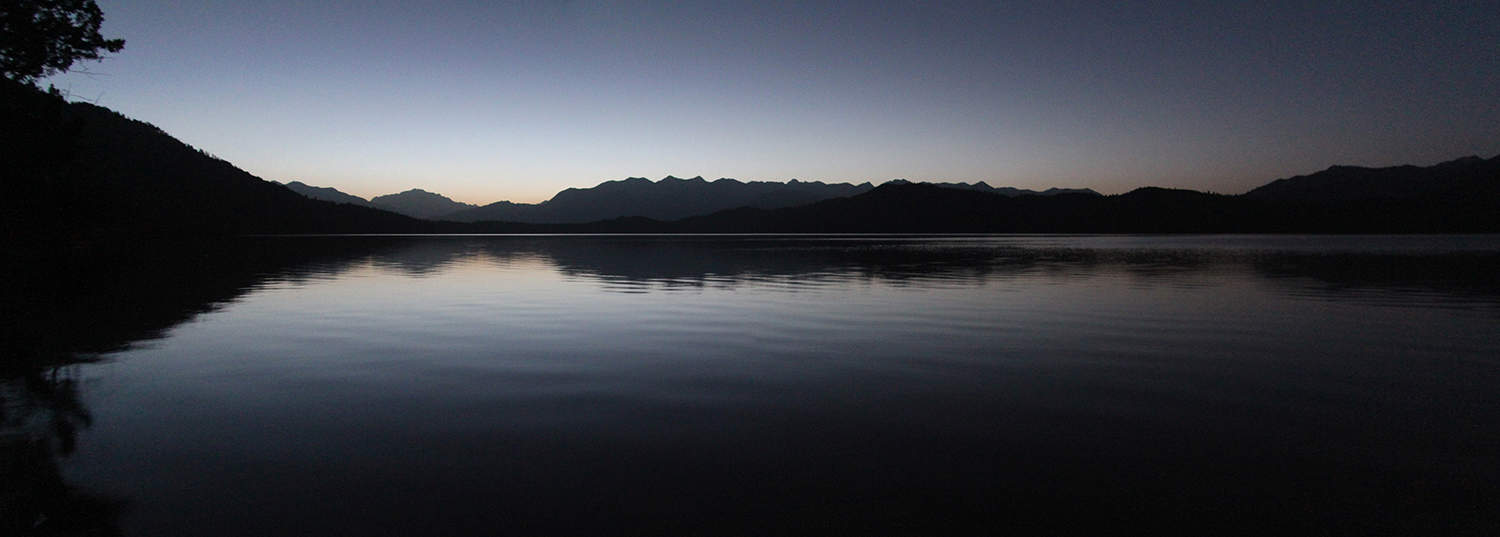
Day 9: Rara Lake all day
Rara Lake is an idyllic place; the astoundingly clear water surrounded by protected forest is a nature-lover’s dream. A walk around the rim of the lake (13km, 5½hrs) is really worth the effort – see if you can spot the stele marking the cardinal points, nobody knows how or why they are here. On the north-eastern bank is Rara Mahadev Temple, decorated with woodcarvings of elephant, peacock and people. On the full moon in July/August locals gather here to honour the god Thakur, who, legend says, created the lake by firing an arrow at the western shore and then built the eastern bank by stamping down the earth. Swirling rock formations at the eastern end of the lake are said to be his footprints. There are some old canoes near the army camp that you might be able to use. The lake water is extremely clear for swimming, but cold, and Park rules stipulate that you must use buoyancy aids.
10
Day 10: Rara Lake–Pina 4¾hrs
Take the lakeside trail back to the western end of the lake and the bridge over the out-flowing Khatyar Khola. Cross the bridge and continue around the lake to a trail junction in the south-western corner, the left-hand trail continues around the lake, but this time take the southern (right) fork and climb an easy gradient through forest. Crest the grass-covered ridge (3060m) to the south of the lake in 2½ hours from camp. Descend through a fine cedar forest to Jhari (2550m, 1¼hrs) and to a trail junction. There is a newer trail that avoids Pina and takes an almost direct route south to Ghurchi Lagna, which is reached in 6 hours. You need local knowledge to follow this route, which is committing as the first campsite is in the valley on the far side of the pass. Alternatively, the older route descends to Pina where there is a good campsite; to take this route descend to the small river in the valley, which you should cross to the true right bank. Keep descending for another 20 minutes before a slight climb to a grinding mill, beyond which are the cultivated fields of Pina (2440m, 30 mins). Do not descend through the village, instead contour through the upper parts of the village to a campsite next to a teahouse (10 mins). Note: if you want to take an extra day to reduce daily trekking hours, it is possible to break the return trek to: Rara Lake to Jhari (day 10), then to Chauta (day 11), then Padmara (day 12), Jumla (day 13) and fly to Kathmandu on day 14.
11
Day 11: Pina–Bumra 7¼hrs
To the south of Pina a valley climbs up towards Ghurchi Lagna (3445m) to the south. The trail follows a stream through forest and some rocky spurs; it takes 3½ hours to reach the pass. From the top of the pass there are good views of Kanjiroba Himal. Descend to a small valley which joins another from your left, take the larger, downstream (south-westerly) route that continues to descend. The valley then curves westward and another tributary joins from your left, again continue downstream (south-west) and descend. Once you reach about 3100m the valley turns to the south and enters forest; pass the National Park office and enter Chauta (2745m, 1¾hrs from the pass). Descend through the village to a trail junction turn south (left) and contour about 150m above the Sinja Khola. It is now 2 hours to Bumra (2850m) where you can camp, but if you have the time, continue for another 20 minutes or so to some better campsites beside the river.
12
Day 12: Bumra–Jumla 7hrs
If you camped in Bumra, descend to the Sinja Khola and follow the true left (south) bank along a broad trail to a bridge (2720m, 1hr), which you cross. The trail now climbs an unrelenting gradient through birch forest for 3½ hours to some pastures where there is a trail junction (3520m). The left-hand fork, which continues across the meadows, leads to Padmara (3060m, 2½hrs) and will add an extra day to the return to Jumla. A smaller trail branches right towards a tree line; you might have to scout around for this if the meadow is overgrown. Climb through the forest, which soon ends, and emerge onto another grassy pasture that leads up towards the Danphe Lekh pass (3685m, 30 mins). From the top you can see the broad meadow of Chere Chaur, where you camped the first night out of Jumla, descend to it (40 mins) and continue on the same trail back to Jumla (1½hrs).
13
Day 13: Jumla–Nepalgunj–Kathmandu
Reconfirm your flights as soon as you arrive in Jumla. Depending on schedules you should be able to fly to Nepalgunj in the morning and then catch one of many afternoon flights to Kathmandu the same day.

GHT India Short Treks

GHT Bhutan Short Treks

GHT Immerse Mustang

GHT Immerse Dolpo

GHT High Bhutan

GHT High India Himalaya

GHT Alpine High Route

GHT High Nepal Traverse

Rolwaling and Tashi Labsta

Upper Dolpo Circuit

Book Now

For more information. Please complete this form.

Ask Expert

For more information. Please complete this form.