GHT West Nepal Trek
GHT West Nepal Trek
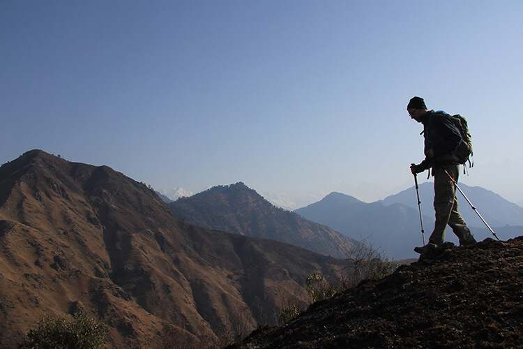
Pristine, adventurous and absolutely stunning, the GHT West Nepal Trek is through a trekking paradise. Most areas very rarely see trekkers and some sections are through genuine wilderness that will test your navigation skills, involve crossing some tough passes and a river crossing or two along the way.
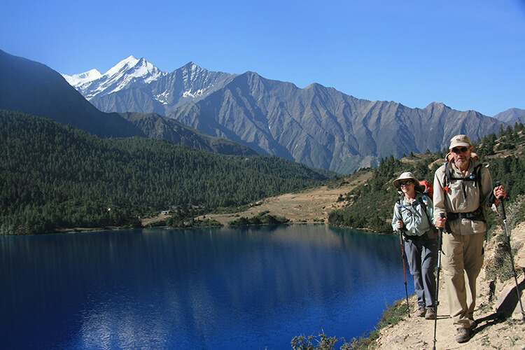
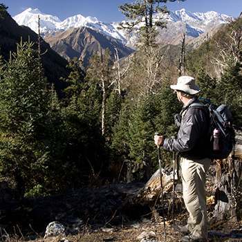
Beginning in Kagbeni, you head across Upper Dolpo via the stunningly beautiful Phoksumdo Lake and then through some really wild valleys to Upper Mugu and Rara Lake. The final trans-Himalayan landscape section through Humla brings you to the Tibet border at Hilsa. And you can also do the trek in reverse as well.
- Total Trek 40 days over about 650km
- 8 passes over 5000m.
- 3 days of rest and/or acclimatisation included
GHT West Nepal Trek for 40-days cost estimates:
- Solo as much as possible US$8,990.
- Twin-share with minimum guiding US$5,450 per person.
- Twin-share fully supported US$11,990 per person
Get in Touch if you have questions?
5 Best Things about the GHT West Nepal Trek
- Some stunningly beautiful trails and locations.
- Trekking like it used to be 50 years ago.
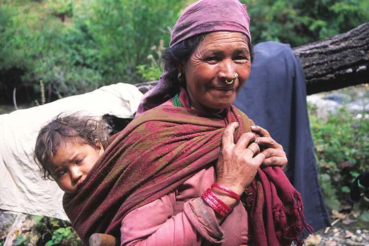
- Unique Tibetan-based cultures.
- Good chance to spot wildlife, including snow leopard.
- Feel like you are standing on the spine of the planet on the Upper Dolpo – Upper Mugu traverse.
Get ready for a fantastic adventure!
GHT Nepal Trek Summary Details
- Duration & Distance: 40 days total, 650km depending on route
- Grade 4: some difficult navigation and river crossings
- Experience required: Strenuous mountain walking experience required
- Walking times: From 3 to 9 hours per day
- Highest point: Nyingma Gyanzen La, 5563m
- Best season: April to June, or September to November
- Accommodation: Camping most of the time
- Guide Book: Nepal Trekking & the GHT, Trailblazer Publications, 2020.
- Digital Route and Planning Map: NP301 GHT Nepal, Himalayan Map House, 2017
- Topographic Maps: NP107-110 GHT Annapurna, Dolpo & Mugu and Far West Nepal, Himalayan Map House, 2017
When to do the GHT West Nepal Trek?
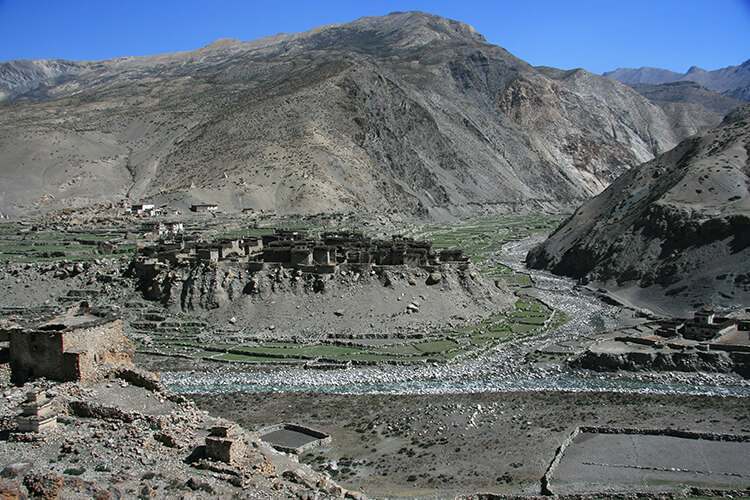
West Nepal has a slightly different weather pattern compared to the central and eastern regions. Located at a higher latitude means that winters are longer and the monsoon is shorter, so April is the earliest start pre-monsoon but you can start in September. This also means that the trek can be done east to west and west to east.
A second issue is the rapid increase in altitude from Kagbeni, which makes the west to east option appealing to those who have not had time to pre-acclimatise. If you need to pre-acclimatise, then you should think about adding 3-4 days before the start for a visit to Muktinath.
For more information about choosing the right time to trek, see When to Trek?
GHT Nepal Route Map
The GHT West Nepal Trek combines Dolpo, Mugu and all of the Far West regions.
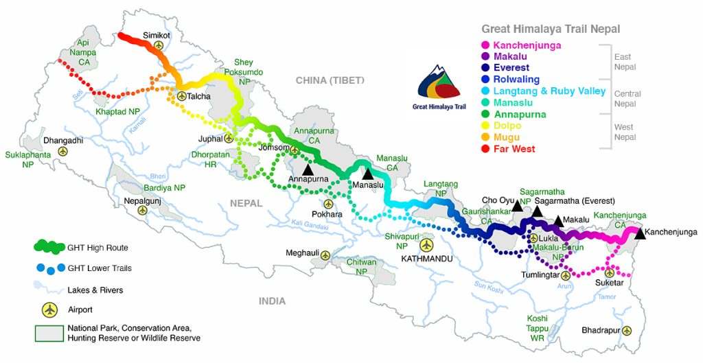
GHT West Nepal Trek Itinerary Summary
Please see Tour Plan for daily route description details.
Days – Route
1-13 Enter Upper Dolpo and cross to Ringmo at Phoksumdo Lake
14-23 The Upper Dolpo to Upper Mugu wild traverse
24-37 Trek through Mugu and Humla to the border with Tibet at Hilsa
38-40 Return to Kathmandu
How much does the GHT West Nepal Trek Cost?
There are some route variations for the GHT West Nepal Trek, and potential side trips and side loops, for example:
- Add 3-4 days for pre-acclimatisation to Mukinath at the start.
- Include the Dhaulagiri Circuit at the start to acclimatise and enter Upper Dolpo through Hidden Valley.
- Take an alternative route through Upper Dolpo via Saldang to immerse yourself in the amazing corner of Nepal.
- Take the lower route from Rara Lake across to the India border at Darchula.
All of the GHT West Nepal Trek requires Restricted Area Permits, so you need a guide all the time, and the Upper Dolpo permit costs US$500 per person, so this is the most expensive section of the GHT… but worth every penny!
GHT West Nepal Trek for 40-days cost estimates:
- Solo as much as possible US$8,990.
- Twin-share with minimum guiding US$5,450 per person.
- Twin-share fully supported US$11,990 per person
To help you budget and plan, we’ve made a comprehensive costing explanation on How Much Do Treks Cost?
Customisation is Normal
Want to do things a little differently? Maybe take some extra time, or go a bit faster? Or avoid technical sections or combine with other trails? Every GHT trek is different and that changes the price, but please feel free to Get in Touch to ask questions and how to customise your own trek.
Bookings
Please note that www.greathimalayatrail.com does not handle bookings for treks. We are here to inform you about the trails and logistics, but you will need to book through a registered trekking operator in Nepal. If you would like an operator recommendation or feedback on a company you are already talking to, then please Get in Touch.
Social and Environmental Impacts
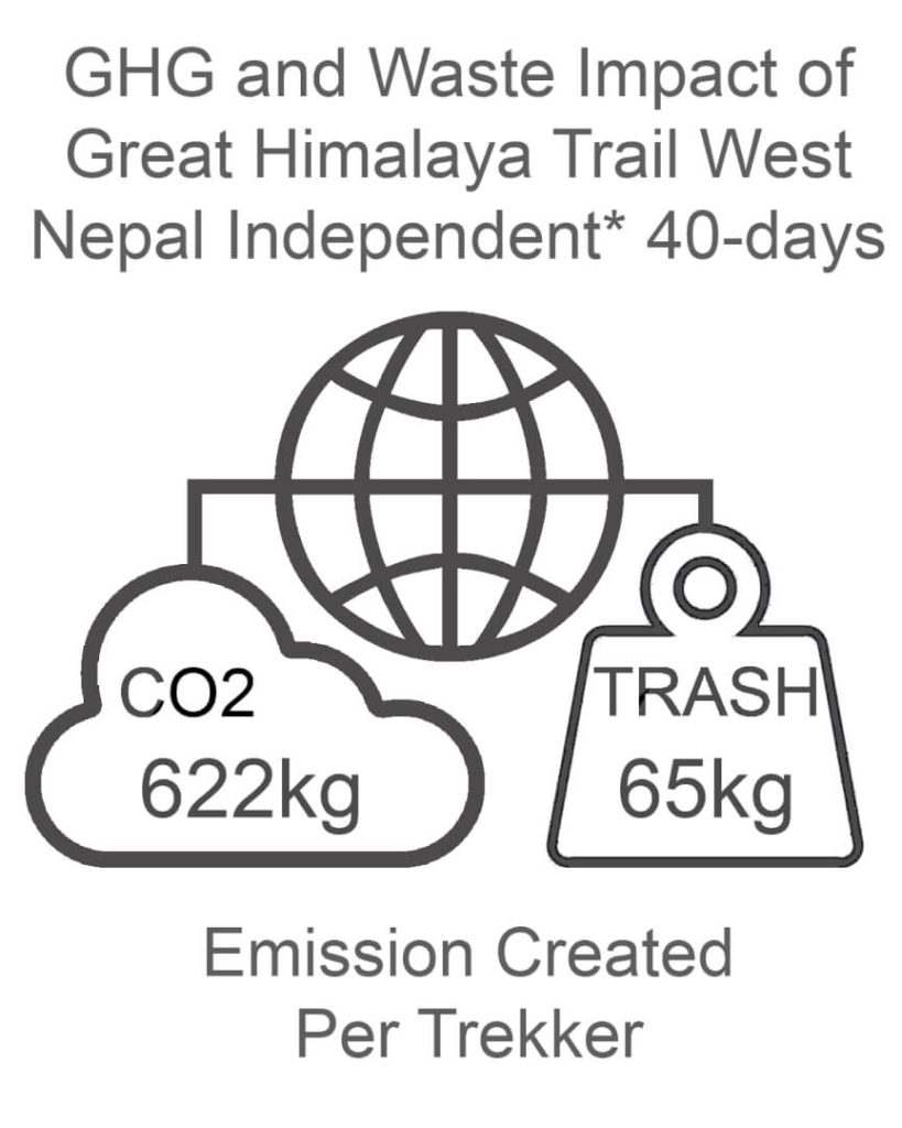
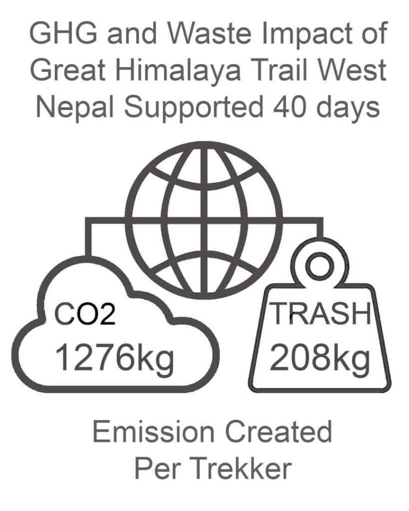
The GHT has been designed around the principles of Responsible Sustainable Tourism and we do our very best to make sure that the GHT is good news for the locals and the environment along the trails. To walk the talk, we have pioneered the development of social impact assessment (see the MyGHTi project) and calculate Green House Gas and Waste created for each trek.
There is more information about how we calculate impacts at The Impact of Your Trek
For Solo and Twin-share GHT West Nepal Trek with minimum guide service (independent as much as possible)

The Trade-Off
You need both a guide and camping gear throughout the trek, although there are some teahouses enroute and places to resupply locally.
This trek also has the biggest footprint due to lengthy transportation of you and supplies.
For Fully Supported Twin-share GHT West Nepal Trek

The Trade-Off
You and your crew can resupply locally, but additional services are hard to find.
However, due to the remoteness, many goods already have a higher than normal footprint. So we recommend using pack animals for some sections.
Cost Breakdown Explanation of Your GHT West Nepal Trek
Transport to and from the trek
There are two types of transport costs, those to get you to and from the trail and those for your support team to get to and from the trail. In Nepal, foreigners pay approximately double the local price for transport, except for local buses that charge the same regardless. Domestic flights in Nepal are expensive, but unavoidable if you go to Simikot.
- For the GHT Nepal Trek for 40 days, the total transportation costs vary from US$1,100 to US$2,010 per person.
Permits and Entry Fees
Apart from your tourist visa (see more in Visas and Permits), to do the GHT West Nepal Trek you need to pay for National Park or Conservation Area Entry Fees and Restricted Area Permits (RAPs). All RAPs must be issued for a minimum of two foreigners who must be accompanied by a qualified local guide. What if you want to do a solo trek? Then you need to purchase two permits but you still must have a guide with you at the checkposts. There are a number of ways of dealing with this issue, but the most common is to have a guide meet you only when it’s absolutely necessary.
There are 6 different permit and entry fee costs and some vary seasonally, so let’s assume that you are doing your trek between March and June;
- For the GHT West Nepal Trek for 40 days, the per person cost for permits and entry fees is US$719 (if two people are trekking together) and US$1,369 if you are a solo trekker.
Support staff
As explained above, most GHTers only want to have a guide when it’s obligatory, however, some folks want to have a support team with them for the whole trail, which we call a Fully Supported Trek. There is a big cost difference between having a guide with you sometimes and a crew of 5 or 6 with you all the time. However, a Fully Supported Trek has a few major benefits: (1) you don’t have to carry much weight, (2) you don’t have to worry about navigation, campsites, cooking, etc, and (3) the extra money you spend is in remote villages and local wages, which has very positive social impacts.
- The GHT Nepal Trek ‘Guide only when necessary’ cost for a solo GHTer US$2,200, which is the same for 2 trekkers going together and is therefore half per person.
- The GHT Nepal Trek ‘Fully Supported’ cost for two GHTers US$3,800 per person.
Meals and Fuel
You and any crew that are with you have to eat and sometimes buy fuel when in remote areas. Food and Fuel costs vary enormously along the GHT, where a cup of tea can cost 50cents to US$4! So we calculate an average daily amount based on previous season costs, which we is currently US$55 per day per trekker on this trek – but this is if you only eat the local food (dhal bhat) and do not eat western dishes. Eating local meals is a really good idea as you will be served much more food (dhal bhat is refillable at no extra cost), and it’s super fresh and healthy. And let’s face it, why would you come trekking in Nepal to eat bad pasta anyway?
- A solo trekker on the GHT West Nepal Trek for 40-days should budget about US$2,275 to buy food and fuel for themselves and the guide.
- A Fully Supported GHT West Nepal Trek for 40-days should budget about US$4,000 per person to keep everyone well fed and fueled.
Administration & Contingencies
Be prepared for the unexpected and plan for resupply points. Most GHT treks include resupply points as you need to receive permits while in the field as they are date specified, so why not also send some other stuff along with the paperwork? Leave small packages of snacks, clean clothes, spare money, etc in Kathmandu and you can always add or remove items before the resupply point. These costs also include an administration payment to the trekking company, which includes their profit and staff insurance.
- Average administration and resupply costs are US$1,040 to US$1,500 per person.
Flexibility, Changes and Surprises
BUT no GHT is the same! So, these prices will no doubt vary depending on your itinerary, time of year and what happens while in the field. However, they are a good starting point to begin planning. Just remember to be flexible, accept changes as the happen and always be wary of surprises!
Get in Touch if you have questions?
Costing kindly provided by Mr Pema Sherpa, Pema Treks & Expeditions, Kathmandu
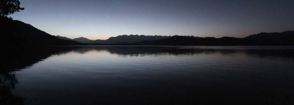
Nepal’s largest lake is not to be missed – Rara Lake
-
Destination
-
DepartureKathmandu
-
Dress CodeMid-altitude mountain clothing and equipment
-
GradeGrade 4
-
Idea Date Range15/10/2021
-
Style of TrekSolo, Partially Supported or Fully Supported
Days 1-13 Enter Upper Dolpo and cross to Ringmo at Phoksumdo Lake
Days 14-23 The Upper Dolpo to Upper Mugu wild traverse
This day begins with one of the most spectacular sections of trail in Nepal: from the western side of the lake outflow, head towards the cliffs to your west (left), which you traverse along a precipitous trail. For the first 40 minutes the trail doesn’t climb very much but does feel exposed in places, and there are excellent views of the lake and village. After crossing a small stream, the track climbs about 400m steeply before contouring around a rock-face at roughly 4140m (1.5hrs). It is amazing to think that yaks frequently use this trail!
After 80 minutes the trail descends to the floodplain of the Phoksumdo Khola at the northern end of the lake (3630m), where there is an excellent grassy lunch place or campsite. This valley is overgrown in the lower reaches with black caragana bushes, which have needle-like thorns. After 35 minutes cross the river and enter patchy pine forest which is soon replaced by silver birch (the bark of which is often used by Tibetans for writing prayers to leave on passes and important chorten) as the valley narrows. Cross the river via stepping-stones several times as you ascend the valley. After 70 minutes the valley begins to narrow to a cliff-lined gorge and the trail remains on the true left (northern) bank.
You will pass through a few copses of silver birch, which could make a campsite, but continue for 30 minutes to a large copse at the mouth of a tributary gorge of the Tuk Kyaksar Khola (3750m) with a red-pink western (left) cliff line and a dark grey eastern (right) cliff. There are also some cairns beside the small river that flows from this gorge, which mark a rough trail. There is a trail that continues up the main valley at this point so you will need to be vigilant not to miss the gorge and campsite.
From here there are two routes to Shey Gompa: the first, which initially continues up the Phoksumdo Khola, is used by pack animals and takes a little longer. The second route is more direct but rougher and not suitable for pack animals. From the campsite it is only a few minutes to the mouth of the gorge, which is more safely ascended in the morning when the river is lower. The trail winds up the gorge, crossing the river many times. There are many animal tracks in the gorge so take care when routefinding. The sound of the river reverberating from the cliffs makes conversation difficult, so make sure to keep your group together.
The gradient eases after 1½ hours as the gorge widens. In another hour there is a small campsite (4435m) of about eight flat plots scraped out of rocky ground on the true right (western) side of the valley. However, there is a far better camp at the head of the valley where a small waterfall has carved a gully (4717m, 30 mins).
From here you have two choices. If the flow of water through the waterfall is low you should probably camp at this spot, as there will be little or no water higher up. If the flow is strong, such that it fills the bottom of the gully (you might need to climb for about 100m to check), then continue to the higher camp above.
DAY 15: WATERFALL CAMP – SHEY GOMPA 6.5HRS
Climb the switchback trail to the true left (east) of the waterfall and after about 100m the gradient eases. You now ascend the upper reaches of the river valley, which gradually broadens, to a large basin. A large scree slope rises on the true right (west) side of the basin and Nangdala La is on the above ridgeline, which is called Churan Lekh. Do not be tempted towards either of the easier-looking saddles to the north and north-east. There are plenty of flat areas in the basin (4810m, 2.5hrs from the previous camp), the most popular is at the base of the long curving trail that leads up to the pass.
The trail to the pass is over loose slate-scree up an unrelenting gradient for 2 hours and 20 minutes. From the top of Nangdala La (5350m) you can see a broad valley descending to the north carved by a substantial stream, which you should reach in an hour from the pass.
The trail now follows an easy gradient down the valley, crossing the stream a few times depending on your chosen route. This valley is popular with yak and sheep herders so try to buy some fresh yoghurt, butter, or milk as you descend.
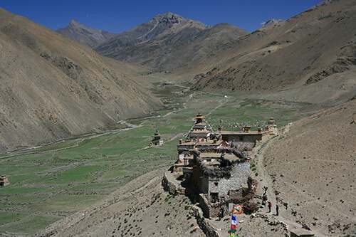
In 1.5 hours, you will reach the red-painted walls of Shey Gompa (4343m), ringed with mani walls and chorten, set amid a large pasture.
DAY 16: SHEY GOMPA – BHIJER 8HRS
From Shey Gompa, take a trail that climbs up from the campsite for about 400m (70 mins) before swinging into a small valley. The trail descends slightly to the stream, which you cross, before climbing the far hillside for another 100m or so (35 mins) to a ridge (4860m) with views of the Tartan Khola and Tsankang Gompa opposite. Traverse the broad hillside before dropping into the Den Khola valley, where there is a kharka of the same name (4553m, 1hr).
The trail then heads back up to a minor ridge (1hr) before traversing past some monsoon kharkas to another ridge (4810m, 30 mins). A final undulating traverse brings you to the last minor pass of the day (4840m, 25 mins), which is decorated with prayer flags and chorten.
An easy descent leads to the large kharka of Tora (1hr) where there are three trails. The most northerly (right) trail climbs rapidly to the ridge above, the middle takes an easier gradient to a point further along the ridge and the more westerly (left) descends to the village of Tata and on to Shyamling (aka Samling). Do not take the path on your right. If you have the time, visit Shyamling Gompa (2hrs) and then take the round-about trail to Bhijer (1½hrs).
The direct route to Bhijer (3850m, 1¾hrs) is the middle trail that makes an easy ascent of the ridge before a sometimes steep descent to the village where there is a campsite. The lama at the gompa in Bhijer is also an amchi (a Tibetan medicine doctor) and he tells an intriguing tale of the first settlement of the village. There is also a cheese factory in Bhijer that’s worth checking out, and to buy some cheese!
DAY 17: BHIJER – PHO 8.5HRS
Wind through the village to a trail that climbs to some chorten to the north. Switchbacks ascend a ridge, where there is a cairn and some prayer flags (4605m, 2.5hrs). You now enter a basin beneath the rocky Yambur Peak. Traverse the rocky trail for 40 minutes to the base of the final steep climb to Yambur La (4813m, 30 mins). Descend a steep trail on the far side of the pass to a large kharka, which makes a good lunch spot (4030m, 1.5hrs). The next section of trail has had some extensive maintenance but is still steep and slippery in places. Descend into the Tora Khola canyon on a trail carved from cliff-faces to a large wooden cantilever bridge (roughly 3400m, 1hr). The crisp, clear water here makes it an excellent site for a cool swim! The trail winds around some craggy cliffs before ascending a steep gully via switchbacks to the terraces of Pho (4087m, 3hrs), where there are a couple of campsites.
If you haven’t already employed a local guide you will definitely need to get one here at Pho. The next section to Mugu is one of the toughest parts of the GHT.
DAY 18: PHO – PUNG KHARKA 7.5HRS
From the top of the village climb to a painted chorten (10 mins) where the northern and southern trails diverge. Take the right fork and climb switchbacks across scrubby slopes to the first ridgeline at 4645m (1.5hrs), from where there are good views back down to Pho. The trail then climbs at an easy gradient though a basin to a major ridge, the Gyallo Raud Lekh, that descends from the large rocky peak above you to the south (left). The ridge has a large cairn and prayer flags at which you should turn north (right) and follow a gradually ascending ridgeline.
The trail rounds a rocky hill to then follow a sharp and craggy ridgeline, which steepens considerably to Nyingma Gyanzen La (5563m, 3hrs). This pass sits in the very centre of the Great Himalaya Range, with Kanjiroba Himal to your south and a line of slightly lower snowy peaks along the Tibet border to your north. It is like no other place in the Himalaya and makes you feel as if you are walking along the spine of the planet.
Descend a steep trail that continues to follow the craggy ridgeline down to a notch marked by a triangular rock and prayer flags (5450m, 20 mins). Cross through the notch and continue to descend steep ground into the valley to the north-east of the pass. The trail winds down the centre of the valley, but stays in the central scrubby vegetation rather than on the left or right side. After about 900m of descent you will reach the end of the valley (100 mins) but do not continue to the river confluence. Instead, follow a track that winds beneath a cliff line to your north (left).
Note: if you are trekking this route in reverse, it is critical that you do not head further downstream than 4440m. Beyond this point the river valley becomes extremely dangerous.
The trail then slowly descends to the Swaksa Khola (4440m), where there are a few tent platforms scraped out by nomads. However, there is a far better site on the eastern (right) side of the valley on the grassy Pung Kharka (4650m, 1hr).
DAY 19: PUNG KHARKA – CHYANDI KHOLA 6HRS
Continue up the valley for 1hr, passing a river that flows down from the west (left) through a huge kharka area of grassy hillocks. There are some small caves on the east (right) bank opposite the river confluence; just beyond them cross to the west bank. Continue to follow the Swaksa Khola up a valley that becomes flatter as you reach another large kharka and potential campsite (4820m, 50 mins).
Note: Locals have established two Yala pass options, the safer one of which is not marked on the Finaid map but is marked correctly on the GHT maps. The not-so-safe Yala La is prone to rockfall and no longer used by locals, so should be avoided.
The Yala La (5414m, 2.5hrs from the kharka) is an obvious saddle to the north of the Yala La marked on the map and is reached by climbing a trail up steep grassy hillside to the right of a glacial snout. The trail then traverses beneath a rock band to a small basin of red and orange rocks. Climb through the basin towards the rocky ridge above, where a series of large cairns and chorten can easily be seen from below. There is a steep descent on the far side to a shallow basin before another steep descent into the large grass-covered valley of the Chyandi Khola (4830m, 1.5hrs). Snowy mountains surround you; as there are no settlements for miles around, the sense of wilderness is palpable.
DAY 20: CHYANDI KHOLA – TAKLA KHOLA 7.5HRS
There are many potential campsites in the valley for the next 40 minutes. The trail follows the northern bank of the river before moving right next to the water’s edge. You may need a 20m hand line in places as the trail can be a bit tricky. This section involves some tricky navigation. Approaching some forest, the trail suddenly starts to climb the true right (northern) side of the valley and includes some short, steep descents steeply to avoid a series of landslides. A final slippery descent brings you to a confluence with a small river entering from the north (3995m, 3hrs).
Cross the simple log bridge over the river and climb a steep switchback trail straight up a shallow gully to a ridgeline at 4365m (1.5hrs), which is marked by a chorten. The trail now traverses a broad hillside, with great views of the valleys to the south. A final rocky scramble brings you to a last ridge marked by four large cairns (4495m, 1hr), before a steep descent through silver birch forest to the Takla Khola (3785m, 2hrs), where a few small logs to act as a bridge. There is a good campsite on the far bank in a grove of silver birch.
DAY 21: TAKLA KHOLA – THAJUCHAUR 6.5HRS
Leave camp by following a trail up the forested river valley to your west (rather than the larger river to your north). After 40 minutes pass a tributary that flows down from the north (aka Chhyugulden Khola). Continue on an easy gradient ascending ancient moraine and landslide debris for about an hour to a small lake, after which the trail slowly crosses a boulder-filled watercourse to the beginning of the pass-climb (4410m, 15 mins from the lake). Follow switchbacks that climb a grass- and wildflower-covered slope to a scree-filled basin. The trail climbs the left-hand side of the basin across rocky ground to the cairn-covered Chyargo La (5150m, 2.5hrs).
A good trail descends from the top of the pass and at roughly 4600m (1.5hrs) there is a potential campsite. Follow the ancient moraine on the north (right) side of the valley down to an enormous flat-bottomed valley called Thajuchaur (4050m, 1.5hrs).
Note: if you are trekking this route in reverse look for a black rock with a large white cairn that marks the route up to the moraine.
DAY 22: THAJUCHAUR – SHILENCHAURA KHARKA 3.5HRS
The trail now descends into a V-shaped valley and frequently climbs away from and descends back to the Chham Khola. There are many trail junctions, at each one follow the largest or freshest route. After 30 minutes the trail crosses to the middle of the river and then back to the northern (right-hand) bank to avoid a landslide.
In another 1hr you reach a large flat, pine-forested area that makes an excellent campsite (roughly 3500m). From here, cliffs rise on both sides but a good trail leads down to the end of the valley. There used to be a both a cantilever and log bridge to the south bank of the Chham Khola but ignore them all. Instead, scramble over some boulders to the very end of the valley along the northern bank. Once you have reached the Mugu Khola (1hr), turn north (right) and follow an easy trail for 30 minutes to a bridge that crosses to the west bank of this much larger river, there is also a simple teahouse at the bridge. It is not necessary to go all the way to Mugu. Instead, turn south (left) and head downstream through the Shilenchaura Kharka (2945m, 20 mins), opposite the Chham Khola confluence and a good campsite. In fact, for the next 3 hours there is a series of riverside glades that would all make a good campsite.
DAY 23: SHILENCHAURA KHARKA – TIYAR 4HRS
A new road is being constructed along this route so expect some slight route changes. The river performs a massive S-bend and on the second curve a tributary joins from the north (right) and is crossed by a rigid metal bridge. After 3 hours from Shilenchaura the valley narrows and in 45 minutes you reach another major confluence, at Tiyar, with the Namlan Khola, which the locals also call the Karnali Nadi. Just before the confluence, cross a wooden bridge to the west bank of the Mugu Khola and climb a dusty trail to some large chortens. Just beyond the chorten is a gompa with a grassy forecourt that makes an excellent campsite (2418m). Padma Dundul Choling Gompa was used as an ‘education’ camp by the Maoists but is now being restored by the resident lama.
Days 24-40 Trek through Mugu and Humla to the border with Tibet at Hilsa, then to Kathmandu
A new road is being constructed along this route so expect some slight route changes. Retrace your steps past the chorten and cross back to the north bank of the Mugu Karnali Nadi. Once on the far bank, turn west (left) and climb an easy gradient to the main trail, which you follow for 3.5hrs to a large blue suspension bridge.
Note: there is a small shop just before the bridge, which sells rice and flour.
Cross the bridge and continue heading west (right) for 30 minutes to a major bend in the river where there might be a small water source near a large bank of river stones. In another 1hr is a campsite in a small copse beside the Mugu Karnali Nadi (Lhumsa) and there is a small shop in another 1hr.
DAY 25: LHUMSA – RARA LAKE 6HRS
A new road is being constructed along this route so expect some slight route changes. Continue on the south (left-hand) bank all the way to the end of the valley, marked by a small school with a large stele in the forecourt (2hrs). There are more of them behind the school and they either declare land rights, or mark the old border between Tibet and the Khas Kingdom. The trail swings south (left) and descends into a smaller valley. At a large trail junction, take the left, higher fork, then descend to and cross the Gam Gad river via a small wooden bridge (15 mins). It is a 40-minute climb up a hillside where a few pine trees offer some shade to the large bazaar of Gamgadhi (2095m). There is a teahouse as you enter the village but no campsite.
Climb up through the town and follow a large trail to Rara Lake (3010m, 2.5hrs) where there is a campsite, teahouse and fabulous views of Nepal’s largest body of fresh water.
DAY 26: SPARE DAY
DAY 27: RARA LAKE – BAM 7.5 HRS
Walk to the eastern end of the lake and take the left fork, signposted Gamgadhi (2095m, 1.5hrs) and descend to the sprawling district centre of Mugu. The trail is easy to follow the entire way, the last section is on a road that links to Talcha.
Take the trail from the top of the bazaar at the western end of the town – you will have passed it on your way into Gamgadhi. Descend at a constant gradient for an hour to the Karnali Nadi, where there is a campsite (1740m, 1hr) before the suspension bridge.
Note that the constant passing traffic could pose a security issue for your group so don’t leave things lying around, or consider continuing to Bam.
Cross the suspension bridge and ascend a steep rocky trail, turning left at 1920m and again at 2046m to crest a ridge at 2180m (1.5hrs). Descend to a small river and then climb to Luma (2073m, 30 mins).
The trail climbs steadily from here through fields and then pine forest to another ridge (2600m, 2hrs). Take your time to look at the stele about 20 minutes from the top of the ridge, they are similar to those at Rara Lake.
It’s then an easy traverse to Bam (2700m, 40 mins) before a slight climb to the school where you can camp. There is also a simple dhaba (eating place) here.
DAY 28: BAM – JOGIMARA 6.5HRS
A contouring trail leads to a stream near Ghachaur (2650m, 1hr) where the climb to today’s pass begins.
First ascend steep switchbacks before entering forest; it will take about 3½ hours to reach Chankheli Lagna (3594m), where there are some good views of the Kanjiroba range to the south-east and endless hills to the north. It is then a very pleasant 10-minute descent to a great campsite beside the Rauli Khola (3005m) and another 15 minutes to the teashop at Jogimara, where you can sleep in their loft.
DAY 29: JOGIMARA – PIPLAN 6HRS
It is an easy ascent for about 100m to round a hill-spur at 3120m before descending about 500m to the Milchham Khola (110 mins). Then another small climb that involves crossing a landslide, which is still close to another ridge (2717m, 30 mins) with views of the lower valley and Rimi village, where there is a teashop (2552m, 1hr). If you are trekking this route in reverse, you might want to camp here to break this day into two stages and then continue to Jogimara tomorrow.
It is a long traverse to Deuri (70 mins), where you pass a large school before a slight descent to Darma (30 mins). Head through the village to the helipad on the far side and then descend steep switchbacks to the main riverside trail, which winds around to a suspension bridge over Humla Karnali.
Cross the bridge and then it’s a short climb to Piplan (1700m, 1hr) where you can camp in the school.
DAY 30: PIPLAN – APSIA LEKH 7HRS
Pass through the village to the helipad where a trail turns right and begins to climb slightly before steepening to switchbacks to Nimagaon (1980m, 1.5hrs).
Continue up through the village for another 1.5 hours to crest a ridge and where the rail starts to traverse through a shallow basin to another ridge (2724m, 15 mins) beneath Korka village. You do not need to enter Korka. An easy descent for 30 minutes brings you to a stream, which would make a good lunch spot.
The trail then climbs again but not as steeply to Puma (2805m, 70 mins) where you could camp in the small school grounds. Just beyond the school the trail forks, turn right and climb switchbacks through pine forest for 2 hours to Apsia Lekh (3195m), a broad grassy ridge makes a great campsite. There are great views of Saipal Himal towering over the depths of the Karnali Nadi valley. There is a good water source about 100m downhill on the eastern side of the ridge.
DAU 31: APSIA LEKH – PUNKHA KHOLA 5HRS
After yesterday’s strenuous walk, today is much easier so take your time and enjoy the morning views! The day begins with a lovely contouring trail and great views of Saipal Himal and the surrounding valleys to Kallas (45 mins) where there is a teashop. Then descend to Nunyapani Khola and ascend an easy trail to a ridge before another easy descent past Phuche to Rodikot Khola (2386m, 2hrs). The trail then climbs an easy gradient for the next 2 hours to a campsite beside Punkha Khola (3010m) and the base of tomorrow’s climb.
DAY 32: PUNKHA KHOLA – YANCHU KHOLA 7HRS
Ascend steep switchbacks through forest for roughly 500m before the gradient eases a little. There is a kharka at 3512m, which could be used as a campsite but water is another 30 minutes beyond. Steep switchbacks lead to the Margor Lekh Bhangjyang (4037m, 3.5hrs) with great views north to the Simikot valley, Saipal Himal and endless ranges to the south. The trail descends slightly as it traverses steep hillside to the Bhigauda Dada (30 mins) before becoming very steep and switchbacking down to the Yanchu Khola (2100m, 2hrs).
There are several campsite options in this valley, your choice will depend on the time taken to cross the pass and the number of herders and livestock at each place. There is a kharka about 10 minutes before the Yanchu Khola, or a site in a forest on the far bank or, if dry, one of the grassy sections beside the river a little further downstream (10 mins).
DAY 33: YANCHU KHOLA – SIMIKOT 7HRS
Descend the true right bank of the river for about 15 minutes before a gradual climb to Durpa village where the trail then contours past the school.
Beyond the village wind around open hillside and then begin the long, dusty descent to the pilgrimage site of Kharpunath (2100m, 3hrs) where there are a few teashops. This is not a very secure campsite and if you need to stay here you will have to be very careful of your possessions. A better option is to walk up the true left bank of the Humla Karnali for 30 minutes to another collection of teashops before turning right into the Kudila Khola valley, where there are more camping options.
If you have the energy, continue to the comfortable hotels and teahouses of Simikot. From the Kudila Khola, head upstream, crossing small tributaries for 45 minutes or so to a few teashops and a rigid metal bridge, which you cross and then start the long switchback trail to Simikot (2985m, 2hrs 20 mins). You enter the large bazaar town from the south and most of the teahouses and hotels are near the airport entry on the far side of the village, but the opportunity for a shower and a comfy bed are great motivators!
DAY 34: SIMIKOT – KERMI 8.5HRS
A new road is has been constructed along this route so expect some slight route changes.
A substantial trail winds westwards uphill and away from the village centre. It’s an easy climb for about 300m (3270m, 1hr from the airstrip) to the top where there are a couple of teashops. Then steep switchbacks down through pine forest and then more open hillside as you pass a few homes and another teashop (1hr).
From here continue down but do not go all the way to Dharaphaya, which you can see below. From above the village the main trail heads up the Humla Karnali valley on the true left bank and continues to descend towards the river. In an hour pass through Manjgaon, where there is a teashop and where the trail levels out somewhat about 150m above the Karnali. A final short descent to the campsites at Dharapori (2360m) is in another 1½ hours. There is a small campsite beside the trail as you pass a grove of walnut trees, and two larger, grassy sites after you cross a small bridge over the Hepka Khola. The main village is less than 10 minutes further along the trail.
Follow the main trail passing Dharapori village and in about 40 minutes come to a few large rocks at a trail junction, take the left fork where the route descends a little into a gorge section of valley. The Humla Karnali valley turns left into a steep-sided gorge where there is a series of waterfalls called Chaya Chahara (2hrs), which is a popular lunch spot. From here climb some switchbacks to Dhar Kermi (aka Dhad Kermi, 1hr) and then an easier gradient all the way to Sangrak Kermi (2860m). There are some good trailside campsites beneath the village of Sangrak Kermi which is about 1 hour above the main trail.
In the narrow valley beside the village is a hot spring (30 mins from campsites) that fills a knee-deep concrete pool. There is a short-cut trail which is best used on your return to camp as it is a little confusing in dense scrub at a few points. The main route to the hot springs goes through the village.
DAY 35: KERMI – MUCHU 7HRS
Begin with a long easy ascent on a trail with little shade for an hour to Okharthala, then patchy pine forest for 1hr to Salli Kudh (3143m), a minor pass with prayer flags and views back down the valley. The pass is atop a peninsula around which massive cliffs rise from the turquoise Humla Karnali. Descend for 30 minutes (en route pass a flat area with an unreliable water supply) to the Salli Khola, which you cross on a long suspension bridge to a flat area that makes a good lunch spot. Follow the road/trail to a large flat area beside the river – a popular halt for mule trains – in another 1hr. Then it is a gradual climb to Taplun (Yalwang, 3060m, 1hr), a scattered community on a large south-facing hillside. On the far side of the village is a gompa and school where you can camp in the grounds.
The trail winds around a rocky ridge before descending to Yalbang village (30 mins), a pretty Buddhist settlement at the entrance to another gorge section of the Humla Karnali. Sheer rock walls rise from the rushing turquoise river that is said to pre-date the Himalaya. Occasional glimpses of snow-capped mountains dwarf the minor ups and downs as the trail undulates to avoid rocky bluffs.
In 2hrs from Yalbang reach a small copse near the end of the gorge section. In another 30 minutes cross a wooden bridge to the true right (south) bank then it’s a gradual climb to Muchu village (30 mins) where the valley is considerably wider.
DAY 36: MUCHU – YARI 5.5HRS
Cross a small watercourse to Chhuigan village and then descend gradually to Tumkot Khola and a good campsite (3073m, 45 mins). On the pointy hill above is a Sakya gompa, ask locals if the key holder is around before going. From the end of the campsite, the trail enters a small gorge and climbs switchbacks for about 400m (3467m, 1.5hrs) to a minor pass marked by a cairn and prayer flags called Pathalna by locals. Here the gradient eases and continues to follow the under-construction road to Palbang (3472m, 1hr) where there are a couple of shabby teashops. Then a gradual ascent to the Yari valley where the trail flattens to a cluster of homes (3663m, 2hrs) where there are normally fallow fields to camp on. Note the old village is in the valley below (10 mins) but campsites are very limited.
DAY 37: YARI – HILSA 7HRS
The trail descends a little past the main Yari village area (10 mins) before beginning the climb up an easy gradient to Jogi Odar (4052m, 1.5hrs) where there is a series of tent platforms carved beside the new road route and a couple of teashops.
The gradient steepens a little before entering a shallow valley called Shiv Shiv (aka Sip Sip) and has a couple of disused kharka and a potential campsite full of broken bottles. The last section is a steep ascent to Nara La (4560m, 2hrs) with views of Saipal and Muztagh Ata ranges. Descend crossing the road a few times before following it on a long gradual descent across barren hillside. Come to a point where the main trail descends rapidly down scree or you can continue on the longer road route. If you take the scree shortcut, you will arrive in Hilsa (Yulsa) (3647m) in 2.5hrs from the pass; the road route takes another 45 minutes. There are no good campsites in Hilsa (Yulsa), but there are two local teahouses and another new one is being built. The sealed road to Taklakot and the Chinese border post are on the far side of the river, so don’t be surprised if you see the occasional Chinese tourists in town!
NOW HAVE A PARTY! YOU JUST FINISHED THE GHT!!
DAY 38: DRIVE TO SIMIKOT
There are plenty of jeeps plying the route between Hilsa and Simikot, a journey that will take most of the day.
DAY 39: SPARE DAY
DAY 40: FLY TO KATHMANDU
