1
Lamayuru to Chilling / Leh-Leh, 4 days
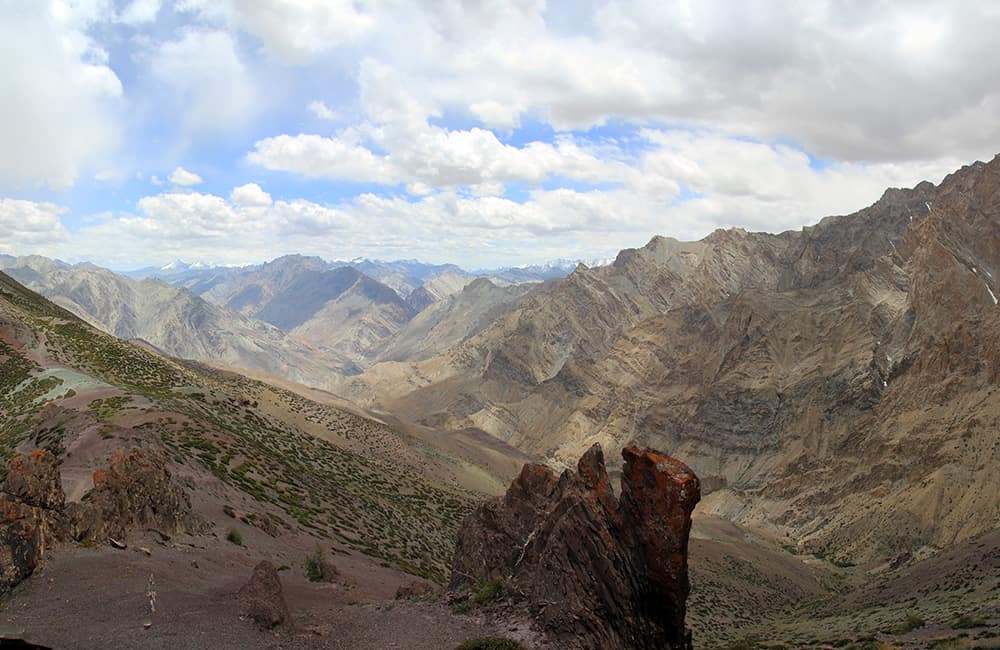
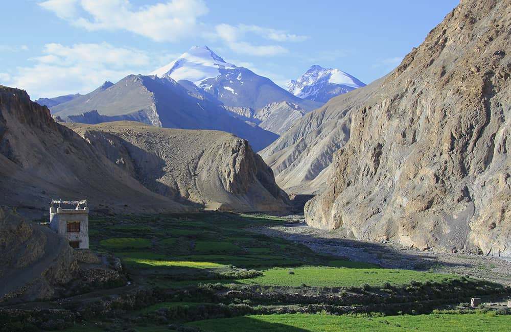
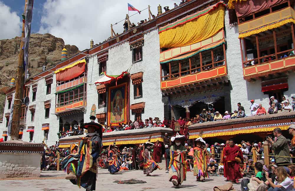
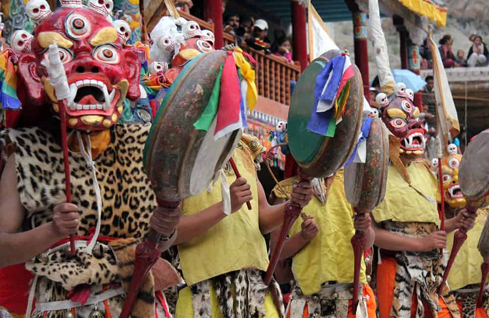
Full of classic Ladakh views of colourful rock formations, staggering hospitality and some challenging passes, this trek is ideal for those on a short timeframe. Beginning at the picturesque gompa at Lamayuru the trail winds from village to village over 4 passes to Chilling where there is a regular bus service to Leh. It is really worth trying to coincide your trek with the Lamayuru Gompa Yuru Kabghat festival in June. This two-day lama dancing purification and invocation is led by the protector mask Mahakala (aka Gonbo) and the demon-destroyer Padmasambhava.
The drive from Leh to Lamayuru follows the Indus river (known locally as Sengge Kha Babs, from the lion's open mouth - ie the river that flows from holy Mt Kailash) first to Alchi (2 hours) and then turning away from the highway at Khalsi (2 hours) to arrive at the impressive gompa complex in another 30 minutes.
2
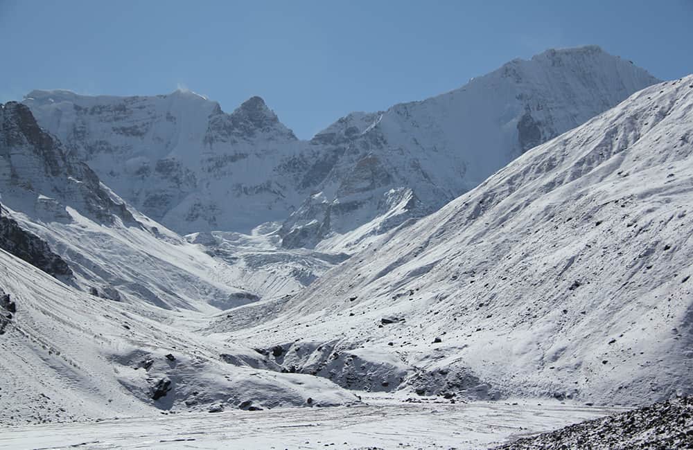
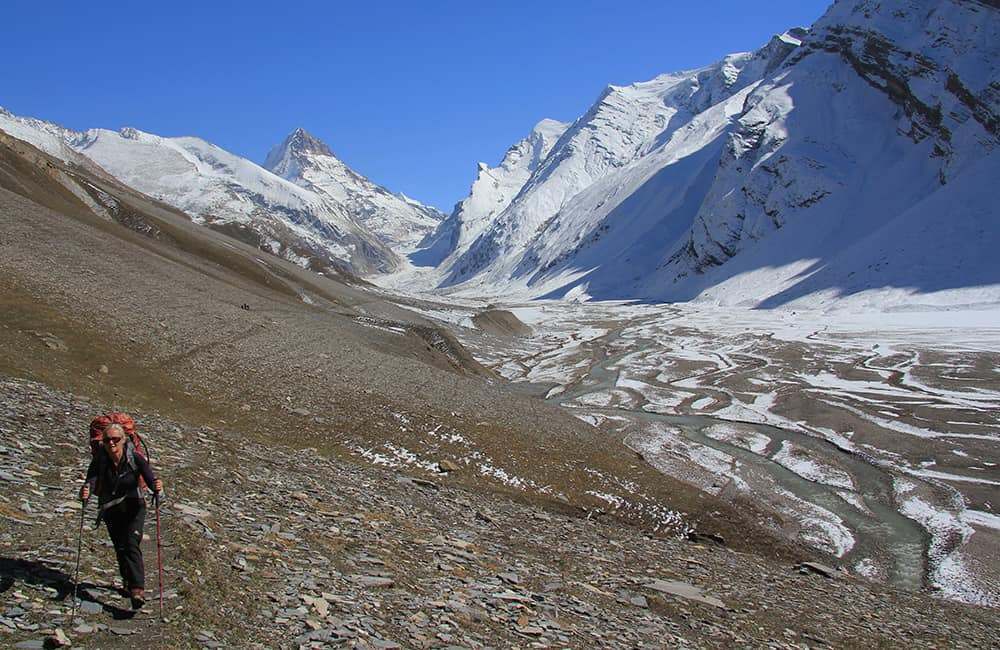
Lamayuru to Hinju 2.75hrs + 40min drive camp 3788m Alt Var 1020m
Beneath the gompa Lamayuru village fills a broad water gully. There are a few basic teahouses here and one offers cooking classes! From the gompa descend to the village and follow the watercourse down through the village to the main road (5 minutes) where you can choose to either head downhill (turn left) on the road for about 5 minutes to a trail that heads right across some fields towards some chorten on the far hillside.
Alternatively, head down through scrub to the main valley stream, where you head downstream (turn left) and keep crossing the stream until you meet the trail from the road in about 15 minutes.
Just before the confluence of a valley from your south (right) climb a trail on the true right bank to a collection of chorten (3412m, 20 minutes from gompa, N34°16’51.6” E76°46’58.6”) where there are good views of the gompa. Follow a good trail into the tributary valley, which soon narrows and begins to follow the watercourse gully. In roughly 20 minutes come to a trail junction, where you turn left into a steep-sided gully – do not head right on the more obvious trail that climbs to Chaghacha (aka Pamz kharka). Remain in the gully for about 5 minutes and then climb a little to be level with the main valley floor. Beyond the deep gully is the large open pasture of Chaghacha. Continue climbing easy switchbacks and then after a short traverse reach Prinkti Pass (3728m, 50 minutes from chorten, N34°15’54.0” E76°46’56.5”).
The trail rapidly descends to a watercourse that winds through some impressive gully scenery and ends at the Shillakong road (3230m, 1 hour, N34°14’31.5” E76°48’19.1”) where you turn left (downstream). Cross a bridge and pass Shilla village, following the road to Wanla (3172m, 30 minutes), which joins the new Lamayuru Sumdo – Hinju road. You might be lucky and hitch a lift with a passing vehicle but it would be wiser to pre-book a car to drive you up to Hinju (3788m, 40 minute drive, N34°11’12.6” E76°55’53.6”). If you want to walk the 23km it will take about 5 hours.
Note: homestay accommodation and campsites in Wanla, Phanjila (after 14km) and Hinju.
Wanla Folktale
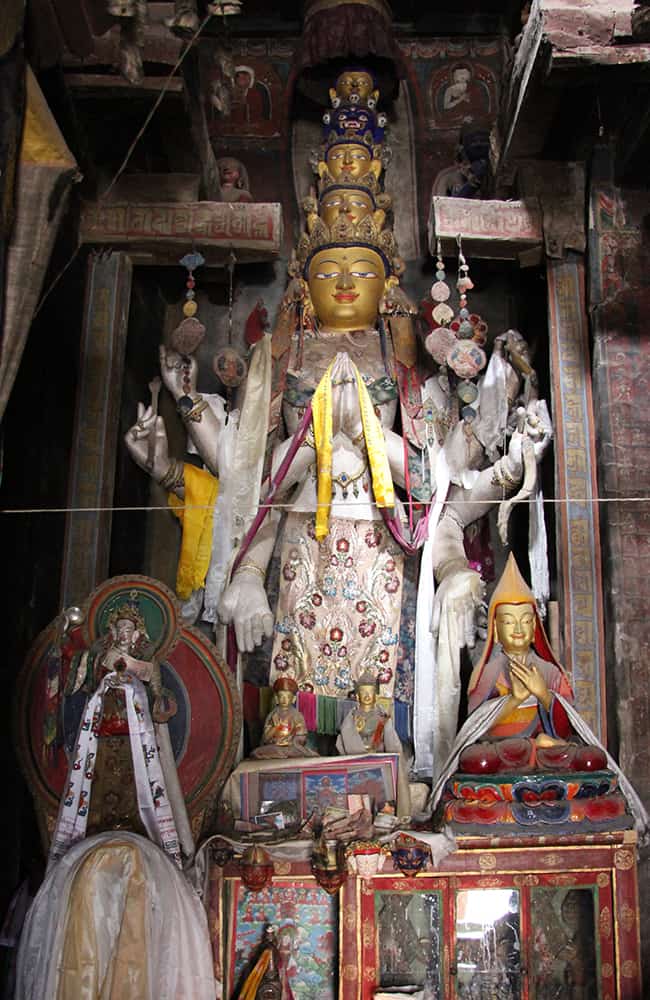
It is worth visiting the Gandharan-style Wanla Gompa, a contemporary of Alchi Gompa, where there is also a statue of the local protector Jingme Dadul, son of Kumchen Bugdaskep, the first king of Wanla about 400 years ago.
It is said that Jingme Dadul was a humble man who always put others before himself. One day, while travelling to Leh, he met a God who asked him what he wanted as a reward for his efforts. “Power,” came the reply and thus Jingme became king of all Ladakh. However, the God only granted this one wish to Jingme, who later died childless and with no alternative heir. His popularity throughout Ladakh was legendary and the villagers of Wanla still maintain his house and land for his reincarnation augered to be 900 years after his death. When locals want to borrow one of his possessions or use his land (the school was built on some of his fields) they consult his statue in the gompa. Consent or otherwise is then passed through a village oracle who becomes possessed by his spirit. The oracle also issues village orders or criticism on behalf of Jingme, whose return, it is believed, will bring Wanla fame again.
3
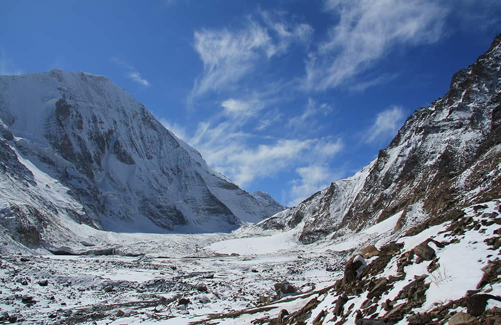
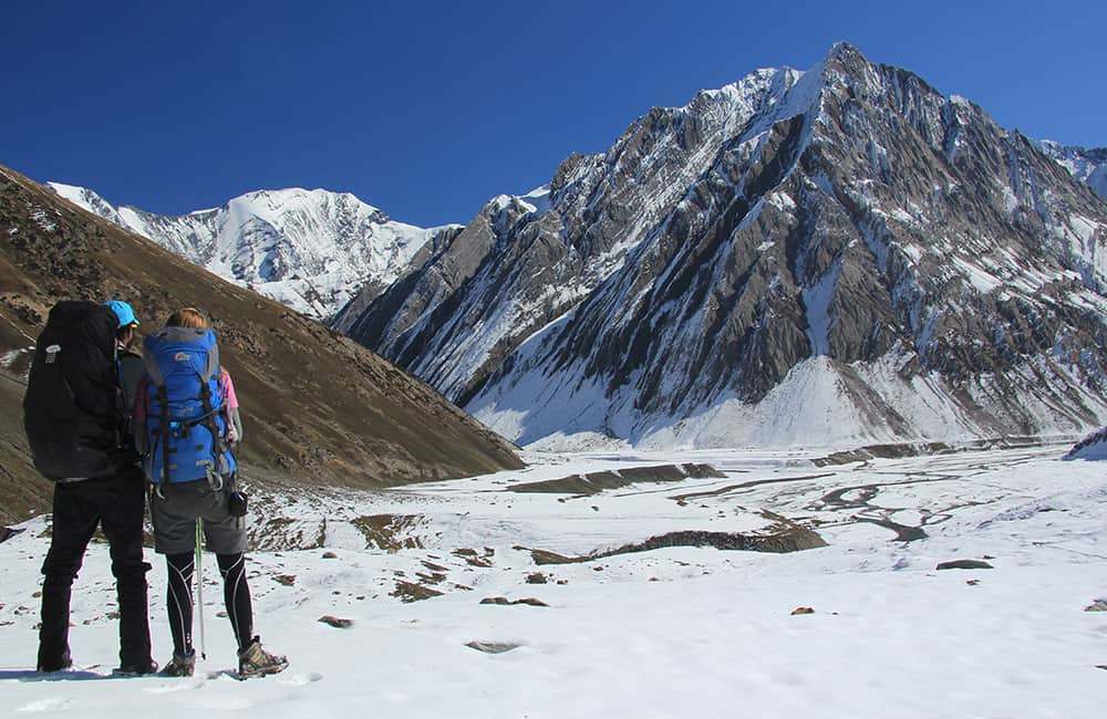
Sumda Chenmo 6.25hrs camp 3969m Alt Var 2150m
Walk through Hinju to the last house and climb a couple of metres to follow the irrigation channel. When the irrigation channel turns away from the path, do not follow it. Instead, continue heading up the valley on the true right bank. Pass a couple of grassy river-side campsites and in 45 minutes pass the substantial camp at Angshang, where there are a few houses but no home-stay. Either cut between the houses or across the camping area to follow a substantial trail as it gradually climbs up the valley floor.
In 1 hour and 35 minutes, come to a confluence where there are some simple herders shelters beside the true right tributary (4343m, N34 09'17.8" E76 59'51.3"). Head up this tributary for about 15 minutes, when the trail then climbs switchbacks up the left (true right) bank to open hillside. Longer switchbacks continue to climb all the way to the Konski La (aka Konzke La, 1 hour 20 minutes, 4909m, N34 09'03.0" E77 00'35.1") where there are good views of ochre, taupe and sand coloured peaks and ridges both east and west.
Switchbacks descend to a stream gully, which you follow down to the true right bank of the main valley. Cross back and forth across the growing stream to a collection of herders huts on the true left bank (45 minutes, 4372m, N3408'43.7" E77 01'54.2"). Remain on the true left bank and pass more herders huts in 15 minutes, after which descend to and then cross the river. In 10 minutes cross back to the true left bank and traverse steep earthy hillside broken by small landslides for 30 minutes and then return to the valley floor. To your left (northeast) is a campsite at the mouth of a tributary that eventually leads to the Serdultran La.
Note: after the cloud-burst storm in September 2010, the trail to Serdultran La is broken and dangerous in many places.
Impressive ochre cliffs rise from the true left river bank, which force you to cross the river to the true right bank. Either, immediately climb up to a trail about 50m above or head down stream for a short distance to where the climb is a little less. A large chorten beside the trail marks a point where you should aim for if coming from below. The trail briefly turns right before descending to the river as the valley then turns left. Again cross the river and follow an irrigation channel as it winds around cliffs to Sumda Chenmo (1hour, 3969m, N34 06'56.4" E77 05'19.8") where there is a campsite and eight homestays operating on a rota basis.
4
Chilling 6.5hrs camp 3246m Alt Var 2550m
Cross the stream in the centre of the village and pass just above the last house in the village along a large trail. Contour to some chortens and then descend to the river, which you must cross near a herders shelter called Lasgo. On the far bank is a good campsite and beyond, another stream which you need to cross to a trail that climbs a steep hillside (1 hour, 3770m, N34 06'07.3" E77 07'15.2"). The trail is a little loose at first but soon gives way to easy switchbacks on a scrubby slope all the way to Lanak Pass (55 minutes, 4130m, N34 06'05.2" E77 07'48.5").
Above the few cairns on the pass rises the amazing rock spires of Photaksur peak. A slight contouring descent into the Lanak valley brings you to a small stream, and beyond, a campsite and tea shop (30 minutes, 4106m, N34 05'42.2" E77 08'41.4"). In another 15 minutes reach some herders huts and ahead is a rock spire, which you must stay to the left (east) of as you climb further. Do not head towards the main rocky peak at the end of the valley. The trail climbs switchbacks on scrubby hillside towards a notch in the ridge above next to some prominent rocks. You don't see the narrow saddle of the Dhundhunchen La (1 hour and 15 minutes, 4602m, N34 05'19.4" E77 09'33.7") until you are almost there, but the views are worth the effort.
There are excellent views along the trail as it traverses away from the pass to where jade coloured earth cover a saddle on a prominent ridge. Just before the saddle is a pullu (dharamsala, 25 minutes, 4488m, N34 04'42.9" E77 09'56.0") beneath some knife-blade like rock formations. From the saddle, follow the trail as it descends southeast (right) at first on easy gradients but then more steeply to herders huts at Sanak (1 hour 15 minutes, 3764m, N34 03'26.4" E77 10'56.7"). Steep switchbacks lead down into a river gully and in 15 minutes turn left, downstream, and follow the river crossing it frequently. The increasingly impressive gorge pass some old chortens, where you cross to the true left bank and then pass a mani wall. A roadhead homestay is down towards the riverside from here, but better homestays are just around the corner in Chilling (1 hour, 3241m, N34 02'18.2" E77 12'13.4").
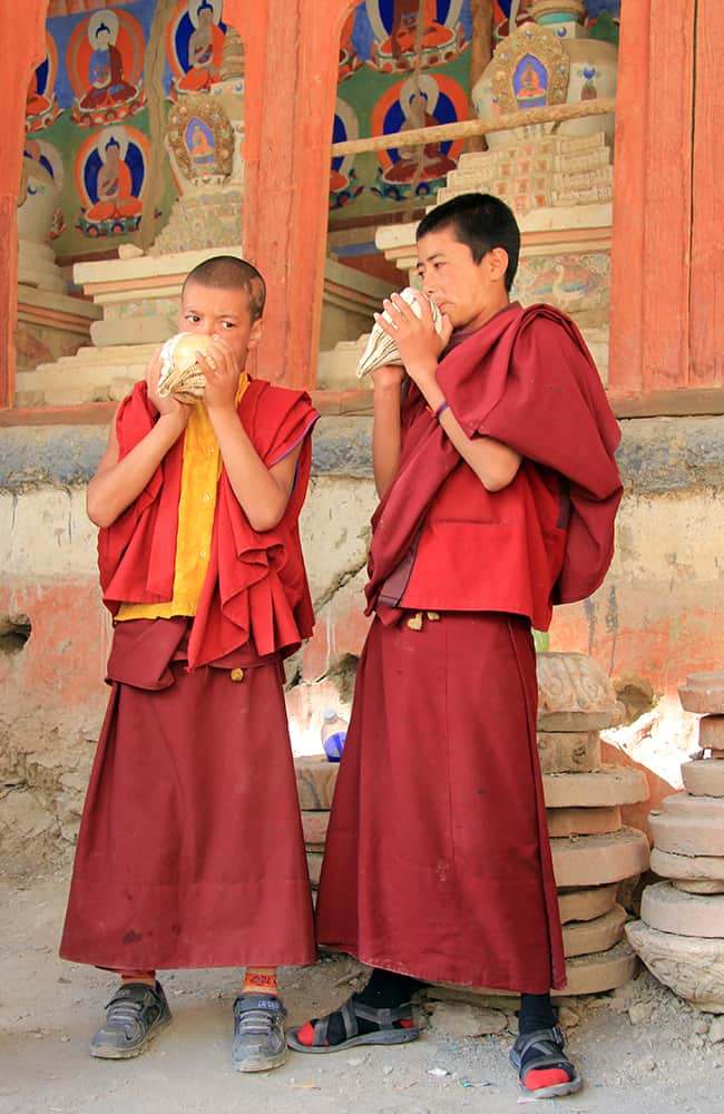
Note: Chilling is famous for intricate metal work, including the manufacture of the musical instruments seen in monasteries.
5
Markha Valley and Hemis, Leh-Leh, 4 days
Understandably popular, the trek from Chilling through the Hemis National Park to Shang Sumdo and Hemis Gompa, is a fabulous way to experience the best of Ladakh. Dramatic scenery, traditional Ladakhi villages, plenty of grassy pastures and inviting homestays make this route ideal for independent and group trekkers. However, the Markha valley trail is on the verge of disappearing thanks to a road building project, so get there soon before it disappears.
This trek is normally commercially advertised as an 8 to 10 day program. I did it in 5 days Leh to Leh, and I think it would be fine for most people over 6 days if you have already spent a couple of days in Leh. Although Nymaling isn't very comfy, I would also recommend using homestays.
A word of advice
During the main trekking season, July to September, the best campsites are frequently pre-booked by groups who send someone ahead early in the morning. Unfortunately this is now common practice and trying to explain campsite sharing etiquette is a complete waste of time. So, to avoid disappointment later in the day try and team up with one or two other groups who are prepared to share sites and send your own person ahead as early as possible.
6
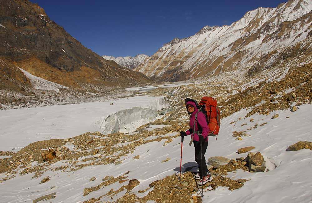
Leh - Chilling - Skiu 3.5hrs camp 3388m Alt Var 320m
A 3-hour twice weekly bus service operates between Leh and Chilling on Sunday and Thursday. A private car will do the trip in 2 hours and 30 minutes. If you are starting from Chilling, today is a short day so take your time to explore the village and maybe buy a souvenir piece of metal work? If you are driving from Leh to Chilling, get an early start to arrive before the temperature gets too hot in the afternoon.
Follow the dirt road upstream (true left) beside the Zanskar Tsangpo (large river) to a cableway across the river (1 hour, 3199m, N34 00'29.9" E77 12'28.4"). The cableway isn't in the best repair but safe enough. Expect to spend 15 to 30 minutes ferrying people and gear, and to pass the time check out the makeshift shop but beware that prices here are massively inflated. A section of dirt has been completed on the far bank but it will be a few years before the State government has the budget to build a bridge.
Begin by following the road across a dusty plateau. The trail soon starts short-cutting across the road loops and climbs to a rise marked by chatta. Then it's an easy undulating traverse to the oasis-like Kaya (aka Skaya, 1 hour 20 minutes), which is spread over a large area. There are a few home-stays here and a couple of campsites. Beyond the village the valley narrows and the effects of cloud-burst damage are obvious all the way to Skiu (aka Skyu) Gompa. After crossing a badly damaged watercourse there are many chortens and a small teashop (30 minutes, 3370m) run by a metal worker who sells rings and simple souvenirs. There are some fine campsites in another 15 minutes as well as Tsarik Homestay (3388m, N33 58'46.9" E77 16'19.8"). If Tsarik Homestay (named after the owner) is full then you will need to ask around in the village to find alternative homestays.
7
Markha 4.75hrs camp 3757m Alt Var 500m
The trail from Tsarik Homestay follows the irrigation channel on the true right side of the Markha Drokpo (small river). The shade from poplar trees ends at the hamlet of Pentse beyond which you cross the Pentse Chu to a new teashop called Chotak (roughly 1 hour). In another 50 minutes of steep-sided gorge cross a wooden bridge (3438m, N33 56'42.5" E77 19'34.6") to the true left bank. The trail winds through some large shrubs and then crosses some alluvial debris to the tent-teashop at Nakding (20 minutes, 3553m). It is then an easy section of trail to the campsite and homestay at Sara (20 minutes, 3588m).
Surrounding vegetation soon ends after Sara and in 20 minutes cross a wooden bridge to the partially ruined village of Chaluck. A slight climb around a rocky spur leads to Lhato Marpo (20 minutes, 3676m, N33 54'39.3" E77 22'25.2"), the spot where locals believe a spirit guardian lives to protect the valley. One day each month a lama from Markha must come here to perform a puja to honour the guardian. Pass a ruined village that hugs the base of steep hillside as you continue to gradually climb. Rounding another chorten-covered spur the valley dramatically opens up and ahead is a large flat area covered in shrubs and poplar trees called Thinlespa. Among the shrubs is a homestay and campsite and a little further you have to wade across the river - choose your crossing place carefully as the current is surprisingly strong (1 hour from Lhato Marpo, 3727m, N33 53'41.3" E77 24'08.5").
From the far bank it is about 10 minutes to the first homestays in Tongyet Yongma
and after crossing an alluvial fan is a substantial grassy campsite and comfy homestay of Tongyet Kongma (25 minutes, 3757m, N33 53'18.6" E77 25'00.8"). To reach the village of Markha, cross a small bridge and climb over a small spur on which is Markha Gompa and in the village below are four basic homestays (5 minutes).
There's love in a name
Markha's original name was Margha, which means beautiful nurturing place. The locals think of the village so fondly that they say they love it more than their mother's lap.
8
Nyimaling 5hrs camp 4858m Alt Var 1200m
IMPORTANT: if you are unacclimatised you should break this route into two days by staying in Hangkar Yongma or Hangkar village.
Cross the stream that bisects Markha and leave the village on a broad grassy trail passing some more potential campsites. Remain on the riverbed as you wind up the true right side of a narrowing gorge. As the cliffs converge in about 30 minutes, wade across the river and head towards an impressive rock spire. In another 10 minutes wade back to the true right bank where the river runs up against a cliff face. The wind around a rocky spur on which are some mai walls and chorten, and above is Techa Gompa. A small teashop marks the start of the trail up to the gompa. The gorge now opens up to Homalong (30 minutes, 3876m, N33 52'06.7" E77 27'49.8") where there is a homestay and campsites.
Head around a spur and stay close but not always next to, an irrigation channel. The valley continues to broaden and after crossing another minor spur and views of a finger-like rock spire and Kang Yangtze II. Cross a broad grassy pasture, where there is a community-owned teashop at Da Amo. The popular lunch stop and honestays at Hangkar Yongma (1 hour 15 minutes, 4000m, N33 50'13.1" E77 30'05.8") are the first of two potential night halts for those needing further acclimatisation. The next is just around a spur beyond the village then instead of continuing beside the river, climb some switchbacks up a rough gully. At the top are more chorten and a slight descent into Hangkar village proper, where there are a couple of homestays and a campsite. On the far side of the village head up a narrowing valley, passing a tributary valley and then cliffs soon appear on the true left bank.
Note: The tributary just before the cliffs is the route to Zalung Karpo Pass.
Remain on the true right until the cliffs begin to change to hillside, when you then cross a bridge to the true left side of the valley. Just beyond is the popular campsite and teashop of Tachutse (1 hour 10 minutes, 4254m, N33 48'42.5" E77 32'01.9"). There are more but smaller campsites after a 20 minute climb to a shallow valley where a herders shelter sits on a moraine ridge above.
Do not continue to follow the main valley! Instead, bear right and climb the shallow valley almost to it's end where switchbacks climb hillside on your left (true right) to a cairn-covered ridge. This is an excellent view point and popular rest stop (30 minutes, 4573m, N33 48'36.8", E77 33'09.3"). Follow the ridge for about 20 minutes to a small lake that marks the trail junction; turn right to the Kang Yangtze II Base Camp, or turn left to continue to Nyimaling.
Crossing rolling moraine for 30 minutes to a ridge slightly above the Nyimaling Plateau, to which you descend and then follow, climbing very slightly to Nyimaling camp (30 minutes, 4858m, N33 47'11.5", E77 35'38.5"). There are some grotty tents-for-hire and a teashop as well as a small dairy that produces goat and dzo milk and cheese. If you camp on the true left bank (near the teashop) then you are obliged to use the disgusting toilet nearby. It is fair to say that Hemis Gompa, who own the land, should spend some money to improve Nyimaling - they certainly make enough from tourists in the gompa!
If you have broken this day to assist acclimatisation then you will have plenty of time to climb the moraine hill towards Kang Yangtze for afternoon views.
9
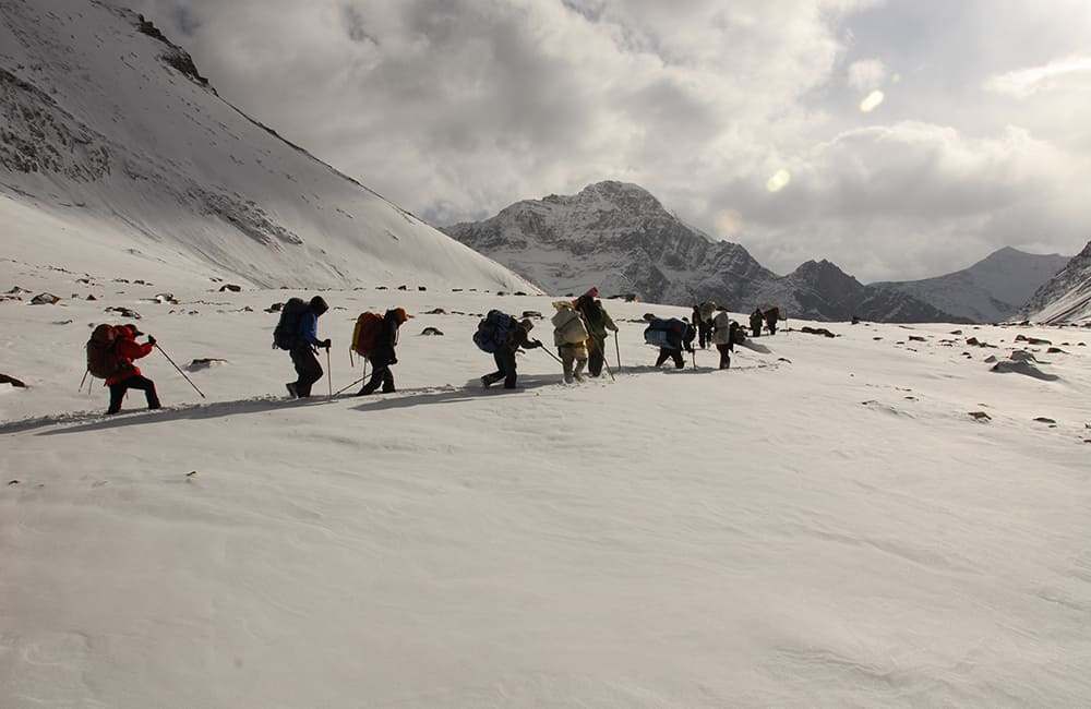
Shang Sumdo - Hemis/Leh 5hrs + drive camp 3583m Alt Var 2200m
It is worth getting an early start to enjoy early morning views both on the way up to and on the pass. Cross the bridge near Nyimaling teashop and head up a trail that rises from behind the dairy area. Easy switchbacks climb to a plateau which you cross to the base of the final climb to the pass (1 hour, 5116m, N33 47'22.7", E77 36'43.6"). Then some more easy switchbacks take 25 minutes to Kangmaru La (5286m, N33 47'25.2", E77 37'02.6") where there are many cairns and lumdar.
The descent from the pass is on switchbacks that are a little steep - look out for Blue Sheep in the valley. Continue down into a gully and herders shelter (45 minutes, 4750m, N33 48'01.7", E77 37'27.6"). After a slight descent cross the stream to the true right bank, this is the first of many crossings! After another couple of crossing climb a 30m section of switchbacks on the true right bank, follow a short traverse and then descend to the river again. But instead of crossing, stay in the watercourse for about 10 minutes and then climb the true right bank again. Traverse for about 15 minutes and then descend and cross the river, this time climb to trail on the true left bank (30 minutes, 4385m, N33 48'53.8", E77 38'25.7"). Then for the next 30 minutes you are either on the true left bank or in the watercourse depending on water level until Chu Kurmo (4150m, N33 49'27.9", E77 39'03.3") where there is a campsite and two teashops.
Daubes of white paint on boulders now mark the trail all the way to Shang Sumdo, so although unsightly, it does mean you can enjoy the view and not worry too much about navigation! Wind around the true left bank and then follow a trail that criss-crosses the watercourse, passing Changdok in about 20 minutes. The trail continues to alternate between the true left bank and riverbed all the way to the end of the valley. Pass a tributary trail junction in about 40 minutes (3926m) that might lead to the Gyuncho La but as noone had ever heard of this pass it is hard to say.
The main part of Shang Sumdo lies on the true right bank and as you pass on the opposite bank the trail becomes road. The road is broken further down, so you have to continue to the confluence with the Kitshan Chu (50 minutes, 3700m, N33 49'45.4", E77 40'42.2"), where there are a couple of homestays, campsite and road.
Hemis is a 30 minute drive, or 12km walk from here. Alternatively, Leh is a 1 hour 15 minute drive away. There is no regular bus service so you should pre-book any transport before beginning the trek, or be prepared to walk to Martselang (10km) to catch a bus.
10
Urgin La & Kang La, Manali to Padam, 12 days
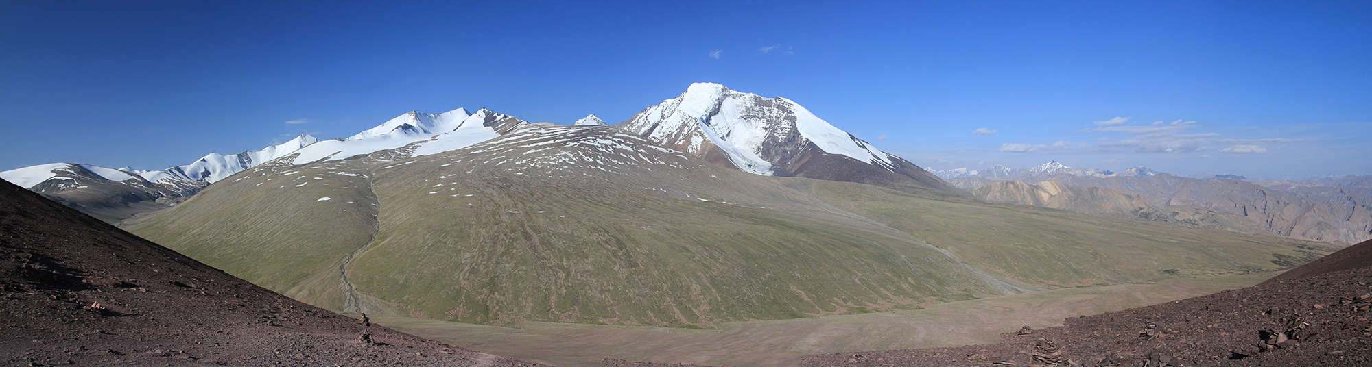
The combination of these two passes provides an excellent two week trek (Delhi-Delhi) if you include ample acclimatisation time. Beginning near Dartse in the Bhaga valley, you first slowly approach a picturesque glacial system. Then cross the Urgin La to reach the Miyar valley, which boasts one of the longest glaciers in the Indian Himalaya and is spectacular on a grand scale. A 26km glacial approach to the Kang La is the longest of any in the central Himalaya and a fitting way to reach Padam, the capital of Zanskar.
Now that a motorable road is being built over the Shingo La this trek is expected to become much more popular in the next few years. However, it does involve a technical and committing climb to the summit if the Urgin La that should not be attempted without adequate skills and equipment.
The first pass, Urgin La, is in Himachal Pradesh as well as the approach (Miyar valley) to the Kang La. The Kang La sits on the border with J & K, the remainder of the trek is in Jammu & Kashmir.
Brief Itinerary
Day Place Height Time taken
1 Delhi
2 Manali 2000m 14hrs drive
3 Zangskar Sumdo 3938m 7.5hrs drive
4 Kuddu 4030m 2hrs
5 Approach camp 4532m 5hrs
6 East High Camp 4846m 4.5hrs
7 West High Camp 4991m 6hrs
8 Nr Gumba 3777m 4.5hrs
9 After Khaigot 3928m 4.5hrs
10 Zardung 4284m 6hrs
11 Kang La BC 4730m 5.25hrs
12 Kang La north 4619m 9hrs
13 Temasa Topgo 4219m 3hrs
14 Padam 3587m 3.5hrs plus drive
15 Srinagar / Delhi 1607m 20hrs drive plus flight
Getting there and away.
Delhi - Manali 14 hours stayed in Johnson's hotel Rs2500/night.
Manali - Rhotang pass 2.5 hours (early start) then 1.5 hours to Koksar for brekky then 3.5 hours to Zanskar Sumdo.
Bibcha to Padam 40 minutes stayed Changtang Hotel (t: 9469 458067) Rs300/night.
Padam to/from Kargil 9 hours.
Kargil to/from Leh 5 hours (now an excellent road).
Kargil to/from Srinagar 10 hours.
Srinagar to Delhi is a 1 hour flight but you need almost 3 hours for security checks ( not so long in reverse).
11
Days 1-3 Delhi - Manali - Zangskar Sumdo 3140m 21.5hrs
minor road construction points that slow you down. Once you reach the first hills at Bilaspur the road gets busy with heavy vehicles due to a nearby cement factory but after 40km or so it's clear going again to Kullu. This regional commercial centre famed for pashmina shawls is always busy and can be a bottleneck during the day. Beyond the town are a multitude of rafting outfits and riverside restaurants that cater to the huge influx of domestic tourists during the monsoonal months.
Johnson's hotel is pretty well in the centre of Manali and has some good food although breakfast doesn't begin till 8am (if you're lucky).
The legendary Rhotang La (literally, Pass of Death) will soon be bypassed by a tunnel due for completion in 2013 along as part of a new road network linking Manali and Leh through Zanskar. It takes 2.5hrs to reach the top of the pass if you avoid the sightseers who start mid-morning. Then 1.5hrs down to the first settlement and popular dhaba stop at Koksar. In a short while turn north into the Bhaga river valley and reach the police checkpost at Dartse (aka Darcha) in 2.5hrs then another 1hr up to the Zangskar Sumdo campsite (3938m, ref: N32 48'06.7" E77 06'50.8"). Road construction work over the Shingo La means quite a few people move up and down past the campsite so be careful of your possessions.
Note: Due to the rapid ascent to 4000m you might want to rest for a day in Zangskar Sumdo to acclimatise. There are a few easy walks around, both up valley and towards the Shingo La.
12
Day 4 Zansgkar Sumdo - Kuddu 4087m 2hrs
Follow an obvious dirt track up valley from the campsite, remaining on the true right of the valley throughout the next days. You soon begin crossing easy moraine mounds and the trail sometimes winds close to the cascading Barai Topgo river. In 1hr and 15 minutes reach a pretty lake in the moraine (4030m, ref: N32 49'23.0" E77 05'30.8") where some groups choose to camp.
Wind around the left (true right) side of the lake and cross a series of small flat areas and gradually climbing moraine. In 30 minutes, reach the top of the moraine and look down on the confluence of a major tributary from your left. At the outflow of this valley is a large flat grazing area with some shepherd's shelters, called Kuddu (4087m, 20 minutes plus river crossing, ref: N32 49'50.8" E77 04'37.5").
Note: before crossing the main outflow there is a large brown boulder painted with "ND <- -> TL" with the arrows indicating the Tarsalamu La (TL) is up the tributary valley (beside Gangsthang Peak) and links Naingahar and Dartse. The location of the Tarsalamu La varies on different maps but this painting seems to indicate that locals are specific about the location... either that or it is misleading graffiti.
13
Day 5 Approach camp 4532m 5hrs
To the northwest of camp climb lumpy moraine using a clear trail. Pass the mouth of a substantial tributary to your right and sometimes wind close to the river. The trail can be hard to find in the larger boulders so take your time. Climb another mound of moraine and suddenly you find yourself in a small grassy flat-bottomed valley (4268m, 1 hour and 30 minutes, ref: N32 51'21.3" E77 03'58.9") that is good for camping.
Continue up bouldery moraine and occasional river-side trails as the valley winds through a slight 'S' shape. As you climb out of the S you get the first views if the upper valley from some small flat pasture areas (2 hours and 30 minutes). Instead of stopping here, continue for another 1 hour (4532m, ref: N32 53'17.9" E77 02'40.4") to a good sandy area on the far bank (true left) of the river.
You now remain on the true left bank until you reach the glacier at the head of the valley.
14
Day 6 East High Camp 4846m 4.5hrs
From camp wind across mainly flat valley floor with some small areas of moraine until you come to another campsite with some rubbish (4583m, 1 hour, ref: N32 53'35.4" E77 01'39.4") and begin climbing moraine from here. On the far side of the valley are two ice falls either side of a minor peak, which are incorrectly identified as routes to the Shinka La and Tarsalamu La on the Editiones Olizane map.
The gradient is pretty constant as you continue up valley and you might have to dig out platforms to camp on as there is no clear campsite. The snout of a glacier is at 4750m and has an impressive cave at the mouth. In another 100m or so we made camp (4846m, 3 hours and 30 minutes, ref: N32 54'25.6" E76 59'52.2").
15
Day 7 West High Camp 4991m 6hrs
Cross to the bulging glacier that flows down from the end of the valley and walk straight up passing another minor peak on your left. The higher neve is broad with a distorted horseshoe shape of peaks - an impressive start to the day!
The pass lies on a rocky ridge, which descends directly from the northwest buttress of the lesser peak. Approach via the glacier to beneath the lowest point along the ridge and climb mixed rock and snow using a gully. The Urgin La (5362m, 4 hours, ref: N32 55'08.6" E76 58'05.3") offers great views northeast and southwest, and a lack of prayer flags combined with some decrepit cairns indicate it is no longer used regularly.
On the far side of the pass you descend by traversing a boulder slope to your right (true right) to some prominent moraine you can clearly see from the pass. A shallow depression beside the moraine holds a lake during the monsoon months but is dry for much of the year. On the ridge of the moraine are some shepherd's shelters but a much better campsite is at the confluence with the main valley (4991m, 2 hours from the pass, ref: N32 54'10.1" E76 57'15.7") where rocks give way to soil for the first time in few days.
16
Day 8 Near Gumba 3777m 4.5hrs
A short climb to the top of moraine above the camp and on the true right of the valley provides a clear view of your route ahead. You should be standing on a large rib of medial moraine that you follow towards the entrance of the valley. Some prominent cairns mark where you begin to descend more steeply (4838m, 1 hour and 30 minutes, ref: N32 54'14.9" E76 56'07.1").
A series of 'steps, of descending moraine and small grassy areas leads down to the valley mouth - always remain on the extreme right of the valley floor. There are good views of the Miyar valley from the top of a boulder section you need to find a way through - follow any of the animals tracks with care, as the ground is fairly loose. Take a descending traverse route that winds into the main valley and then drops for the last couple of hundred metres directly to the main trail below. Turn right (up valley) on the main trail and follow for less than 20 minutes to a fairly sheltered grassy pasture with good water (3777m, 3 hours, ref: N32 55'01.5" E76 53'56.9"), which is before the large windswept site at Gumba (note this is not the same Gumba as the village down valley, this is their summer grazing pastures thus the name-sharing).
Note: the road head at Thingrot (aka Thingot) is an easy day's walk down valley, and Manali can then be reached in a long drive of 12 hours.
17
Day 9 After Khaigot 3928m 4.5hrs
This is an absolutely terrific and easy day as you wander up a really impressive alpine valley. Begin by crossing mainly flat ground (the Gumba grazing grounds) and some short moraine sections to a bridge over the Nakora Nala (3840m, 1 hour, ref: N32 56'28.7" E76 53'49.7"). After a short climb up the far bank come to some small ponds that offer pretty reflections of peaks in the morning light. The trail continues alternating between grazing areas and moraine, passing Kornu boulder cave (3898m, ref: N32 59'01.1" E76 51'04.9") in 2 hours, and then the Khaigot grazing areas in another 2 hours. A good campsite is at the very end of the Khaigot area in the lee of some moraine (3928m, 30 minutes, ref: N33 00'47.2" E76 49'58.9").
18
Day 10 Zardung 4284m 6hrs
Cross another couple of grazing areas separated by fans of alluvial debris and reach the beginning of glacial moraine in 1 hour and 30 minutes (3974m, ref: N33 02'10.2" E76 48'05.0"). The trail climbs lateral moraine to your right (true left) where short flat-ish sections are separated by knife-edge ridges and scree slopes. Once about 150m above the glacier the trail traverses hillside with some up and downs through stream gullies and across loose scree. In about 3 hours the moraine finally ends at a rocky bluff that marks the confluence of the Takdung glaciated valley from your right (true left). The confluence is commonly referred to a Zardung (meaning rocky place) and from a vantage point try and identify a spot in the glacier to camp as well as a tongue of glacier beyond. Descend loose ground to the glacier and navigate to your proposed spot. It will probably take some time to dig out platforms (4285m, 1 hour and 30 minutes from the top of the moraine, ref: N33 05'06.2" E76 45'43.1").
19
Day 11 Kang La BC 4730m 5.25hrs
It should take about 40 minutes to cross to the tongue of glacier a little further up the Miyar valley that you should have identified yesterday. It is easiest to get onto the glacier as quickly as possible rather than remaining on the moraine. The walk up the centre of the glacier is both awe-inspiring and surprisingly easy. Hanging valleys perch high above the valley floor and impressive peaks form an avenue throughout the day. There are a few deep gullies caused by melt water and the occasional sink hole, which are easily crossed or avoided but be cautious!
In roughly 2 hours and 30 minutes, reach a medial moraine that crosses the glacier. Head to the extreme left (true right) of the moraine and look for cairns that mark a route over the moraine to a small lake (4533m, 30 minutes, ref: N33 07'26.2" E76 45'31.1") and beyond, the upper valley.
Descend to the glacier and again head straight up valley. In 45 minutes reach another medial moraine that cuts across the valley. Some cairns mark a point where you can begin crossing, but the trail soon disappears and it will take about 30 minutes to reach the far side. Again head straight up the valley and keep an eye out for some low lateral moraine on your left (extreme true right). When it begins to disappear climb it and check for tent platforms, as this is the last point 'off-ice' to camp before the pass (4730m, 30 minutes, ref: N33 09'33.5" E76 45'49.8").
20
Day 12 Kang La north 4619m 9hrs
Continue heading straight up the Miyar glacier, passing the confluence with the Jangpar glacier in 1 hour and 45 minutes. Ribs of moraine run from the the confluence up towards the pass, which lies beyond a couple of ice steps at the head of the valley. Follow a rib that curls towards the left (true right) of the valley and an obvious cliff. Before reaching the cliff climb the glacier slope to your right and then after a shallow basin, climb another slope to the pass plateau. The Kang La is the point where a descending valley joins from your left, some cairns and prayer flags on the rocky hillside mark the junction (5465m, 3 hours, ref: N33 14'11.7" E76 49'09.2").
The descent is heavily crevassed so you should rope together. Head down the true right side of the glacier towards moraine. Running water is hard to come by at first but melt water can be found below 5000m, or if you have time, continue descending for 3 hours and 15 minutes to an excellent site (4619m, ref: N33 17'05.6" E76 49'06.3") at the valleys mouth.
Note: at the confluence with the main valley you can turn left (up stream) to the Poat La.
21
Day 13 Temasa Topgo 4219m 3hrs
After the long day yesterday, you might be tempted to lie in and take your time. The upper Temasa Togpo valley is both very pretty and full of great campsites. Continue down the true right side of the valley for about 1 hour and then cross to the far bank. In another 2 hours, and almost every hour or so there are some great camping choices. To traverse the entire valley and drive to Padam is a long haul unless you are particularly well planned so pick a site that suits you and look forward to a hot shower tomorrow night!
Top Tip: send some crew ahead today to book a car from Padam to wait for you tomorrow.
22
Day 14 Padam 3587m 3.5hrs plus drive
The trail undulates across alluvial fans and moraine with patches of grazing ground in between. In about 2 hours and 30 minutes reach a final small patch of grass beneath a rocky ridge that stretches across the mouth of the valley. It's a 150m easy climb to the lowest point on the ridge, the Kong La (3951m, 30 minutes, ref: N33 22'43.5" E76 55'20.5") from which you look down on Bibcha, the first village since Dartse. Take a direct route to the road (3700m, 30 minutes), which is used infrequently by local vehicles. If you've been organised, jump in your waiting vehicle for the 40 minute drive to Padam passing the impressively sited Bardan Gompa. The intense blue of the Zangspo river is a stark contrast against the ochre, grey, adobe and black hillsides; a fitting end to the trek!
23
Ghans Galli (Kashmir), Padam to Srinagar, 8 days
I was always reluctant to believe that the travel warnings about Kashmir were totally accurate, so for some time I have been asking Kashmir veterans for their comments. Perhaps unsurprisingly many were reluctant to say anything other than the 'official line' but a few suggested talking to the locals and army posts to see how the security situation was at a local level. So while driving from Padam to Kargil I stopped at Pannikher (aka Panikhar) and had a chat. The result was a plan to trek to Phalgam but we only managed to reach Bat Kal valley as snow slowed our progress and the crew refused to continue over Gull Galli. So this trek is only a week, but my word, what a cracker it is!!
From Pannikher, head up towards Bobang Galli, which you could consider crossing in good conditions. The alternative is to bear left around Bobang peak and cross Ghans Galli, a longer and arguably more impressive route to the Bagau / Humpet valley. The walk down to the roadhead at Bashmina is close to Himalayan nirvana.
Do this trek and see how wonderful Kashmir still is!
Brief Itinerary
Day Place Height Time taken
1 Pannikher 3276m 6.5hrs drive
2 Danaro 3790m 3.5hrs
3 Nem Mitung 3906m 3hrs
4 Moraine camp 3572m 7.5hrs
5 Bagau 3365m 5.75hrs
6 Won Kadal Cave 3148m 4.25hrs
7 Rikinwas 2718m 5hrs
8 Srinagar 1607m 2hrs plus 5hrs drive
Getting there and away.
Padam to/from Rangdom 3.5 hours then Rangdom to/from Pannikher 3 hours stayed at Gov't rest house Rs200/night.
Pannikher to/from Kargil 2 hours.
Kargil to/from Srinagar 10 hours.
Kargil to/from Leh 5 hours (now an excellent road).
24
Day 1-2 Pannikher - Danaru 3790m 3.5hrs
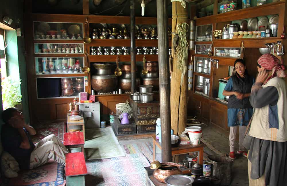
Whether you come from Srinagar (12 hours drive) or Padam (6.5 hours drive) or Leh (7 hours drive) you will probably want at least a day to rest and organise crew in Pannikher (aka Panikhar). The J&K Government Tourist Resthouse is a bit rundown but you can't fault the hospitality of the caretaker/cook Ibrahim and the villagers. Ibrahim can put you in contact with potential crew, but you will need someone in the group who can speak Hindi or Urdu well.
From the Pannikher (3276m, ref: N34 06'57.9 E75 56'55.0") guesthouse walk up through the village on the Sanku-bound sealed road. At the end of the village the road drops to a wooden bridge, which you cross and then turn immediately left and head up stream (true left bank). In a few minutes reach a police post where your entire group will need to register (3294m, 10 minutes, ref: N34 07'10.6" E75 56'25.5").
Follow a dirt track up the valley that locals have built to ferry supplies to an irrigation channel they are building. Pass some shepherd's shelters in 1 hour 30 minutes and again when you reach the end of the track after another 1 hour. The end of the track has a dirty campsite, so push on, following a trail that traverses between 50m and 100m above the river. After a short gorge section the valley opens up and you now cross moraine and scree. The upper valley has a large flat area which is waterlogged, so camp among some herder's shelters on the last area of moraine, called Danaru (3790m, 2hours, ref: N34 05'06.8" E75 51'20.0").
25
Day 3 Nem Mitung 3906m 3hrs
It is possible to combine some of today's trek into yesterday and tomorrow, thus saving a day. However, if you are acclimatising or just want to enjoy the scenery, it's best to take your time with these camps.
The trail remains about 50m above the valley floor as it traverses the hillside to the right (true left) of camp. The are 4 or 5 streams to cross so be careful of ice if getting an early start. After 30 minutes the trail crosses some gently sloping ground as the valley turns sharply right (westwards). Descend to the valley floor and ford the river and then head towards a large tributary valley that has joined from your left (south, or true right).
Climb easy moraine on the right (true left) side at the mouth of the tributary and continue on good trail into the valley. Ahead are the impressive vertical faces of two peaks known as the black angels. In 2 hours and 30 minutes from the river crossing reach the large pasture of Nem Mitung (aka Kalapari - black angel camp, 3906m, ref: N34 03'23.9" E75 51'00.9"), which lies directly in front of impressive walls of rock and ice.
Note: if you would a short acclimatisation walk then continue on tomorrows trails to views of the lake and glaciers above.
26
Day 4 Moraine camp 3576m 7.5hrs
Beyond camp the valley makes a gradual curve to the right (southwest) and the trail climbs moraine on the inside of the curve (true left). Head towards some prominent pyramid shaped boulders (as seen from below) on the moraine ridge (roughly 1 hour) where the gradient then eases as you enter another section of flat valley. Almost the entire valley floor is filled with glacial lake and surrounded by moraine and ice boulders, the effect is spectacular with the peaks above.
Carefully wind around the right (true left) side of the lake while staying close to the lake edge (and away from potential rockfall areas). Ahead, an icefall cascades down from the southeastern face of Bobang peak towards the heavily receded glacier that has formed the lake. There are a few cairns that indicate a route to and then across the glacier but follow them with care as there are crevasses. Head towards a lateral moraine ridge on the far side (true right) of the glacier and then climb up towards large mounds of moraine but remain on the rib - do not head left into the centre of the valley, but also do not follow the small ablation valley to your left. Once on top of the moraine you should be able to spot a long ridge descending from the peak to your left and then a small knob of rock as it meets the moraine - that's the pass! Ghans Galli (4414m, 2 hours and 30 minutes from lake, ref: N34 01'02.2" E75 49'17.1") sits above another smaller lake formed in a basin once filled by glaciers descending from the surrounding peaks. It is amazing to be in such an extreme mountain environment at only 4400m - an altitude close to the treeline in much of the Himalaya!
On the far side of the pass is a slightly undulating plateau of moraine and small glacier. Cross this while heading around the left (true left) side of another small lake in 30 minutes. Descend to the left of the outflow from the lake all the way to a huge glacier in the main Bagau / Humpet valley below. The mountain scenery here is the equal of any I have seen in the Himalaya and a good excuse for a rest break!
Turn right (down stream) and gradually cross the lower glacier. Beware of many crevasses! Where possible follow ribs of medial moraine. Continue down the left (true left) side of the glacier making sure you avoid the sometimes enormous crevasses all the way to a point where you can drop off the glacier and cross to moraine mounds on the right (true right) side of the valley (2 hours and 45 minutes). Follow an obvious but small track down valley staying to the right (true right) and in about 45 minutes reach the first good campsite (3572m, ref: N34 00'05.4" E75 45'43.4"), after which there are many more.
27
Day 5 Bagau / Humpet 3365m 5.75hrs
The Bagau valley is huge and many herders bring flocks of sheep to graze the pastures called Marpha Phons, during the summer months. Marpha Phons is so poplar that solid stone and wooden huts have been built throughout the valley, the first group is beside the Kantar Nala, which you pass in 45 minutes from camp (3577m, ref: N34 00'07.5" E75 44'21.9"). Slight rises over alluvial debris and long flat stretches mean today is a relaxing stroll compared to yesterday!
Pass another collect of huts at 3535m (ref: N34 00'07.4" E75 43'21.9") where the trail contours away from the valley floor on to scree-covered hillside to your right (true right). The junction with the Bobang Galli trail is at Sokor (3479m, 2 hours and 30 minutes, ref: N34 00'58.0" E75 40'30.5"), where there is another collection of substantial huts. Easy trail continues from here down valley, although there is a short up and down to avoid a riverside rockface just before another collection of huts at Bagau / Humpet (3365m, 1 hour and 45 minutes, ref: N34 02'54.3" E75 38'21.1").
Note: Humpet is actually a burial site further down the valley where there are no huts.
28
Day 6 Won Kadal Cave 3148m 4.25hrs
You could rush through the next couple of days to shorten the trip but why miss some of the best scenery the Himalaya has to offer? As one of our team noted, this is the sort of country designed to make you fall in love... it is really that pretty.
Continue down the true right side of the valley to where a large tributary enters from the right. Somewhere opposite the tributary you need to ford the Bagau Nala to the true left bank. As the valley turns left (westwards) follow a distinct trail over some moraine mounds. Just before the final climb on the moraine is a shallow basin and a graveyard, called Humpet (3375m, 1 hour). The trail now descends into narrow river gorge on the true left bank and leads to a pleasant grassy area called Dumbaho (3190m, 40 minutes, ref: N34 03'57.2" E75 34'51.8"). Beyond is the confluence with the Bat Kal valley and high on the far bank you can see the trail that leads to Gull Galli.
Turn left (down stream) at the confluence and remain on the true left bank as you traverse steep scree and grassy hillside to where the valley begins to open up. Beside a grassy area above the trail is a massive boulder that has split cleanly in two forming Won Kadal cave (3148m, 45 minutes, ref: N34 03'00.1" E75 33'32.1"), which makes an excellent kitchen.
29
Day 7 Rikinwas 2718m 5hrs
Remain beside the river as you leave camp and in about 10 minutes cross a wooden bridge (3003m, ref: N34 02'51.6" E75 33'26.9") to the true right bank. The valley now opens up and puts on a real show of Kashmir beauty. Grass pastures become commonplace, pine and maple trees fringe cascading streams, while snow covered peaks rise above. There is no massiveness like elsewhere in the Himalaya, rather the scenery feels proportioned and on a human scale which only adds to the appeal.
Remain on the true right side of the valley and reach Suknoo village (aka Sukhnai, 2810m, 3 hours and 45 minutes, ref: N33 59'00.3" E75 30'53.3") where you are sure to receive a surprised but very warm welcome. Beyond the village cross a tributary that flows down from your right and then continue on very easy trail to bridge that crosses back over the Bat Kal to Rikinwas (aka Rekenwas, 2718m, 1 hour) and camp beside the river (ref: N33 57'09.7" E75 30'53.9").
30
Day 8 Srinagar 1607m 2hrs plus 5hrs drive
Climb to and then walk thru Rikinwas village and exit across a long, slightly descending pastural and cultivated area. From the top of a small rise you can see the newly rebuilt Margi village (destroyed in a fire in 2010) and further away, on the true right bank, the roofs of the roadhead village Bashmina (2653m, 2 hours, ref: N33 53'55.8" E75 30'50.8").
Sumo jeeps regularly ply the route to Anantnag in 5 hours via the Margo La (3700m).