1
Day 1: Kathmandu–Nepalgunj all day
As the flight from Nepalgunj (150m) to Juphal leaves before any flights from Kathmandu arrive, you have to overnight in Nepalgunj. There are some hotels in town and a few, more basic places to stay near the airport. Whichever option you choose, it is advisable to book in advance, as they are frequently full. There isn’t much to see or do in Nepalgunj so perhaps book a mid-afternoon flight.
2
Day 2: Nepalgunj–Juphal–Dunai 3hrs
Make an early start to the airport for the 40-minute flight to the dirt airstrip at Juphal (2475m). Once back on the ground there isn’t much to see, so make a start downhill on a broad trail, which descends between terraced fields. The trail turns into a shallow gully before once again heading out to terraced fields and descending a bit more steeply. You will clearly see the trail angling down to a small group of buildings beside the Thuli Bheri Khola (2080m), which you should reach in 45 minutes.
At the river, follow the broad dirt track that was built as a service road between the airstrip and the sprawling district headquarters at Dunai (2140m, 2¼hrs), where there are some simple teahouses.
3
Day 3: Dunai–Chhepka 5¾hrs
Dunai is the administrative centre for all of Dolpo, as well as the main trading centre. From the centre of the town descend to a suspension bridge and cross the Thuli Bheri Khola to the true right bank and then turn left on a trail that heads upstream along a denuded hillside to the confluence of the Suli Khola. There are two options, a higher, quicker trail that climbs over the lower Palihalna Danda, or the slightly longer riverside route, both of which converge at Sulighat (2282m, 1¾hrs), where you need to register at the National Park office.
The trail up the Suli Khola has little shade and seems to endlessly go up and down, but it is faster and more convenient than taking the old higher route via Rahagaon, which is some 600m above.
From Sulighat continue on the true left (east) bank of the river for 1¼ hours to Raktang (2421m), where there is a teashop and the trail crosses to the true right (west) bank on a suspension bridge. In another hour you will need to re-cross the river at Shyanta, a winter settlement for Ringmo village. Cross a large tributary, the Ankhe Khola, in 15 minutes, then the trail begins to climb for an hour to Chhepka (2720m), where there are some simple teahouses and a campsite. If you have time, continue to an excellent campsite in a pretty walnut grove 20 minutes beyond Chhepka.
4
Day 4: Chhepka–Jharina Hotel 6hrs
Less than 10 minutes beyond the walnut grove the trail crosses the Suli Khola to the west bank but soon returns to the east bank (70 mins) after avoiding a steep, landslide affected area. The trail continues through dense forest for another hour before crossing a tributary from your right and then climbing a switchback trail for roughly 380m to a broad grassy plateau (80 mins). The enjoyable flat trail does not last long – in 45 minutes you descend to the river. There is a campsite on the far bank at Rechi (2940m, 30 mins) but most trekkers continue from here to Sanduwa (2960m, 1½hrs).
To reach Sanduwa, continue on the true left (east) bank beyond Rechi for an hour to a bridge, which you must cross, near the Tapriza Secondary School and gompa (established by a Swiss ethnology student, Marietta Kind, who spent 1½ years in Ringmo). The teachers and children are always happy to receive guests and please consider giving a generous donation as the school receives very little support from the government. See : www.tapriza.org for further information.
From the school, continue on the true right (west) bank of the Phoksumdo Khola (previously called the Suli Khola). In 20 minutes you will reach Jharina Hotel and campsite (3020m).
5
Day 5: Jharina Hotel–Ringmo 4hrs
The trail climbs slightly along the true right (west) bank of the Phoksumdo Khola for 30 minutes to a campsite on the hillside, well above a wooden bridge that leads to Rike and the trail to Dho Tarap. Do not descend to the bridge. Instead, continue climbing through cedar and pine forest on a trail that swings northwards. There is now a long climb past another small winter settlement, called Polam (3400m, 1hr), where there is another checkpost. Continue climbing switchbacks to a ridgeline with excellent views of the turquoise and cobalt blue Phoksumdo Lake, and an enormous waterfall formed by the headwaters of the Phoksumdo Khola (3800m, 80 mins). The trail now descends through birch forest to the clear-running headwaters before climbing an easy gradient towards Ringmo village (3640m, 1hr), where there are some simple teahouses. On the far side of the village, cross a bridge to the National Park office and campsite (10 mins), or you can also camp on the western side of the lake outflow (but it is a little dirty). Ringmo is undergoing transformation into a homestay village so check for details when you arrange your trip.
6
Day 6: Ringmo all day
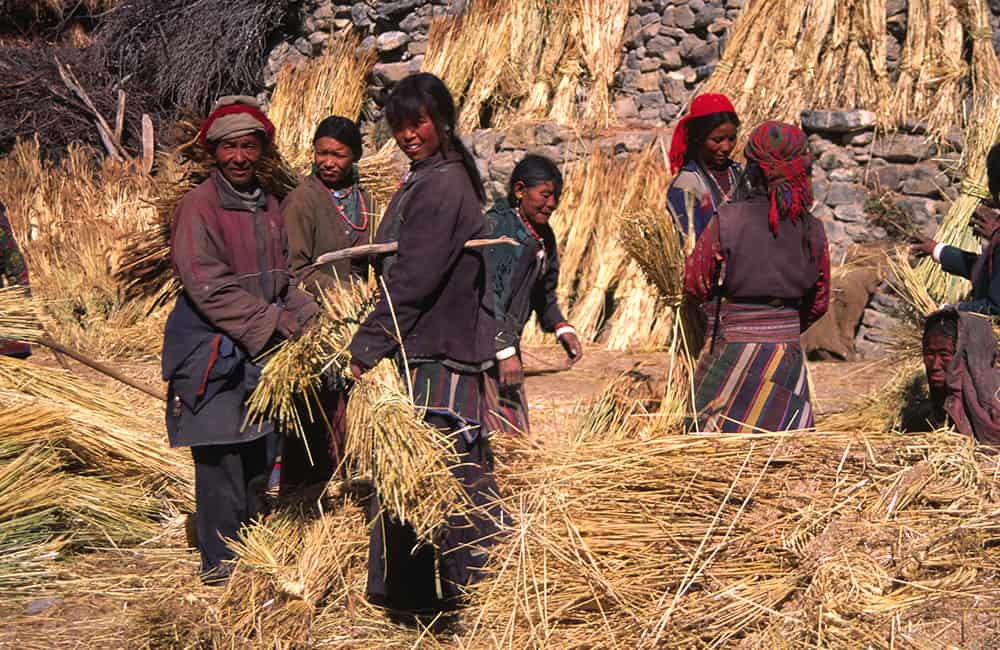
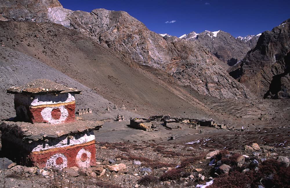
Phoksumdo Tal (Phoksumdo Lake) is a RAMSAR-registered wetland (The Convention on Wetlands of International Importance, especially to Waterfowl Habitat) and is Nepal’s deepest, and second largest, lake. Perched on the southern shoreline is Ringmo, a traditional Tibetan village, where the locals make a range of handicrafts. About 1.5km away, on the south-eastern edge of the lake, is the Bon tradition Pal Sentan Thason Chholing Gompa. There is much conjecture about the Bon religion, but one well-respected expert David Snellgrove (in ‘Himalayan Pilgrimage’, Shambala Publications) asserts that it is contemporary and extremely similar to Tibetan Buddhism. The most important distinction is that all movements are opposite to Tibetan Buddhist practice, so for example, you should pass a mani wall or chorten on your left side, and when walking around or within a gompa, you should walk anti-clockwise.
The Legend of Reng
For many locals throughout Dolpo, Phoksumdo Lake is referred to as ‘the evil lake of Reng’ and the gompa is sited here to keep any bad demons at bay. It is believed that long ago there used to be a village where the lake now is. The valley was flooded by a spiteful demoness who was fleeing from the wrath of the Buddhist sage and magician, Padmasambhava, who was on his way to Tibet to convert the people there to Buddhism. In an effort to confuse the sage, the demoness gave the people in the village a turquoise, making them promise not to tell her pursuer that she had passed that way. But Padmasambhava turned the turquoise into a lump of dung. Thinking the demoness had tricked them the people told the sage where she had gone. In a rage of revenge, she flooded the valley killing everyone.
The monks at Tshowa Gompa continue to perform daily pujas to make sure the spirit of the demoness is confined to the lake. However, locals say that she takes a yak from passing caravans each year by making it fall from the trail around the lake.
7
Day 7: Ringmo–Phoksumdo Khola Camp 5½hrs
This day begins with one of the most spectacular sections of trail in Nepal: from the western side of the lake outflow, head towards the cliffs to your west (left), which you traverse along a precipitous trail. For the first 40 minutes the trail doesn’t climb very much but does feel exposed in places, and there are excellent views of the lake and village. After crossing a small stream, the track climbs about 400m steeply before contouring around a rock-face at roughly 4140m (1¼hrs). It is amazing to think that yaks frequently use this trail!
After 80 minutes the trail descends to the floodplain of the Phoksumdo Khola at the northern end of the lake (3630m), where there is an excellent grassy lunch place or campsite. This valley is overgrown in the lower reaches with black caragana bushes, which have needle-like thorns. After 35 minutes cross the river and enter patchy pine forest which is soon replaced by silver birch (the bark of which is often used by Tibetans for writing prayers to leave on passes and important chorten) as the valley narrows. Cross the river via stepping-stones several times as you ascend the valley. After 70 minutes the valley begins to narrow to a cliff-lined gorge and the trail remains on the true left (northern) bank.
You will pass through a few copses of silver birch, which could make a campsite, but continue for 30 minutes to a large copse at the mouth of a tributary gorge of the Tuk Kyaksar Khola (3750m) with a red-pink western (left) cliff line and a dark grey eastern (right) cliff. There are also some cairns beside the small river that flows from this gorge, which mark a rough trail. There is a trail that continues up the main valley at this point so you will need to be vigilant not to miss the gorge and campsite.
8
Day 8: Phoksumdo Khola Camp–Pass Camp 5½hrs
From here there are two routes to Shey Gompa: the first, which initially continues up the Phoksumdo Khola, is used by pack animals and takes a little longer. The second route is more direct but rougher and not suitable for pack animals. From the campsite it is only a few minutes to the mouth of the gorge, which is more safely ascended in the morning when the river is lower. The trail winds up the gorge, crossing the river many times. There are many animal tracks in the gorge so take care when routefinding. The sound of the river reverberating from the cliffs makes conversation difficult, so make sure to keep your group together.
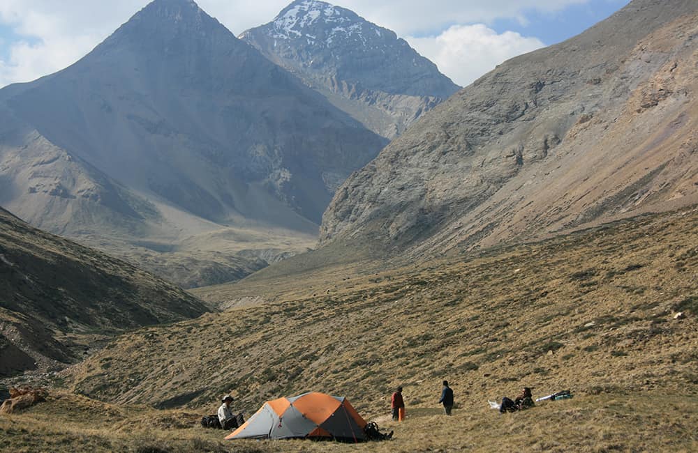
The gradient eases after 1½ hours as the gorge widens. In another hour there is a small campsite (4435m) of about eight flat plots scraped out of rocky ground on the true right (western) side of the valley. However, there is a far better camp at the head of the valley where a small waterfall has carved a gully (4717m, 30 mins).
From here you have two choices. If the flow of water through the waterfall is low you should probably camp at this spot, as there will be little or no water higher up. If the flow is strong, such that it fills the bottom of the gully (you might need to climb for about 100m to check), then continue to the higher camp above.
Climb the switchback trail to the true left (east) of the waterfall and after about 100m the gradient eases. You now ascend the upper reaches of the river valley, which gradually broadens, to a large basin. A large scree slope rises on the true right (west) side of the basin and Nangdala La is on the above ridgeline, which is called Churan Lekh. Do not be tempted towards either of the easier-looking saddles to the north and north-east. There are plenty of flat areas in the basin (4810m, 2½hrs from the previous camp), the most popular is at the base of the long curving trail that leads up to the pass.
9
Day 9: Pass Camp–Shey Gompa 5hrs
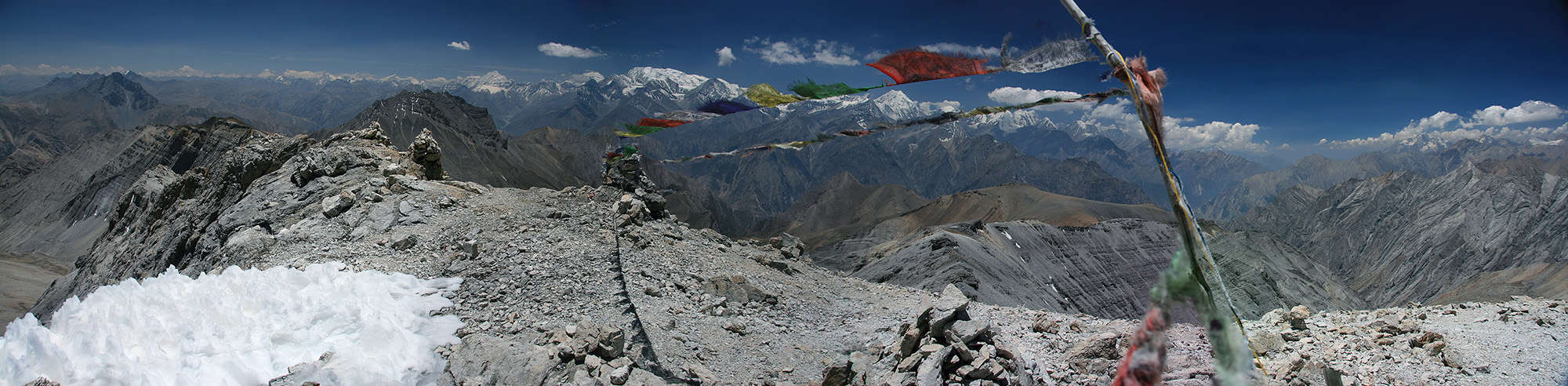
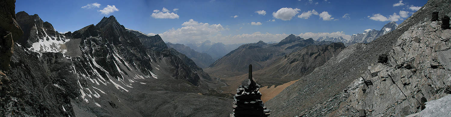
The trail to the pass is over loose slate-scree up an unrelenting gradient for 2 hours and 20 minutes. From the top of Nangdala La (5350m) you can see a broad valley descending to the north carved by a substantial stream, which you should reach in an hour from the pass.
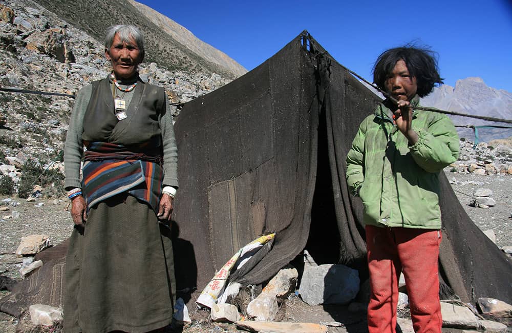
The trail now follows an easy gradient down the valley, crossing the stream a few times depending on your chosen route. This valley is popular with yak and sheep herders so try to buy some fresh yoghurt, butter, or milk as you descend.
In 1½ hours, you will reach the red-painted walls of Shey Gompa (4343m), ringed with mani walls and chorten, set amid a large pasture.
10
Day 10: Shey Gompa all day
It is worth spending a day at Shey to explore both the Kagyupa sect gompa as well as the hermitage at Tsakang. There are many legends surrounding the founder of Shey Gompa and Tsakang, Tsan-zin Ra Pa, who lived in the early 17th century (see David Snellgrove’s Four Lamas of Dolpo, Himalayan Book Seller), making this one of the most sacred valleys in Dolpo. Locals insist that the killing of any animal is prohibited in or around Shey Gompa; this perhaps explains why it is relatively common to spot blue sheep and snow leopard in the valley.
Perched on the cliffs of Crystal Mountain, about an hour north from Shey, is the hermitage of Tsakang. Traditionally the Lama of Shey lived here, although the current incarnate is at school in Kathmandu. However, if you can find the key-holder to let you in, the frescoes here are worth the climb.
See Shey to Shyamling & Dho Tarap, pp000-00 for details of other trails from Shey.
11
Day 11: Shey Gompa–Namgung 6-6¾hrs
From the gompa, head east into the arid Sephu Khola valley, following a trail along the north bank. After 80 minutes, the trail forks where a tributary flows down from the north. Turn left into this tributary valley and climb on loose ground for 2½ hours to Sela La (5095m).
From the pass, descend into a shallow valley, where a number of trails seem to converge from different directions, to an obvious fork in an hour. The right-hand trail descends beside a watercourse to a campsite upstream from the small village of Namgung (4360m, 1hr). Alternatively, take the left-hand fork, which climbs a ridge and then descends a parallel watercourse to the old Kagyupa sect Namgung gompa set high on a cliff-face (1¼hrs), from where you can walk downstream along the Namga Khola to the campsite (less than 30 mins).
The legend of Shey
Shey means crystal, a name derived from Crystal Mountain due west of the gompa, which is streaked with quartz veins.
An annual festival in June/July is based at the gompa and involves circumambulating Crystal Mountain in honour of Drutob Senge Yeshe who defeated a demon and converted Dolpo to Buddhism a thousand years ago. Joel Ziskin, in his National Geographic article (see Vol 151, No 4, April 1977), was the first to relate the legend, ‘Many years ago, the Buddhist ascetic Drutob Senge Yeshe came to Dolpo and found here a wild people whose supreme god was a fierce mountain spirit. The lama went directly to this mountain and meditated. There he attained enlightenment… A flying snow lion [a legendary companion of the Snow Leopard] had served the yogi [male practitioner of various forms of religious practice] as a mount. When the mountain god resisted with an army of snake-beings, this loyal lion reproduced itself 108 times and overcame them. Drutob Senge Yeshe then transformed the earth spirit into “a thundering mountain of purest crystal.” A white conch shell fell from the sky, and the yogi rose on his lion and pierced a hole in Shey’s summit. Rainbows arced across the heavens.’
12
Day 12: Namgung–Saldang 2¾hrs
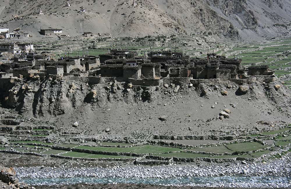
From Namgung there’s a number of trails that climb over the ridge on the far side of the valley and then descend to Saldang; do not follow any trails that head down the Namga Khola valley. Once over the ridge that forms the northern bank of the Namga Khola (1¾hrs), descend heading north-west towards the Nagon Khola and the commercial and administrative centre of Upper Dolpo, Saldang (3770m, 1hr), where there is a school established by some German trekkers who first came in 1995. A horse-racing festival in July to honour the Black Goat King, who once ruled central Dolpo, begins from the newly decorated gompa in the village.
Trails from all over Dolpo converge at Saldang; to the north are interesting gompas in the Karang valley (2½hrs), Luri (Sunger Gompa) and Nisalgaun (Yangze Gompa, a further 2 hours from Karang). Circling around via Nisalgaun, or crossing Khoma La to the east of Saldang, is the village of Shimen, which leads to a route via Chharka Bhot, Niwas La, and Kagbeni to Jomsom (see Kagbeni to Chharka Bhot, pp000-00).
Heading east, over Neng La (Nengla La), is the route to Bhijer, Pho (see Shey to Pho) and on to Mugu (see Pho to Gamgadhi. To the south, is the main trading route to Dho Tarap (see Other Trails in Dolpo).
13
Day 13: Saldang–Chagaon 3hrs
The Nagon Khola valley has gently sloping hills on its true right (south-eastern) bank across which runs an easy undulating trail. Settlements merge into one another and provide glimpses of the day-to-day lives of this seemingly inhospitable region. An easy 3 hours from Saldang is Chagaon (3840m), where you can see a gompa beside the river. There is another hermitage gompa, popular with local and Tibetan lamas, high on the ridge above. Camp in or near Chagaon, there are many spots to choose from.
14
Day 14: Chagaon–Darsumana Dhobhan 6½hrs
As you continue south the valley walls become steeper and the terrain more desolate. A crumbling fort stands as an impotent guard above the river beyond the last village, Chasip (less than 30 mins). Continue along the main trail as it slowly climbs beside the river. After 1½ hours cross the river to the true right (east) bank, and a couple of stone houses at Rakyo Kharka. From here you may need to wade through the river a few times if floods have damaged the trail, but try to remain on the true left (west) bank. In a further 2 hours a large tributary, the Dachung Khola, flows into the valley from the south as the main valley swings westwards. Cross the Nagon Khola to the true right (east) bank and turn into the Dachung Khola valley. Stay on the true right bank of the Dachung Khola, do not cross the river.
A further 1¾ hours brings you to another major river junction with rivers from the south-east and south-west. Turn right, crossing the Dachung Khola, into a steep-walled valley (the south-west option to your right) and reach a flat grassy campsite at 4700m, in 45 minutes called Darsumana Dhobhan.
15
Day 15: Darsumana Dhobhan–Tokyu 5hrs
A steady gradient climbs about 500m from the campsite to the top of Jyanta La (5220m, 2hrs). Take care when route-finding as there are many trails in the area, it might be easier to try and stay in the middle of the valley to avoid moving off course. Descend into a huge shallow alpine valley, which is boggy (and normally frozen) at the bottom, beside the Jyanta Khola.
The gradient remains gentle on the true left (east) bank of the river until you reach a loose wall of terminal moraine after 1½ hours. Once down the moraine the gradient eases again and you cross the river to the true right (western) bank. You will pass a series of mani walls and chorten on either side of the valley as it widens. A final descent brings you to the upper reaches of the Dho Tarap valley, and a campsite near to the village of Tokyu (4209m, 1½hrs).
16
Day 16: Tokyu–Ghyamghar 6hrs
The large, fertile Thakchu Khola valley is home to 10 Magar and Bhotia villages, which almost merge together. This is one of the highest permanent settlements on the planet at an average of 4100m, and a popular place for Tibetan nomads to graze their yak herds. There are both Buddhist and Bon gompas in the valley, although they are not as old as those in Upper Dolpo.
The trail down through the valley is an easy and enjoyable walk past villagers busy with daily life. Some French donors built the Crystal Mountain school towards the end of the valley (where you can camp). It’s just before the trail turns south past some large kani and mani walls, and enters Dho Tarap (3950m, 1½hrs), the last village in the valley. If you have time, visit the nunnery of Ribum Gompa and Regu Chorten on the hillside above the village, which has a large and well-preserved statue of Tsong Kharpa. A tributary branches west from Dho Tarap and leads to Chharka Bhot, see Chharka Bhot to Pho via Dho Tarap, Phoksumdo and Shey.
From Dho Tarap, continue descending the now narrowing Tarap Khola valley. The trail through this valley can be affected by landslides, which slow your progress. There are few campsites so consider which to use to suit your group’s speed. At first, the valley doesn’t descend too rapidly as it follows the true left (east) bank of the river. After 2½ hours there is a campsite, called Kama or Langa Kharka (4010m) at the confluence of a tributary, Klang Khola, flowing from the east (left). Cross the Tarap Khola to the true right (west) bank beyond the campsite and descend a rough rocky trail through scrubby patches of forest; it might be a surprise to see and smell trees again after the denuded slopes of Upper Dolpo! The trail descends rapidly to the Sisal Khola, where woodcutters have made a rough camp. The trail swings back into the Tarap Khola and descends rapidly to a bridge in a narrow gorge, which you cross to the true left (east) bank. You might be able to spot Blue Sheep on the rock-face high above on either bank. Beyond the bridge is a climb of about 200m over a small peninsula in the valley called Ghyamghar (3755m, 2hrs), where there is a small campsite.
17
Day 17: Ghyamghar–Laisicap 7hrs
The valley now becomes a sheer-sided canyon with the river in a white rage beneath a bridge, which you cross to the true right (west) bank. The gradient eases to a more gradual descent on an undulating trail for the next 2½ hours to another major tributary junction with the Nawarpani Khola where there is another campsite. The trail then crosses back to the true left (east) bank for a short section before returning to the true right (west) bank at Chhyugar (3440m, 1hr), where locals sometimes camp beneath a large rock overhang.
The trail has been blasted and gouged from rock as it now descends more rapidly to a steep switchback section that drops to a pretty lace-waterfall at Laina Odar (3370m, 2½hrs). The trail descends rapidly again and suddenly the Tarap Khola valley merges with the Thuli Bheri Khola valley. Either camp at an excellent site in a fine pine forest near a deserted police post before the bridge to the true left (south) bank, or continue, crossing the bridge, to a smaller campsite before entering Laisicap village (2775m, 1½hrs).
18
Day 18 : Laisicap–Dunai 5hrs
After days of descending treacherous trails it is a relief to be walking on a broad thoroughfare beside the Thuli Bheri Khola. However, a lack of shade can make this a hot walk on a sunny day, so have plenty of water and sun cream.
Follow the trail west and about an hour beyond Laisicap is a fine kani at the entrance to Tarakot (2540m), a popular winter settlement for people from Dho Tarap. Beyond Tarakot the trail crosses to the true right (north) exposed bank of the Thuli Bheri Khola and resumes a typical up and down profile all the way to Dunai (2140m, 4hrs), which you reach by crossing a bridge back to the true left (south) bank of the Thuli Bheri Khola.
19
Day 19-20: Dunai–Juphal–Nepalgunj–Kathmandu
Retrace your steps from the first day of trekking to the airstrip at Juphal (2475m, 3½hrs), where you can fly back to Nepalgunj and then catch a late morning or afternoon flight to Kathmandu.