1
Day 1: Kathmandu–Dhangadhi All Day
There isn’t much to do in Dhangadhi beyond exploring the bazaar area, so it’s a good idea to take the afternoon flight (70 mins). Tucked in a remote south-western corner of Nepal there aren’t many hotel options either, but Hotel Shree Jagadamba (: jagadambadgd@wlink.com.np, % +977 (0)91-523590, 520390, 526090) is pleasant and the manager (Bishnu Raj Bhatt) can organise a four-wheel drive to Darchula.
2
Day 2: Dhangadhi–Darchula All Day
It is a long drive to Darchula (expect it to take 14-16 hours), so a 4-5am start is advisable. The first section to Dadeldhura takes about 3½ hours and Hotel Sunrise is a good place to stop for breakfast.
Not far beyond the town centre is the Darchula/Baitadi and Chainpur road junction where there are great views of Api and Saipal Himals. Sealed road continues for another 3 hours to Gokuleshwar (where there is a charter-flight-only airport), then you are on a very slow dirt road to Darchula (680m, 9hrs with many delays). You cannot drive into the centre of Darchula as the ‘road’ is more like an alleyway. A couple of simple hotels are near the centre of town; both offer Nepali food.
The suspension bridge across the Mahakali is not an international border crossing for tourists, although locals can cross with ease. It makes sense to shop for provisions on both sides of the river as prices vary dramatically and the quality of fuel in India is much better.
3
Day 3: Darchula–Dailekh 5hrs
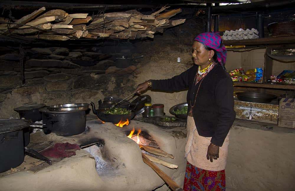
From the centre of Darchula, walk north through the town, passing the main market area. At a fork take the right-hand trail that climbs very slightly (the left goes down towards the river) and follow as it enters a tributary valley from the right. The trail is now a jeep track, which goes as far as Sela (the road is expected to be finished to Sipti in 2014) and involves a short climb to Kante (1332m, 1½hrs), where there are some dhabas. In another 30 minutes on aneasy gradient, you reach Sela, where there are more dhabas and the current road-head. A good trail leaves the road construction heading up the true left (south) bank of the river. You pass through some friendly villages as you gradually climb to Maiakohli (1825m, 1½hrs). A further 1½ hours brings you to the top of the valley, a minor pass called Dailekh (2166m). There are some dhabas and basic ‘hotels’ on the pass and it is possible to camp on some unused terraces on the far (east) side.
4
Day 4: Dailekh–Sipti 4½hrs
The descent from the pass on the true left (north) hillside is on an easy gradient at first, passing through a couple of hamlets that have the same name as the large village, Khar, which is on the other side of the valley. When you reach an old hydro-feeder pipe take the steep shortcut downhill to the riverside. Follow the true left bank and cross a suspension bridge (1400m, 100 mins) to a couple of teashops, and then some larger dhabas at Jamir (10 mins, 1380m).
Beyond Jamir the trail becomes almost as large as a dirt road; no doubt cars will arrive from Gokuleshwar and Darchula in the next year or two. Continue descending beside the river on the true right bank and cross two bridges, the second (1292m, 30 mins) marks the low point before the climb to Sipti.
Ascend steep switchbacks to 1511m (40 mins) where the gradient then eases. The trail gradually climbs across rocky hillside and has many small ups and downs. There is a short final climb of about 100m to Sipti (1842m, 1¼hrs) where there is a basic hotel with accommodation; ask the hotel owner if he can make his excellent smoked fish curry!
5
Day 5: Sipti–Seri 3¾hrs
To make the day more interesting it’s a good idea to wake early and climb to the viewpoint above Sipti, where you can see a building on top of a hill to the east of the village.
Walk through the village to the police post and shortly after take a left-hand fork that climbs past some houses and then through forest. After 40 minutes the trail forks again, take the left trail, which heads north towards a saddle.
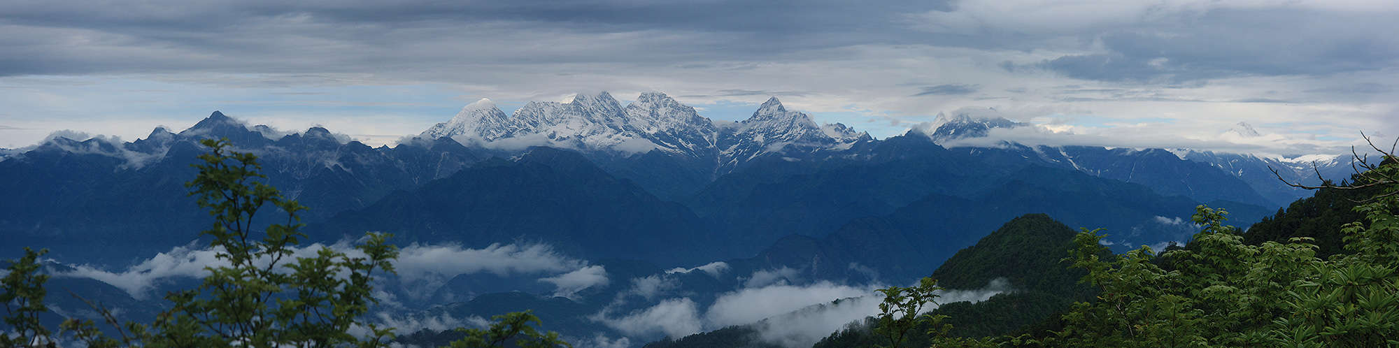
In 15 minutes reach the saddle and then follow small tracks up the ridge to your right. Sometimes you have to push through scrubby bushes but it only takes 20 minutes or so to reach the telephone repeater tower on top of the hill (2232m, 1¼hrs from Sipti). From here, there are good views of Api and Nampa Himals, although not a full panorama.
Leave the summit on an obvious track that leads down the southern ridge to another saddle and the main trail to Seri. It’s a long descent and there are many shortcuts, some of which are very steep, so choose your trail carefully! On your descent take a little time to identify a suspension bridge below, and perhaps stop for a cup of tea at the hamlet of Ninta (1730m, 45 mins).
Once at the bottom of the climb turn downstream (right, on the true right bank) to a hamlet where you then have to wind between paddies to the suspension bridge. Cross the bridge and turn upstream (on the true left bank) and walk along the newly built road to Seri (939m, 1¾hrs from Ninta) where there are several dhabas. Ask locals for a place to camp as there are some fields near to the river.
6
Day 6: Seri–Ramita 5hrs
Follow the dirt road as it descends slightly to Nala Bugara (971m, 1¾hrs) where there are a few teashops and a good view of Api Himal. In another 45 minutes you pass the new hydro-electric power project and remain on the true left (east) bank of the river. In another 45 minutes you reach the current road-head of Gunna (868m) where buses frequently depart to most major west Nepal towns, including Dhangadhi.
From Gunna, head east, up a pretty tributary and in 1¼ hours reach the teashops of Sela Tada (1150m). There is a school here where you can camp if you are running short of time. If you continue onwards look for potential campsites beside the river, there is a small island in the river near Ramita (1148m, 30 mins) that makes a nice campsite.
Optional side trip from Seri
Following is a 2- to 3-day side trip from Seri to Khandeshwari and back; note that from Lama Bagar to Khandeshwari is a long and tiring day.
Alternatively, from Khandeshwari, you could attempt a high route that heads north-west back to the Mahakali river, or head east over a high route towards Chainpur. Both of the high routes are only open May-October.
1-2 days: To Markarkot Temple, before Khandeshwari Bazaar 6hrs
Remain on the road to Lattenatia (1054m, 1¼hrs), and then register at the police checkpost at Lama Bagar in another 20 minutes. About 5 minutes beyond the checkpost is a stone-walled campsite (1066m) on your right.
Continue following the new road to Dharamgaon (1hr) where it ends at the base of a rock-face. As the valley narrows there are plenty of ups and downs, some up to 200m, which can be tiring. There is very little drinking water beside the trail, so the dhaba at Chauki Bagar (1210m, 1¾hrs) is a welcome sight. The trail is easier from here but still up and down to Makari Gad (1479m, 1½hrs). From the collection of dhabas you look straight up a steep rock and grass-covered face to a ridge where two pine trees stand against the skyline, 1000m above – they mark Makarkot Temple! The switchbacks are mostly on an easy gradient but there are steeper turns closer to the top.
Once you crest the ridge there is a small teashop and a little higher above the teashop is a small campsite (2222m, 2hrs). Further up this ridge are excellent views of Api and Nampa Himals and in the shallow basin below is the large trading village of Khandeshwari. If you have the time, continue to Khandeshwari, where there is a basic teahouse and campsite. There are fine views of Api from above the village and there is plenty of local life to see!
Retrace your steps the following day and as much is downhill it is an easier 6½ hours to Lama Bagar.
7
Day 7: Ramita–Kaphalseri 5¾hrs
The trail climbs very slightly for the next 20 minutes before descending to a wooden bridge over a small gorge. There is a pretty waterfall and plunge pool here but the place rarely gets sunlight so it’s a bit slippery. The trail climbs steadily up switchbacks for the next 2¼ hours to Gunnai Bhangjyang (2125m) where there are pleasant valley views, but not of mountains.
From the Bhanjyang, head true right (south-east) into the next valley. The trail is flat at first but then becomes a steep descent into a small valley. It will take about an hour to reach the river beside which there are many pleasant places to lunch – unfortunately there are no dhabas here. The gradient is easy downhill again to a new bridge, which you cross to the true left bank. An easy trail winds between cultivated fields and pretty villages to Kaphalseri (1350m, 2¼hrs), where there is a good campsite before crossing the suspension bridge at the start of the village.
8
Day 8: Kaphalseri–Run Lekh 4¾hrs
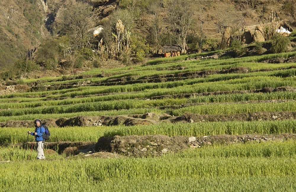
The easy trail continues to Pipalkot (1208m, 1½hrs) where there is a police checkpost where you must register. Soon after the village, turn left (uphill) at a trail junction. After a short climb the trail levels and traverses open hillside to a village that sits on top of a small peninsula of land created by the confluence of a major valley, the Paudi Khola, to your left.
Pass through the village and descend to a bridge over the Paudi Khola (1228m, 30 mins), which you cross. Turn left on the true left bank (east) following a small trail that along the valley floor for about 20 minutes and then climb steep switchbacks to Bubir Gaon (1535m, 1hr from bridge). From above Bubir the gradient eases for 30 minutes before another steep switchback section to Khollekh Gaon (30 mins) and just beyond the village, the ridge of Run Lekh (1982m, 20 mins). It is possible to camp before and after Run Lekh or near to Khollekh; search around for the best spot.
9
Day 9: Run Lekh–Mulsia 5hrs
From the small teashops on Run Lekh, turn left (north-east) on an open trail across scrubby hillside to a minor ridge (2275m, 40 mins). The gradient eases but continues to climb towards Kadachaud. Just before the final ascent to the village there is a small and very friendly teashop. Beyond Kadachaud is Bhanjor Bhanjyang (2580m, 2hrs), which does not have any teashops or shelter. Here you have two choices:
l Option 1: Continue traversing hillside to your left on good trails that take 2 days towards Chainpur. There are many trails to choose from but none actually reaches Chainpur as the new road follows the final 10km of old trail to the town.
l Option 2: Descend into the valley below and then continue down to the road the following morning. Note that this route is also ideal for those wanting to trek to Khaptad National Park. This route is described (see pp000-00).
There are not many campsites in the valley below Bhanjor Bhanjyang. There are a few flat spots after descending for about 30 minutes, when you then cross to a main trail on the true left of the valley and descend to Mulsia (1845m, 2hrs) where there is excellent spring water. It is a good idea to find a local guide in the village for the following morning as the trails are very confusing.
10
Day 10: Mulsia–Chainpur 3hrs
Descend to Mulsia but stay on a trail that stays to the true left (east) of the village – do not go through the village! There are now many trails between compact villages so keep your group close together. The trail eventually reaches the riverside beneath some cliffs (2hrs 20 mins) and you now have to cross many streams along the riverbed to reach the road (20 mins) and the Seti Nadi valley. The village of Jhote is about 20 minutes north (left) along the road, where there are dhabas and frequent passing vehicles to Chainpur (1296m, 2hr drive). There are a few ‘hotels’ in Chainpur and some good dhabas, but the highlight is the local doughnut shop!! You must register at the police post and expect a small squadron of government officials who will want to see your documents as a pretext for a boring chat.
If you are continuing to walk, Chainpur has a good market where you can restock almost all supplies. There are frequent buses to Dadeldhura and Dhangadhi throughout the day.
NOTE: From Chainpur there are two routes to Martadi. The main trade route takes 4-5 days and heads back down the Seti Nadi valley on the true left bank before turning left at Khairadagaon into a tributary valley. You then pass through Pasal Bagar, Gadraya and Dogadi en route to Martadi. However, this route is long, congested with donkeys and the likely route of a road-construction project.
The alternative route is faster (3-4 days), considerably more challenging and offers some great views of the Api and Saipal Himal; this route is described here.
11
Day 11: Chainpur–Forest Camp 6½hrs
Today is a tough day, so get an early start. Cross the suspension bridge at the northern end of Chainpur to the true left bank of the Seti Nadi. Then wind between fields and pass a hamlet before beginning a gradual ascent on open hillside. The gradient eases after 30 minutes and you cross a minor ridge into the Pandhirabis Khola. Continue on an easy traversing trail on the true right side of the valley, passing small villages to Khetkot (1675m, 2hrs). You can camp in the school here if you had a late start from Chainpur.
Descend to the river at the far end of the village and cross a small bridge. The trail gradually climbs the true right bank, again passing through small villages. The last village is Thanatholi (2105m, 2½hrs), which is very friendly and you might want to ask for a local guide here to take you to the pass or beyond. The trail now climbs through forest to a kharka (2365m, 1½hrs), which is a good place to stop before attempting the pass tomorrow.
12
Day 12: Forest Camp–Trailside Camp 8hrs
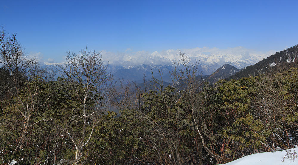
The trail remains on the forested true right side of the valley the entire way to the pass. For most of the way it is easy to follow but there are a few tricky navigation sections when enclosed by bushes. After 1½ hours the gradient begins to increase and eventually becomes switchbacks before a final short traverse to Bateli Bhanjyang (3236m, 3hrs) where there are some great views of Api and Saipal Himals.
Beyond the pass is a steep switchback descent to a small kharka and then steep again to the Gwani Gad. Just before reaching the river there is a campsite on your left behind some trees (2050m, 3hrs) but you’ll have to use the river water. If you have some energy, there is another small campsite in 30 minutes. It’s about 80m down to the river, which you cross and follow an easy trail that gradually climbs the true left bank.
After leaving the forest you round a prominent ridge, where there is a slightly sloping grassy campsite (2062m, 30 mins). There is a small spring water source a little further along the trail and the small village of Kotgaon, another 20 minutes on, where you can buy very basic supplies.
NOTE: There is another trail option between Kotgaon and Kolti, which is best done in reverse for navigation reason. See Other Routes: Kolti to Kotgaon.
13
Day 13: Trailside Camp–Martadi 5hrs
Passing through Kotgaon, the trail then begins a long gradual descent to the river and there is a dhaba at Manakot (1548m, 1½hrs). Less than 10 minutes further, cross a suspension bridge to the true right bank and then follow a good trail that gradually climbs away from the river. At each trail junction, take the larger, more used route and do not descend to the river. The valley turns sharply south (right) and there is a good water source at Satera (1519m, 1hr) if you are feeling hot. Another short traversing section is followed by a descent to the river and suspension bridge at Jugadakot (1302m, 1¼hrs).
Cross the bridge to Gumti (yes, the villages on either side of the river have different names) and follow a very worn trail up a small side valley, which becomes switchbacks in about 15 minutes. This last section up to Melkha Bhanjyang (1583m, 30 mins) can feel much tougher than it is, but there are some teashops at the top.
Follow the dirt road and you will soon see Martadi on the far side of the valley. There are some excellent campsites (1410m, 20 mins) beside the river; it is another 20 minutes to the main bazaar if you want to explore and buy rations or stay in a teahouse.
14
Day 14: Martadi–Forest Camp 5hrs
If you have camped by the river, you will have to cross it to follow the road (under construction) heading east. If you stayed in Martadi head east from the town and descend to the road. You soon come to a suspension bridge where the river has cut a gorge, cross the bridge and a short climb brings you back to the road (1685m, 1hr). Continue along the road, which is the quickest route. If you want to avoid the road you can take trails in the valley bottom, but it will add an extra hour or so to the day.
At Rajatholi (1946m, 1¾hrs) there are some dirty dhabas at the entry to the village, and a much nicer dhaba at the far end of the village where they have excellent buffalo curd and ginger and lemon tea. Continue along the road but take the occasional shortcut to avoid long U-bend corners. After an hour you pass the last village and leave the road to follow a trail through open forest. The road building is continuing through this forest so it is easy to navigate. There are some excellent grassy areas to camp and some derelict buildings that offer very basic shelter at 2569m (2¼hrs from Rajatholi).
15
Day 15: Forest camp–Jungsal 4¼hrs
The pass of Porakhe Bhanjyang (2702m) is only 20 minutes away, where there are a couple of small teashops. A large and well-used trail descends through open forest with views of distant peaks to take your mind away from the endless donkey trains. In 20 minutes pass the ramshackle collection of dhabas popular with donkey drivers, called Dharamsala on most maps. It’s a constant descending gradient on a loose trail for the next 2 hours and there are a few teashops beside the trail. In another hour you reach Kolti, and in another 30 minutes pass the airstrip (daily flights to Nepalgunj).
The hotels in Kolti are expensive and not very pleasant, so continue for another 30 minutes to Jungsal (1344m) where there are some good campsites to your right about 100m from the trail. The locals here are very welcoming and there is a small shop for basics.
16
Day 16: Jungsal–Abagaon 5½hrs
Today will be a hot walk so get an early start! Continue down the main trail to the end of the Kolti valley. A chautara (1106m, 1¼hrs) beneath a huge Bodhi tree marks the point where you head north into the Karnali Nadi valley. The trail remains on the true right bank of the Karnali Nadi, it’s a hot walk! Every 20-30 minutes there is a teashop or dhaba, so refreshments are close at hand.
After 2 hours you pass a couple of small dhabas and the trail climbs exposed hillside. On the far side of the hill the Karnali Nadi has cut a deep gorge and the trail forks. The main trail, which heads uphill (left) is the longer donkey route. The right-hand, smaller trail, is only for humans; do not attempt it if you suffer from vertigo! The smaller trail is much faster but does involve some ups and downs on exposed rock, for most people the walk is exhilarating!
Beyond the final rocky section descend to a trail beside the Karnali Nadi – it is not necessary to go through Boldhik village. Head for a long suspension bridge (1131m, 1hr), which you cross and then turn north (left) to follow a flat trail that winds around into the Kateri Khola valley. Enter the valley and remain on the true left (south) bank trail – do not cross the river! The trail soon climbs switchbacks for about 100m and then levels again.
There are no organised campsites near here, so it is best to identify a field and ask locals for permission to camp. There are some friendly locals in Abagaon (1283m, 1¼hrs) and the locals have some basic provisions to sell.
17
Day 17: Abagaon–Jamiya 5½hrs
The valley twists and turns and it feels like you are making slow progress, but the villages are pretty and there are many distractions along the trail. Reach Matichaur (aka Tallibagar or Takbagar, 1795m) in 3¼ hours, where there are a few dhabas.
The valley now straightens and you make rapid progress along a route that the locals prepared as a road a few years ago but there was never enough money to build a bridge over the Karnali Nadi. As you head up the valley the houses become smaller – a clear reflection of the smaller plots of farmable land.
In about 2 hours you reach Jamiya (2170m) where locals will tell you there is a campsite beside the old trail about 100m above. If you are a small group ignore the advice and continue along the main trail to where the valley narrows considerably; there are some grinding wheels beside the river (below you) and a small campsite among boulders (2179m, 20 mins).
18
Day 18: Jamiya–Rara Lake 4¼hrs
You are now walking through a delightful mixed forest to Baunpani (2431m, 1¼hrs), the last village before Rara Lake National Park. There are a few teashops and dhabas here. Beyond, there are some lovely campsites, the first is at Karmasi (30 mins). The gradient increases and there can be some muddy sections after heavy rain, but the trail is great for most of the time.
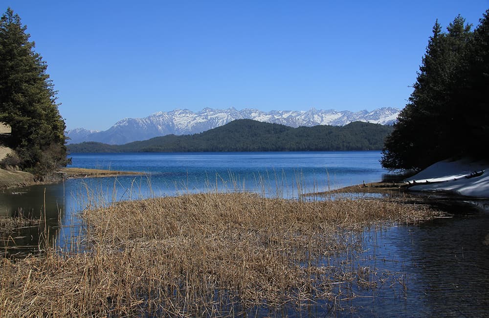
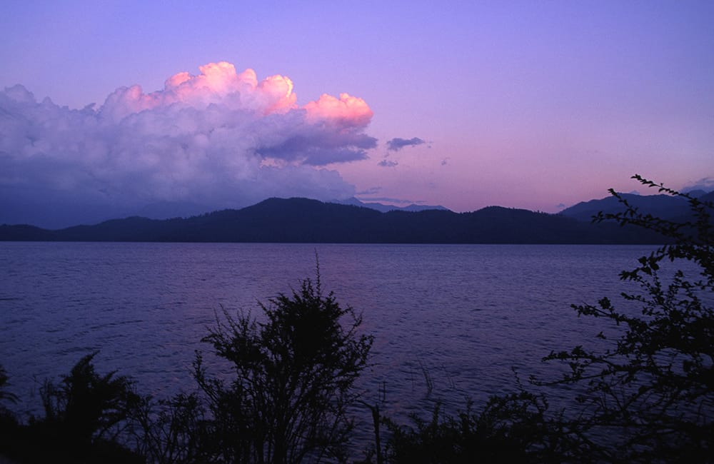
The only community inside the National Park is Murma (2900m, 2¼hrs) where there are a few dhabas. In another 40 minutes you reach Rara Lake; walk around to the National Park centre and campsite (2983m) where you need to register. In clear weather the views of and around the lake are magnificent and it is worth spending a whole day walking around.
19
Day 19: Rara Lake All day
Rara Lake is an idyllic place; the astoundingly clear water surrounded by protected forest is a nature-lover’s dream.
A walk around the rim of the lake (13km, 5½hrs) is really worth the effort – see if you can spot the stele marking the cardinal points, nobody knows how or why they are here. On the north-eastern bank is Rara Mahadev Temple, decorated with woodcarvings of elephant, peacock and people. On the full moon in July/August locals gather here to honour the god Thakur, who, legend says, created the lake by firing an arrow at the western shore and then built the eastern bank by stamping down the earth. Swirling rock formations at the eastern end of the lake are said to be his footprints.
There are some old canoes near the army camp that you might be able to use. The lake water is extremely clear for swimming, but cold, and Park rules stipulate that you must use buoyancy aids.
20
Day 20: Rara Lake–Talcha–Nepalgunj–Kathmandu 2½hrs’ Walk/All Day
Follow the trail east around the northern edge of the lake and at a junction turn right (the left trail goes to Gamgadhi) and continue following the lake shore.
After 1¼ hours you come to a small landing beach used by the army to ferry supplies and VIPs across the lake. The trail now heads straight into forest before turning right (south) and descending. There are some confusing trail junctions but there are always many villagers in the forest cutting firewood who can provide directions.
The trail comes out of the forest above Talcha airport (2740m, 1¼hrs), which you descend to on a steep trail. The village is growing rapidly and there are a couple of teashops and a teahouse.
The flight out of Talcha is magnificent and thrilling! First you fly over Rara Lake before turning south and flying over some of route you trekked over the last few days. Then the forests of the pahar and terrai pass beneath the wings before landing in Nepalgunj (150m).