1
Day 26 Laya to Limithang, 4hrs, 450m
Head to a group of about six houses at the far western end of the village to find the trail to Limithang. As you pass through the village you might notice that a couple of houses have a decorated white box on the rear wall. This shows that someone within the house has been suffering from an ongoing illness. Every home has a spirit house, normally on a rear or side wall, but locals believe that sometimes a spirit can become unhappy with this ‘home’ and causes disturbances that result in illness. To placate the spirit another spirit house is built, decorated with Buddhist motifs and placed beneath the eves above the original spirit house.
From the houses descend past a thin white chorten and then a gradual down for roughly 20 minutes to the Laya Chu. The trail then climbs a little for the next 50 minutes before descending once again to the river, which you reach in another 30 minutes. Pass through a grassy glade of pine tees for 10 minutes to a bridge over the Laya Chu (3832m) which you cross to the south (left) bank.
The trail now leaves the main valley to head west up a tributary valley. Just as you start climbing there is a tree beside the trail covered in offerings. High on the far side of the valley is a gompa that Laya locals believe protects their village and to which each house has to make an offering. However, the gompa is very far and the trail dangerous, so rather than going to the gompa they visit this spot from which they can see the gompa and place the offering on a small wooden alter at the base of the tree or they tie it in the branches.
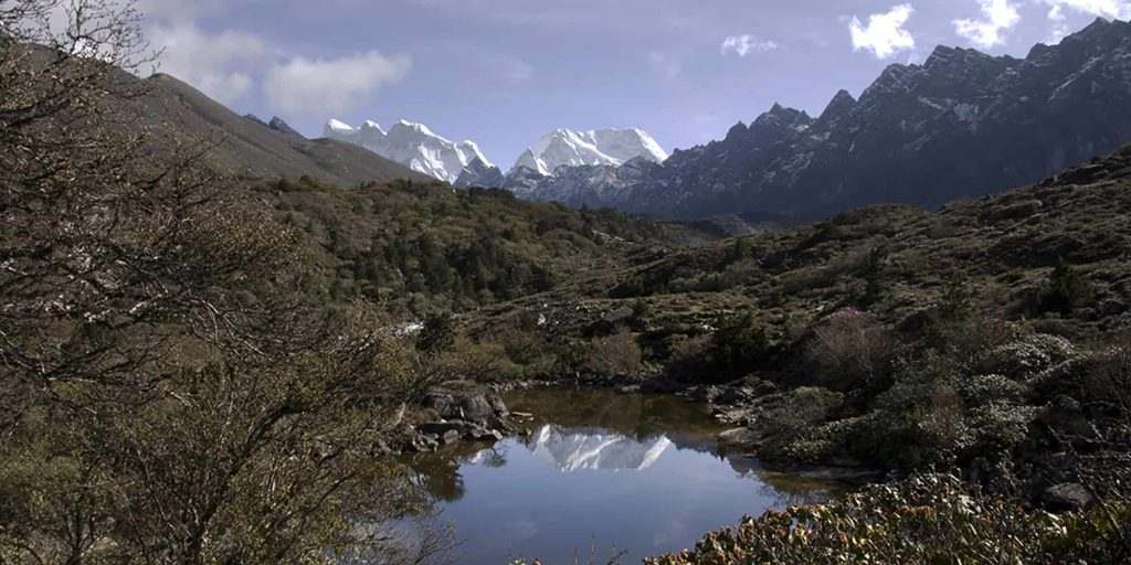
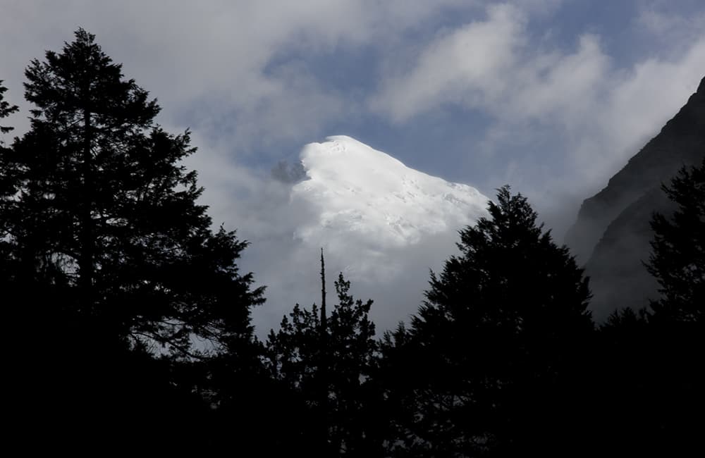
The trail first climbs across a landslide before heading up through forest for about 250m. Reach some herder’s huts (4082m, 50 minutes) where the gradient eases and you pass another herder’s hut. Pine, juniper and rhododendron forest fill the valley as you continue to gradually climb the north (right) bank of a small river. A couple of craggy rock towers dominate the valley to the north and are a stark contrast to the grassy slopes to the south. Great Tiger Mountain appears at the end of the valley, a grey moraine wall at it’s base. As you approach the moraine wall you can see a large grassy meadow, called Limithang (4163m, 1 hour), which is spread across much of the valley floor. Also note a couple of herder’s huts built against large boulders to your right. Camp as close to an old forested section of moraine wall as you can.
2
Day 27 Limithang to Thankhasam, 7hrs, 2000m
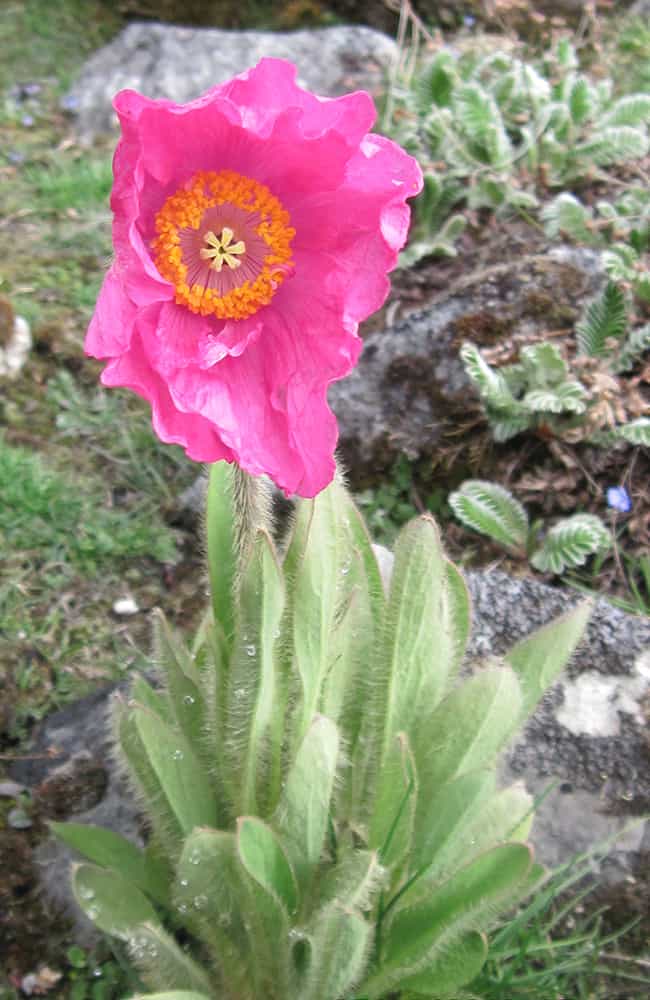
Head up the grassy meadow to find a large trail that passes through rhododendron forest where you might spot some blue poppy among many primulas. There’s many mountain views to enjoy as you reach a herder’s hut in 50 minutes where there are more blue poppy. A short rise leads to a broad flat-bottomed valley with a couple of large boulders standing in a grassy area that would make a good camp (4442m, 30 minutes). There are a number of trails ascending steep rocky slopes from here, the one you need the switchbacking trail to the southwest, which leads to a series of shallow valleys and moraine hills. Climb the main moraine ridge keeping the largest shallow valley to your left all the way to the Sinchey La (5015m, 2 hours). During the climb remember to stop and turn around to enjoy views of snowy mountains all the way to Table Mountain above Thanza!
On the far side of the pass the landscape changes to brown and ochre hues and rolling slopes reminiscent of the Tibetan Plateau. In 40 minutes reach a potential campsite in a broad valley, Chuthana (4675m). Stay on the south (left) side of the valley as you continue to descend gradually before swinging sharply south (left) to a herder’s hut (4577m, 40 minutes) used by Forest Department staff who live here from mid-March to the end of September to protect the resident Takin population. Consult with them regarding routes around or through the ‘Takin Zone’. We were sent on a circuitous route around the head of the valley on some very rough trails that descended to the river (4028m, 1 hour and 20 minutes), passed a ruined dzong before heading up a tributary valley and a small campsite called Thankhasam (4054m, 50 minutes). The main valley once had dozens of hot springs and a large resident population (thus the dzong) but that was long ago and the springs have disappeared. It is thought the Takins like this valley because of the residual salts in the earth and vegetation.
Note that the main post-monsoon campsite of Tsherango is closed in the pre-monsoon months. If you cross the ‘Takin Zone’ your crew and horsemen will likely have to pay a fine.
3
Day 28 Thankhasam to Shakyapassa, 5hrs, 1450m
Cross a small log bridge next to the camp and climb switchbacks through rhododendron, spruce and birch forest. The gradient eases a little as you emerge from forest but resumes again as you approach the Jari La (4747m, 2 hours and 20 minutes) marked by chorten and prayer flags that mark the border of Laya and Lingshi districts. The first 200m or so down is steep to a small stream where the gradient then eases. Follow the stream on the north (right) bank to a grazing area and herder’s shelter (4399m, 45 minutes) where you cross the stream to the south bank before crossing back again after 10 minutes. The trail then traverses hillside as the stream falls away below. Do not descend to the stream or to the herder’s huts you pass in about 20 minutes. Instead, stay high and head for some herder’s shelters you can see on a ridge at the end of the valley.
Note there is a sky-burial place on top of the rocky crags above which you should avoid, but explains why Himalayan Griffin are so common in this valley.
From the herder’s shelters begin a long traverse around steep grassy hillside to your northwest (right). The trail descends slightly but then steeply as you enter a pretty alpine valley with a meandering river. The whole valley is called Shakyapassa (4000m, 1 hour and 15 minutes) and there is an excellent campsite next to the river.
4
Day 29 Shakyapassa to Tekethang, 6hrs, 1400m
Walk down stream to a bridge that leads to a lone herder’s hut and where the trail heads into forest. Climb a sometimes steep trail for 50 minutes to a grazing area where water is scarce as its name implies, Chumigey (water-no-place, 4188m). A short climb around a ridge at the far side of the pasture is followed by a gradual descent past a salt-lick popular with blue sheep judging by the tracks. Continue down to another small grazing area next to a stream that could be used as a campsite (4156m, 40 minutes) before beginning the long traversing climb to the Goku La (4445m, 1 hour). From the pass traverse steep hillside until you are overlooking the Chebisa valley into which you descend and walk through the village. It is possible to camp here (3880m, 1 hour) but it makes for two short days so we pushed on. Wind around a large ancient moraine wall to Gangyul village (3810m, 1 hour) which sits beneath a massive overhanging rockface and at the head of the valley the impressive bulk of Tserim Kang. An easy traversing climb ascends another moraine wall to a cairn before climbing a short section to a slightly higher section of moraine marked with cairn and prayer flags (4133m, 50 minutes). The trail can be seen winding around hillside as it heads up the north (right) side of the Linghsi valley, which was once a penal colony. Lingshi village (4070m, 1 hour) is dominated by Yugyel (aka Ugyel) Dzong, which was built by the Zhabdrung in the 1600s and is undergoing partial restoration. Tourists are not permitted to camp in the village, instead continue around hillside on the far side of the village, pass a large chorten and descend to a broad valley called Tekethang (4025m, 30 minutes). If you have a rest day at Lingshi then it’s a good idea to visit the dzong, the school with some very friendly children and the post office, which is popular with stamp collectors.
5
Day 30 Tekethang to Jangothang, 5.5hrs, 1650m
Climb the ridge to the west through dwarf rhododendron to a cairn (4375m, 1 hour and 15 minutes) and views of the valley below and dzong. The trail now gently climbs a valley heading west. After 1 hour (4445m) cross a stream and begin climbing across loose schist towards the Nyele La (4880m, 1 hour and 15 minutes). A short steep descent on schist brings you to a small bowl-like valley and then to a much larger U-shaped valley. Walk to end of the valley staying on the north (right) side of the small river before a steep descent to the Jichu Drakey Chu (4220m, 1 hour and 40 minutes) dominated by a large moraine wall at the end of the valley. Turn left once crossing a bridge and pass three traditional Bhutanese homes before reaching the tourist hut at Jangothang (aka Jongothang, 4106m, 25 minutes) at the base of Jomolhari (aka Jhomolhari), one of Bhutan’s most sacred mountains.
6
Day 31 Jangothang to Takengthanka, 3.5hrs, 500m
We linger in camp hoping for mountain views but like most days we’re out of luck. It’s a gentle 30 minutes down to the forest office and health post, after which there is a village or hamlet every 20 to 30 minutes. At Takethang (3910m, 1 hour) the valley walls close in to become a steep-sided river valley and enter pine and birch forest. The trail now has some muddy sections but nothing too bad. In another 1 hour reach the white chorten in a grazing area at Rajitoyah (3795m) and in another 15 minutes you’ll need to register at the army post (3775m). The trail is rocky and muddy from here down to the tourist hut at Takengthang (3618m, 40 minutes) were there are views of Jomolhari if you’re lucky!
7
Day 32 Takengthang to Shana, 5hrs, 600m
The bridge (3541m) to Yaksa is 15 minutes downstream – do not cross it! Instead continue for another 5 minutes to a second bridge, which you cross to the east (left) bank. This is now a typical river-side trail with many up and downs, some steep but nothing more than 50m or so. Despite all the cloud over the last week or so there hasn’t been much rain on the trail so it’s not too muddy but I’ve herd horror stories of this route (and the trail out of Gasa) so we count ourselves lucky. In 2 hours and 15 minutes we come to a clearing often used by up-trail groups as a lunch spot. Just beyond is a bridge back to the west bank that you cross (3249m). For 30 minutes follow a small path winds beside the river until coming to a major trail junction marked by cairn and prayer flags. A stone-paved trail heads right to Phari Dzong in Tibet – this is a popular trading route and you should not go this way. Instead turn left and head downhill to Shingkarap (3108m, 20 minutes) where the trail gradient becomes easier but the amount of mud increases. In another 1 hour and 15 minutes is a bridge to the village of Shana, but only cross it if you want to by-pass the rather uninspiring campsite (2892m), which you’ll reach in another 20 minutes.
8
Day 33 Shana to Balakha, 4.75hrs, 600m
Beyond the campsite you pass another bridge on the south side of Shana village and soon come to the army checkpost at Guntiswara (2842m, 15 minutes). There are plans to extend the motor road to this army post in 2011. Continue passing through open pine forest and villages to a large chorten (2633m, 1 hour and 40 minutes) where you turn right, following a trail that doubles as an irrigation channel for the surrounding fields. In 40 minutes you’ll come to the suspension bridge at Missi Zampa (2560m) and the beginning of the dirt road. It’s a dull walk for 1 hour down to Drugyel Dzong (2584m), which was burnt down in 1961 and where the sealed road starts. It’s a tempting 45 minute drive to Paro from here, but there is more trekking for those who have a masochistic streak!
Walk down the sealed road for about 15 minutes to a bridge over a stream and many pray flags. Immediately after the bridge turn west (right) onto a dirt road used by local loggers. Follow the road for 30 minutes until it swerves left and a small trail heads straight on. This trail winds through dense undergrowth and pine forest for another 30 minutes to a large grazing area near the village of Balakha (2870m).
9
Day 34 Balakha to Haa, 5hrs, 1700m
Head up a small valley heading west for 30 minutes to a small log bridge. The trail now climbs switchbacks steadily for 1 hour and 45 minutes through rhododendron and birch forest to the Saga La (3870m). There are some chorten and prayer flags on the pass and there are meant to be views of Kanchenjunga from here, but we had 10m visibility! The descent is easy on good trails through forest and increasingly large grazing areas, which lower down would make a good campsite (roughly 2900m, 1 hour and 15 minutes). As you approach and then walk around Chunduthang the trail becomes very muddy but it doesn’t last long because you soon reach a dirt road. Walk down the road into the bottom of the valley and where some power lines cut through some open pine forest there is a campsite (2846m, 1 hour). This is the traditional campsite, which has now been converted into a ground used for religious ceremonies. However, there are plans to build a new school on the site so camping around here may become problematic from 2011. It’s an 8km drive to Haa town and then on to Thimpu.
