Top
 

Tamang Heritage Trail

Culture, mountains, great trails... what more could you wish for?

Tamang Heritage Trail

$915 per person

Tamang Heritage Trail Trek

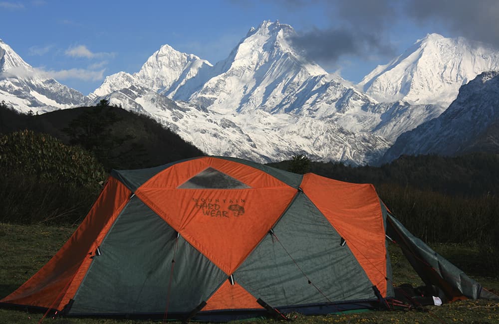
The Tamang Heritage Trail is an excellent trek along an easy-going route through authentic villages that offer a homestay program in traditional homes. Plus  there are great views of mountains in Tibet, Langtang and Ganesh Himals, set against rhododendron forests. It’s all just a day from Kathmandu!

Key points:

  • Trekking Grade: Grade 2
  • Duration & distance: Maximum 9 days total
  • Gradient: Gentle slopes and hills
  • Quality of path: Formed track
  • Quality of markings: Signs at beginning, end and during trek
  • Experience required: No walking experience required
  • Walking times: Less than 6 hours per day
  • Steps: Short step section on second day
  • Highest point: 3600m
  • Best season: Oct to May
  • Accommodation: Camping and teahouses
  • Recommended map: NP105 GHT Series Langtang and Helambu, Himalayan Map House, 2017
  • Recommended Guide Book: Nepal Trekking and the Great Himalaya Trail, Trailblazer, 2020.
Grade 2

GRADE 2

Ruby Valley Ganesh Himal
Manaslu and Ganesh Treks Gatlang Village

When to Trek the Tamang Heritage Trail?

Tamang Heritage Trail was created by some Nepali NGOs who worked with villagers to improve local trails, the result is an easy-going route through pristine mountain scenery. The trail was designed to showcase the local Tamang culture and is best when combined with one of the many Buddhist festivals throughout the year. So yes, this means the trail is perfect for any time of year! Although it is pretty wet and steamy during monsoon!

The highest point of this trek, at 3600m, also makes it ideal for those who are susceptible to altitude sickness but who still want to experience panoramic Himalayan views. The best time for views is November to January when the air is free from haze and the mountains in Tibet can be seen clearly, but expect cold nights! The main trekking seasons (both pre- and post-monsoon) see a few small trekking groups visiting, but the region is most popular with independent trekkers who are in search of something different. The openhearted hospitality of the Tamang people makes any welcome something special, especially if you visit during festivals.

Tamang Heritage Trail Accommodation and Permits

The Tamang Heritage Trail borders the Langtang National Park but you do not require any permits. However, the checkpost at Dunche might insist that you pay the National Park entry fee. Try you best to smile and explain that you aren’t going to visit the park!

Everything is basic and tailoured for Nepali trekking tourists, so things are very cheap everywhere, making this an ideal trek for those who want an inexpensive mountain fix. It is possible to hire locals guides and porters in communities. But beware of asking route directions from random folks you meet along the trail as there are lots of potential routes, so it is easy to get lost!

The Tamang Heritage Trail was affected in the 2015 earthquakes, but is now fully reconstructed. Homestays and teahouses offer accommodation and meals in every community, and be sure to check out the viewpoint above Nag Thali!!

The Tamang Heritage Trail is on the top northwest corner of the Langtang Map

Langtang Valley Map

Tamang Heritage Trail Route Options

One of the highlights of the trek is the opportunity for a ‘homestay’ in the village of Briddim. This involves staying in a traditional Bhotia house for up to three nights.

The main trail can be extended in a number of directions, including to Dudh Kund (‘Milk Lake’) on the northern slopes of Langtang Lirung. Also consider Sangjung Kharka and Kalo Pokhari near Paldor Peak, and Jaisuli Kund above Somdang. There are also connecting trails to valleys to the south-west of the Ganesh Himal including the Ruby Valley Trek (connects at Gatlang).


NOTE: A new road linking the border town of Rasuwa to Trisuli is now completed and unavoidable if you want to cross the Bhote Khosi valley between Briddim and Thungmen. There is also a road to Tatopani (via Chilime) and another to Somdang (via Gatlang). So, it is now impossible to avoid roads all the time, so take a scarf or buff to protect against dust when the occasional jeep passes.

How Much does the Tamang Heritage Trail Trek Cost?

To help you budget and plan, we’ve made a comprehensive costing explanation on How Much Does the GHT Cost? But here’s a simplified breakdown.

GHT Tamang Heritage Trail Trek for 9-days estimated costs:

  • Solo as much as possible US$915.
  • Twin-share with minimum guiding US$920 per person.
  • Twin-share fully supported US$2,175 per person.

Do you have any questions about costs? Please Get in Touch for more details.
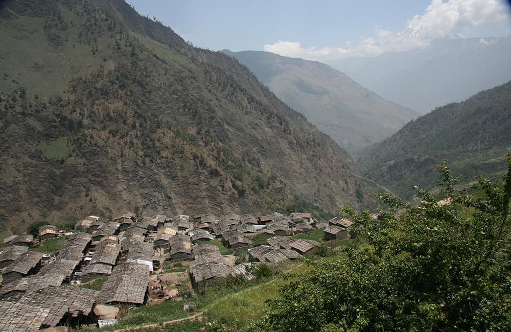
Tamang Heritage Trail Gatlang

Customisation is Normal

Want to do things a little differently? Maybe take some extra time, or go a bit faster? Or avoid technical sections or combine with other trails? Every GHT trek is different and that changes the price, but please feel free to Get in Touch to ask questions and how to customise your own trek.


Bookings

Please note that www.greathimalayatrail.com does not handle bookings for treks. We are here to inform you about the trails and logistics, but you will need to book through a registered trekking operator in Nepal. If you would like an operator recommendation or feedback on a company you are already talking to, then please Get in Touch.

Your Impacts on the Tamang Heritage Trail Trek

Tamang Heritage Trail Social Impact SOLO

Solo (Independent)

For a 9-day trek the social impact is a little low but your GHG and waste footprint is also low.

Consider taking an extra day or two to relax in a Briddhim homestay and really get to know the locals.

Tamang Heritage Trail GHG and Waste Impact SOLO
Tamang Heritage Trail Social Impact TWIN

Twin Share (Independent)

For a 9-day trek the social impact is a little low but your GHG and waste footprint is also low.

Consider taking an extra day or two to relax in a Briddhim homestay and really get to know the locals.

Tamang Heritage Trail GHG and Waste Impact TWIN
Tamang Heritage Trail Social Impact CAMPING

Camping (supported)

The Tamang Heritage Trail was designed for solo and teahouse trekking so it’s not a surprise that these impacts are unsustainable.

So, there is no justification for doing a camping trek.

Tamang Heritage Trail GHG and Waste Impact CAMPING

For more information about social, Green House Gas and waste impacts of treks, see The Impact of your Trek.

  • Destination
  • Departure
    Kathmandu
  • Dress Code
    Low-altitude alpine clothing and camping equipment required
  • Included
    Tamang Heritage Trail
  • Grade
    Grade 2
  • Idea Date Range
    15/10/2021
  • Style of Trek
    Solo independent and teahouse
1
Day 1: Kathmandu–Syabru Besi 8hrs
The drive from Kathmandu offers good views of Manaslu, Ganesh and Langtang Himals as well as brief glimpses of villagelife in the Himalaya. The first section is a sealed road to Trisuli before the precipitous dirt road to Dhunche, where there is a National Park and police checkpost. Continue to Syabrubesi (1503m), where there are many teahouses and a campsite. As most of the day’s drive is on dirt roads, a light scarf to protect your face against dust may be useful.A local legendOne of the villagers from Briddim joined our camp one evening and told an intriguing tale: ‘A long time in the past, the Chinese and Nepalese had a brief war, which resulted in the Chinese army marching through Rasuwa and occupying the hills to the south of Dhunche. The defending Nepalese were caught off-guard and with few troops were not going to be able to halt the Chinese. As the invaders established their camps overlooking the valleys around the Trisuli river, the Nepali general devised a cunning plan. Each night he lit small braziers and mounted them on cattle, which the Chinese were led to believe were the countless camps of the growing defending forces. The Chinese general believed the ruse and withdrew, which saved Nepal from an embarrassing loss.’
2
Day 2: Syabru Besi–Briddim     4hrs
Make your way north through Syabru Besi, following the road, to the checkpost located above the steps that lead to a suspension bridge across the Bhote Kosi. After leaving your details, cross the bridge and then turn upstream on the true left bank following a trail that climbs briefly before an easier gradient to the village of Wangel (1633m, 1hr). There is a water pipe in the centre of the village, take the trail, opposite the pipe, that climbs between houses. You will enter mixed pine and rhododendron forest after roughly 30 minutes. Stay on this main trail for the rest of the day, and at any trail junctions always take the noticeably larger track. It’s mostly an easy gradient as you traverse hillside, but there are two steeper sections in the forest. A deserted house is reached after 1½ hours; monkeys can often be spotted here.For another hour the trail winds around another ridge before arriving on the edge of a basin above Briddim (2229m). You can descend and walk up through the village or traverse around to a trail above the village and then walk down. The school offers a small campsite and there is a basic teahouse, however it is far more enjoyable and convenient to stay in one of the homestays. Many people elect to stay for two or three nights in the homestay to really get the feel for what life is like in a Himalayan village. There are local trails to explore up the Briddim Khola that runs beside the village and along the ridge to the south of the village. Alternatively, see how a typical household works, spin wool, and learn about traditional culture.A Briddim folktaleLong ago the field near the gompa was a tal (a small lake), which the villagers sometimes used for washing. One day, a great and famous high lama came to the village. He stayed in the gompa and the villagers looked after him. When he was here the villagers asked him if he could do something about the tal; they already had a good river for washing and water so the tal wasn’t very useful (Tibetans refuse to kill animals and therefore place little value on fish). So the lama recited some powerful mantras (Tibetan Buddhist prayers) and all the water and laundry that was around and in the lake spiralled up into the clouds and disappeared. The fish that had lived in the water all jumped out of the tal and into a large rock beside the field. So the tal became a field, which the lama said the villagers must protect, as it was now sacred. The villagers may only sow three crops per year there, at most, and sometimes when they plough the field they find dzee stones (sacred stones believed by some to be fossilised caterpillars). Ask the locals to show you the fish in the rock.
3
Day 3: Briddim–Thungmen (Thuman) 5½hrs
Take the trail that leaves Briddim past the gompa and traverse through forest above Lingling and then descend a steep trail to the Bhote Kosi (2hrs). Follow the road route for 30 minutes to a bridge that crosses to the true right bank of the Bhote Kosi and then climb narrow switchbacks for 1½ hours to the terraces surrounding Dalphedi (2317m). The trail climbs more gradually from Dalphedi to a ridge to the south of the village. A pronounced rock outcrop marks a minor pass (visible from Dalphedi) decorated with prayer flags. The trail descends some rough stone steps and then traverses a rock-face before turning west and providing the first views of Thungmen (Thuman, 2338m, 1½hrs). An easy trail traverses around to the Palpachhe Khola before climbing slightly to the village.There isn’t a good campsite in Thungmen, but there are some simple teahouses and a decaying wooden Nyingmapa sect gompa that is said to be 450 years old, and is definitely worth a visit. The locals are building a new concrete gompa, so please leave a donation with the key-holder who tries his best to maintain the old building. If you are camping, continue up through the village to a school (15 mins) and a series of grassy fields, which can all be used as campsites.
4
Day 4: Thungmen–Nagthali 4hrs
The trail is sometimes steep and there is no reliable water source so make sure you pack enough supplies. Climb a well-established trail that leads up to a series of terraces and pastures before reaching the forest (roughly 2750m, 1½hrs) above Thungmen. You are now in a fine rhododendron, juniper, pine and oak forest that attracts birds. The trail switchbacks up to a small, derelict chorten (2870m, 1hr), where the trail forks: take the left trail into a small valley. Remain on the south (left) bank of a small stream, as the trail continues to climb. Locals have cut young trees to leave stumps about 1m high as trail markers.As you near the end of the small valley the track crosses the stream before climbing a short section to a large kharka (3010m, 1hr). There are two trails to the top of the hill, the left-hand track loops around a large thicket of dense rhododendron bushes and climbs some steps. The second heads from the herder’s shelter through a narrow track that climbs a sometimes slippery slope directly to the hilltop. There are few trees on the top of Nagthali (3165m, 30 mins) and you should easily spot the small gompa and new teahouses as you approach. There are plenty of places to camp or share a room for a small fee.
5
Day 5: Nagthali Viewpoint 5hrs
To the north of the gompa, nestled against the forest, is a small stone meditation hut for Buddhist hermits who visit from Tibet. You will see a track leading off to the right, which then winds around the hill through one of the most beautiful old-growth rhododendron forests in Nepal. The trail swings to the north again (3310m, 1hr) and stays on top of a narrow ridge offering views of the Ganesh Himal and Chilime valley below. During the winter months and just after dawn, red panda can be spotted in the forest along this ridge. The track then climbs again before turning right (3400m, 45 mins) and away from the forest and on to an open hillside of dwarf azalea bushes. This track can be hard to follow when it gets overgrown, especially when it swings north (left) towards a copse of rhododendron festooned with Spanish moss. After another 45 minutes you should reach a rarely used kharka with a small stream. This eerie forest section again gives way to dwarf azalea as you continue to ascend an easy gradient to a magnificent viewpoint (3720m, 1hr) of countless peaks in Tibet, the Ganesh and Langtang Himals. Take the same route back to Nagthali (1½hrs).
6
Day 6: Nagthali–Tatopani 3½hrs
From Nagthali the trail heads south-west over the edge of the plateau – ask the locals in the teahouse if you are unsure. The trail drops to a small copse before turning back on itself and descending steeply, heading north-north-west. As you descend you will notice the small village of Brimdang (2848m, 1¼hrs), where there is a large chautara above a stone stairway. If you look at the houses while facing north you should see a small track that heads into the dense forest behind the buildings. If you ask the locals they might guide you along this shortcut to Tatopani (‘Hot Water’). However, the main trail continues down the steps and becomes a larger track that heads north past terraces and small, forested sections. The hot springs of Tatopani (2607m, 2hrs) are ahead, marked by many prayer flags in some trees. These hot springs are probably the largest in Nepal and perhaps the most popular. Most evenings, locals and visitors congregate in the three pools and sing songs to each other. There are teahouses and a campsite near the springs.
7
Day 7: Tatopani–Gatlang 5¾hrs
Locals will probably be in the hot springs soon after dawn – feel free to join them for a dip before breakfast! From the centre of Tatopani follow a rough stone-paved trail, which descends to a single farm building before flattening out to an easy gradient. The trail steepens again before entering upper Gonggang (2227m, 1hr). A lone teashop marks the end of the higher community and the descent to the lower village, which is on the other bank of the Chilime Khola via suspension bridge. On the far bank, follow the road downstream (true right bank) to Chilime village (1762m, 45 mins), where there is an old wooden gompa. The locals here are friendly but the village is frequently dirty. Take the road that leaves Chilime passing a small school and a series of chorten and mani walls. A long, derelict mani wall marks the entry to the Gatlang valley, and the trail heads right (west) following the Gatlang Khola.If you want to return to Syabrubesi from here, turn left and cross the bridge to Thanbuchet and head straight down the valley on a trail on the north bank. At the end of the valley you will meet the Bhote Kosi, where you cross the Chilime Khola and follow the road along the true right bank (south) to Syabrubesi (2½hrs).To visit Gatlang, turn right and cross another bridge about 300m upstream from the mani wall. The trail now climbs through oak and rhododendron forest before meeting the terraces of Gatlang (2238m, 4hrs). Along the trail are large chorten decorated with beautiful mani stones. There is a community teahouse at the bottom of the village and a private teahouse at the very top. If you are camping, you will probably be directed to the school above the village.This is a very friendly village, although a little dirty, and the local Mother’s Group is always willing to provide a show of traditional songs and dancing for a donation.
8
Days 8-9: Gatlang–Syabrubesi–Kathmandu
From Gatlang head up to the dirt road above the village and follow it east (turn left once on the road) for 3½ hours to a small pass, Rongga Bhangyang (2187m) above Syabrubesi. If you have the time, climb to the viewpoint to the north of the pass (2320m, 15 mins). The trail continues north from the viewpoint (or directly down from the pass), descending into forest before turning back on itself and descending rapidly to Syabrubesi (1503m, 2hrs).