1
Day 1 Samdruk Jongkhar to Trashigang, 10hrs, 350km
It takes 3 hours to drive from Guwahati to the Bhutan border at Samdruk Jongkhar (187m) on what becomes a dirt road for the last 25km as part of a ‘road improvement’ program. The Indian immigration post is 3km from the border on the north side of the road, behind some trees on the edge of a tea plantation. A weather beaten sign out the front is easily missed. An ornate concrete gateway marks the border and the point at which politeness begins. We didn’t linger and after getting the necessary stamps we headed away from the sweltering heat of Assam and up into the cool freshness of the foothills. The Indians are ‘improving’ the road all the way to Trashigang (1075m) so there are some rough bits. The difference in peoples, architecture and attitude is immediately obvious and profound; it’s hard to believe that you are in a neighbouring country. Much of the drive was in cloud and then darkness fell as we arrived in Trashigang at 11pm. But food was waiting for us, along with a comfy bed.
2
Day 2 Trashigang to Trashi Yangtse, 3hrs, 65km
Day 2 Trashigang to Trashi Yangtse, 3hrs, 65km
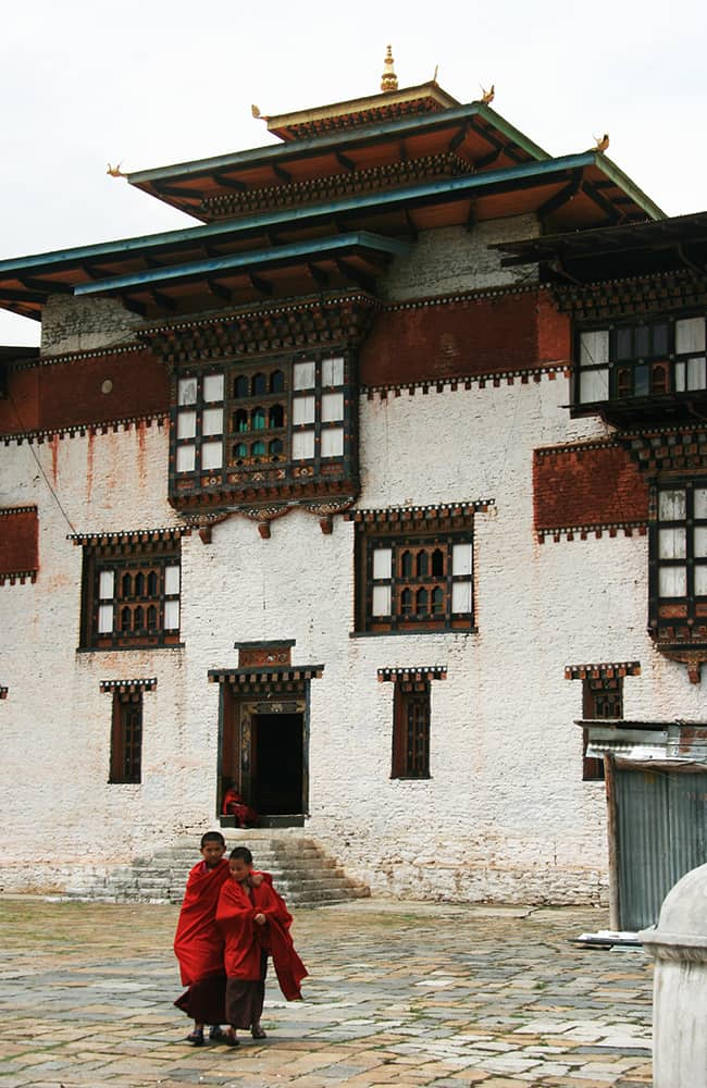
We visit a nearby village and meet some nomads from Metok a rneighbouring region with close links to Bomdilla in Arunachal Pradesh. I try some ara, the local firewater made from corn, it’s rough and I can’t imagine what it must be like to drink for breakfast, which is a local custom. Tea and coffee are not drunk in preference to ara and alcohol abuse is a problem but noone gets violent or argumentative, they just pass out. There is also a bit of an issue of unmarried mothers around here, also thanks to ara. We sped a bit of time wandering around Trashigang and the scenic dzong (fort), which looks like a ship beached on a hilltop. Dzongs are administrative and religious centres for each district in Bhutan and many date back 400 hundred years. The 65km to the road head at Trashi Yangtse (1773m) is a pretty drive through dense forest. On the outskirts of the town is Chorten Kora, a large stupa in Nepali-style where we said a prayer for our trek.
Legend of Chorten Kora
Long ago there was a fierce demon that terrorized the Trashi Yangtsi valley. Many locals and travelers were killed and no mater what magic or prayers the local lamas and people did they could not appease or destroy the demon. One day they consulted an astrologer who predicted the birth of a female whose sacrifice would subdue the demon. But at the appointed time and place the only child that could be found was the daughter of the king of Arunachal Pradesh. The locals implored the King for his daughter but he refused and for years the demon continued to take his toll. When it came time for the daughter to marry the king held a competition to find the most able suitor, which resulted in a horse race that a Bhutanese man won. He had made a supreme effort to win the race and asked for the princess to appease the demon, but again the King refused. The suitor explained his story to the princess who agreed to sacrifice herself. To prevent further suffering she begged her father to let her go. Finally the King relented and she went into spiritual retreat while the locals of Trashi Yangtsi built a giant stupa. Artesans came from Nepal with a model of Bhoudnath and prepared a special room inside the dome. When the stupa was ready the princess was bricked into the dome with her possessions, and so the demon was subdued and the people of Trashi Yangtsi have lived peacefully ever since.
3
Day 3 Trashi Yangtsi to Taupang, 5.5hrs, 800m
We camped outside Trashi Yangtsi dzong and woke early on the first trekking day. Raj and I made offerings to Avolokishwara (the Remover of Obstacles) at the shrine in the dzong for a safe journey while Pasang (cook), Tchewang (camp assistant) and Ichy (cook assistant) loaded the horses.
Follow a rough road over a bridge across the Durgi Chu and in about 20 minutes turn right as the road switchbacks left. The trail follows a river and you cross a small tributary in 40 minutes using a log bridge before then crossing the Durgi Chu in another 10 minutes via a cantilever bridge (the most common type of bridge in Bhutan). Climb switchbacks for about 120m to three white chorten (30 minutes) where there are some fields, a couple of houses and the trails levels. Beyond the fields the trail climbs again for about 350m and another white chorten (2230m, 2 hours) and open fields used by herders. Another slight climb to the long-ago deserted village of Saksing where the trail narrows and gets muddier. Pass through bamboo forest and climb to another pasture area called Sana, which is somewhat overgrown by dwarf bamboo and where there are some deep mud bogs (1 hour and 50 minutes). From here it is another 40 minutes on a slightly improved trail to the campsite at Taupang (2569m).
4
Day 4 Taupang to Pimi, 9hrs, 2700m
Today is one of the toughest days of the whole trek and an early start is definitely a good idea.
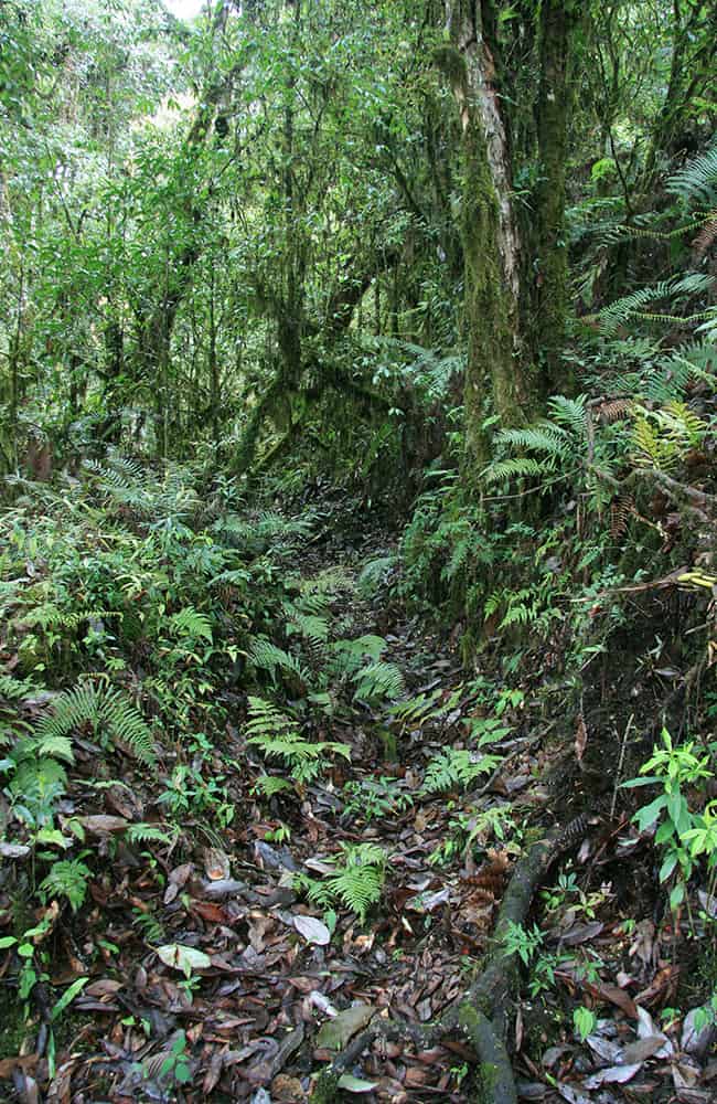
The Taupang camp overlooks the junction of two rivers, the young Durgi Chu and the Tongdala Chu, the north (right) bank of which you follow from camp. Continue through birch, oak and hemlock forest for about 1 hour before rock-hopping across the river and beginning long switchbacks up through forest. This region receives heavy rain for much of the year forming what is called cloud-forest. Spanish moss, orchids and ferns cover pine, birch and large rhododendron trees. At about 3000m come to an open area overgrown with dwarf bamboo and thistles; you may need a machete or two to get through. The trail then gets steeper and switchbacks through a broad range of rhododendron trees. Large white blooms compete with red, orange, pink and yellow varieties in what must be one of the best displays in the Himalaya. Reach the first ridge-top, the Sher Labcha (3525m, 2 hours and 45 minutes), where there is a small open grassy area with views back to Trashi Yangtsi. To your west is the upper end of a valley which you now walk around to meet the main Donga ridge which you follow for a couple of kilometers to the Dong La (3985m, 3 hours and 15 minutes). Unfortunately there are no campsites before the pass. Descend a steep rocky trail on open hillside then through forest for 2 hours to the large herding area of Pimi (3136m) where there are a couple of places to camp. The first grassy place is not the best so if you have enough energy continue for another 1 hour (100m) to some chatta (prayer flags on bamboo poles) where there is a good flat area.
5
Day 5 Pimi to Minji, 3.5hrs, 1260m
This short day allows for some recovery from yesterdays slog over the Dong La!
From the end of the second grassy area the trail enters dense forest and winds down steep muddy trails. In 2 hours and 30 minutes arrive at a picturesque gompa (2197m) in a large grassy field, which would make an excellent campsite. Continue down through the sprawling village of Minji to another gompa, which also makes a beautiful campsite (1 hour, 1879m). There is a large festival held here on the June fullmoon when locals use the many masks, drums, ornate hats and three statues that are carried around for dances and purification ceremonies. One of the locals normally does an early morning puga, which you can watch.
6
Day 6 Thangmachu and Lhuntse, 1.5hrs, 800m
There are a few choices of what to do today, either walk down to the river and then up to Thangmachu school. Alternatively, organize a car and visit Lhuntse Dzong and then drive to the school camp. Or you could drive to the school camp and then walk the first section of tomorrows trek.
A road winds slowly down from Minji to the Thangmachu bridge (1195m, 1 hour and 30 minutes) but it is much faster and easier to take the numerous shortcuts down through the village. It takes about 45 minutes to drive the 15km to Lhuntse Dzong, which is the regional administrative centre so you cannot go inside the rooms. However, there are strong connections with the royal family that make for some interesting tales and this area is home to reputedly the finest cloth weavers in Bhutan. Ask around in the small market beneath the dzong and you’ll soon be surrounded by yards of cloth called keira, the traditional women’s dress. One keira can take a year to weave, pure silk versions can cost between Nu40 and 80,000. I purchased a cotton base with silk detail for Judy for Nu15,000 which was considered a bargain by most locals. The royal family have supported the weaving industry here and it has now spread all over the country. The weavers of Khoma, a nearby village, are still considered to be the best and all of the spare work (not for personal use) goes to the royal household.
From the Thangmachu bridge it’s a 40 minute drive or an uphill walk for 3 hours and 30 minutes using both the rod and shortcuts on corners to the school at the top of the hill. You will have to request permission to camp from the headmaster.
NOTE: We had to change horses here as one of our horsemen came down with a virus. We lost a day waiting for the new horses to arrive.
7
Day 7 Tangmachu to Ungar, 8.5hrs, 800m
Just on the western side of the school is an old kani (gateway), mani wall and two derelict prayer wheel chorten. Follow the trail here as it gradually descends to a stream which you cross in 35 minutes (roughly 200m down) and then begin a gradual ascent past a small village and on to a functioning water-driven prayer wheel in 55 minutes. The trail then dips through a small watercourse before climbing to a white stupa on the Youmin La (2038m, 1 hour and 30 minutes). Do not continue straight around the hillside, instead ascend the trail immediately behind the stupa and in 10 minutes pass a small herder’s shelter or bamboo. Just beyond is a potential campsite. The trail then undulates slightly as it traverses steep hillside above Youmin village to another white stupa (2036m, 50 minutes), and shortly after you climb about 200m to a third white stupa (2282m, 45 minutes), which is also referred to as the Youmin La. The trail is now wonderfully flat to Shukang (2 hours and 30 minutes) where locals say the gompa was built by Tsong Karpa in the 8th century. It’s then a long descent on a trail that links small villages all the way to a bridge over the Ungar Chu and a campsite beneath the village (1750m, 1 hour and 15 minutes).
8
Day 8 Ungar to Pemi, 5.5hrs, 1280m
Wind around the base of Ungar village across terraced fields to small river that flows down from the southwest. Cross via a log bridge and immediately begin climbing switchbacks through dense forest. There are many animal trails so it is wise to continue following the largest route, which is sometimes steep and muddy. After roughly 2 hours and 30 minutes you come to an open grassy area (roughly 2400m) on the ridge used as a grazing place by the people of Ungar. The gradient begins to ease from here as you now follow the ridgeline. Occasional flat sections through cloud forest make for an enjoyable climb. Another larger flat section in forest (2680m, 1 hour and 30 minutes) makes a good lunch spot. Continue climbing and traversing the odd flat section along a narrow ridgeline until you reach the beginning of a large open area of dwarf bamboo and grass. The whole hilltop area is called Pemi (3032m, 1 hour and 30 minutes) and a ruined building, said to be used by previous Kings as they toured the region, sits near the only water source. Before reaching the ruins there is a flat-ish area with bamboo herder shelters, this is the only potential campsite on this side of the Rhodang La. Water can be found in forest on the northern side of the ridge.
9
Day 9 Pemi to Bumthang, 9hrs, 2300m
The first 1 hour of trail is along the ridgetop and only climbs a little. There are exceleltn views back to the Don La and to distant mountains northwards. The climb to the Rhodang La (3860m, 2 hours and 45 minutes) is steep and winds around craggy outcrops of rocks that were a challenge to the trail builders. Most of the steps and stonework are about 100 years old and most are still in excellent condition. The ridge is barely 3m wide when you reach a few prayer flags but soon widens as you continue heading west and climbing a gentle gradient to the Phul La (4135m, 1 hour and 15 minutes) passing a couple of derelict stone huts enroute. It’s a broad and easy descent from the pass, a distinct contrast to the climb up! After roughly 45 minutes the descent becomes a long gentle downward traverse through pine and rhododendron forest to Phokpey camp (3790m, 1 hour and 30 minutes), so named after the village in the valley below. If you are tired camp here, otherwise continue across the grassy area and follow a trail down through bamboo forest.
Over the next 1 hour and 30 minutes you pass through all four types of bamboo used in Bhutan – the dwarf variety (up to 1 metre) is used to make arrows, a slightly larger variety (upto 2m) is used for weaving mats and bowls, a variety the grows to 4m or so is used for strong baskets and heavy duty household items, and the largest variety (up to 6m) is used as a building material.
Once in the main valley there are many trails through the bamboo and then mixed broad leaf forest and local knowledge is helpful. The surrounding valleys are called Bumthang , which is also the district name that covers much of central Bhutan. Ugyen Choling Palace (2915m, 2 hour and 30 minutes from Phokpey Camp) is the home of the first King of Bhutan’s uncle and is a really interesting museum where you can stay. There is a campsite beneath the Palace (15 minutes) beside the main river below but I’d recommend staying in the Palace.
10
Day 10 Bumthang to Tangbe, 7.75 - 8.5hrs, 1350m
From the chorten in front of the Palace descend for 15 minutes to a small village where there are a number of camping spots. Do not enter the village, instead turn right at a chorten, cross a new wooden bridge and then walk down an avenue of willow trees to bridge over the Tang Chu (2744m, 10 minutes). Warning! If you are allergic to bee stings DO NOT cross this bridge – there are many hives on the far side and bee attacks are reported. There is another bridge about 15 minutes further upstream. Both trails lead to the same dirt road being built to a nearby village. Follow the road for about 30 minutes and where it begins to climb a little there is a trail heading left down to a small river. From here you can choose which route is better for you:
- Option 1. River trail – this a more direct and considerably faster route up the valley but after rain the bamboo forest section is very muddy.
- Option 2. Village trail – continue on the road and then pass through a village on your left. On the far side of the community, wind around fields and across some pastures to rejoin the river trail.
Once on the main trail in the river valley continue to climb easy gradients to a large white kani (gateway) and some small chorten (3283m, 1 hour and 30 minutes via river trail or 2 hours and 15 minutes via village trail). From here it is an easy 45 minute climb to the Phe Phe La (3545m) through rhododendron, pine, spruce, hemlock and magnolia forest. It’s an easy descent on a trail that is washed out in many places to a large meadow at Trashiling (aka Nalakhang, 2860m, 2 hours and 30 minutes), which is a popular campsite.
The next section of trail isn’t particularly interesting so if you have the energy continue to the next camp. Head down-valley from the campsite through alternating grassy pastures and pine forest. The trail is often muddy so you’ll become expert at balancing on slippery bowling-ball shaped rocks almost completely submerged in mud. Come to a bridge in 1 hour 15 minutes which you cross and then continue heading downstream on a dirt road passing villages to Koling (2692m, 30 minutes) where there is a grassy area or 10 minutes further to Tangbe where there is another grassy area and shop.
Most horse-drivers stop here and your next connection is 7km (by road) away, so most crew will organize a 4WD car to transport all the gear. You can walk along the road, or get a lift in the car, neither option is particularly thrilling!