1
Day 1: Pokhara–Marpha–Jomsom–Kagbeni all day
The ascent of the Kali Gandaki valley can cause altitude sickness so it is wise to include acclimatisation periods if you are susseptable to rapid increases in altitude. One of the most popular places to stay at Marpha (2670m), whether you fly to Jomsom (where you could also rest) and then walk for 2 hours (20 mins by vehicle), or drive up from Beni, biut if you do stay at Marpha you will need to add 1 day to this itinerary. Marpha is a picturesque stone-flagged village surrounded by apple orchards, from which the locals produce cider and brandy.
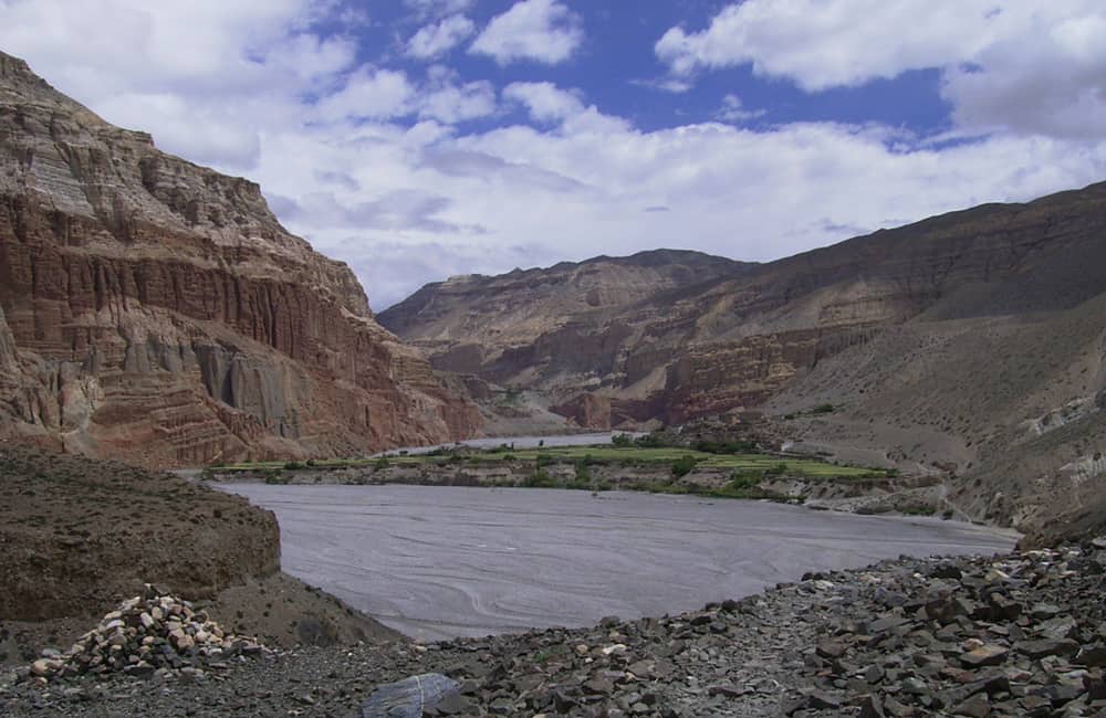
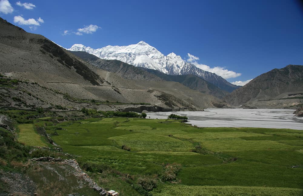
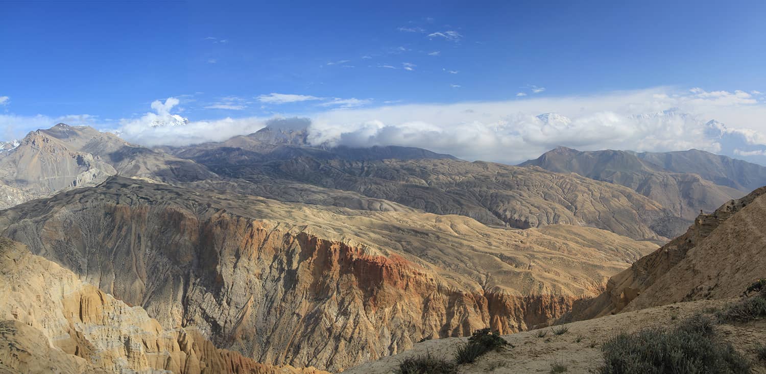
The Kali Gandaki valley is one of the oldest and most important trade routes between Nepal and Tibet. Dating back to the 1400s, the local Thakali people were renowned traders in all goods, especially salt and wool (from Tibet), and grains (from Nepal). This valley is said to be the deepest natural river gorge in the world, as it runs between two 8000m peaks, Annapurna I (8091m) and Dhaulagiri (8167m).
The road to Jomsom (2720m, 2hrs) is normally busy with local traffic and can be reached in 30 minutes by vehicle. The town is spread along the road and crosses the Kali Gandaki beyond the Nepal Army barracks but most of the teahouses are near to the airport entry. At the end of the community is a jeep parking lot where you can get a seat to ride as far as you like towards Jomsom – note that the best time to travel is in the early morning.
Walk along a broad dirt road that follows the east bank of the river to Ekla Bhatti (2740m, 2hrs) where there are some teahouses and a fork: the right track climbs to Muktinath (see day 15 of Naar, Phu & Thorung La, pp000-00), but you continue along the valley bottom to Kagbeni (2810m, 30 mins), which can be seen ahead and a substantial tourist hub. Your Mustang permit is from Kagbeni onwards so it is important that you arrive here the day before it becomes valid.
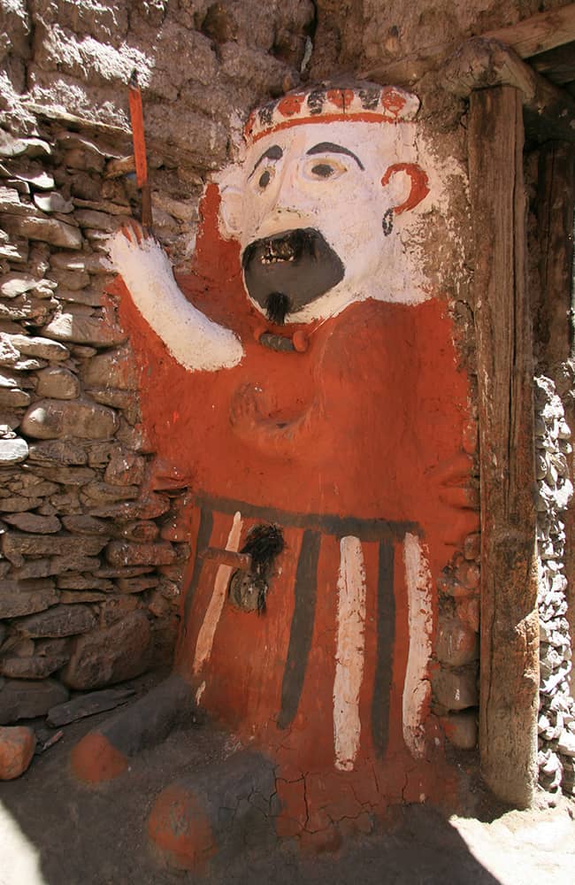
Kagbeni, an oasis-like settlement of narrow flagstone-paved paths and flat-roofed homes, is dominated by an old but still functioning Tibetan Buddhist gompa of the Sakyapa sect. The remains of an old fort lie on the northern edge of the village and would have looked formidable before the local king fell on hard times and his dethroned descendants moved on. A male spirit-protector guards the northern gateway of the village (there is a smaller female protector at the southern entrance) and beyond is a mani wall, next to which is the ACAP registration office and information centre.
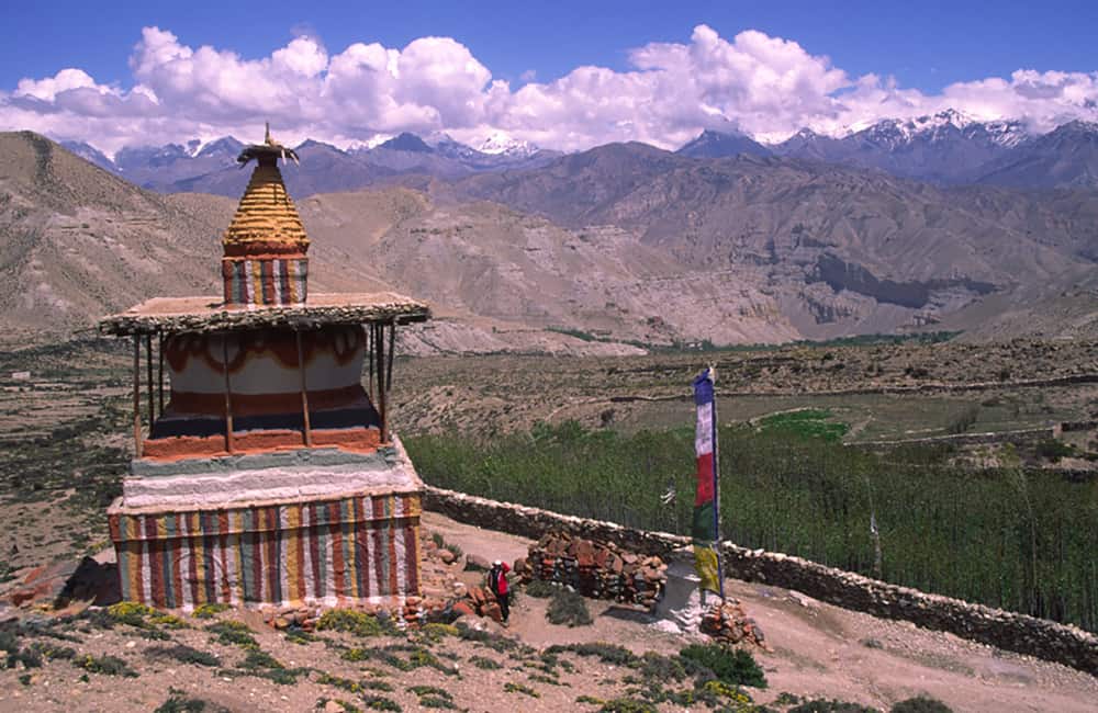
Beyond the village there are excellent views of the gompa with Nilgiri, Tilicho, Annapurna and Dhaulagiri rising above.
2
Day 2: Kagbeni–Samar 6hrs
From Kagbeni the trail continues to follow the road on the true left (east) bank of the Kali Gandaki, often traversing slopes of loose rock where you might be lucky and find ammonites. The valley narrows and a large cliff-face on your right is dotted with ancient cave dwellings before opening out again at the village of Tangbe (3060m, 2½hrs).
The trail undulates across what looks like moonscape to Chhusang (2980m, 45 mins), where there is a small teahouse. If you have the time, ask one of the locals to guide you to a small but impressive cave gompa dedicated to White Tara (Buddha of Success and Achievement) about 10 minutes from the village. There are also impressive rock formations and some meditation caves in the cliffs on the west bank of the Kali Gandaki. Chhusang is bordered to the north by a broad river, which can be tricky to ford after heavy rain.
The valley ends abruptly at a narrow canyon with more meditation cliffs above and a metal bridge that leads to Chele (3050m, 45 mins) on the true right bank of the Kali Gandaki. There are a few teahouses here and good views back down the valley, with the peaks of Nilgiri and Tilicho in the distance. The trail climbs through the centre of Chele and then follows the road until a sharp bend, and you again follow walking trail into a small eroded valley. Do not cross the bridge to Ghyakar, but continue on a track blasted and chiselled from an enormous cliff-face, which eventually leads to a small grassy basin and Dajori La (3735m, 1½hrs) pass with views down to the Samarkyung Khola. You again follow the road to Samar (3660m, 30 mins), which is a small, picturesque village surrounded by poplar trees, chatta on tall poles, and terraces used for cultivating millet.
3
Day 3: Samar–Geling 7hrs
There are two options to follow from Samar to Syanboche; the road route via Bhena, but as there is little point walkin g along the road, I will only describe the trekking route via Chungsi Cave.
At first, follow the road through the centre of the village to an old kani where the track rapidly descends into a heavily eroded watercourse and then climbs a steep trail on the far bank. Cross a short section of flat grassy ground, past an old stupa before reaching another eroded watercourse, which you cross by another switchback trail. Once you reach the top of the far bank the trail forks: take the right fork that climbs a ridgeline marked with prayer flags and shown as Chorate (3760m, 1½hrs) on some maps.
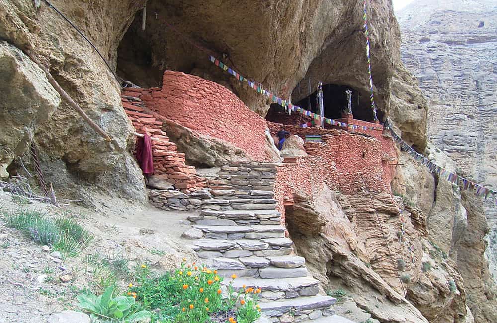
The trail now heads down switchbacks into a steep-sided valley, before levelling a little as it crosses some loose hillside. The descent continues to a small river junction (1hr), which you cross and perhaps cool your feet! You now ascend the narrow tributary valley to your left for about 20 minutes and climb steps to the entry of Chungsi Cave, inside which is Ranchung chorten.
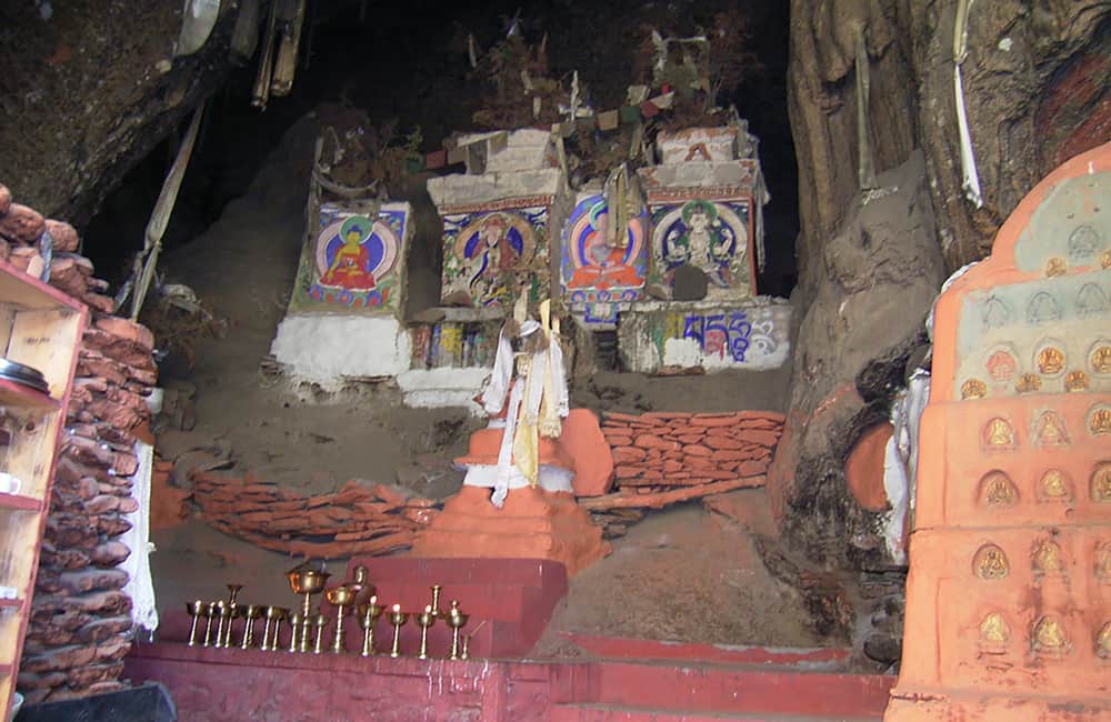
Ranchung chorten means ‘the chorten that built itself’, or appeared by a miracle. The cave has a large natural pillar, which appears to be supporting the roof of the cave temple. Locals also worship this pillar as a chorten. From the entrance, go to the left of the pillar and climb a few steps into a dark passageway that runs behind the pillar. There are many carvings in the rock-face worn smooth by devotees touching them. It is said that the images are predominantly of Padmasambhava (8th century) and Atisa (11th century), the two great teaching lamas who founded what became competing Tibetan Buddhist sects (red hat and yellow hat respectively). However, scholars believe that the cave was of religious importance long before Buddhism arrived in Mustang and was probably a ritual site for an animist belief system.
Retrace your steps to the river junction, but in stead of descending the the river, turn left and begin ascending the Syanboche Khola valley. The trail is clear and direct up the valley all the way to Syanboche (3800m, 1½hrs) where there are teahouses should you want to rest.
On the far side of the village the trail climbs to another pass (3850m) before descending an easy gradient to a fork marked by a painted cairn. Turn right at the cairn and descend to a broad flat-bottomed valley and the village of Geling (Ghiling, 3570m, 2½hrs).
There are two Ngor-pa sect (an off-shoot of the Sakyapa) gompas in the village, which date back to the sect founder Ngorchen Kunga Zangpo in the 15th century. The main gompa is dedicated to Maitreya (the Future Buddha) and contains frescos of the thousand of Buddhas of the Bhadrakalpa (a time when all 1000 Buddhas shall appear). The second, smaller gompa is high on the rocks above the village, and is called the Gonkhang. This is where the village spirit-protectors are stored, and is a very holy and powerful shrine. The resident lama may not be willing to uncover the fierce-looking deities for fear of angering them.
4
Day 5: Geling–Ghami–Tsarang 6½-7¼hrs
There are two trail options from Geling; the fastest route climbs a steep hillside above the two gompas before heading due north along a shallow valley to a pass (4025m, 2hrs) with excellent views back towards the Annapurnas. Then descend to the main road route and on to Ghemi (3520m, 1¾hrs). The second, slower road route takes an easier gradient climb up the main Geling valley to the Nyi La (4010m, 2½hrs), which also offers some great views. A long but easy descent brings you to Ghemi (3520m, 1hr), where there are a couple of teahouses.
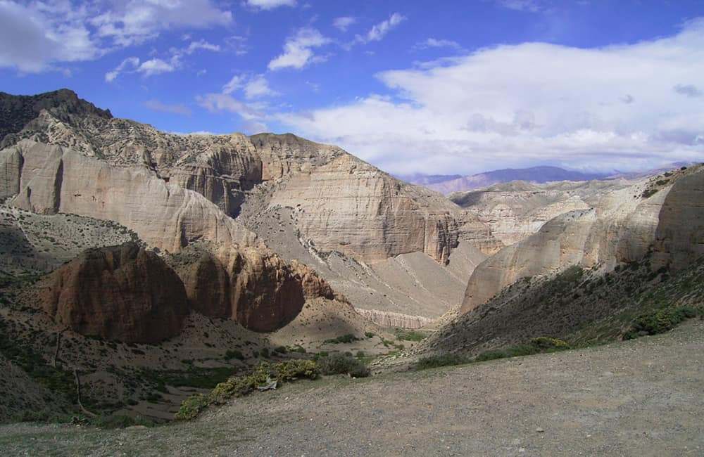
Again, there are two options from Ghami. The road route over the Tsarang La (3870m, 2hrs) is the fastest but dusty way to reach Charang (Tsarang, 3560m, 1½hrs) where there are many teahouses. A longer trekking-only route first follows the trail to Drakmar (note there are two trails, both of a similar duration) that reach a junction before the main village (3740m, 1¼hrs). If you have time, it is worth walking through Drakmar, as there are two paths that climb up through the dramatic multi-coloured cliffs (both before and after the village). Both trails converge on the broad, flat plateau above the cliffs (4000m, 1hr). From where you follow a very easy descending trail down the shallow valley to Charang (Tsarang, 3560m, 1½hrs)
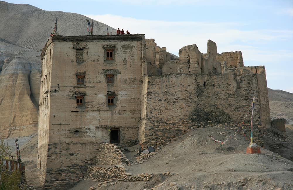
Charang is the old capital of Mustang and is dominated by a huge crumbling fort that used to be the royal residence. The extensive gompa and library here has similar but larger frescos and statues to those in Geling’s gompa.
A Visit to Lo Gekar
For those with a little extra time, a visit to the gompa of Lo Gekar is a must!
From the trail junction on the plateau above Drakmar, follow the left-hand trail (north) and do not descend towards Charang. The trail climbs slightly as you cross the Mui La (4170m, 30 minutes) and then descend to Ghar Gomba (gompa, 3950m, 45 minutes), where there is only a campsite to stay. Take your time to explore the gompa, it is one of the most important in all of Mustang.
From the gompa, descend a little to cross bridge over the usually dry riverbed of the Chharang Khola (3820m, 15 minutes) and then climb steadily to the Chogo La (4280m, 1½hrs). It is now an eassy descent down the Thulung Khola valley before turning left to round smooth hillside that locals call the Marang La (4230m, 30 minutes). You now drop straight down to the capital of Mustang, Lo Manthang (3810m, 45minutes), where there are many teahouses to choose from!
The legend of Lo Gekar
A local legend says that the Buddhist saint Padmasambhava founded Ghar Gumba in the 8th century, when he came to Mustang to do battle with evil powers out to destroy Buddhism. It is said that he came to Lo Gekar while he was on a journey through Mustang to Samye, where he established the first gompa in Tibet (built ad775-787), thus making Ghar Gumba one of the oldest Tibetan Buddhist gompas in the Himalaya. The main statue in the inner prayer room is said to be a self-emanating image of the saint, flanked by his two principle consorts, Mandarava and Yeshe Tsogyal. Smaller statues of other deities are displayed around the room, which is decorated with some fine frescos. The anteroom is uniquely decorated with hundreds of wooden tablets each with a Buddhist deity painted in vivid colours. A large cavity in the north wall holds a very rare collection of wooden and clay statues, including one of Padmasambhava on a horse prepared for battle against the demons.
5
Day 6: Tsarang–Lo Manthang 4½hrs
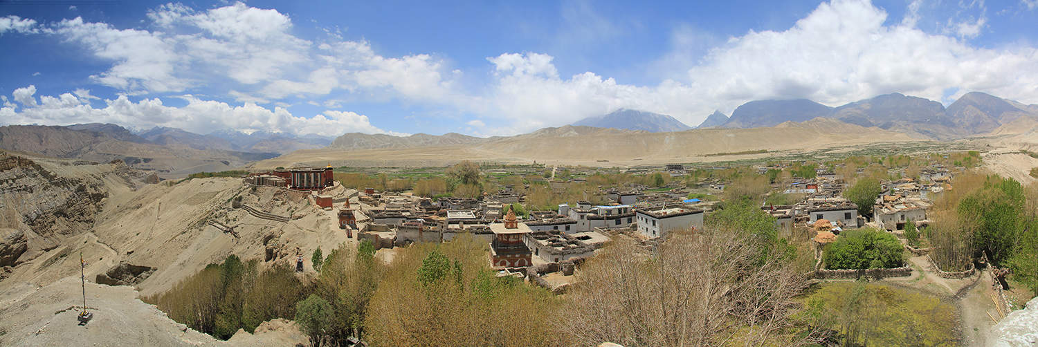
The trail from Tsarang drops into the Tsarang Khola ravine to the north of the town; you will need to duck under a metal water pipe as you descend. Cross the bridge and climb the far bank, and ascend to the mouth of the Thulung Khola and the dirt road, which you follow for 2½hrs, past a large stupa, to a broad plateau where there is a lone teashop. In the cliff-face above the teashop you can see more cave dwellings. Continue to follow the road to Lo La (3950m, 1¼hrs), where there are fine views of Lo Manthang (3809m) and northern Mustang. From the pass it is an easy downhill for 45 minutes to the ancient walled capital, which sits upon the ‘Plain of Aspiration’.
Only the (ex-) King of Mustang is allowed to ride through the main gateway, all others must walk into the 600-year-old mud-walled city. It is worth spending at least two days exploring Lo Manthang, which is crammed with about 150 homes linked by narrow, twisting alleyways. The flat roofs of each home are used for drying crops during the daytime, and at night young lovers are able to easily climb from roof to roof for liaisons. Established as the capital of Lo by Raja Amapal in the 1380s, the people of Lo Manthang avoid building homes outside of the city walls believing that bad spirits will cause havoc in their households if they do. The Lamas, who circumambulate the city during festivals blessing the walls as they go, perpetuate many such superstitions.
The former Raja, ‘Lo Gyelbu’, named Jigme Dorje Palbar Bista, fulfils a mainly ceremonial role when in residence although he is loved and respected throughout his Kingdom. It is said that he keeps some of the best horses, Lhasa Apsos, and the most ferocious Tibetan mastiffs in Mustang. The Raja’s palace is an imposing 4-storey building in the centre of the city. His wife, the Rani, is from an aristocratic family in Lhasa.
6
Day 7: Lo Manthang all day
Apart from the intriguing town itself, there are three major gompas to explore, Jhampa, Thupchen, and Chhoede, all of which have undergone expert restoration over the last 20 years.
The oldest gompa is Jhampa Lhakang (meaning ‘god house’), begun in ad1387 during the reign of King Amapal, and later designed by Ngorchen Kunga Zangpo (who also established Geling and Tsarang gompas). Jhampa is said to contain 1000 hand-painted Yogatantric mandalas of amazing intricacy, as well as a large gilded clay statue of Maitreya (Future Buddha), which is two stories tall. The ground floor is undergoing long overdue restoration, but the second floor is accessible, so too is a third floor sanctum, which leads to a flat roof, which offers excellent views of the city and surrounding countryside.
Nearby is the great gompa of Thupchen, founded in ad1412, which you enter through an entrance hall protected by baroque statues of the four Lokapala, who keep evil spirits at bay. Commissioned by King Chang Chen Tashi Gon, the grandson of Amapal, this is perhaps the most impressive of the three gompas. The main prayer hall has two rows of ornate statues, the larger row against the western wall are Shakyamuni, Avalokiteshwara (Compassion of all Buddhas), Manjushri, and Padmasambhava (Guru Rinpoche), and a lower one with statues including Vajradhara (Primordial Buddha), White Tara, Amitaya, and Hayagriva (the wrathful manifestation of Avalokiteshwara). The walls are adorned with large frescos of Buddhist deity triads, which are flanked by hundreds of minor deities. An antechamber on the northern side of the gompa is under renovation and is likely to be for several years; it was probably dedicated to the protector Mahakali.
The final gompa to visit is Chhoede, the main religious hub of Lo Manthang, and normally guarded by some fierce Tibetan mastiffs, so you are advised to secure the services of a monk to accompany you. Established in ad1757, there are three notable places to visit, the main gompa prayer hall with many bronze, brass and copper statues and the sacred thanka of Mahakala and Dorje Sonnu (the evil demon ritually killed during the Teeji festival).
Note: the monks prohibit taking photographs of these statues in an apparent bid to limit interest in them among collectors of stolen art.
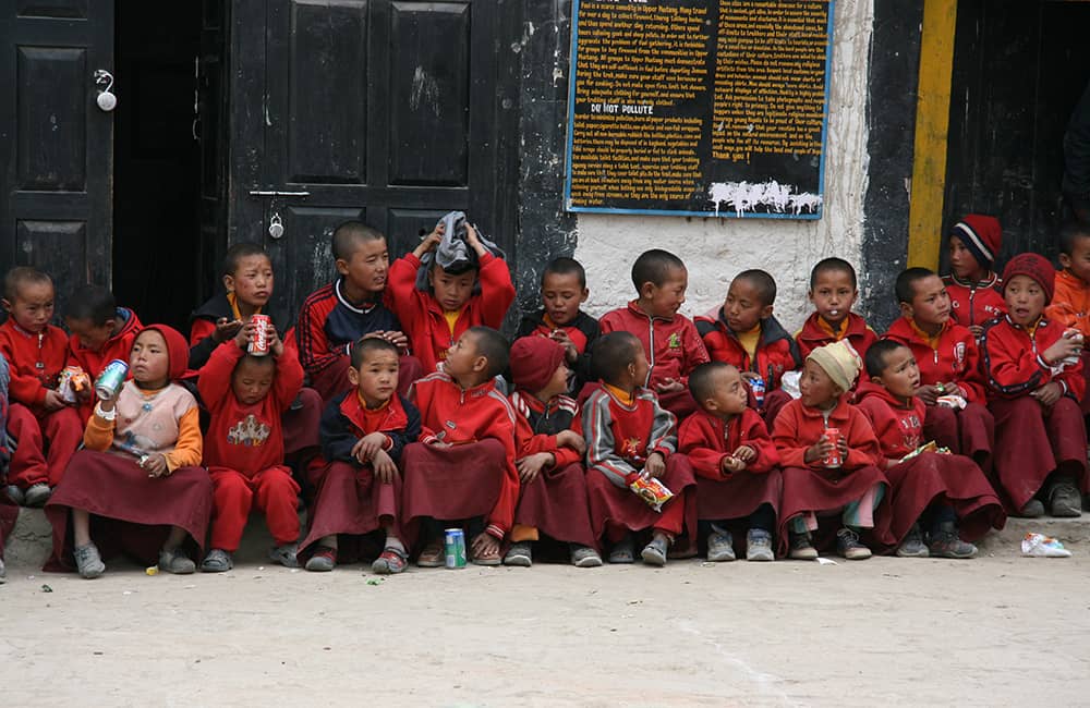
In a small building next to the gompa is a large prayer wheel, which almost fills the room. It is said that circumambulation three times while spinning the wheel will drive away any bad dreams. The final spot worth visiting is the monastic school beside the entry to the Chhoede compound, where the students and teachers welcome visitors and are keen to show off their language skills. A large new prayer hall opposite the school is where the monks prepare for their dances at each festival.
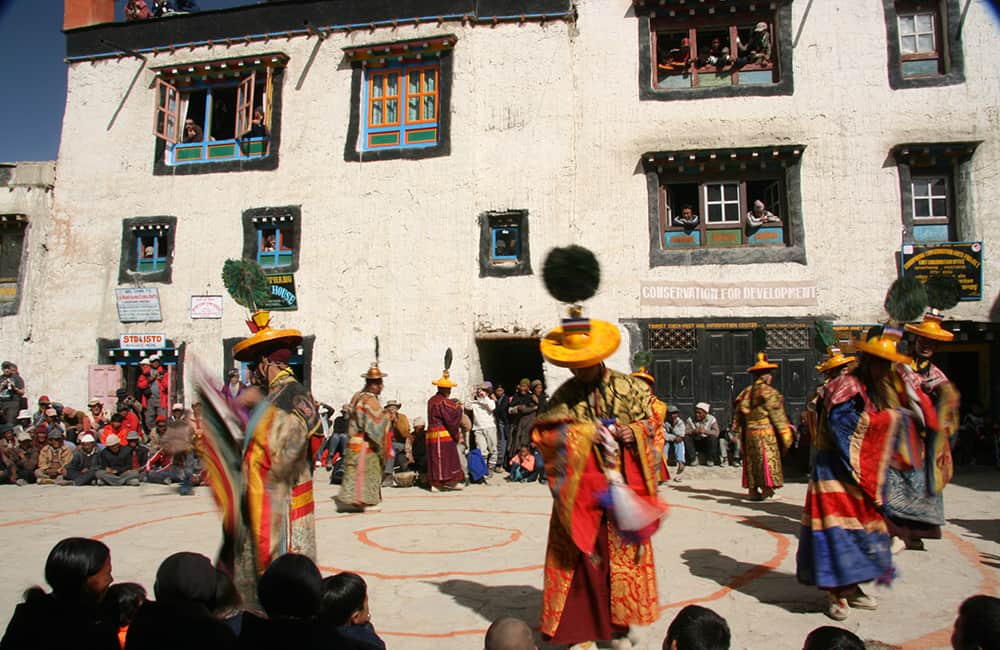
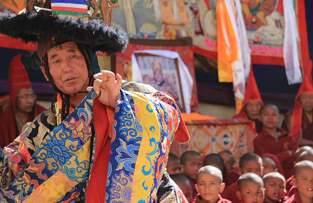
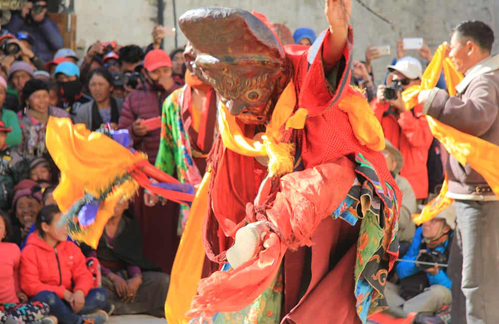
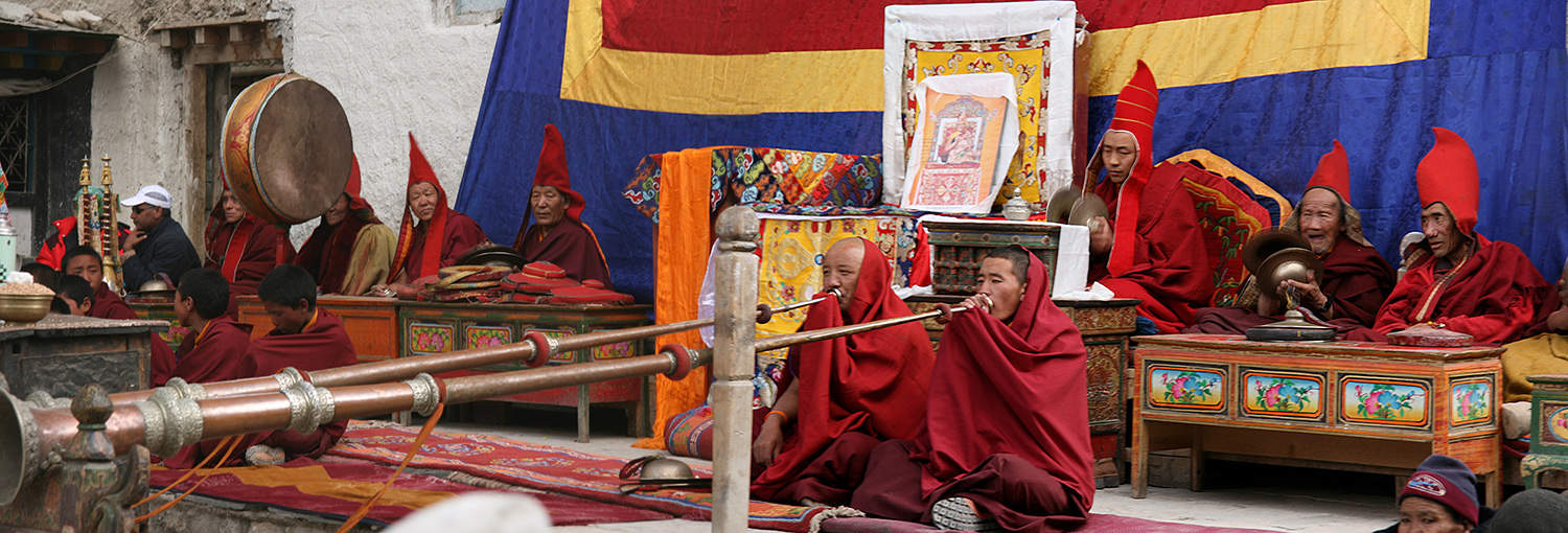
Teeji festival
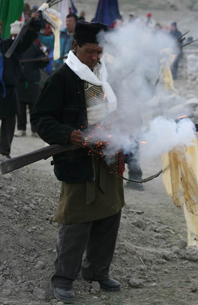
The Teeji (comes from the words ‘ten che’, meaning the hope of Buddha Dharma) festival is a three-day ritual known as ‘The Chasing of the Demons’, which centres on a local myth that tells of a deity named Dorje Jono, who must battle against his demon father (Dorje Sonnu) to save the Kingdom of Mustang from destruction. The demon father wreaked havoc on the Kingdom by creating a shortage of water (a precious resource in this very dry land), which caused all sorts of disasters including famine and animal loss. Dorje Jono eventually beats the demon and banishes him from the land, and the community is saved from a plague of misfortunes. Of course, the local population celebrates their salvation, as water will be plentiful again, and the balance and harmony of day-to-day life is restored.
Over three days, the lamas from Chhoede Gompa enact battles and folklore scenes through intricate mask-dances, which culminate in a fireworks and musket-firing melée outside the main gate of the city. Each of the three evenings, there is a cultural programme in the centre of the city, where young and old come to enjoy dance and singing performances. Teeji is a lively, vivid and amusing celebration and reaffirmation of a myth said to have been bought to Mustang by Padmasambhava in the 8th century. Apart from the symbolic ritual of cleansing the Kingdom, Teeji coincides with the end of the dry winter/spring season and ushers in the wetter monsoon season (the growing season in Mustang). So for everyone in Mustang, it is a ‘must-see’ event, where locals dress up in their finery and have a good time.
7
Day 8: Lo Manthang–Yara/Luri Cave Gompa 5½ + 4hrs
Follow the main road south out of Lo Manthang to the Lo La (3950m, 30 mins) and after descending a short way, take an obvious trail through a shallow valley that branches left away from the road. You soon begin the long slow climb along the Udi Danda on a trail tha provides some great views of Mustang. After a final climb to the Dhi La (3950m, 3hrs) you can have a good rest and hopefully enjoy views of a distant Dhaluagiri. The descent to Dhi (3400m, 45 mins) is on a loose and sometimes steep trail, but there are teahouses in the village that also make a great lunch!
Cross a bridge at the northern end of the community over the Mustang Khola and turn right to enter the Puyung Khola valley. You soon come back onto road and will reach Yara (3650m, 1¼hrs) where there are a few teahouses.
There are two routes to Luri Cave Gompa, a more scenic route through the Puyung Khola valley and and easier but slightly longer trail via Ghara. Most groups take a circular route that returns via Ghara that is now described.
From Yara, the trail climbs open hillside before entering the steep-sided gorge cut by the Puyung Khola. The trasil crosses back and forth through the river, so care should be taken after rain storms. After about 1½hrs, you reach the first of the cave gompas (Tashi Kabum Gompa) but access is very difficult since the 2015 earthquake and the condition inside is unknown. In another 30 mins the valley opens out and you turn left and climb to a constructed gompa beneath steep, eroded cliffs. Ask at this gompa for the Luri Cave caretaker/key holder as he often locks the entry. It is another short climb to the Gompa (3950m, 10 mins), which needs some repairs after the earthquake, but the main statues and chorten are in good repair. The Gompa pre-dates the main gompas in Lo Manthang by about 100 years and are good examples of Buddhist art before the Tibetan style was fully developed.
From the constructed Gompa, take road route to Ghara (3920m, 45 mins), from which there are some goods views of a distant Dhaluagiri. It is then an easy 45 mins descent back to your teahouse in Yara.
8
Day 9: Yara–Tangye 6hrs
From Yara, it is a short, steep climb for the first 20 mins but then the gradient eases as you make a long traverse around a barren hillside. A short, completely flat section leads to a steep descent down an eroded cliff to a stony riverbed. Cairns mark the trail if you are having trouble identifying the river-crossing point, and if the stepping stones are immersed you will have to wade the ankle-deep water. The river crossing is usually where you can see the road on the far bank. Just beyond are a couple of local teahouses (3450m, 1¾hrs) frequented by truck drivers who bring supplies for further road construction to Dhey.
It is now a long uphill for 1½hrs to a minor pass (approx. 3920m) where you then drop into a shallow valley and begin a long gradual desent to a plateau above Tangye. A short steep, loose section descends between eroded cliffs before becoming an easy downhill walk to the picturesque village where there are teahouses (3340m, 2½hrs).
9
Day 10: Tangye–Tetang/Chhusang 8hrs
Today is a long distance to cover, so start early and hopefully you’ll have some fantastic views along the way!
Cross the bridge beyond the village and turn right on a trail that winds around hillside to another bridge the crosses Yak Khola (30 mins). It’s now a long uphill, which is steep at first, then eases and then steepens again to Pa La (4160m, 2½hrs). The trail decends a little and then winds around scrubby hillside to a potential campsite at Pa (4080m, 30 mins) which makes a good rest stop! Note: this is the last reliable water source before Tetang!
The next section of trail is one of the most spectacular in all of Mustang, so enjoy the views!
An easy trailtraverses around barren hillside and offers views of norther Mustang. In some palces the hillside is quite steep and the trail worn to a narrow section, but it never becomes too exposed. After a couple of hours you begin following the major ridge of the Siyarko Tangk Danda. There are views to the south of Tilicho and Nilgiri, a distant Dhaulagiri and western and northern Mustang. Take some time to find photo spots with eroded multi-coloured cliffs and dramatic panoramas!
The trail begins to descend at a unrelenting pace and becomes steep and loose for about 300m and then eases before a trail junction (3170m, 4hrs from Pa) – left leads to Tetang and right to Chhusang, which about about the same distance from this point. The left trail to Tetang (3040m, 30 mins) cuts down through steep, eroded cliffs, whereas the right trail to Chhusang (2980m, 40 mins) is much easier, although you will have to walk along the road into the village. There are rooms available to stay in at Tetang, but you will have to search them out. There are teahouses in Chhusang.
10
Day 11: Tetang–Muktinath 5-6hrs
To be honest, not many people trek the final section to Muktinath as the temptation of a jeep from Chhusang to Kagbeni and Jomsom is hard to resist. However, the views from the Gyu La are excellent in good weather, so if you are willing to get up early for a 1000m climb, then this is worth the effort!
If you begin at Chhusang, add an extra 30 minutes to reach Tetang, which is connected by a good road.
From Tetang, a steady climb heads uphill from behind the village before crossing a plateau – keep heading for the deep valley on the far side of the plateau. It’s an unrelenting climb through the valley and steepens as you bear right (south) as you approach the Gyu La (4077m, 3½-4hrs). If you have the energy, climb the minor peak to your right from the top of the pass for some of the best Himalayan views possible!
The descent to Muktinath (3760m, you can see below in the valley) is on an easy trail and takes about 1½-2hrs, there are many teahouses here as well as the sacred Hindu and Buddhist pilgrimage sites. Note you have now joined the Annapurna Circuit trail route via the Thorong La.
11
Day 12: Muktinath–Jomsom-Pokhara 3¼hrs
The only trail section down to Kagbeni is the first section from Muktinath to Jharkot (3550m, 45 mins) and then follow the road to Kagbeni (2810m, 2½hrs). If you have stayed at Kagbeni on the way up to Lo Manthang, then it might be more convenient to jump in a jeep at Muktinath and head straight to Jomsom (1½hr drive).
There are many daily scheduled flights from Jomsom to Pokhara, or a 10hr jeep drive.