1
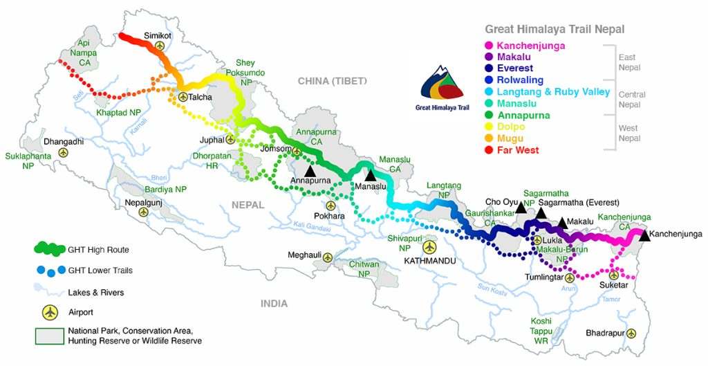
Days 1-10 Kathmandu to Kanchenjunga Base Camp (KBC) at Pangpema
DAY 1: KATHMANDU – TAPLEJUNG/SUKETAR – DRIVE TO SUKATHUM 8-20HRS
The only scheduled flights to Suketar (2420m) from Kathmandu are on Sunday and Wednesday (Tara Air), for the rest of the week you either have to fly via Bhadrapur, or charter your own flight, or use a combination of flight and bus or jeep (8 to 12 hours) to the large Limbu settlement of Taplejung (1820m) via Illam. Flights can be delayed due to bad weather so it is wise to organise a second option, just in case. If you arrive late in the day at Suketar there are some simple teahouses next to the airport, alternatively it is an easy downhill walk for two hours to Taplejung. A regular jeep service heads from Taplejung to Sukethum (5 hours) throughout the day.
DAY 2: SUKATHUM – AMJILOSA 6HRS
Cross the suspension bridge at the Sukathum campsite to the true left bank of the Ghunsa Khola, and follow a trail through dense forest until the valley narrows into a deep gorge (2hrs). Waterfalls cascade down both sides of the valley; the sound of the river will make conversation difficult. It is essential you concentrate on the trail. Locals have built a stone walkway beneath a cliff-face along the river’s waterline, which makes for some great pictures but care is needed at all times. After negotiating this section, there is another hour of dense forest trail before you cross a bridge at the base of a steep climb. Switchbacks ascend 350m (2hrs) before the gradient eases, about one hour before Amjilosa (2308m).
DAY 3: AMJILOSA – GYABLA (KYAPRA) 5HRS
The trail leaving Amjilosa wastes no time in climbing a minor ridge to a sharp turn to the north (30 mins). The forest is dense and dark as you again descend towards the Ghunsa Khola at Thyanyani (2405m, 1hr) and the first of a few slippery log bridges across streams. There are a few small stone shelters here which are normally only used by herders in monsoon.
For the first time in a number of days the trail doesn’t seem to continually climb up and down, as the valley widens slightly and feels less claustrophobic. After the third bridge (2hrs) the trail climbs another steep track for roughly 300m (2hrs), the last section beside a stream can be slippery so care is needed. You crest the climb and find yourself on the outskirts of the picturesque village of Gyabla (Kyapra, 2730m). For those with time and energy there is a pleasant walk up behind the village with views of the Birdhungga Danda.
DAY 4: GYABLA (KYAPRA) – GHUNSA 4.5HRS
After the previous week this day marks a noticeable change in the flora and fauna along the trail. At first, the trail seems much like that of the previous afternoon; a broader valley bottom permits views of the river and hillsides, which continue for 1½ hours. Then the trail climbs for 200m (1hr) and suddenly you notice rhododendron, camellias and azaleas rather than bamboo and cardamom beside the trail. The village of Phale (Phere, 3140m) is spread over a large area. The first houses are the winter village for Ghunsa, before the village proper (30 mins). This is a Tibetan refugee settlement where it’s possible to buy handicrafts and homemade rugs from some of the locals, ask around when you arrive and potential sellers will soon find you! From Phale a pretty trail winds through dwarf conifer and pine forest before crossing a suspension bridge (to the true left bank) and arriving at Ghunsa (3595m, 1½hrs) in a broad section of valley. Waterfalls fall from the steep cliffs above this Sherpa village that feels like the edge of nowhere on a cloudy day.
DAY 5: SPARE DAY
DAY 6: GHUNSA – KHANGPACHEN (KHAMBACHEN) 5.5HRS
Deodar pine and rhododendron forest, grassy glades dotted with wild flowers, and increasingly spectacular mountain scenery combine into what is perhaps the most impressive section of trail along the entire trek. It will take about 1½ hours to reach a bridge that crosses to the true right bank of the Ghunsa Khola and Rampuk Kharka (3720m). Note that the bridge is often blocked with sticks to prevent yaks from wandering. The trail now climbs almost 400m past, and then through, a large landslide (beware of rockfall) beside the terminal moraine of the Kanchenjunga Glacier to 4100m (2½hrs). A brief traverse of the hillside offers a good view of Jannu before descending to the yak farming settlement of Khangpachen (Khambachen, 4050m, 1½hrs).
DAY 7: KHANGPACHEN (KHAMBACHEN) ALL DAY
A day to acclimatise is normally taken at Khangpachen (Khambachen), where there are two great day walks to help you adjust to the 700m altitude gain tomorrow. One route is to explore the valley directly behind Khangpachen and walk up to the base of Tha Nagphu (5980m), a massive snow and rock dome that you can see from the village. Alternatively, for those feeling fit, cross the river and climb the true right (left-hand) side of the Kumbhakarna Glacier lateral moraine to the popular pilgrimage site beneath the massive vertical north face of Jannu – there is a large boulder and plenty of prayer flags to mark a viewpoint.
DAY 8: KHANGPACHEN (KHAMBACHEN) – LHONAK 5HRS
The trail away from Khangpachen is surprisingly easy as you gradually climb scrubby lateral moraine for one hour. Then comes perhaps the hardest and most dangerous section of the entire trek, a climb up a long section of landslide, mostly across large boulders, which takes about 2½ hours. It is wise to keep moving, however slowly, across this section and complete the climb as early as possible as the risk of rockfall increases throughout the day. Once across the stream from the waterfall section the trail climbs steeply (beware of rockfall) for a short section to the top of an ancient lateral moraine at 4670m (a popular lunch stop), where the gradient eases as you cross some scrubby and grass-covered moraine. On the far side is the Lhonak Khola, which you follow to a seasonal bridge and a few stone shelters at Lhonak (4780m, 2hrs).
DAY 9: LHONAK ALL DAY
The large sandy bed of the Lhonak Khola offers an inviting walk for an acclimatisation trip. It is important that you are prepared for and understand the hazards of river crossings if you want to fully explore this valley. It is possible to explore a rough track along the western edge of the Lhonak glacier to the confluence of the Chabuk and Chijima glaciers at 5080m, 5 hours’ return. Alternatively, you can enjoy the views of Gimmigela, Wedge Peak, Nepal Peak and Tent Peak (Tharpu Chuli) that line and head the valley to the east. Try to spot the rock pinnacle on the far side of the glacier, just at the point it turns south-west.
DAY 10: LHONAK – KANCHENGJUNGA BASE CAMP - LHONAK 7HRS
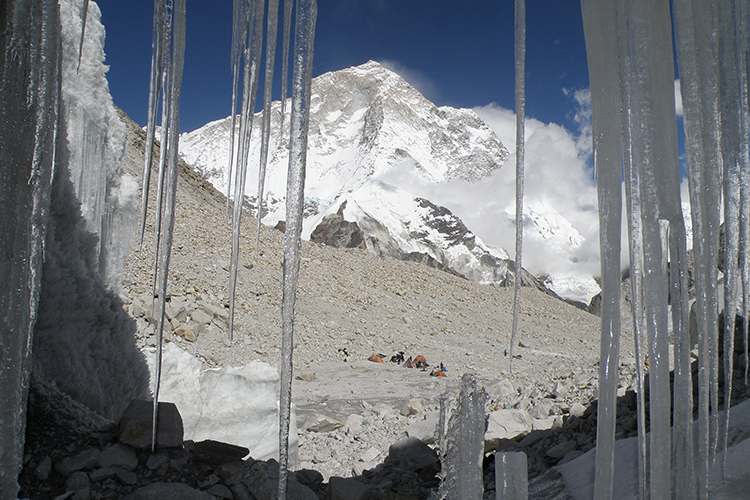
The trail from Lhonak climbs gently along the massive lateral moraine of the Kanchenjunga glacier for the first 2 hours. It’s hard not to stop and admire the views of the peaks and the glacier below. A short steep section of loose rock and landslide formed by a side river will take 40-60 minutes to cross. The trail then climbs more gently for another hour before you reach the few stone huts of Pangpema and Kanchenjunga Base Camp (5143m). Expedition groups will probably not have a permanent camp here as an advanced base camp across the glacier has become a preferred spot.
Now your GHT Nepal Trek begins! From this day you head west until you meet the border with Tibet.
Navigation is easy, simply retrace your steps to Lhonak (3hrs).
2
Days 11-18 KBC over the Nango La and Lumbha Sambha to Hongon
DAY 11: LHONAK – GHUNSA 7HRS
Your first full day on the GHT is an easy one to Ghunsa (6hrs).
DAY 12: GHUNSA – LANJONG KHARKA 5.5HRS
From Ghunsa, descend the main trail beside the Ghunsa Khola for 1½ hours to a trail junction, just before the Yangma Samba Khola (before Phale) that descends from the Nango La valley to your right. Ascend a small trail, first through scrubby pine forest and then grassy hillside for 3¼ hours to a series of kharka (summer grazing pasture), which offer some rough tent platforms.
The following morning get an early start for Nango La (4776m, 1¼hrs), as cloud often obscures the view. Once over the pass descend to a bowl-shaped valley to a dharamsala (emergency shelter) in 30 minutes. Livestock have made the ground around the dharamsala very muddy so only stay here if you have no other choice. Descend to the west on the true right (northern) bank of a stream, which rapidly grows in size and often involves some route finding through scrubby rhododendron.
There is an excellent grassy campsite at Lanjong Kharak (3734m, 3hrs from the dharamsala) towards the end of the valley before you descend through dense woodland to the Yangma Khola valley.
DAY 13: LANJONG KHARAK – OLANGCHUN GOLA 7HRS
Once beside the river, the trail swings north, upstream, for about one hour before descending to the Yangma Khola bridge (3430m, 2hrs), which you cross. There are many minor up and downs as you walk downstream on the true right (western) bank of the Yangma Khola and then turn west (right) into the Tamor Khola valley (2800m, 3½hrs). Do not cross the bridge over the Tamor Khola: you must stay on the true left (northern) bank following a broad trail to Olangchun Gola (3191m, 1½hrs).
DAY 14: OLANGCHUN GOLA – PASS CAMP 7.5HRS
There are some signs along this route now, they are accurate and should be followed. From Olangchun Gola head north-west for 3½ hours along the Tamor Khola, which brings you to a river confluence and bridge, which you cross to head up the Dingsamba Khola. There is a campsite at the confluence of the two rivers (3712m). A small trail through dense rhododendron forest climbs the true left side of the valley to a large, flat area used by herders (1½hrs).
At the end of the valley a trail climbs up and over a black rock band into another, smaller valley (4453m, 2½hrs), where you should camp.
DAY 15: PASS CAMP – THUDAM 8HRS
A stream cascades down a rocky slope on your left; climb the broken trail on the true left (north-west) side of the stream to exit the main valley. If snow covered, this can be a tricky starting place to find, so use the GPS reference: N 27°43’53” E 87°41’21” at approx. 4,470m. You then reach a plateau (1½hrs) with a lake and views of the Lumbha Sambha. Climb the ridge on your right (northern side of the small plateau), heading for the northernmost of three obvious saddles. There is a small trail to follow but snow often obscures your route. You should crest the saddle (5136m, 1hr; GPS ref: N 27°43’44” E 87°39’55”) after another hour.
Do not descend into the Palun Khola valley below! There is a small trail that traverses beneath a peak marked 5422m on the map to another saddle and the Lumbha Sambha La proper (5159m, 30 mins), with views of Kanchenjunga and Jannu to the east and Makalu to the west. An easy-to-follow trail descends to the north-west into a large valley and the source of the Lapsi Khola (1hr). This valley has many campsites and the following day you should reach the strongly Tibetan-influenced community of Thudam (3556m, 4hrs) where there is a basic teahouse.
DAY 16: THUDAM – KHARKA 8.5HRS
The trail gradually becomes overgrown and harder to follow as you descend the Medokchheje Khola, there are many minor trails in the area and you might appreciate the knowledge of a local guide for this section. Just before a large wood-cutting camp the trail climbs (3020m, 1½hrs) and splits again after 30 minutes of climbing, take the west (left) fork. A sometimes scrambly trail winds around ridges and climbs to a minor pass (3369m, 2hrs) before descending into dense forest beyond where you can camp in a small sloping kharka (1½hrs). The trail continues in much the same vein to another kharka (2hrs) dominated by a large rock
DAY 17: KHARKA – CHYAMTANG 4HRS
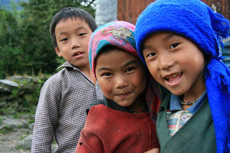
The trail goes to the right of the rock and climbs steeply to another minor pass (2820m, 1hr) before a long descent down countless switchbacks to a bridge over the Arun Nadi below (1850m, 2hrs). You are bound to receive a warm welcome from the Lhomi people in Chyamtang (2187m, 1hr), where you can now enjoy the luxury of a main trail!
From Chyamtang there is a direct route to Molun Pokhari by following a ridge-top trail along the Simbokpa and Pejung Danda. This route requires a local guide as it is rarely used and poses some very tricky navigation. However, although a very long day, it is still faster than going via Hongon.
DAY 18: CHYAMTANG – HONGON 5.5HRS
The more popular route is via Hongon as the local shops have more variety than in Chyamtang. It is an easy day to Hongon (2323m, 5½hrs) where you can easily stock up on food and fuel before embarking on the next section to the Makalu region.
3
Days 19-26 Hongon to Makalu Base Camp (MBC) via some wilderness trails
DAY 19: HONGON – BAKIM KHARKA 3.5HRS
From Hongon, climb a well-used trail that goes straight up to a ridge behind the village. There are some tall prayer flags beneath the ridge that mark a burial site. Avoid going there or taking photos of the site as it will only offend the locals and your crew will believe that any disrespect will bring bad luck. There are many small trails towards the top of the ridge, most of which are created by grazing animals, so it might take a little time to find the chorten that marks a minor pass (2710m, 1½hrs).
Just after the pass the trail forks: you must go right; do not descend to your left. The trail traverses a hillside, crosses a stream and then climbs a small ridge before meeting the Tojo Khola. You need to stay on the true left (east) bank of this river and follow a trail made by woodcutters through rhododendron forest covered in moss. Eventually the trail crosses the Tojo Khola to the true right bank and Bakim Kharka (3020m, 2hrs) is a good campsite
DAY 20: BAIKIM KHARKA – MOLUN POKHARI 4.5HRS
After another hour there is a smaller campsite at Khazakhani Kharka (3480m). The trail becomes steep and rocky but offers great views south of the Arun Nadi valley. Climb for nearly 500m (2½hrs), as you near the top of the plateau (3950m) there are some scrambling sections. A series of chortens mark the end of the climb and the edge of Molun Pokhari, a picturesque lake.
Wind around the north side of the lake to a large campsite in a valley to the west (3954m, 40 mins).
The trail to the Tibetan border, Popti La (4200m, 3hrs) can be seen heading north out of the valley.
DAY 21: MOLUN POKHARI – CAVE SHELTER 9HRS
A small trail climbs a ridge to the south of the campsite, before heading south-east, then east to a rocky ascent that climbs a minor pass (4201m, 1hr). Be careful not to take a small trail that heads south just before the pass. Just after the pass is a great view of Tin Pokhari and the eastern edge of the Makalu-Barun National Park.
An easy to follow trail descends a ridge to your left; there will probably be some yaks around the lake. At a small lake on your left is another trail junction (30 mins), head to your right and continue descending next to a small stream to the valley bottom. Cross the Dhunge Khola (the plank bridge is often washed away) to a large kharka on the far bank and continue down the valley on the true right bank to a drier campsite, which normally has a bamboo structure over a kharka (3590m, 1hr).
A small trail through dense forest continues to follow the true right (west) bank of the Dhunge Khola. After 1½ hours, and rounding a ridge that draws you away from the main river valley, the trail forks beneath cliffs in the middle of a small clearing. Either descend a steep stream bed to your left (which doesn’t look like a trail at all), or continue on a small trail that bears right and into the tributary valley of the Kholakharka Khola.
The streambed trail will take you to a large hollow tree used by locals as shelter before descending a couple of metres to the watercourse. A large tree has been felled creating a bridge across the river, but you will require a couple of safety lines as the log can be slippery (45 mins, note you only need to use the log if the stream is in spate). Cross the Kholakharka Khola, about 80m upstream of the confluence with the Dhunge Khola – after heavy rain this is a very difficult river crossing.
The right-hand trail goes to a point where the river crossing over the Kholakharka Khola is safer but will add up to 1½ hours to your day.
Either route will mean you cross to the true right (west) bank of the Dhunge Khola and then follow a small, overgrown trail to the Saldim Khola (2hrs). A-hard to-find trail in dense rhododendron forest then climbs briefly, heading parallel to the Saldim Khola. The trail gets lost in the gouged out river-bed (almost certainly caused by a GLOF, Glacial Lake Outburst Flood) and you will need to find your own way across a boulder-strewn and shifting route (for about an hour) until you can see a large slightly overhanging rock-face on your left. Scout around and you should find a small trail that leads to the base of the rock-face, which makes an acceptable campsite (3115m). Apparently, there is an alternative trail up the real Saldim Khola to another possible camping spot, but we didn’t see the trail junction.
DAY 22: CAVE SHELTER – KALO POKHARI 5HRS
Climb the watercourse a little further before exiting on the true right (left) on a small trail that ascends just to the left of a much steeper watercourse, which looks more like a cascade. Ascend steeply (for 350m) between two streams on a small trail (1½hrs) before the gradient begins to ease; you can then cross the stream to the true right (left) and head up a shrub-covered slope. Pass a small lake and continue to climb to a waterless kharka and on to the ridge top (3855m, 1hr), which you will follow before descending slightly to an east-facing kharka and possible campsite. You then climb a craggy trail around a ridge to a minor pass (4207m, 1hr), before dipping through a shallow valley and climbing another ridge (4253m, 1hr) to arrive at a black water lake (4192m, 30 mins), where there is enough room to camp.
DAY 23: KALO POKHARI – RHODODENDRON KHARKA 5HRS
Climb the next ridge to a pass (4624m, 1½hrs) before a steep, rocky descent, which is treacherous if snow-covered. From the valley bottom the trail climbs another ridge to a minor pass (4457m, 1½hrs), where you can see a large valley and campsite below, it will take another 1½ hours to descend through dense rhododendron shrubs and walk a little way up the valley to a kharka (4097m, 30mins).
DAY 24: RHODODENDRON KHARKA – LANGMALE 7HRS
The slight downhill to the lip of the valley gives you a moment to identify the blue-roofed Mumbuk teahouses on the far side of the valley before you enter a beautiful forest of fir, pine and large rhododendron, and the trail steepens. Before you reach the Barun Nadi the trail heads upstream (true left bank, northwest), past another rock overhang cave (3366m, 1½hrs), and then after crossing several streams, finally into the open valley bottom. You now follow the Barun Nadi along an easy trail broken by occasional landslides to Yangla (Yangri) Kharka (3557m, 2½hrs). There are a number of teahouses here, along with basic supplies and a large campsite.
The next section of trail is one of the most spectacular in the entire Himalaya as you wind through rhododendron, fir and pine forest. Yosemite-like cliffs form an enormous U-shaped valley crested with glaciers and a series of snowy peaks including Pyramid Peak, Peak 4, Peak 6, Chamlang and Peak 5 all show themselves. In one monstrous rock-face a massive cave contains a waterfall in freefall. Lumdar (strings of prayer flags) are suspended from poles to mark a pilgrimage site popular during the July/August full moon, when it is said that the waters here can cure many illnesses. For 3 hours you’ll keep stopping and absorbing the evolving panorama, before arriving in Langmale Kharka (4410m), which has a couple of teahouses and campsites spaced well apart.
DAY 25: SPARE DAY
DAY 26: LANGMALE – MAKALU BASE CAMP 4HRS
The avenue of mountains that line your route become ever more spectacular as Peak 3 and the snout of the West Barun Glacier appear. From Langmale Kharka the trail enters an ancient lateral moraine through which the infant Barun Nadi flows. A large glacial lake fills the valley to your left and an easy to follow trail leads to Shersong (4630m, 2½hrs), a large grassy area used by yak herders in the monsoon months. Turn right and follow an obvious trail that climbs more moraine, and, once on top, maintain your height; do not descend into the valley to your left. A number of small trails (formed by yak herds) stay about 100m above the valley floor before finally descending to a small bridge and the stone huts of Makalu Base Camp (4870m, 2hrs). Expeditions have left all sorts of supplies here over the years and it is possible to buy anything from wine to kerosene to apple jam and dehydrated meals. To the north, the massive bulk of Makalu rises about 3598m (11,824ft) to a pyramid summit; this is truly one of the most spectacular mountain viewpoints in Nepal!
4
Days 27-31 From MBC cross the High Passes to Chhukung in the Everest region
DAY 27: MAKALU BASE CAMP – SHERPANI COL BASE CAMP 6.5HRS
Those with mountaineering experience and equipment may choose to cross three passes of roughly 6000 metres (Sherpani Col, West Col and Amphu Labsta) into the Solu-Khumbu (Everest Region). If you want to attempt the high passes you should have a guide or climbing sherpa who knows the route well. Identifying the route and avoiding crevasses can be very difficult, especially if snow covers the trail.
From Makalu Base Camp follow the well-defined trail to Hillary Base Camp and then continue along a smaller trail on the south side of the Barun Glacier valley. Do not descend to the ablation valley (created by snow and/or ice melt from a glacier) beside the glacier until forced to do so, you could camp at a small area known as the Swiss Base Camp (3hrs). Just beyond the campsite the trail becomes hard to follow as it climbs towards a steep boulder-filled gully formed by a cascading stream that flows from a valley approximately opposite the one that leads to Makalu Advanced Base Camp. Identifying this valley can be difficult, especially in cloudy weather. Climb to boulders to the north (true left) of the watercourse for about 300m. The gradient then eases and ahead you will see a small trail ascending the northern side of a rocky valley. There is a small flat area (2.5hrs) before the trail climbs further. After another hour you reach the Sherpani Col Base Camp (5688m), at the snout of a glacier. There are two routes that climb either side of the glacier snout, so you will need to do some reconnaissance to decide on the appropriate route.
DAY 28: SHERPANI COL BASE CAMP – BARUNTSE HIGH CAMP / HONKU BASIN 7-11HRS
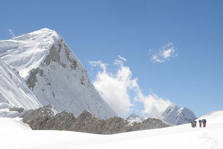
The first is to the south (true right) of the snout and climbs mixed rock and ice, before veering onto the glacier. Beware of rockfall and crevasses on this route. The second option is to climb the rocky slope and gully to the north (true left) of the glacier snout. Once the gradient levels, step across onto the glacier. On the glacier, head towards the base of a rock-face on the southern (true right-hand) side of the glacier, where it begins to rise towards the Col. Do not get too close to the rock-face as there is constant danger from rockfall. Traverse across the base of the rock-face to a point beneath some prayer flags, which are easily spotted on the rocky ridge above. Climb towards the prayer flags from rocks beside the glacier; this will require a handline (20m) for the first, loose scrambling section, and possibly another fixed rope for an easy 20m rockclimb to the top of the Sherpani Col (6180m, 3-4hrs from Base Camp).
You will need to abseil (35m) down to the West Barun Glacier, which you reach after crossing a snow-bridge over a bergschrund (a deep crevasse between a glacier and mountainside). Beware of rockfall while descending to the glacier! Cross the glacier (2-3 hours – beware of crevasses!) to Baruntse Advanced Base Camp and the only spot on the glacier with some shelter from constant wind. Most groups elect to camp here and prepare the abseil over the West Col for early the following morning. There are two routes over the West Col and they vary according to snow conditions each year. One route is over the snow bulge at the northern end of the West Col ridge, but this will involve crossing more crevasses at the bottom of the descent. Alternatively, take a route over the southern end of the West Col ridge (6190m). To reach the ridge cross another bergschrund and climb a loose rocky route at the far southern end of the distinct rockwall that forms the pass. From the summit there is a 200m abseil into the Honku Basin and some potential campsites (3hrs) if you are going to head to the Amphu Labsta, or Baruntse Base Camp (4hrs) if you are exiting via the Honku Khola route. The full traverse normally takes about 11 hours, as time is lost preparing the abseils and fixing a rope up and down the Sherpani and West cols. If you have a large group it is advisable to run two ropes, one for clients/porters and the other for equipment.
DAY 29: SPARE DAY FOR WEATHER
DAY 30: BARUNTSE HIGH CAMP / HONKU BASIN – AMPHU LABSTA BASE CAMP 5-9HRS
The route to, and over, Amphu Labsta (5845m) to Chukhung is now popular with groups who have climbed Mera Peak. However, this is still probably the most dangerous pass in Nepal and care needs to be taken on both the ascent and descent. Most groups that attempt the pass camp beside one of the Panch Pokhari lakes (5hrs)and get an early start.
DAY 31: AMPHU LABSTA BASE CAMP – CHHUKUNG 9 HRS
A collection of cairns are reached after about an hour, which mark the point where you have to choose one of two routes to the pass: the more popular is up a series of ice cliffs, while the other climbs an exposed, steep rocky and snow-covered section direct to the pass. Full climbing equipment is required for either route and it is wise to fix any ropes in the afternoon prior to crossing. The descent is a bottleneck as there is a short abseil (30m) to a ledge, which then leads down steep rocky ground to the Amphu Labsta Glacier and the trail to Chhukung (4730m, 11-15hrs from West Col base depending on group size).
5
Days 32-36 Cross the Everest Region via the Cho La and Renjo La
DAY 32: SPARE DAY FOR WEATHER
DAY 33: CHHUKUNG – DZONGLA 5.5HRS
The day begins with a very pleasant, easy walk down to Dingboche (4410m, 2.5hrs). Then climb the moraine hill behind the village and enjoy one of the best sections of the Everest Base Camp trek as you cross flat-ish yak grazing pastures. After 2.5hrs you need toc ross the outflow of the Khumbu Glacier at Dughla, which might involve some searching around to find the current crossing place. It’s then a quick 10mins up to the teahouses at Dughla.
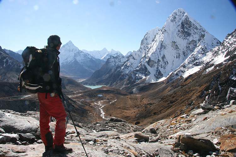
The main trail to Dzongla (4830m, 3hrs) is both easy and dramatic, with Cholatse providing some inspiring views enroute.
DAY 34: DZONGLA – GOKYO 8HRS
An obvious trail loops over a grassy hill behind Dzongla and then gradually climbs a large meadow to a rocky bluff near the end of the valley. The trail switchbacks up to a rock-face and then climbs to the right, up a worn boulder-strewn trail to an area of smooth rock slabs covered in cairns, next to a glacier. Stick to the true right (south) side, rather than climbing onto the glacier immediately, on a track that is frequently covered in snow, before crossing the glacier just before Cho La (5420m, 2½hrs). There aren’t any views of the highest peaks but there are many lesser peaks that fill the western horizon. Beneath is a steep rocky trail that will be covered in parts with snow and ice. Take care on the descent but keep moving as the lower section is prone to rockfall from a craggy peak to your left. In less than an hour you should reach an easier gradient; cross a minor boulder-covered ridge, which leads to a good campsite in a trough. Climb the grassy hill on the far side of the campsite to a large obvious boulder and then a long steep descent brings you to the teahouses and campsites at Dragnag (Thangnak, 4700m, 1½hrs).
Of all the glaciers in the Everest region the most impressive is the Ngozumba, which you must cross on a trail to the west of Dragnag. Ask locals which route is currently recommended and take your time while crossing the glacier to catch mountain reflections in the turquoise lakes. Once on the far side of the glacier turn north (right) and join the main Gokyo trail just before a large lake (1hr from Dragnag). The trail to Gokyo (4790m), located on the east bank of another large lake, takes a further hour.
DAY 35: GOKYO – LUMDE 6.5HRS
From Gokyo head to the base of the Gokyo Ri climb, but instead of heading up the hill take the left-hand trail that heads around the lake. There are two trails, do not take the one by the lakeshore; instead, take the other which climbs slightly. In an hour you should reach the bottom of a steep switchback trail where the ground is loose and climbs an unrelenting gradient for another hour. At the top of the climb the gradient eases a little and heads across a rocky section, which can be icy from December to March. You now enter a broad valley, which can make an ideal high camp for those with tents. The trail heads due west across the valley and then climbs again around a rocky spur before heading up to Renjo La (5360m, 1½hrs) via a stone staircase. The trail is much easier to follow now that the people from Thame have completed a major reconstruction project. This is especially true on the western side of the pass, which is now a stone staircase in good repair. The view from the pass is one of the best in the entire Solu-Khumbu, and a terrific lunch spot. The trail down the western side of the pass rapidly brings you to the edge of a glacial lake, where the stone steps finish. Beyond is another lake, Relama Tsho (4905m, 2hrs), which is a popular camping spot for those approaching the pass from the Thame side. A broad trail now winds around the eastern side of a hill above the lake before descending to a large sandy kharka. At the very end of the kharka the trail descends rapidly into the Bhote Kosi valley and in one hour you should reach the few teahouses at Lumde (4368m).
DAY 36: LUMDE – THAME 3HRS
An easy trail descends from Lumde to a bridge at the village of Marulung (4210m, 1hr), where there are some more teahouses. You now cross the Bhote Khosi and descend the true right (western) bank along a broad and easy-to-follow trail to Thame (3820m, 1½hrs), where there are many teahouses beyond a large moraine with some stupas on top. If you have the time, it is worth climbing this moraine and following a trail through juniper and fir forest to Thame’s major gompa (at the entrance to small valley heading west from the main village); it is the site of a Mani Rimdu festival in May.
6
Days 37-43 From Thame, cross the Tashi Labsta and descend to Simi
DAY 37: THAME – PARCHEMUCHE TSHO OR DHARAMSALA 5.5-8HRS
The trail up to Thyangbo Kharka (4320m, 3hrs) first passes the famous gompa, and continues along the true right (northern) side of the valley and providing good views of a series of pinnacle-like peaks to the south. At the Kharka, there is a teahouse and good campsite.
Remain on the north side of the valley and gradually climb to a trail beneath a black cliff-face and that looks down on Parchemuche Tsho (4780m, 2.5hrs), where there is a campsite. Cross a shallow basin and climb the trail on the far side which becomes steep. In another 2.5 hours reach Ngole (5130m) where there is a small dharamsala shelter.
DAY 38: PARCHEMUCHE TSHO OR DHARAMSALA – PASS CAMP 4.5-7HRS
Locking up towards Agole Peack, you can see a distinctive V-shaped notch of snow about 70m high in a cliff line above. Metal chains have been placed to provide anchors bot for the climb through the notch and then up to a rocky ledge that heads west (right) from the top of the climb towards the Tashi Labsta Pass high camp (5665m, 4.5hrs). The camp site is beneath an overhanging rock-face on the north side of the approach to the pass and about 100m down from the summit. There are camping ledges in the overhang and try to camp as close to the main wall as possible as there is frequent rockfall.
If there is already a group camped here, head a little higher on the northern flank of Pachermo to a snowy plateau that is often used as a base camp for groups climbing Pachermo. The strong social and economic links between the Rolwaling and Thame valleys mean that you could even meet a wedding party camped up here during the summer months!
DAY 39: PASS CAMP – TRAKARDING GLACIER 7HRS
The top of the pass is a climb of 100m from the camp (5760m, 30mins), climate change has exposed the underlying rocky ridge that used to be covered by snow and ice. Depending on conditions, you might need to use a rope (about 30m) to descend the western side of the pass, but if snow and ice conditions are good, it is an easy glissade.
The descent down a small glacier is straightforward but beware of crevasses! At the snout of this glacier (5435m, 1.5hrs) you will need to scout around for an easy descent, but you might also need a handline of about 20m. Turn south to descend beside the true left of the Drolambu Glacier in a shallow ablation valley, which eventually turns into a stream bed. In 1.5hrs you should reach the snout of the Drolambu Glacier, which has exposed a rocky descent to the Trakarding Glacier. There are some campsite ledges at the end of the glacier (5350m), or you can scramble down (safety line might be necessary) a rocky ledge to more camp spots in the moraine below (5085m, 1 hour). Before descending to the Trakarding Glacier, take a little time to identify a potential route across it, with clear points of reference, for when you cross it tomorrow. It is also a good idea to identify Kabug across and further down the valley and the distinctive dark earth wall that you will need to climb to reach it.
Then turn west and stay on the true right (north) side of the Trakarding Glacier for 1.5hrs to yet another campsite called Noisy Knob (4880m), which is larger than the previous two.
DAY 40: TRAKARDING GLACIER – KABUG 4.5HRS
You need to cross the Trakarding Glacier as soon as possible, as the further you descend the north side of the valley the more prone to rockfall the trail becomes.
Unfortunately, the route is always changing and there are many cairn markers, some of which do not indicate good trails! As with all glacier crossings care should be taken at all times, and your party should remain together throughout the crossing.
To reach the far side of the glacier normally takes about 3 from camp, and you then continue descending the true left (south) side until you reach a steep dark earth section of moraine rising to your left in another 30 minutes (depending on your crossing point). The earth is on top of permafrost, so it can be a slow process climbing the relatively short 100m or so. Once at the top of the moraine climb, you cross to the Kabug campsite at the far-westerly side of the kharka (4820m, 1hr).
DAY 41: KABUG – BEDING 5.5HRS
A short climb up moraine behind the campsite brings you to a great viewpoint of Tsho Rolpa and surrounding peaks (4830m, 30mins). It is now a long and sometimes steep descent to Chhukyima (4580m, 1hr) where there are a couple of teashops and a campsite tucked into a small ablation valley about half way along Tsho Rolpa.
Continue down the ablation valley to the outflow of the lake, where the trail becomes very easy to follow all the way to Na (4180m, 2hrs) where there are campsites and teahouses that serve an excellent lunch.
The trail is now delightful as it slowly descends through a broad alpine valley. Note the frescos beside the trail of Padmasambhava (aka Guru Rinpoche, the Lotus Born, who first took Buddhism to Tibet in the 8th century) with a small shrine, and Om Mani Padmi Hum, carved on what must be one of the largest single mani stone anywhere. The trail begins to steepen as the valley narrows and you enter fir and pine forest. Arrive at Beding (3740m, 2hrs) where there are teahouses and a campiste.
Today has been a relatively short and easy trekking day, so take a little time to visit the gompa in the village. It is said that a Buddhist monk came and lived in a cave behind the gompa before the village was established. To mark the site, a chorten was built and to offer a khadag to the chorten is considered to bestow good luck on the giver for as long as the scarf remains attached. Please offer a donation to the gompa if you want to admire the wood-panel frescoes inside.
DAY 42: BEDING – DOKHANG 4.5HRS
From Beding the trail remains easy to Nyamare (3550m, 30mins) and tehn gradually steepens as you enter the V-shaped river-cut valley. A quick descent of a few hundred meters brings you to a bridge over the Themlung Khola (1.5hrs), which is surrounded by cairns. If you stand in the middle of the bridge and look up the steep ravine to the north you will see the holy peak of Gaurishankar looming overhead.
Do not cross this bridge! Instead remain on the true right (north) bank of the Rolwaling Khola for another 20mins before crossing to the true left (south) bank trail by another bridge. The character of the trail is changing again with rhododendron, pine and juniper shading wildflowers in mossy glades, and the river cascading beside the trail. There are a few small landslides to cross, which make ideal places to spot birds catching insects above the river. There is a teahouse and campsite at Dokhang (2791m), about 2hrs down.
DAY 43: DOKHANG – SIMIGAON 5.5HRS
From Dokhang, it’s an easy uphill for 1hr to Gyalche Kharka (2832m) where there is a teashop and campsite. A long descent now begins, first passing a large waterfall after 1.5hrs, where there is a pleasant pool to rinse feet and face. Another 1.5hrs of down brings you a kharka in the forest about 30m above the river (2060m). Be careful to take the left hand trail at a junction about 10mins after the kharka and begin a climb to a minor ridge in 1hr before descending to Simigaon (2036m, 30mins) where there are teahouses and campsites.
Note that you can end the trek here and drive back to Kathmandu.
7
Days 44-50 Head through the lower Rolwaling to The Last Resort, then back to Kathmandu
DAY 44: SIMIGAON – ORANGDANDA 7HRS
It’s about a 650m descent, first through easy village paths and then stone steps, to Chetchet (1377m, 1.5hrs) beside the Tama Khosi river below, and where there is a campsite.
Sorry to say that for much of rest of today you will be on roads and small short-cuts between road sections. Head south on the road from Chetchet and ask for the trail to Purano or Orangdanda, which can be tricky to spot due to road works and rain runoff, but it isn’t far (about 1hr). Climb stone steps at first before the gradient eases on earth trails to Purano (1560m, 1hr). The trail now climbs hillside to Thare (aka Kebre) through which you continue up Deulang (1898m, 2hrs) where you will again meet the road. Orangdanda sits on a dominating ridge beyond (2029m, 1hr) and where there is a community-owned lodge, built by Eco-Himal, that has an excellent view of the Gaurishankar Himal
DAY 45: ORANGDANDA – LOTING 6.5HRS
You begin the day by following the road out of the village, passing through Yarsa for about 1hr before a short climb up to Goraicha and Khadkatol (2230m, less than 1hr). Again follow road Laduk (2050m, 1hr), where there is another Eco-Himal teahouse.
You now traverse srubby hillside and pass through small forested sections for 2.5hrs to Chyasarpa (2020m, aka Chyasrba), which you reach by climbing a small dry watercourse. Round the hillside and descend to a road that leads to Chilinggkha (1924m, 1hr). Continue following the road to Loting (1768m, 1hr) where there is an Eco-Himal teahouse.
DAY 46: LOTING – BIGU GOMPA 3.5HRS
Descend through scrubby forest to the Sangu Khola (1650m, 1 hr), which you cross and then turn right, and in 30mins cross the Kotheli Khola bridge (1732m). Climb a steep trail passing through Alampu and on to Bigu Gompa (2516m, 2hrs), where there are teahouses and the famous ani-gompa (nunnery) dedicated to the thousand-armed Buddha, Avalokitesh-wara (Compassion of all Buddhas), who is the all-seeing, all-knowing remover of obstacles. The nuns are happy for visitors to attend morning prayers; a donation is appropriate for even brief visits.
DAY 47: BIGU GOMPA – SANO JYANDAN 6HRS
Heading west, follow the road and any shortcuts that you can find, on a long climb to Rupthang (3400m, 4hrs) and shortly thereafter to the Tinsang La (3531m, 30mins). A small trail winds north away from the road and behind the teashops, crossing a grassy hillside to a ridge that heads due west (about 45mins). Cross steep, rocky hillside while remaining as close to the top of the ridge as possible to Marmin Jyandang (3250m, 1hr). The trial winds through old-growth rhododendron forest, with a couple of minor up and downs and then through a dry watercourse to arrive at Palati Jyandang (3210m, 30mins). A short downhill section through forest brings you to the large grazing area of Sano Jyandang (3127m), where there is permanent water in the rhododendron-forested gully to the north of the campsite.
DAY 48: SANO JYANDAN – THE LAST RESORT 4.5HRS
Follow the obvious trail west out of the kharka, descending through patches of forest and open, rocky sections. There are some excellent views down to the Khagdal Khola 700m below as you descend passing through Sindurche Kharka (2780m, 30mins). The trail then veers north-wards and away from the ridge, descending through mixed forest to Mandre (2180m, 2hrs). The trail heads straight down through the village to Cati (1520m, 45mins), where you stay to the right to by-pass the village, crossing terraces, to a trail that heads north to Sakhuwa village (1480m, 30mins). Pass the village school and follow an old road to Tyanthali (1390m, 20 mins) and Chaku before descending stone steps to the Last Resort bridge (1170m, 30mins).
The Last Resort is a popular rest stop for GHTers, so don’t be surprised if you meet someone else doing the trail here! You can always do a bungy jump too if you think the GHT isn’t thrilling enough!
DAY 49: SPARE DAY
DAY 50: Drive to Kathmandu
