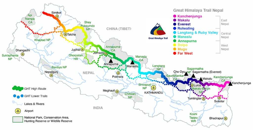
1
Days 1-12 Kathmandu to The Last Resort, then over Tilman’s Pass to Syabru Besi
DAY 1: KATHMANDU – Drive to THE LAST RESORT 5HRS
DAY 2: THE LAST RESORT – BAGAM 5HRS
Leave The Last Resort on the Arniko Highway from the main gate and pass through Panlan village immediately to the south. From here the trail climbs a steep hillside with little shade to Baldun (1890m, 1.5hrs), which the locals might refer to as Listi. However, the real Listi (2260m) is a Tamang community on a plateau further up the hill and is reached in another 60 minutes. As you approach the ridge above you will clearly see a Hindu Temple, beneath which is a community health post where you can camp.
Continue on the temple ridge to a series of chorten overlooking Listi and then swing north-east, keeping on the ridge. Do not traverse around the ridge (to your left, or more north). After 1.5 hours you reach the top of the ridge above Listi and a broad grassy place (2650m) where cremations occur, so treat the area with respect. From here you can see the trail traversing a hillside to your north to a minor pass where a Sherpa village called Bagam (2705m, 45 mins) is home to some of the three hundred nuns from Bagam Gompa, situated below the ridge. There is also a school here, which makes a good campsite.
DAY 3: BAGAM – CHOGORMOGOR KHARKA 4HRS
To the north, you can see a steep forest-covered ridge and the trail from Bagam leading straight up to 3286m (1.5hrs) to a temporary dharamsala, which is just below the main ridge. At the top of the ridge there is a trail cross-roads, turn left and continue on the ridge proper. At first the trail looks like a watercourse and you are tempted to bear right, but don’t stray from the ridge and the trail soon becomes a pleasant flat walk through pine forest. Shotang Kharka (3379m) is reached in 20 minutes; you will need to ask herders to show you where the water source is located.
From Shotang the trail continues north, climbing a ridge with good views of mountains to the north-east in Rolwaling and Tibet, and north-west in Langtang. Pilgrims who come for the August festival have made the trail broad and easy to follow to Chogomogor Kharka (3924m, 2hrs), which is a major trail junction both north–south and east–west.
Side Trip: To reach the sacred lake of Bhairav Kund, climb a little to a chorten and then head north-east across the east-facing flanks of a rising series of craggy peaks; there is a dharamsala and campsite at the lake (4113m, 1.5hrs).
DAY 4: CHOGORMOGOR KHARKA – TEMBATHANG 8HRS
From Chogomogor Kharka take a trail that heads east-north-east to a kharka on the Paulan Dada (3812m, 1.5hrs). Be careful to stay on the west-ridge trail from this kharka as many tracks lead into the forest. Descend a trail, which gradually becomes very steep as you enter dense forest. In 2 hours, you reach a temporary dharamsala and series of chorten directly above Kyangsin village (2520m) to which you descend in 30 minutes. A trail then traverses a hillside to the north-east and once around the ridge descends steeply to the Nyasem Khola (1861m, 2hrs), where there is a camping place on the far side of a suspension bridge. Do not camp close to the bridge as there are quite a few ticks and lice in the area; instead pick an area about 20 or 30 meters upstream.
Climb a trail on the far side of the river for 300m to Nimatol village (2158m, 1hr) where there is a new trail that traverses the sometimes-steep hillside to Tembathang (2160m, 45 mins). You will need to employ a local guide from this village, as the trails ahead are frequently overgrown and rarely used.
DAY 5: TEMBATHANG – NEMACHUKPA KHARKA 8HRS
There are two options from Tembathang:
- A long route to Panch Pokhari via Hille Bhanjyang follows more substantial trails. A local guide is advisable for a confusing forested section before Hille Bhanjyang.
- A more direct route, described here, to Panch Pokhari heads upstream from Tembathang. Follow a flat trail north from the village to a wooden suspension bridge over a tributary but do not cross the bridge! Instead, follow a small trail that crosses the river about 10 metres downstream and then winds onto flat ground where there are some well-used kharkas. From the northern end of the kharka descend to the river. The trail now climbs the true right (eastern) side of the river course to the hamlet of Tegu where you continue to follow a trail along the bank. In 1.5hrs from Tembathang you will reach the remains of Thipu (aka Tharpu) village. There is a good campsite by the river before the village area.
Note: the enormous landslide area on the far bank destroyed Mahathan village and most of Thipu village but, incredibly, with no loss of life.
Do not cross the river at the village, instead continue on the true right (east) bank for one hour to a small bamboo and log bridge. Cross carefully to the true left bank and then continue north on a sometimes scrubby trail through forest to Chedupa Kharka (2513m, 1hr). From this large kharka a small trail heads north for about 50 metres before heading up the steep hillside to your left. You might need to ask a local to identify the trail. There are many ticks and leeches along this track so be vigilant. Climb for about 800m to Salingling Kharka (3323m, 3hrs 40 mins), where you might be able to find water in a gully to the south. If not, continue for another 45 minutes to Nemagchukpa Kharka (3578m), where there is permanent water.
DAY 6: NEMACHUKPA KHARKA – PANCH POKHARI 4HRS
Continue along the ridge through rhododendron forest to an intersecting ridge, which leads to Panch Pokhari. There is another, small kharka campsite at 4048m (2.5hrs) on the ridge. From here it is only 1.5 hours to the lakes of Panch Pokhari (4074m), which you reach by crossing the main north–south ridge at 4229m.
DAY 7: PANCH POKHARI – TIN POKHARI 7HRS
Directly to the east of the temple at Panch Pokhari is a short climb back to the ridgeline (4245m, 40 mins), which you should cross and descend to a broad kharka (4070m, 20 mins). Follow the obvious trail north as it rises to cross a hill spur into another shallow basin. For the next 1.5 hours continue north crossing similar spurs and basins between 4000m and 4200m. In the fourth basin you will see a trail junction where the left trail climbs towards a rocky outcrop and the right trail swings away to the north-east. You can take either trail, but if the north-facing slopes are covered in snow and/or ice you might find the longer, but lower, north-east trail safer. The higher route climbs to a small lake (Lingsing Kharka, 4450m, 1hr) whereas the north-east trail contours lower slopes at 4000m +/- 30m for 2 hours before climbing and rejoining the higher trail at a small basin with a well-built stone kharka (4273m). From this kharka continue north, climbing for about 100m before the trail levels and you then drop through a small valley to ascend a final ridge above Tin Pokhari (4255m, 1.5hrs), although the three lakes have dried up.
From the ridge above Tin Pokhari you have a clear view of both glacier approaches to Tilman Pass and Tilman East Pass. In clear weather it is even possible to see the rocky ridge of Tilman East Pass at the base of the west ridge of Dorje Lakpa peak. Your choice of which pass to attempt will depend on time available, weather conditions and skill level. The easier route is Tilman Pass (the western of the two glaciers), however Tilman East Pass is a spectacular option for experienced groups and is worth considering if you have time available.
DAY 8: TIN POKHARI – TILMAN’S SOUTH CAMP 5HRS
From Tin Pokhari follow a trail that drops into an ablation valley to the north-west, trek through some kharka and climb for 2.5 hours until you each a campsite (4646m) at the valley’s end, marked by a steep moraine wall. There are a few large boulders on top of the moraine wall, climb to the most northerly of them and descend beside a small glacial lake.
From the lake cross to the middle of the glacier and follow an indistinct trail marked by occasional cairns. In 2 hours, you will reach a campsite (4867m) on the glacier just as the valley narrows, and in a further 20 minutes you will reach the base of the pass (4848m).
DAY 9: TILMAN’S SUTH CAMP – TILMAN’S NORTH CAMP 6HRS
There appear to be two routes up the lower rocky section of the pass, but the right-hand rock-climbing option is exposed and prone to rockfall so it is better to ascend the loose scree to the right of the icefall (and to the left of the rock-climbing route). Once above the rock band, traverse around to your left and climb mixed ice and rock to the right of the icefall and beneath a steep rock-face. Once at the rock-face traverse left to the glacier and then climb directly onto the pass snowfield. Tilman Pass (5308m, 2hrs 40 mins) is through a narrow notch to the north-west of the snowfield. Beware of rockfall on both sides of your approach.
Once on the pass descend a steep snowy slope to the north-west. Beware of crevasses on your descent, it is wise to rope everyone because the descent becomes steeper as you approach a broad plateau covered in avalanche debris at 5130m (45 mins), where you could camp. Follow a snowmelt stream on the true left (western) side of the plateau to a steep drop to a glacial lake in a valley below. This section can be treacherous and care should be taken on the rock and ice-filled gullies; a handline may be needed in places. In less than 2 hours you should reach the lake, where you can camp on the northern shore (4756m). Alternatively, continue to the left (north-west) of a moraine wall to an indistinct campsite at 4720m (30 mins).
DAY 10: TILMAN’S NORTH CAMP – LANGSHISA KHARKA 4HRS
Continue to descend north-west to a small, level, sandy place (20 mins) about 200m above Langshisa Glacier. A landslide ahead along the old trail means that you must now descend to the glacier, the moraine here is very unstable, steep and prone to rockfall. Beware of patches of hard ice covered by loose moraine as you descend to the side of Langshisa Glacier (45 mins). Descend beside the true left bank of the glacier for 1.5hrs when the first patches of vegetation appear. Continue descending through prickly bush as directly as you can while following some not-so-obvious stone cairns towards Langshisa Kharka (4285m, 1.5hrs) and wade the river to a large campsite.
DAY 11: LANGSHISA KHARKA – LANGTANG 4.5HRS
The main trail to Kyangjin Gompa (3900m, 3hrs) feels like a highway compared to the previous days, and the coffee and cakes at the Himalaya Bakery are a real treat. It’s 1.5hrs to Langtang village where the scar of an enormous landslide from the 2015 earthquake remains. There are lodges on either side of the landslide area to choose from.
DAY 12: LANGTANG – SYABRU BESI 8.5HRS
It’s an easy cruise down the main trail through Ghoratabela (3030m, 2.5hrs), then Rimche (2399m, 2hrs), Bamboo (1970m, 1.5hrs) and finally to Syabrubesi (1503m, 2.5hrs)
2
Days 13-18 Through the Ganesh Himal to Machhakhola
DAY 13: SPARE DAY
DAY 14: SYABRU BESI – GATLANG 4.5HRS
There are two trails to Gatlang (2300m) from Syabrubesi: the first option follows the new valley road to the Chilime Khola valley into which you turn west (left) and follow a good trail to Thambuchet and then to Gatlang.
The second, faster option from Syabrubesi is to climb a trail that begins beside Buddha Guest House. This is a direct route to the Rongga Bhanjyang (2187m, 2hrs) above Syabrubesi, and also sometimes coincides with the route of an old road to Somdang. From the pass it is an easy 2 hours and 20 minutes along the road to Gatlang (2238m).
DAY 15: GATLANG – SOMDANG 6HRS
From Gatlang the road is rarely used by motor traffic as landslides and fallen trees often block it. Follow a large track from Gatlang school up to Parvati Kund (45 mins). From the lake the trail intermittently cuts across the road as it winds through pine and rhododendron forest. At 3100m (1.5hrs) you come to a large kharka where you can camp. Not far above you re-join the road and follow it as it traverses a steep rocky hillside to another, smaller, kharka where the road does a U-turn. Here you take a small trail that climbs up and right, away from the road, into a gully filled with rhododendron to the Khurpu Dada Pass (3710m, 2hrs). For location reference, note a line of old powerlines (now only poles) that crosses the Khurpu Dada, small chautara and trail junction. To the north, along the ridge, is a small trail, which leads to Jaisuli Kund (aka Jageshwar Kund, side trip: 3hrs), from where you could head to Paldor Peak Base Camp. Instead, head west and descend quickly, cutting across the road a few times, before following it again as it gradually descends to Somdang (3258m, 1.5hrs), where there are some campsites and teahouses.
DAY 16: SOMDANG – SERTUN 9HRS
From Somdang, the dirt road climbs up through forest and in 2.5hrs you should reach a minor pass at 3780m, where the trail begins traversing steep, rocky hillside. If there has been recent snowfall care should be taken to avoid small avalanches along this section. The road traverses above a large kharka before arriving at the Pansan Pass (3830m, 1hr) where locals have built a small gompa and a small teahouse.
Descend through rhododendron forest for 1.5hrs, passing through a couple of kharkas, which are potential campsites. However, it is best to continue to the terraced fields of Lawadun or Tipling village (1890m, 1.5hrs), where there is a small teahouse in the centre of the village and camping is possible in the school. Nearly all the locals in this region of the Ganesh Himal are friendly Gurung Christians, who have decided to ban all alcohol from their communities. Then follow the main trail-cum-road to Sertun (1920m, 1.5hrs).
DAY 17: SERTUN – DHARAMSALA 9.5HRS
Continue on the easy main trail to Boran (1560m, 2hrs). As you enter Boran there is a stone house on the right-hand side of the trail. Next to this house is a stone staircase that cuts down through the northern edge of the village to the Akhu Khola below. Descend to the river, cross a suspension bridge and pass a campsite in a small grassy field beside the Lapa Khola (1285m, 30 mins). If you choose to camp by the river you will need to post a night guard on your camp as local thieves are not uncommon.
Note: it is possible to descend to the Dhading Besi roadhead in 3 days from Boran by following the main trail to the south.
From just beyond the riverside campsite, cross another suspension bridge to the true right bank and begin the long climb to Lapagaon (1850m, 2hrs), a large Tamang village, where there is a small teahouse towards the top of the village and the school grounds can make a good campsite. Unless someone in your group knows the trail ahead it is wise to employ a local guide from this village.
A new, steep trail climbs a hillside to the west of the village to a chautara with views back down the valley (2200m, 50 mins). You now enter a section of mixed forest with many trails. After 1hr you reach a kharka with a dharamsala (GPS: 2441m, N 28° 10.246’ E 084° 59.077’). The trail heads north-west up a gully with a rocky spur to the north. The gully steepens as it nears a ridge and the barely distinct Mangro Pass (2936m, 1.5hrs, GPS: 2882m, N 28° 10.102’ E 084° 58.726’), which leads to the first of a series of shallow basins that make the next two hours tricky to navigate.
Descend into and then climb out of the first basin to another minor forested ridge in 45 minutes (GPS: 2728m, N 28° 09.908’ E 084° 58.354’). The trail now heads north-west, first through forest and then across an exposed hillside to the large Myangmal Kharka (50 mins, GPS: 2936m, N 28° 09.468’ E 084° 57.656’), where there is a dharamsala.
DAY 18: DHARAMSALA – MACHHAKHOLA 7HRS
Descend a good trail through forest for 25 minutes to Nauban Kharka (GPS: 2750m, N 28° 09.732’ E 084° 56.900’), which is another campsite. The trail continues to descend, sometimes steeply, through dense forest for just over 2hrs to a bridge over the Richel Khola (GPS: 1555m, N 28° 10.729’ E 084° 55.522’) from where it is less than 1hr to Yarsa village (GPS: 1877m, N 28° 10.857’ E 084° 54.773’). As you leave the village, the trail swings north-west into the large Budhi Gandaki valley and in 30 minutes you reach a trail junction, right is to Kashigaon, but turn left and descend to the river. Do not go to Kashigaon. In 3 hours reach a bridge to Machhakhola (870m) and the main Manaslu Circuit trail.
Note: If you miss the descent to the Budhi Gandaki before Kashigaon you will probably have to continue to Kerauja/Rumchet and then make a very difficult descent to another bridge across the river to Tatopani. This route involves rock scrambling and should not be attempted with loaded porters. You should also consider taking a local guide from Rumchet for this section.
3
Days 19-27 Around the Manaslu Circuit to Dharapani
DAY 19: MACHHAKHOLA – JAGAT 6.5HRS
A road is being constructed around the Manaslu Circuit that follows most of the trekking route, so for the next week you will frequently be following dirt road.
From Machhakhola it’s less than an hour to Khorlabesi (970m). Follow the broad track on the west bank of the river to Tatopani (990m, 1hr) where the waterspouts make a good washing stop. At the end of the village, cross a suspension bridge to the true left (east) bank and continue through sometimes dense forest to Dobhan (1070m, 80 mins), where there are teahouses.
Continue on a broad trail on the true left bank of the river to Yaruphant (1170m, 1hr), where there are a few teashops on a broad grassy slope. From here, the trail climbs about 200m up what was once an enormous landslide that blocked the Budhi Gandaki. The trail descends a little from the top of the climb to the broad riverbed. In the trekking seasons there are some temporary teashops (80 mins from Yaruphant) at the confluence of the Yara Khola.
Vertical cliffs rise on both sides of the valley as the trail continues on the true left (eastern) bank for 15 minutes to a bridge, which you cross to the true right bank and where the Budhi Gandaki has cut a narrow gorge. After a short climb and descent of 20 minutes you reach a flat area where there is a teashop and two grassy campsites signposted ‘Jagat’. The village is actually 10 minutes further up the trail, behind a rocky spur. As you enter Jagat (1340m) on a good stone-paved trail, there is a community-owned campsite on your left and some teahouses before the Manaslu Conservation Area Project (MCAP) and police checkpost. Jagat is a common village name in the high mountains as it means ‘customs post’ and is the traditional tax collection point for trade to and from Tibet.
DAY 20: JAGAT – DENG 6HRS
Beyond the village is the Pangaur Khola, which is crossed using stepping-stones and log bridges. The trail now climbs an easy gradient to a chautara (1hr), where there are good views of Shringi Himal to the north. Descend to Sirdibas (1420m, 40 mins) and turn a sharp left turn at the end of the village to ascend a stream for about 50m before turning sharp right for the main trail. Continue to a suspension bridge, which you cross to the true left bank of the Budhi Gandaki (there is a police checkpost at the bridge) and then climb 200m to the village of Phillim (1570m, 40 mins), another MCAP checkpost and teahouses.
This next section of trail is spectacular and well worth the effort of a long day’s walk. Ekla Bhatti (1650m) is about 45 minutes from Phillim, but take your time and admire the waterfalls on the west side of the valley. After the monsoon, there is a large waterfall beyond Ekla Bhatti, after which you enter scrubby forest that gives way to large pine trees. Forty minutes from Ekla Bhatti you reach a trail junction, where you turn left (the right-hand trail goes to Tsum, see pp000-00). Descend (5 mins) to and cross a bridge, where the trail begins a gradual climb as the valley turns westwards. After the initial climb away from the bridge there is a small trail junction where you turn right (the left trail climbs steeply to Nyak).
Another bridge across the Budhi Gandaki is reached in 45 minutes, which you cross to the true left (north) bank to avoid a steep cliff. In another 15 minutes you cross back to the true right (south) bank using a suspension bridge. In 20 minutes, you will reach Pewa and the junction with the high trail from Nyak (this is where you join the Circuit trail from Rupina La). It’s a good campsite and teahouses at Deng (1860m), which is now 30 minutes away along a pleasant trail with good views of the narrow gorge cut by the Budhi Gandaki.
DAY 21: DENG – NAMRUNG 5HRS
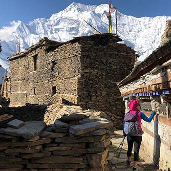
As the Manaslu Circuit trail turns westwards, the shape of the homes changes to squat, dry-stone structures to reflect the changing demands of climate, and the architectural influences of Tibet. Mani walls, chorten and kani are common along the trail. Rice and wheat are replaced by buckwheat, barley and maize in the fields. The trail descends to a suspension bridge, which you cross to the true left (north) bank of the Budhi Gandaki and then climbs roughly 100m to Rana (1910m, 35 mins).
The trail now climbs an easy gradient beneath the village of Umbaie (above which is Shringi Gompa) before winding through the Shringi Khola gorge to Bhi (1990m, 45 mins). Follow an undulating trail through sparse pine trees and hamlets to a large kani (1½hrs) that marks the entry to the Prok and Ghap communities. The paintings and mani stones on this kani are in good condition. The fierce blue and red characters on the kani ceiling and walls are protectors who are meant to stop evil spirits from entering the villages beyond. There is a teahouse and campsite at Prok, only 10 minutes further on.
The trail now gradually swings back to the river, which you cross to the true right bank via a suspension bridge. It’s a slight climb to Ghap, where there are a couple of teashops. The valley narrows and you pass through fine broad-leaf forest to a spectacular canyon carved by the river (45 mins), which you re-cross in another 15 minutes on a larger bridge.
Note: the Himal Chuli Base Camp trail veers left here and climbs the Sherang Khola valley.
From the second bridge, the trail climbs more steeply for almost an hour to Namrung (2630m), where there is a campsite and teahouses.
DAY 22: NAMRUNG – SAMA 5.5HRS
Leave Namrung by crossing Therang Khola along an easy trail that passes a waterfall on your left before entering the scattered village of Barchham (20 mins). The trail now climbs a bit less than 300m on an easy gradient to Lihi (2920m, 50 mins), where there is a campsite and teahouses. Descend and cross the Hinan Khola on the far side of the village and ascend an easy trail to Sho (2880m, 45 mins). It is now an easy up-hill gradient to Lho (3180m, 1hr), where there is a campsite and teashouses, but take your time and enjoy the evolving mountain panorama around you.
Manaslu dominates the skyline at Lho and if you have the time explore the village’s mani walls, kani and Ribang Gompa, which sits on a hill above the village. The trail descends to the Thusang Khola and then climbs a steady gradient for 300m to Shyala (80 mins), a community of mainly log cabins where there is another campsite and teahouses. Next, the trail dips through the Numla Khola before descending slightly and then becoming flat all the way to Sama (Ryo; 3520m, 70 mins), where there are a teahouses and campsites to choose from at the far end of the village.
SIDE TRIP: One of the most popular places to visit is the Pung Gyen Gumba beneath the east face of Manaslu. To get there, back track on the Shyala trail to a junction before the Numla Khola, where you turn right and begin a long and sometimes steep climb for 2 hours and 20 minutes. Once you have crested the ridge above the river the gradient eases and ahead you will see the small gompa. You will be expected to provide a donation to the gompa if you visit it. Higher still is a cave gompa and hot springs, but relaxing in the grassy kharka near the gompa and enjoying the view of Manaslu is a popular pastime before returning to Sama in 1½ hours. Alternatively, explore the village and gompas of Sama, or take a local guide to Birendra Kund for reflections of Manaslu and its northern icefall.
DAY 23: SAMA – SAMDO 2.5HRS
An easy day to Samdo can be combined with a side trip to Birendra Kund. Leave Sama on a broad trail that runs north from the village across grassy kharkas. Remain on the western side of the valley, following a trail that runs parallel to the Budhi Gandaki. After 45 minutes cross the outflow from Birendra Kund to the summer herding area of Kermo Kharka where there is an excellent view of Manaslu from the impressive mani wall.
The trail continues to climb an easy gradient for an hour before dropping to a bridge over the river. Climb to an impressive kani, which marks the entry to Samdo (3875m, 30 mins). This is a Tibetan refugee settlement of about 40 homes, created after the Chinese occupation of Tibet. The border runs along the top of the hills above Samdo and makes an ideal side-trip.
DAY 24: SPARE DAY
DAY 25: SAMDO – LARKYE BASE CAMP 3HRS
From Samdo the trail descends to a bridge across the Gyala Khola. Climb the trail on the far side to a large pile of mani stones (40 mins), where you can look down on Larkye Bazaar, a trading ground (there are no buildings as such) where Tibetans sell large herds of goats before the Nepali festival of Dashain in October/November. The trail now climbs an easy gradient with views of Larkye Peak and the north face of Manaslu for 2 hours and 20 minutes to Larkye La Dharamsala (4460m), where there is a teahouse. Take some time to check that you are well prepared to cross the pass tomorrow.
DAY 26: LARKEY BASE CAMP – BIMTANG 7HRS
The longest and toughest section of the Manaslu Circuit now awaits, but also the most magnificent views – Himalayan majesty and grandeur all around. It is wise to start before sunrise and climb an ablation valley to views of Cho Danda. Although there are some prayer flags at the top of the ablation valley (4690m, 80 mins) you are not at the top of the pass. The trail now crosses rough undulating moraines for 30 minutes to another dharamsala (4905m). From here the trail begins to climb more steeply to the top of Larkye La (5135m, 1¾hrs), where you will be greeted by magnificent views of the upper Bimtang valley and a roofless dharamsala. Views of Himlung and Cheo Himals, Gyagi Kang, Menjung, Kang Guru and Annapurna II fill the horizon. Descend from the pass down a steep slope, which is often snow covered and icy (and may require a handline), for 1½ hours. Beneath you are three glaciers spotted with numerous turquoise lakes; head for the ablation valley to the left of all the glaciers. An easy gradient then leads down to the campsite at Bimtang (3590m, 2hrs), which is serviced by four competing teashops staffed by pretty Gurung women.
DAY 27: BIMTANG – DHARAPANI 7HRS
Continue to follow the ablation valley south from Bimtang, which soon gives way to lateral moraine after 10 minutes. There are good views of the west face of Manaslu from here. Cross a branch of the glacial melt and then turn left, over some more moraine before crossing the main stream of glacial melt and then climbing a ridge of lateral moraine topped by some prayer flags (20 mins).
The trail descends a little steeply through pine and rhododendron forest for 15 minutes before levelling to a gentle downhill gradient. As you descend towards the Dudh Khola through forest the trail passes through a few kharka. There is a lone teashop at Yak Kharka (aka Sangure Kharka, 3020m, 80 mins) after a copse of mountain pepper trees. From here the trail can be a little difficult to follow across some large landslides and through scrubby forest to the scattered settlement of Kharche (1hr). The trail now climbs an imposing ridge that juts into the centre of the valley before a long descent to the many fields of Goa (2515m, 1½hrs), where there are two teahouses.
It is now a gentle downhill to the large Gurung village of Tilije (2300m, 50 mins), where you cross a bridge and pass a new school and begin road-trekking again. After 20 minutes you come to a trail junction; turn right and descend to Thonje (1965m, 50 mins), which you reach after crossing a long suspension bridge. Once at the village continue on the road to a T-junction in front of a teahouse. Turn left onto a dirt track and pass the school; after a short descent, cross a suspension bridge over the Marsyangdi river to Dharapani (1965m, 10 mins), where there is a police checkpost and many comfortable teahouses. Welcome to the Annapurna Circuit!
4
Days 28-36 Around the Annapurna Circuit to Kagbeni, then back to Kathmandu
DAY 28: DHARAPANI – CHAME 5HRS
Follow the route of the new road to the outskirts of Bagarchhap (2160m, 1hr), which you cut through to rejoin the road on the far side of the village. There was a devastating landslide here in 1995; a memorial in the centre of the village only mentions the tourists who died. At the far end of the village there are good views of the Annapurnas and sections of the Lamjung Himal.
From Bagarchhap, continue along the route of the new road to Danakyu (2300m, 35 mins). This is also the main workers site for a Chinese-funded hydro project, so the character of the place has deteriorated in recent years. Beyond the sprawling village, the trail climbs steeply for about 400m through thick pine and fir forest – make sure to turn around regularly to check for views of the Manaslu Himal – before arriving at Timang (2750m, 1 hour and 20 minutes). There are a few teahouses in Timang, any of which make an ideal rest stop with great views of the Lamjung Himal.
Continue along a flat-ish trail to Latamro (2695m, 45 mins), where you descend to and then climb away from a gushing tributary before arriving at Thanchok (2670m, 20 mins). This is a large and often dirty village, but there is a nice teahouse beyond the main settlement, just before re-joining the road for a long and easy descent to Koto (2600m, 50 mins), where there are teahouses and campsites. It is now a short walk to Chame (2675m, 20 minutes)where there are many teahouses and tourist services.
DAY 29: CHAME – GHYARU 6HRS
Walk through the village on stone paving and cross a suspension bridge to the true left (north) bank of the Marsyangdi Nadi and there are another couple of teahouses near some hot springs. Continue to follow the road route to Talekhu (40 mins), where the valley narrows to steep cliffs on either side. In the middle of the next gorge section is a large apple juice factory and luxury lodge at Bratang (2850m, 1 hour), but there is no other accommodation.
Continue following the road and cross a suspension bridge to the true right bank (south) of the Marsyangdi Nadi ion 45 minutes. The trekking trail switchbacks up about 200m through forest, which is badly littered with rubbish, before the trail straightens and you then rejoin the road to Dhikur Pokhari (3060m, 1 hour). You have now walked through a massive bend in the Marsyangdi river and an enormous concave rock wall rises to your right.
At the end of the community there is a broken mani wall and a sign indicating to the right, the trekking route to Upper Pisang (3300m, 1 hour), which is on the true left (north) side of the river. There is lots of teahouses here but check the water quality as the local source isn’t good quality for much of the year.
From Upper Pisang, follow a very easy trail through pine forest to the bottom of a steep switchback climb to Ghyaru (3670m, 1½hrs), where there are some teahouses and excellent views of Annapurna II and IV.
DAY 30: PISANG – MANANG 4.5HRS
The trail is again easy all the way to Ngawal (3600m, 1½hrs) but consider stopping for a cup of tea at the viewpoint teashop – the earlier you arrive, the longer you will want to stay to soak-up the view! There are plenty of teahouses in Ngawal, including a luxury lodge!
Follow the main trail through the upper section of the Ngawal community, do not head down through the village. An easy trail leads to the Lopheling Monastry before descending steeply for about 200m into a pretty pine-forested valley. The very small community of Julu (3500m, 1 hour) has two small teashops where you can also have a simple lunch if you had a late start.
Head down the valley, first following a rough dirt road, but then on clearly marked trail into the main Marsyangdi valley. The trail gradually turns right (west) and joins the road that leads to Munchi (Mugji, 3330m, 1½hrs). The 600-year-old village of Braga (3467m, 30 mins), which is not far and has good teahouses and a fabulous gompa. Manang (3540m, 20 mins), is very close ahead, where there are many teahouses and campsites, as well as a maze-like village that dates back hundreds of years. For trekkers on the Annapurna Circuit, Manang is a popular acclimatisation stop so there are many more services, restaurants and teahouses than you will have come across so far.
DAY 31: MANANG – THORONG PHEDI 5.5HRS
Just beyond Manang is the village of Tangki (3530m, 20 mins), which overlooks the entire community. The trail now swings north and climbs gently to a stone wall with a gate that stops livestock from leaving the high pastures. Do not allow any animals to pass through the gate; if it is locked, use the stone steps to your right. Not much further is Ghusang (3950m, 1hr from Tangki), where you can enjoy some great views of the Chulu Himal, Annapurna III, Gangapurna, Tare Kang (Glacier Dome), Khangsar Kang (Roc Noir) and Tilicho Peak. An easy gradient leads to a suspension bridge over the Ghyanchang Khola, where there are a couple of small teashops (40 mins). In another hour you will reach Yak Kharka (4050m), where there are a few teahouses beneath a slight rise to another teahouse. The trail now climbs fairly constantly at an easy gradient to Ledar (4200m, 40 mins), where there are some simple teahouses, and continues across a hillside covered with many trails. At the first major trail junction take the right, straight route rather than descending to the river. At the next trail junction, take the left-hand straight route, rather than climbing. After 50 minutes from Ledar the trail descends to a wooden bridge over the Kone Khola, which you cross before climbing to a teashop that is expensive (20 mins). It’s now an easy 35 minutes to Thorung Phedi (4450m) where there are extensive teahouses and services.
DAY 32: THORONG PHEDI – MUKTINATH 9HRS
It is a good idea to get a pre-dawn start from Thorung Phedi to avoid the strong winds that often affect the pass after 11am. There are 4 large ‘steps’ up to Thorung La (5415m); the first is a steep climb up scree to Thorung ‘Base Camp’, a decrepit and expensive teahouse and dirty campsite (4830m, 1hr). The trail now winds through a watercourse before climbing through another, larger gully formed by the melt from a glacier on the eastern side of Thorung Peak. In one hour from ‘Base Camp’ you reach a well-built dharamsala at 5100m, which also offers a campsite for those wanting a genuine high camp (ensure you are well acclimatised). From here it’s 1½ hours across undulating moraine to the top of Thorung La, where there is a teashop in peak trekking season, but expect to pay handsomely for a drink! On a clear day you should be able to see some of the Annapurna range to the south and Mukut Himal bordering Dolpo to the west.
From the pass the trail descends steeply over scree, which gives way to grassy meadows before reaching Muktinath (3760m, 3hrs). This large village is a very important pilgrimage site for Hindus and Buddhists, who live in a sacred compound around an eternal flame-from-water. Take some time to visit the famous Hindu temple with 108 carved spouts from which holy water flows, making a cold shower for the brave!
DAY 33: MUKTINATH – KAGBENI 3.5HRS
The valley around and beneath Muktinath has five Buddhist gompas and many Hindu shrines. The trail is broad and busy with four-wheel-drive cars and motorcycles ferrying Hindu pilgrims from Jomsom. From Muktinath, take a trail that descends towards and then through Jharkot (3550m, 30 mins). From here you can avoid the motor road (a 60-min jeep trip to Jomsom, or 40 mins to Kagbeni) by following a small irrigation stream to Khingar (3280m, 20 mins) but from here you will have to take the road route. Make sure you have a scarf or similar to cover your face against dust kicked up by jeeps, or the fierce afternoon wind. Once you reach a broad, flat plateau as you enter the main Kali Gandaki valley there is a shortcut track to Kagbeni (2810m, 70 mins), which avoids the road.
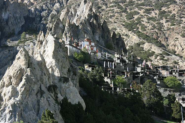
Kagbeni is a delightful village that used to be the Nepal/Tibet border and lies in the bottom of the windswept valley floor of the Kali Gandaki, said to be the deepest river gorge in the world because of the twin 8000m peaks of Annapurna and Dhaulagiri above. The gompa in the middle of the old village is in good condition, and look for the male and female protectors at either end of old boundary wall. The airstrip at Jomsom is 2½ hours (or a 20-minute drive by jeep) to the south, where there are many teahouses and services. There are regular morning flights from Jomsom to Pokhara; the later flights have more potential to be delayed.
DAY 34: SPARE DAY
DAY 35: Drive of Fly to Pokhara
Day 36: Kathmandu
