Top
 

Manaslu Circuit

The Larkye La is the highlight of a stunning trek!

Manaslu Circuit

$1610 per person

Manaslu Circuit

The Larkye La is the highlight of a stunning trek!

Manaslu Circuit Trek

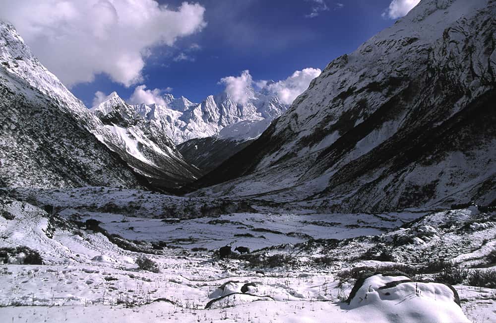
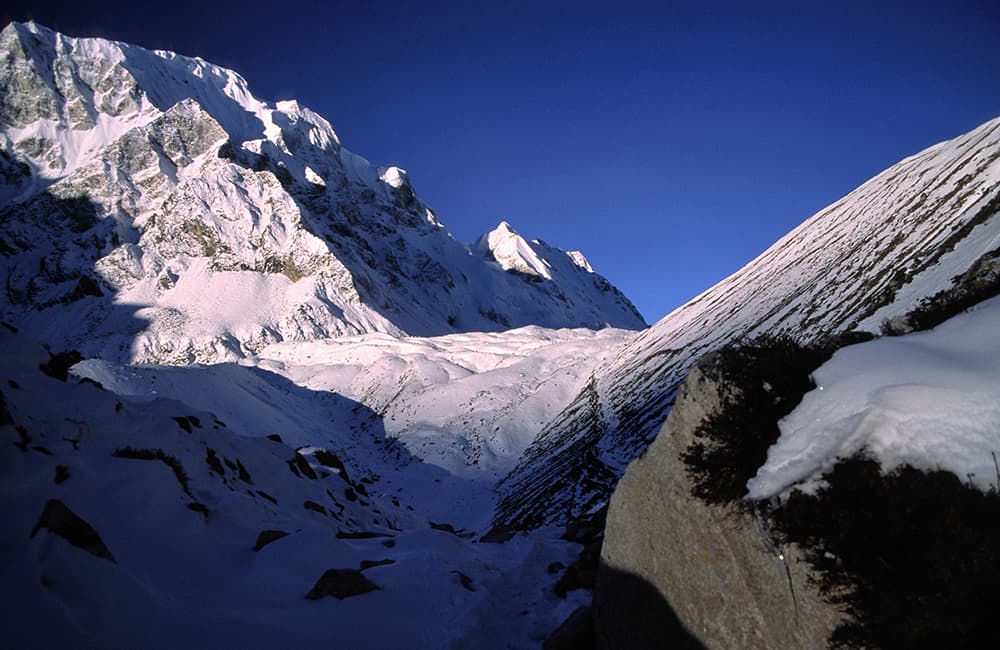
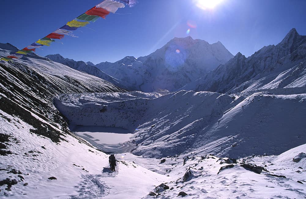
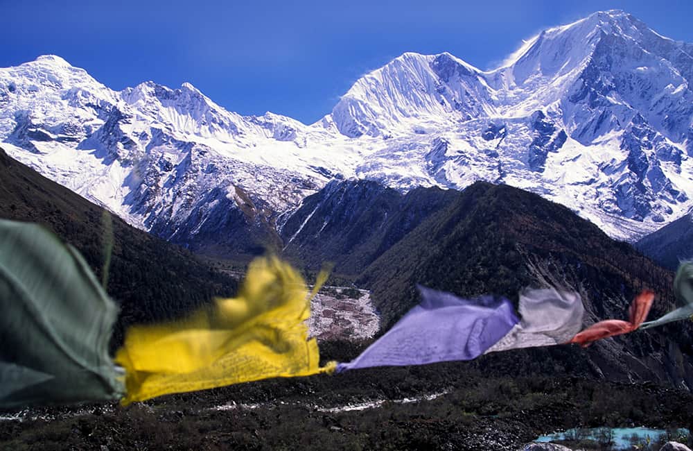
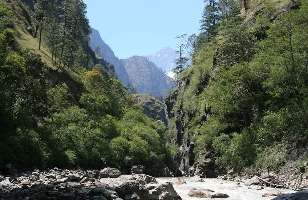
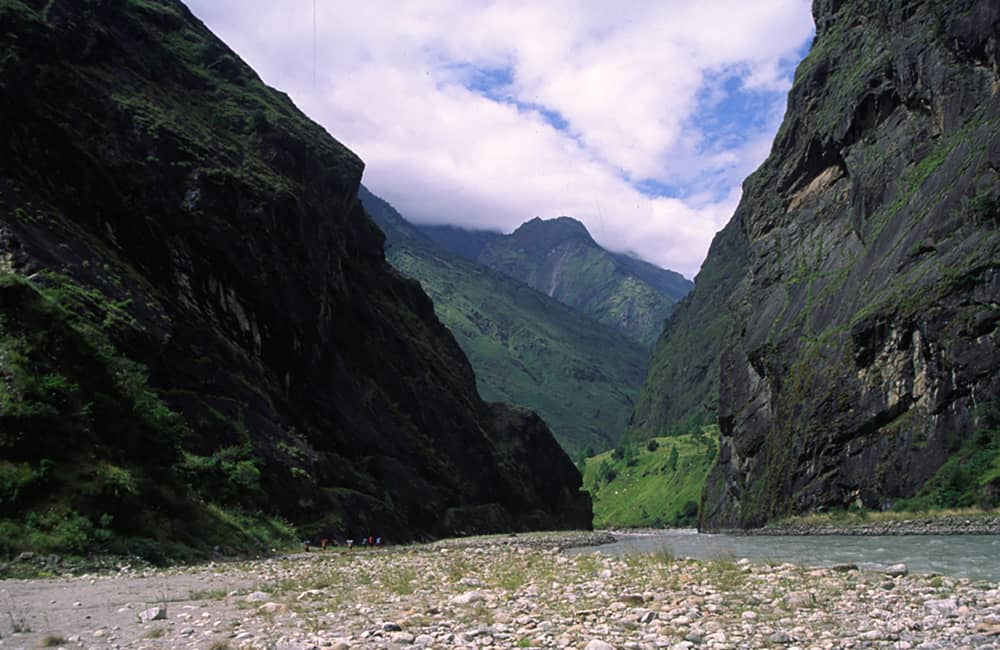
One of the classic Nepal Himalaya treks, the Manaslu Circuit has it all. Stunning mountain vistas, enchanting cultures, some of the most beautiful sections of trail in Nepal, and all around the eighth highest mountain in the world.

Is this tour for me?

Travel Style: Active with Guide in Teahouses

Hiking, trekking, adventure with a guide, and staying in teahouses.

Physical Rating: 3 - Energetic

Trail is sometimes on a rough track with obstacles and arduous sections with limited signage.

Service Level: Basic Teahouse

Comfy, family-owned teahouses with all meals provided along the trail.

Check Your Visa Requirements

Before booking, use our handy entry requirements tool so you know which documents you need to enter and travel through the countries on your trip.

Recommended Group Size

Small group experience; Max 12, Avg 2 to 8

Age requirement: 12+

All travellers under age 18 must be accompanied by an adult.

When to Trek the Manaslu Circuit?

Sandwiched between two very popular trekking regions (Langtang and Annapurna) the Mansalu Circuit is often described as the best general trek in Nepal. The trek is suffering from some extensive road building and some highly commercial attitudes among some locals. However, the Manaslu Circuit trail has retained much of its charm and uniqueness. For those prepared to take their time, there are plenty of options to explore with colourful cultures set against a backdrop of classic Himalayan peaks.

Manaslu Circuit
From 15-25 days

Manaslu Circuit

Difficulty

days

Postive Impacts

GHG Footprint of 15kg CO2e per day

Social Impacts: 60% of trek expenses support local communities directly

Why you will love this Trek

Trekking Grade: Grade 3 Energetic Stunning mountain views Super friendly villages Beautiful forests Enchanting cultures Comfy teahouses
Manaslu Circuit near Dharamsala
Manaslu Circuit

Manaslu Circuit: Route Options

Manaslu and Ganesh region map

How can your Manaslu Circuit Trek create positive impacts?

To help you budget and plan, we’ve made a comprehensive costing explanation on How Much Does the GHT Cost? But here’s a simplified breakdown.

Estimated Cost US$3,050

Trek cost per person (twin share)

Total GHGe per trekker

145kgCO2e

Total GHGe per trekker per day

20kgCO2e

Average per capita EU GHGe = 20kgCO2e per day (www.statistica.com)

Go Local equals positive impacts

What we do…

…make Positive Impacts

% of Trek Cost

Go Local Transport

Use Local Accommodation

Eat Local Meals

Waste Management

Highly Experienced Guide

Biodiversity

Locally supplied transport reduces drive times and fuel usage

Locally supplied accommodation reduces commissions

More nutritious, fresher ingredients, no packaging

Carry out ALL PLASTIC, avoid snacks and soda drinks

A knowledge bank for your peace and wellbeing

National Park entry fee for you and the team

Administrative and office costs

22%

38%


0%

20%

15.2%

4.8%

Do you have any questions about the trail, when to go or the costs? Please Get in Touch to ask an expert and for more details.

Bookings

Please note that www.greathimalayatrail.com does not handle bookings for treks. We are here to inform you about the trails and logistics, but you will need to book through a registered Local Operator LINK in Nepal. Get in Touch

Customisation is Normal

Want to do things a little differently? Maybe take some extra time, or go a bit faster? Or avoid the technical sections? Every GHT is different and that changes the impact and the price, but this it totally normal and your Local Operator will be able to adjust plans without problems. Get in Touch

Social and Environmental Impacts

The GHT has been designed around the principles of Responsible Sustainable Tourism and we do our very best to make sure that the GHT is good news for the locals and the environment along the trails. To walk the talk, we have pioneered the development of social impact assessment and Greenhouse Gas emissions, and environmental impacts like waste created for each trek. There is more information about how we calculate impacts at Impact of Your GHT Get in Touch

Itinerary

DAY 1: KATHMANDU – MACHHAKHOLA

After an early start, you should reach Machhakhola after lunchtime and have time to relax in the afternoon with views of the Budhi Gandaki river.

DAY 2: MACHHAKHOLA – JAGAT 6.5 HRS

We follow the dirt road north out of the village and soon reach Khorlabesi (970m, 1 hour) and then on to Tatopani (990m, 1 hour) where the waterspouts make a good washing stop. At the end of the village, cross a suspension bridge to the true left (east) bank and continue through sometimes dense forest to Dobhan (1070m, 1.5 hours), where there are teahouses.

Continue on a broad trail on the true left bank of the river to Yaruphant (1170m, 1 hour), where there are a few teashops on a broad grassy slope. From here, the trail climbs about 200m up what was once an enormous landslide that blocked the Budhi Gandaki. The trail descends a little from the top of the climb to the broad riverbed. In the trekking seasons, there are some temporary teashops (1.5 hours from Yaruphant) at the confluence of the Yara Khola.

Vertical cliffs rise on both sides of the valley as a spectacular trail continues on the true left (eastern) bank for 15 minutes to a bridge, which you cross to the true right bank and where the Budhi Gandaki has cut a narrow gorge. After a short climb and descent of 20 minutes, you reach a flat area where there is a teashop and two grassy campsites signposted ‘Jagat’. The village is 10 minutes further up the trail, behind a rocky spur. As you enter Jagat (1340m) on a good stone-paved trail, there is a community-owned campsite on your left and some teahouses before the Manaslu Conservation Area Project (MCAP) and police checkpost. Jagat is a common village name in the high mountains as it means ‘customs post’ and is the traditional tax collection point for trade to and from Tibet. 

DAY 3: JAGAT – DENG 6 HRS

Beyond the village is the Pangaur Khola, which is crossed using stepping stones and log bridges. The trail now climbs an easy gradient to a chautara (1 hour), where there are good views of Shringi Himal to the north. Descend to Sirdibas (1420m, 40 mins) and turn a sharp left turn at the end of the village to ascend a stream for about 50m before turning sharp right for the main trail. Continue to a suspension bridge, which you cross to the true left bank of the Budhi Gandaki (there is a police checkpost at the bridge), and then climb 200m to the village of Phillim (1570m, 40 minutes), another MCAP checkpost and teahouses.

This next section of trail is spectacular and well worth the effort of a long day’s walk. Ekla Bhatti (1650m) is about 45 minutes from Phillim, but take your time and admire the waterfalls on the west side of the valley. After the monsoon, there is a large waterfall beyond Ekla Bhatti, after which you enter a scrubby forest that gives way to large pine trees. Forty minutes from Ekla Bhatti you reach a trail junction, where you turn left (the right-hand trail goes to Tsum, see pp000-00). Descend (5 minutes) to and cross a bridge, where the trail begins a gradual climb as the valley turns westwards. After the initial climb away from the bridge there is a small trail junction where you turn right (the left trail climbs steeply to Nyak).
Another bridge across the Budhi Gandaki is reached in 45 minutes, which you cross to the true left (north) bank to avoid a steep cliff. In another 15 minutes, you cross back to the true right (south) bank using a suspension bridge. In 20 minutes, you will reach Pewa and the junction with the high trail from Nyak (this is where you join the Circuit trail from Rupina La). It’s a good campsite and teahouses at Deng (1860m), which is now 30 minutes away along a pleasant trail with good views of the narrow gorge cut by the Budhi Gandaki.

DAY 4: DENG – NAMRUNG 5 HRS

As the Manaslu Circuit trail turns westwards, the shape of the homes changes to squat, dry-stone structures to reflect the changing demands of climate and the architectural influences of Tibet. Mani walls, chorten, and kani are common along the trail. Rice and wheat are replaced by buckwheat, barley, and maize in the fields. The trail descends to a suspension bridge, which you cross to the true left (north) bank of the Budhi Gandaki and then climbs roughly 100m to Rana (1910m, 35 minutes).

The trail now climbs an easy gradient beneath the village of Umbaie (above which is Shringi Gompa) before winding through the Shringi Khola gorge to Bhi (1990m, 45 minutes). Follow an undulating trail through sparse pine trees and hamlets to a large kani (1½ hours) that marks the entry to the Prok and Ghap communities. The paintings and mani stones on this kani are in good condition. The fierce blue and red characters on the kani ceiling and walls are protectors who are meant to stop evil spirits from entering the villages beyond. There is a teahouse and campsite at Prok, only 10 minutes further on.

The trail now gradually swings back to the river, which you cross to the true right bank via a suspension bridge. It’s a slight climb to Ghap, where there are a couple of teashops. The valley narrows and you pass through fine broad-leaf forest to a spectacular canyon carved by the river (45 minutes), which you re-cross in another 15 minutes on a larger bridge.
Note: the Himal Chuli Base Camp trail veers left here and climbs the Sherang Khola valley.
From the second bridge, the trail climbs more steeply for almost an hour to Namrung (2630m), where there is a campsite and teahouses.

DAY 5: NAMRUNG – SAMA (RYO) 5.5 HRS

Leave Namrung by crossing Therang Khola along an easy trail that passes a waterfall on your left before entering the scattered village of Barchham (20 minutes). The trail now climbs a bit less than 300m on an easy gradient to Lihi (2920m, 50 minutes), where there is a campsite and teahouses. Descend and cross the Hinan Khola on the far side of the village and ascend an easy trail to Sho (2880m, 45 minutes). It is now an easy uphill gradient to Lho (3180m, 1 hour), where there is a campsite and teahouses, but take your time and enjoy the evolving mountain panorama around you.
Manaslu dominates the skyline at Lho and if you have the time explore the village’s mani walls, kani, and Ribang Gompa, which sits on a hill above the village. The trail descends to the Thusang Khola and then climbs a steady gradient for 300m to Shyala (80 minutes), a community of mainly log cabins where there is another campsite and teahouses. Next, the trail dips through the Numla Khola before descending slightly and then becoming flat to Sama (Ryo; 3520m, 70 minutes), where there are teahouses and campsites to choose from at the far end of the village.

DAY 6: SAMA (RYO) ALL DAY

It is a good idea to spend a day in Sama (Ryo) exploring the village and/or some of the surrounding viewpoints as part of an acclimatisation programme. One of the most popular places to visit is the Pung Gyen Gumba beneath the east face of Manaslu. To get there, backtrack on the Shyala trail to a junction before the Numla Khola, where you turn right and begin a long and sometimes steep climb for 2 hours and 20 minutes. Once you have crested the ridge above the river the gradient eases and ahead you will see the small gompa. You will be expected to provide a donation to the gompa if you visit it. Higher still is a cave gompa and hot springs, but relaxing in the grassy kharka near the gompa and enjoying the view of Manaslu is a popular pastime before returning to Sama in 1½ hours. Alternatively, explore the village and gompas of Sama, or take a local guide to Birendra Kund for reflections of Manaslu and its northern icefall. 

DAY 7: SAMA (RYO) – SAMDO 2.5 HRS

An easy day to Samdo can be combined with a side trip to Birendra Kund. Leave Sama on a broad trail that runs north from the village across grassy kharkas. Remain on the western side of the valley, following a trail that runs parallel to the Budhi Gandaki. After 45 minutes cross the outflow from Birendra Kund to the summer herding area of Kermo Kharka where there is an excellent view of Manaslu from the impressive mani wall.
The trail continues to climb an easy gradient for an hour before dropping to a bridge over the river. Climb to an impressive kani, which marks the entry to Samdo (3875m, 30 minutes). This is a Tibetan refugee settlement of about 40 homes, created after the Chinese occupation of Tibet. The border runs along the top of the hills above Samdo and makes an ideal side trip.

DAY 8: SAMDO – LARKYE LA DHARAMSALA 3 HRS

From Samdo the trail descends to a bridge across the Gyala Khola. Climb the trail on the far side to a large pile of mani stones (40 minutes), where you can look down on Larkye Bazaar, a trading ground (there are no buildings as such) where Tibetans sell large herds of goats before the Nepali festival of Dashain in October/November. The trail now climbs an easy gradient with views of Larkye Peak and the north face of Manaslu for 2 hours and 20 minutes to Larkye La Dharamsala (4460m), where there is a teahouse. Take some time to check that you are well prepared to cross the pass tomorrow.

DAY 9: LARKYE LA DHARAMSALA – LARKYE LA – BIMTANG 7 HRS

The longest and toughest section of the Manaslu Circuit now awaits, but also the most magnificent views – Himalayan majesty and grandeur all around. It is wise to start before sunrise and climb an ablation valley to view of Cho Danda. Although there are some prayer flags at the top of the Ablation Valley (4690m, 80 minutes) you are not at the top of the pass. The trail now crosses rough undulating moraines for 30 minutes to another dharamsala (4905m). From here the trail begins to climb more steeply to the top of Larkye La (5135m, 1¾ hours), where you will be greeted by magnificent views of the upper Bimtang valley and a roofless dharamsala. Views of Himlung and Cheo Himals, Gyagi Kang, Menjung, Kang Guru, and Annapurna II fill the horizon. Descend from the pass down a steep slope, which is often snow-covered and icy (and may require a handline), for 1½ hours. Beneath you are three glaciers spotted with numerous turquoise lakes; head for the ablation valley to the left of all the glaciers. An easy gradient then leads down to the campsite at Bimtang (3590m, 2 hours), which is serviced by four competing teashops staffed by pretty Gurung women.

DAY 10: BIMTANG – KHARCHE 5.5 HRS

Continue to follow the ablation valley south from Bimtang, which soon gives way to lateral moraine after 10 minutes. There are good views of the west face of Manaslu from here. Cross a branch of the glacial melt and then turn left, over some more moraine before crossing the main stream of glacial melt and then climbing a ridge of lateral moraine topped by some prayer flags (20 minutes).
The trail descends a little steeply through pine and rhododendron forest for 15 minutes before levelling to a gentle downhill gradient. As you descend towards the Dudh Khola through forest the trail passes through a few kharka. There is a lone teashop at Yak Kharka (aka Sangure Kharka, 3020m, 80 minutes) after a copse of mountain pepper trees. From here the trail can be a little difficult to follow across some large landslides and through scrubby forest to the scattered settlement of Kharche (1 hour).

DAY 11: KARCHE – DHARAPANI 4 HRS

The trail now climbs an imposing ridge that juts into the centre of the valley before a long descent to the many fields of Goa (2515m, 1.5 hours), where there are two teahouses. It is now a gentle downhill to the large Gurung village of Tilije (2300m, 50 minutes), where you cross a bridge pass a new school, and begin road-trekking again. After 20 minutes you come to a trail junction; turn right and descend to Thonje (1965m, 50 minutes), which you reach after crossing a long suspension bridge. Once at the village continue on the road to a T-junction in front of a teahouse. Turn left onto a dirt track and pass the school; after a short descent, cross a suspension bridge over the Marsyangdi river to Dharapani (1965m, 10 minutes), where there is a police checkpost and many comfortable teahouses. 

DAY 12: DHARAPANI – BESISAHAR – POKHARA/KATHMANDU

A road has been built from Besisahar to Manang, so you can take a jeep service from Dharapani and then you can transfer to a bus in Besisahar for services to Pokhara or Kathmandu. 

Trip Information

  • Trekking Grade: Grade 4 Energetic
  • Duration & distance: Between 11-16 days total
  • Gradient: Very steep with some arduous climbs
  • Quality of path: Formed track, some obstacles
  • Quality of markings: Signs at beginning, end and major intersections
  • Experience required: Some walking experience required
  • Walking times: Less than 7 hours per day
  • Steps: Occasional Steps
  • Highest point: 5135 m 
  • Best season: Mar-May/Oct-Dec  
  • Accommodation: Camping and teahouses
  • Recommended Guide Book: Nepal Trekking and the Great Himalaya Trail, Trailblazer, 2020
  • Recommended map: NP106 GHT Series Manaslu and Ganesh Himals, Himalayan Map House, 2017

20-35 days

20-35 days

Tea – House Trekking with a Guide

Trekking with a Camping Crew

Make Sure You Include in Your Budget

Transportation

Private or Public Bus/Jeep,
plus walking conditions.

Accommodations

ask for GHT Check-In Point Teahouse
Lodges (6 nights).

Safety & Wellbeing

Does your guide have Wilderness First
Aid training?

Other things to consider:

  • Special care airport pickup
  • English or your preferred language speaking local guide for the trek and city tours
  • All necessary permits for trekking
  • Local porters could be included on the trek
  • All transport between destinations and to/from included activities

Choose Your Local Operator

  • Destination
  • Departure
    Kathmandu
  • Dress Code
    Mid-altitude alpine clothing and camping equipment required
  • Included
    Manaslu Circuit
  • Grade
    Grade 4
  • Idea Date Range
    15/10/2021
  • Style of Trek
    Teahouse
1
Day 1: Kathmandu–Gorkha all day
It is a good idea to leave Kathmandu early to avoid the traffic gridlock and (all being well) arrive at Gorkha (1060m) by lunchtime (it’s roughly a 6-hour bus trip), where there are simple hotels. Towards the top of the town is Tallo Durbar, or lower palace, of Prithvi Narayan Shah who unified Nepal in 1769. This palace is a museum but not always open to tourists. Opposite the palace entrance is a series of stone steps that climb up between traditional Gurung homes to the ridge above. At the top is the World Heritage Listed original palace, Gorkha Durbar (1490m, 1hr) and Gorkha Kalika (temple to the Goddess Kali). Remove all leather garments (including shoes) before entering the temple. The Goddess Kali traditionally represents death and destruction and is supplicated through animal sacrifice. These days she represents time and change, but she is still revered with sacrifices.
2
Day 2: Gorkha–Barpak all day
Hire a jeep in Gorkha and enjoy bouncing along the new road to Barpak (1950m); make sure you have a scarf to protect against dust. Barpak is one of the largest Gurung villages, where many of the families have at least one male relative in the Royal Gurkha Rifles. There are some teahouses and good campsites close to the treeline above the village with views of the village, Manaslu, Peak 29, and Himal Chuli.
3
Day 3: Barpak–Laprak 4½hrs
Follow the road that climbs up to and then through extensive rhododendron forest above Barpak. The gradient is unrelenting for 2 hours but then eases as you begin to near the top of the Gupsi Danda and a minor pass (2670m, 3hrs from Barpak). There are good views of the entire Manaslu range from here. A broad grazing pasture, or kharka, provides an easy and enjoyable initial descent from the pass. There is a trail option to the road route from the pass, and after 20 minutes you can see another large Gurung village, Laprak (2100m, 1½hrs), where there are teahouses and a large school ground to make camp.
4
Day 4: Laprak–Khorlabesi 5hrs
This section involves some tricky navigation, so it might be a good idea to employ a local guide from Laprak or Singla. Follow the main trail through the village, which then descends directly, for about 300m, to a bridge across the Machha Khola. Over the bridge, the trail climbs roughly 200m before swinging eastwards and traversing the hillside. There is a large tree with a chautara beside the trail, which marks where the main trail turns towards the north-east. It is important that you continue traversing at this height and do not descend towards the river. There is a simple teahouse at the village of Singla (2020m, 2hrs), and you can camp in the schoolyard. Continue through the village and be careful not to take some of the smaller tracks that descend towards the Machhakhola. After roughly an hour you will come to a fork where it looks like the right-hand trail begins to descend across unused terraces – do not descend. Instead, take the left trail that climbs for less than 100m. If you or your crew accidentally descend you will find the trail ends in old terraces and you will have to climb back up. In another 20 minutes there are good views of the Budhi Gandaki river and the main Manaslu Circuit trail, which you will reach in another 1½ hours at Khorlabesi (970m), where there are teahouses and a good campsite at the junction of the Namrung Khola and Budhi Gandaki.
5
Day 5: Khorlabesi–Jagat 5½hrs
The trail from Khorlabesi to Jagat is through a dramatic gorge with lots of waterfalls and some landslides. Follow the broad track on the west bank of the river to Tatopani (990m, 1hr) where the waterspouts make a good washing stop. At the end of the village, cross a suspension bridge to the true left (east) bank and continue through sometimes dense forest to Dobhan (1070m, 80 mins), where there are teahouses. Continue on a broad trail on the true left bank of the river to Yaruphant (1170m, 1hr), where there are a few teashops on a broad grassy slope. From here, the trail climbs about 200m up what was once an enormous landslide that blocked the Budhi Gandaki. The trail descends a little from the top of the climb to the broad riverbed. In the trekking seasons there are some temporary teashops (80 mins from Yaruphant) at the confluence of the Yara Khola. Vertical cliffs rise on both sides of the valley as the trail continues on the true left (eastern) bank for 15 minutes to a bridge, which you cross to the true right bank and where the Budhi Gandaki has cut a narrow gorge. After a short climb and descent of 20 minutes you reach a flat area where there is a teashop and two grassy campsites signposted ‘Jagat’. The village is actually 10 minutes further up the trail, behind a rocky spur. As you enter Jagat (1340m) on a good stone-paved trail, there is a community-owned campsite on your left and some teahouses before the Manaslu Conservation Area Project (MCAP) and police checkpost. Jagat is a common village name in the high mountains as it means ‘customs post’ and is the traditional tax collection point for trade to and from Tibet.
6
Day 6: Jagat–Deng 6hrs
Beyond the village is the Pangaur Khola, which is crossed using stepping-stones and log bridges. The trail now climbs an easy gradient to a chautara (1hr), where there are good views of Shringi Himal to the north. Descend to Sirdibas (1420m, 40 mins) and turn a sharp left turn at the end of the village to ascend a stream for about 50m before turning sharp right for the main trail. Continue to a suspension bridge, which you cross to the true left bank of the Budhi Gandaki (there is a police checkpost at the bridge) and then climb 200m to the village of Phillim (1570m, 40 mins), another MCAP checkpost and teahouses. This next section of trail is spectacular and well worth the effort of a long day’s walk. Ekla Bhatti (1650m) is about 45 minutes from Phillim, but take your time and admire the waterfalls on the west side of the valley. After the monsoon, there is a large waterfall beyond Ekla Bhatti, after which you enter scrubby forest that gives way to large pine trees. Forty minutes from Ekla Bhatti you reach a trail junction, where you turn left (the right-hand trail goes to Tsum, see pp000-00). Descend (5 mins) to and cross a bridge, where the trail begins a gradual climb as the valley turns westwards. After the initial climb away from the bridge there is a small trail junction where you turn right (the left trail climbs steeply to Nyak). Another bridge across the Budhi Gandaki is reached in 45 minutes, which you cross to the true left (north) bank to avoid a steep cliff. In another 15 minutes you cross back to the true right (south) bank using a suspension bridge. In 20 minutes, you will reach Pewa and the junction with the high trail from Nyak (this is where you join the Circuit trail from Rupina La). It’s a good campsite and teahouses at Deng (1860m), which is now 30 minutes away along a pleasant trail with good views of the narrow gorge cut by the Budhi Gandaki.
7
Day 7: Deng–Namrung 5hrs
As the Manaslu Circuit trail turns westwards, the shape of the homes changes to squat, dry-stone structures to reflect the changing demands of climate, and the architectural influences of Tibet. Mani walls, chorten and kani are common along the trail. Rice and wheat are replaced by buckwheat, barley and maize in the fields. The trail descends to a suspension bridge, which you cross to the true left (north) bank of the Budhi Gandaki and then climbs roughly 100m to Rana (1910m, 35 mins). The trail now climbs an easy gradient beneath the village of Umbaie (above which is Shringi Gompa) before winding through the Shringi Khola gorge to Bhi (1990m, 45 mins). Follow an undulating trail through sparse pine trees and hamlets to a large kani (1½hrs) that marks the entry to the Prok and Ghap communities. The paintings and mani stones on this kani are in good condition. The fierce blue and red characters on the kani ceiling and walls are protectors who are meant to stop evil spirits from entering the villages beyond. There is a teahouse and campsite at Prok, only 10 minutes further on. The trail now gradually swings back to the river, which you cross to the true right bank via a suspension bridge. It’s a slight climb to Ghap, where there are a couple of teashops. The valley narrows and you pass through fine broad-leaf forest to a spectacular canyon carved by the river (45 mins), which you re-cross in another 15 minutes on a larger bridge. Note: the Himal Chuli Base Camp trail veers left here and climbs the Sherang Khola valley. From the second bridge, the trail climbs more steeply for almost an hour to Namrung (2630m), where there is a campsite and teahouses.
8
Day 8: Namrung–Sama (Ryo) 5½hrs
Leave Namrung by crossing Therang Khola along an easy trail that passes a waterfall on your left before entering the scattered village of Barchham (20 mins). The trail now climbs a bit less than 300m on an easy gradient to Lihi (2920m, 50 mins), where there is a campsite and teahouses. Descend and cross the Hinan Khola on the far side of the village and ascend an easy trail to Sho (2880m, 45 mins). It is now an easy up-hill gradient to Lho (3180m, 1hr), where there is a campsite and teashouses, but take your time and enjoy the evolving mountain panorama around you. Manaslu dominates the skyline at Lho and if you have the time explore the village’s mani walls, kani and Ribang Gompa, which sits on a hill above the village. The trail descends to the Thusang Khola and then climbs a steady gradient for 300m to Shyala (80 mins), a community of mainly log cabins where there is another campsite and teahouses. Next, the trail dips through the Numla Khola before descending slightly and then becoming flat all the way to Sama (Ryo; 3520m, 70 mins), where there are a teahouses and campsites to choose from at the far end of the village.
9
Day 9: Sama (Ryo) all day
It is a good idea to spend a day in Sama (Ryo) exploring the village and/or some of the surrounding viewpoints as part of an acclimatisation programme. One of the most popular places to visit is the Pung Gyen Gumba beneath the east face of Manaslu. To get there, back track on the Shyala trail to a junction before the Numla Khola, where you turn right and begin a long and sometimes steep climb for 2 hours and 20 minutes. Once you have crested the ridge above the river the gradient eases and ahead you will see the small gompa. You will be expected to provide a donation to the gompa if you visit it. Higher still is a cave gompa and hot springs, but relaxing in the grassy kharka near the gompa and enjoying the view of Manaslu is a popular pastime before returning to Sama in 1½ hours. Alternatively, explore the village and gompas of Sama, or take a local guide to Birendra Kund for reflections of Manaslu and its northern icefall.
10
Day 10: Sama (Ryo)–Samdo 2¼hrs
An easy day to Samdo can be combined with a side trip to Birendra Kund. Leave Sama on a broad trail that runs north from the village across grassy kharkas. Remain on the western side of the valley, following a trail that runs parallel to the Budhi Gandaki. After 45 minutes cross the outflow from Birendra Kund to the summer herding area of Kermo Kharka where there is an excellent view of Manaslu from the impressive mani wall. The trail continues to climb an easy gradient for an hour before dropping to a bridge over the river. Climb to an impressive kani, which marks the entry to Samdo (3875m, 30 mins). This is a Tibetan refugee settlement of about 40 homes, created after the Chinese occupation of Tibet. The border runs along the top of the hills above Samdo and makes an ideal side-trip.
11
Day 11: Samdo all day
It is wise to add a day to your itinerary at this point for acclimatisation: consider climbing Lajyung La, which goes to Tibet (north-east of Samdo), or up the slopes to the north of Samdo for some great view of the entire Manaslu range.
12
Day 12: Samdo–Larkye La Dharamsala 3hrs
From Samdo the trail descends to a bridge across the Gyala Khola. Climb the trail on the far side to a large pile of mani stones (40 mins), where you can look down on Larkye Bazaar, a trading ground (there are no buildings as such) where Tibetans sell large herds of goats before the Nepali festival of Dashain in October/November. The trail now climbs an easy gradient with views of Larkye Peak and the north face of Manaslu for 2 hours and 20 minutes to Larkye La Dharamsala (4460m), where there is a teahouse. Take some time to check that you are well prepared to cross the pass tomorrow.
13
Day 13: Larkye La Dharamsala–Larkye La–Bimtang 7hrs
The longest and toughest section of the Manaslu Circuit now awaits, but also the most magnificent views – Himalayan majesty and grandeur all around. It is wise to start before sunrise and climb an ablation valley to views of Cho Danda. Although there are some prayer flags at the top of the ablation valley (4690m, 80 mins) you are not at the top of the pass. The trail now crosses rough undulating moraines for 30 minutes to another dharamsala (4905m). From here the trail begins to climb more steeply to the top of Larkye La (5135m, 1¾hrs), where you will be greeted by magnificent views of the upper Bimtang valley and a roofless dharamsala. Views of Himlung and Cheo Himals, Gyagi Kang, Menjung, Kang Guru and Annapurna II fill the horizon. Descend from the pass down a steep slope, which is often snow covered and icy (and may require a handline), for 1½ hours. Beneath you are three glaciers spotted with numerous turquoise lakes; head for the ablation valley to the left of all the glaciers. An easy gradient then leads down to the campsite at Bimtang (3590m, 2hrs), which is serviced by four competing teashops staffed by pretty Gurung women.
14
Day 14: Bimtang–Dharapani 6¾hrs
Continue to follow the ablation valley south from Bimtang, which soon gives way to lateral moraine after 10 minutes. There are good views of the west face of Manaslu from here. Cross a branch of the glacial melt and then turn left, over some more moraine before crossing the main stream of glacial melt and then climbing a ridge of lateral moraine topped by some prayer flags (20 mins). The trail descends a little steeply through pine and rhododendron forest for 15 minutes before levelling to a gentle downhill gradient. As you descend towards the Dudh Khola through forest the trail passes through a few kharka. There is a lone teashop at Yak Kharka (aka Sangure Kharka, 3020m, 80 mins) after a copse of mountain pepper trees. From here the trail can be a little difficult to follow across some large landslides and through scrubby forest to the scattered settlement of Kharche (1hr). The trail now climbs an imposing ridge that juts into the centre of the valley before a long descent to the many fields of Goa (2515m, 1½hrs), where there are two teahouses. It is now a gentle downhill to the large Gurung village of Tilije (2300m, 50 mins), where you cross a bridge and pass a new school and begin road-trekking again. After 20 minutes you come to a trail junction; turn right and descend to Thonje (1965m, 50 mins), which you reach after crossing a long suspension bridge. Once at the village continue on the road to a T-junction in front of a teahouse. Turn left onto a dirt track and pass the school; after a short descent, cross a suspension bridge over the Marsyangdi river to Dharapani (1965m, 10 mins), where there is a police checkpost and many comfortable teahouses. Welcome to the Annapurna Circuit!
15
Days 15-16: Dharapani–Chyamche– Besisahar–Pokhara 4hrs
Follow the Annapurna trail (see Naar, Phu & Thorung La, days 1-3), but in reverse. A road has been built up from Besisahar to Manang, however there are jeep services at Chyamche (1430m, 4hrs from Dharapani), and then you can transfer to a bus in Besisahar for services to Pokhara or Kathmandu.

GHT India Short Treks

GHT Bhutan Short Treks

GHT Immerse Mustang

GHT Immerse Dolpo

GHT High Bhutan

GHT High India Himalaya

GHT Alpine High Route

GHT High Nepal Traverse

Rolwaling and Tashi Labsta

Upper Dolpo Circuit

Book Now

For more information. Please complete this form.

Ask Expert

For more information. Please complete this form.