Top
 

Makalu Base Camp

A mountain wonderland waiting to be explored!

Makalu Base Camp

$1525 per person

Makalu Base Camp Trek

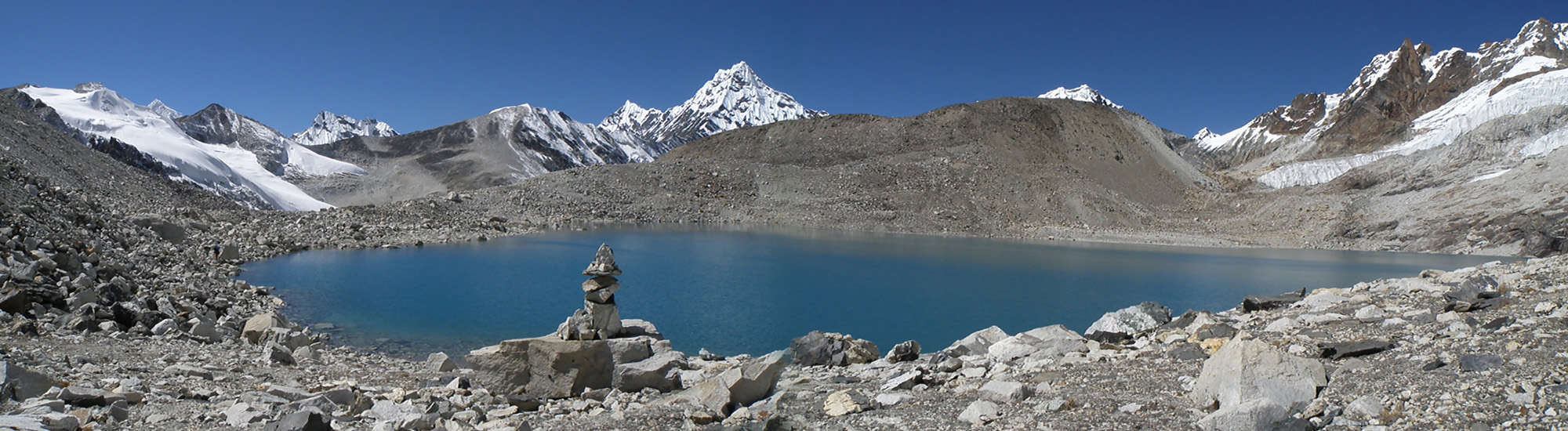
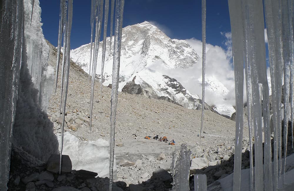
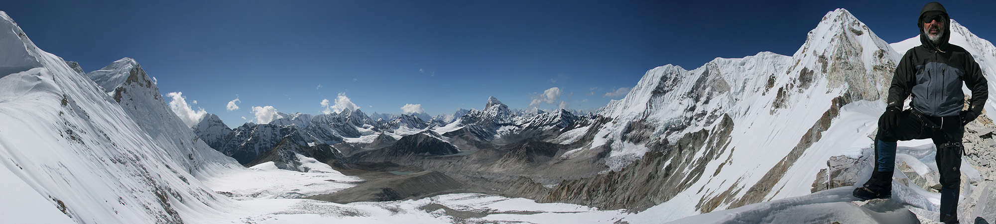
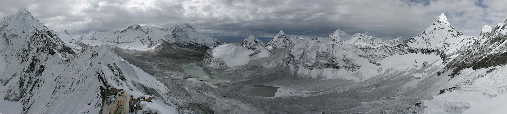
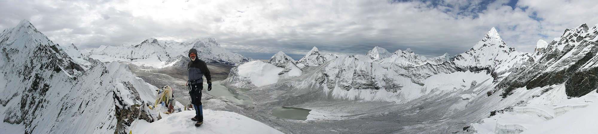
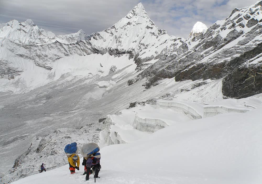
If you love mountains, the Makalu Base Camp Trek is for you! A fantastic Himalayan wilderness experience, towering cliffs, hanging glaciers and Mt Makalu!

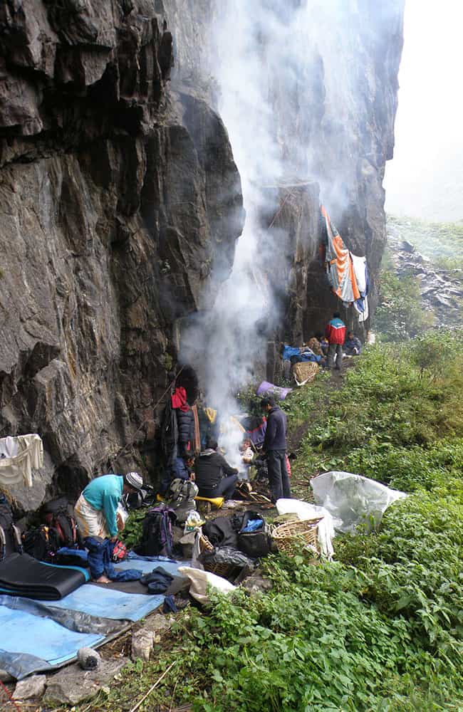
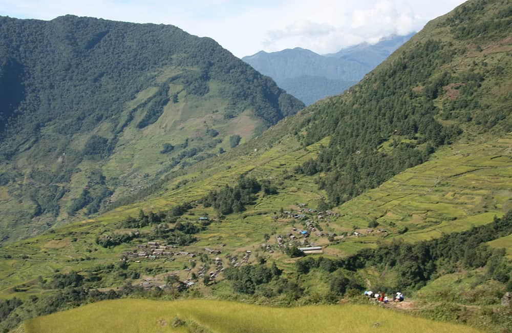
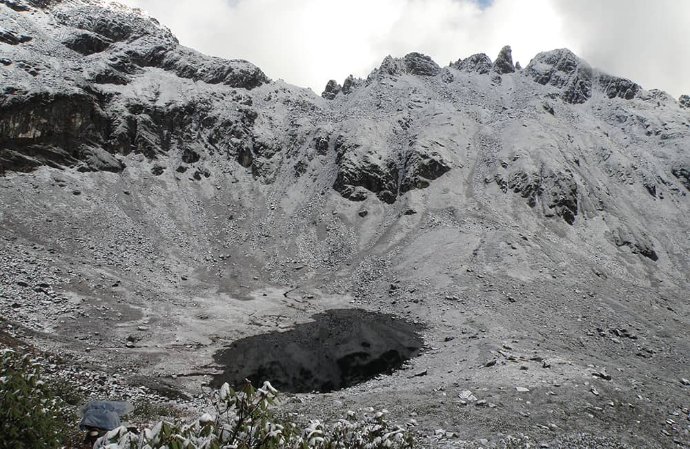
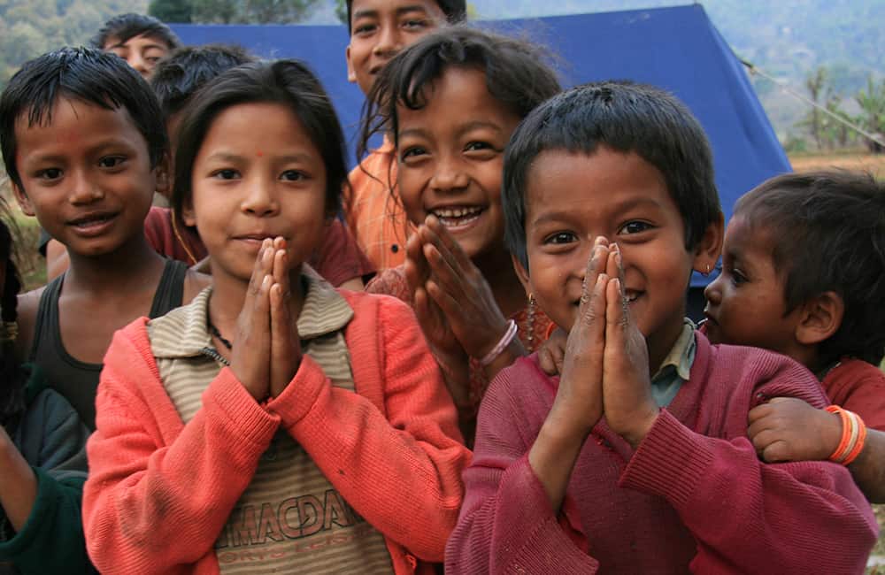
Stand at the foot of the massive bulk of a 3000m rockface at Makalu Base Camp. Cross Himalayan passes, wander through old-growth rhododendron and pine forests, and relax in picturesque and welcoming Rai and Sherpa villages.

Key points:

  • Trekking Grade: Grade 4 Energetic
  • Duration & distance: About 15-35 days total.
  • Gradient: Some steep and arduous sections
  • Quality of path: Formed & rough tracks, some obstacles
  • Quality of markings: Limited signage
  • Experience required: Some walking experience required
  • Walking times: Less than 7½ hours per day
  • Steps: Many steps
  • Highest point: 4825m
  • Best season: Apr-May/Oct-Nov
  • Accommodation: Camping or basic teahouses
  • Recommended map: NP102 GHT Series Makalu Region, Himalayan Map House, 2017
  • Recommended Guide Book: Nepal Trekking and the Great Himalaya Trail, Trailblazer, 2020.
Trek Grade 4

GRADE 4

Makalu Base Camp
Makalu Base Camp Trek

When to Trek Makalu Base Camp?

Like many mountain regions in Nepal, the best time to visit Makalu Base Camp is during the main trekking seasons of April-May or October-November.

Throughout winter (December to March) and the monsoon (June to mid-October) the Arun Nadi and Barun Nadi valley systems funnel wet weather towards Mt Makalu. This can dump large amounts of snow on the both the Khongma Danda and Shipton’s Pass (aka Tutu La), closing them. During the pre-monsoon spring season the extensive rhododendron and orchid forests that cover the Khongma Danda bloom in a multitude of colours. The clear air of the post-monsoon period makes for some excellent mountain photography. It is also the best time of year to cross the high passes to the Solu-Khumbu (Everest) region.

There are several scheduled flights a day between Tumlingtar and Kathmandu, and Tumlingtar and Biratnagar, as well as bus services. If you cross to the Everest region make sure you have purchased your flight tickets out of Lukla, as there can be long waiting lists in October.

Makalu Base Camp Trek Route Options

The return trek to Makalu Base Camp takes about 15 days if you jeep from Tumlingtar to Num and return the same route.

However, the Makalu Barun National Park is enormous and you could easily create a longer mountaineering route across the high passes to the Solu-Khumbu (Everest region) via the Amphu Labsta. Another option is by descending the Honku Khola or Isuwa Khola. Both of these routes can eventually take you to Lukla where you can either fly to Kathmandu or take the trail to Jiri. If you are returning to Tumlingtar from Makalu Base Camp, consider the pretty riverside trail along the Arun Nadi instead of retracing your steps via Num.

GHT Makalu Base Camp Region Map

GHT Makalu Treks

GHT through-hikers have a simple choice in the Makalu region. To go over the high passes, or take a southerly route along the Arun-Salpa Trail. Routes can also include heading up the Arun Nadi to Thudam or continuing directly to Taplejung.


Milke Danda and Kimathanka

One of the least-visited regions in the Himalaya is the Milke Danda. It’s a long ridge that runs south from the Lumbha Sambha and is covered in rhododendron forests, alpine lakes and craggy peaks. The ridge almost bisects eastern Nepal and in the heart of the region is Topkegola, a community renowned for trade with Tibet and India. From Taplejung, it is only a two-day hike from the road-head at Papung to reach Topkegola and another two days to Thudam. Trails across the Milke Danda link Dobhan with Khadbari via Chainpur (5-6 days, village-to-village route) and Jaljala Pokhari (6-8 days, a tough wilderness route with very tricky navigation).

Kimathanka lies beside the upper Arun Nadi on the border with Tibet. From Tumlingtar, it takes 10-12 days to reach and return from the most isolated district centre in Nepal.


Arun-Salpa Trek

The Arun-Salpa Trek is one of the new trekking gems of the lower Solu region and a low route option to avoid the high passes. It is a 8- to 10-day village-to-village route (Grade 3) between the Arun Nadi and Kharikhola/Lukla via Salpa Bhanjyang. The trail follows an old trade route used by Sherpas visiting Sikkim. The trail offers some wonderful views and immersion in a range of hill cultures but is slowly being turned in road. A typical itinerary is: Lukla, Kharikhola, Panggom, Sibuje, Khiraule, Bung/Cheskam, Gudel, Salpa Pokhari, Silicho Danda, Dobhane and Baluwabesi to Tumlingtar.


Apsuwa and Isuwa Khola

For those who want a wilderness challenge, the routes along the Apsua Khola and Isuwa Khola lead into the heart of the National Park. The Isuwa Khola route crosses to Shershong, just below Makalu Base Camp. Whereas the Apsua Khola system leads to the Honku Khola and routes to and around Mera Peak.

If you would like further information regarding route options, please Get in Touch.

How Much does the Makalu Base Camp Trek Cost?

To help you budget and plan, we’ve made a comprehensive costing explanation on How Much Does the GHT Cost? But here’s a simplified breakdown.

GHT Makalu Base Camp Trek for 15-days estimated costs:

  • Solo as much as possible US$1,525.
  • Twin-share with minimum guiding US$1,525 per person.
  • Twin-share fully supported US$3,625 per person.

Do you have any questions about costs? Please Get in Touch for more details.

GHT Makalu Base Camp Trek Sherpani Col

Customisation is Normal

Want to do things a little differently? Maybe take some extra time, or go a bit faster? Or avoid technical sections or combine with other trails? Every GHT trek is different and that changes the price, but please feel free to Get in Touch to ask questions and how to customise your own trek.


Bookings

Please note that www.greathimalayatrail.com does not handle bookings for treks. We are here to inform you about the trails and logistics, but you will need to book through a registered trekking operator in Nepal. If you would like an operator recommendation or feedback on a company you are already talking to, then please Get in Touch.

Your Impacts on the Makalu Base Camp Trek

Makalu Base Camp Social Impact SOLO

Solo (Independent)

Although there are teahouses each day on the main route, maybe think about taking some camping gear to explore some side trips?

That way, you will increase your social impact by purchasing food and fuel from locals.

Makalu Base Camp GHG and Waste Impact SOLO
Makalu Base Camp Social Impact TWIN

Twin Share (Independent)

Although there are teahouses each day on the main route, maybe think about taking some camping gear to explore some side trips?

That way, you will increase your social impact by purchasing food and fuel from locals.

Makalu Base Camp GHG and Waste Impact TWIN
Makalu Base Camp Social Impact CAMPING

Camping (supported)

Although you don’t really need a camping crew for the Makalu Base Camp trek it would be good to have greater freedom to explore.

However, you need to make sure that you purchase as many supplies as possible from locals.

Makalu Base Camp GHG and Waste Impact CAMPING

For more information about social, Green House Gas and waste impacts of treks, see The Impact of your Trek.

  • Destination
  • Departure
    Kathmandu
  • Dress Code
    Mid to high-altitude alpine clothing and camping equipment required
  • Included
    Makalu Base Camp
  • Grade
    Grade 4
  • Idea Date Range
    15/10/2021
  • Style of Trek
    Teahouse or camping
1
Day 1: Kathmandu–Tumlingtar–Num all day
It is a good idea to get the earliest possible flight to Tumlingtar’s grass airstrip (410m) and take the first available jeep to Num, but should you need to camp there is a good grassy site near the airport as well as some simple teahouses. The return jeep journey from Num to Tumlingtar will mean you’ll have to overnight near the airstrip, so it is prudent to book your teahouse accommodation or camping space in advance when you first arrive.For those wanting to walk to Num, either because they have the time or the road is closed, the trek takes 3 days. From Tumlingtar ascend a long ridge running north from the edge of the sprawling town around the airstrip to the Newari and Rai village of Khadbari (1040m, 3hrs walking from the airport), it’s an exposed trail so take plenty of water and sun cream. Khadbari is the administrative centre for the enormous Makalu-Barun National Park and Conservation Area and you will need to register at the park office. Try and coincide your visit with a market day on Wednesdays and Saturdays. There is a campsite next to the large school in the middle of the town.The following day continue along the ridge through picturesque villages to Mane Bhanjyang (1100m, 1hr), where you can see the trail climbing a small hillside basin to a minor pass at Bhotebas (1740m, 3½hrs). On a clear day there are good views of Makalu from a point about 10 minutes beyond the pass and from spots along the trail for the next few hours. The next village, Gogane (1720m, 20 mins) offers an excellent campsite if you are running a little late. Follow the road through moss-covered forest along the ridge to Chichira (1980m, 1hr) and a large camping area; there are also some simple teahouses here.It’s a good idea to get an early start on the final day to Num to get clear views of Mt Makalu before the jeeps drive by and kick up dust. The village of Kuwapani (2010m, 1hr) sits hunched on a narrow section of ridge at a major trail junction. Take the right-hand trail that traverses beneath a triangular hill and passes through Satbaini (Sakurate, 1920m, 20 mins). After another hour you come to a minor pass, Daju La (Dhara Deurali, 2100m) before descending, gradually at first, and then through a steep section of forest with many trails. It is important to stick together through this forested section, as some trails lead down to the Arun Nadi valley and it is easy to take the wrong path. From the pass it is 2½ hours to the large village of Num (1560m), which has a grassy campsite and some teahouses.
2
Day 2: Num–Seduwa 4½hrs
If you look across the valley to the north-west, you will see the day’s destination, the village of Seduwa. The main trail from Num continues along the ridge before curving back on itself to lose height. However, there is also a direct route down some rough steps, which is hard to locate and begins near the village centre (ask around for directions). In 1½ hours you should reach the Arun Nadi (760m) and cross the suspension bridge. The dense, moist forest of the east bank contrasts to the open deciduous forest on the west bank before giving way to cultivation.It will take about 3 hours to climb to Seduwa (1500m), a large trading village with views of countless mid-hills receding in to the distance. You will need to register again with the National Park office.
3
Day 3: Seduwa–Tashigaon 4hrs
Today is the last day of walking through villages as you draw closer to the Khongma Danda, the large and imposing forested ridge at the end of the valley. An easy trail to Murmidanda (1560m, 1hr) brings you to a school where the children will almost certainly break class to ask you questions. The climb to Narbugaon (2000m, 1½hrs) eases to become a straightforward trail that traverses hillside through cultivated fields. As Tashigaon (2100m, 1hr) is the last village on the trail, your guide will spend some time re-stocking food and fuel supplies.It is important that you also research trail conditions for the coming days, check if there is any snow or hazards on the trail, and that locals are using the route. You will be told that there are no supplies up the Barun Nadi valley; this is not true during the main trekking seasons, as all basic supplies are available, although expensive, all the way to Makalu Base Camp.
4
Day 4: Tashigaon–Khongma Danda 7hrs
The trail climbs, often steeply, through some of the most impressive cloud-forest in Nepal. It is important that you climb slowly, rest frequently, and perhaps take some time to admire the clusters of orchids hanging above. Make sure you have enough water and snacks to last the day, as there is no convenient lunch spot with running water. Unshisa (3110m, 5hrs) is the first potential campsite and there is a small teashop open in the main trekking season. You now climb on to the Khongma Danda and your campsite (3500m, 2hrs) will offer morning views of Makalu, with Peak 6 and Peak 7 in the foreground. When you reach camp you should check the entire group, including your porters, for symptoms of altitude sickness.
5
Day 5: Khongma Danda all day
Acclimatisation day. It is important that you begin the day by checking again for any signs of altitude sickness. Some of your group may have had a restless night, make sure they remain hydrated and rest. There is not much to do other than explore the surrounding forest and enjoy the views, so relax and unwind, soak your feet and consume as much water as possible.
6
Day 6: Khongma Danda–Mumbuk 7½hrs
Today is the toughest day on the trek so far and you must be on the lookout for altitude-sickness symptoms in the party. The day begins by continuing along the ridge past the prayer-flag-covered Kauma La (3603m, 1½hrs) with views of Makalu, Chamlang, Baruntse, and if the weather to the east is clear, Kanchenjunga and Jannu.The trail now climbs to the left of the main ridge up to Shipton’s Pass (aka Tutu La, 4125m, 2½hrs) before descending for 200m to a large lake called Kalo Pokhari, which can offer sublime reflections of Peaks 6 and 7 and Chamlang in calm, clear conditions.A short climb up to Keke La (4170m, 1hr) gives views of the Chamlang range and Tibet to the north, the Barun Nadi flows almost 1000m below. The 2½-hour descent is steep and rocky all the way to the stone huts and campsite of Mumbuk (3540m).
7
Day 7: Mumbuk–Nehe Kharka 4½hrs
The trail descends to the Barun Nadi before turning upstream on the true right bank and traversing steep hillside, which is often affected by landslides.Note: locals are discussing building a bridge to the far bank of the Barun Nadi to avoid rockfall sections. Seek local advice for developments.You should take care when crossing any loose ground, as well as watching for rockfall from above. Then about 4½ hours of alternate loose landslide and stable trails brings you to Nehe Kharka (3700m) and a good campsite in a meadow surrounded by pine trees. During the monsoon, normally for the August full moon, there is a fertility festival here as a tradition tells that a famous Buddhist sage, Guru Rimpoche, stayed in a cave high above.
8
Day 8: Nehe Kharka–Langmale Kharka 5hrs
More loose sections of trail, with an occasional well-formed path, continue beside the Barun Nadi before crossing on a log bridge to a wide grassy field called Yangri Kharka (Yangla Kharka, 3557m, 2hrs). There are a number of teahouses here, along with basic supplies and a large campsite. The next section of trail is one of the most spectacular in the entire Himalaya as you wind through rhododendron, fir and pine forest. Yosemite-like cliffs form an enormous U-shaped valley crested with glaciers and a series of snowy peaks including Pyramid Peak, Peak 4, Peak 6, Chamlang and Peak 5 all show themselves. In one monstrous rock-face a massive cave contains a waterfall in freefall. Lumdar (strings of prayer flags) are suspended from poles to mark a pilgrimage site popular during the July/August full moon, when it is said that the waters here can cure many illnesses. For 3 hours you’ll keep stopping and absorbing the evolving panorama, before arriving in Langmale Kharka (4410m), which has a couple of teahouses and campsites spaced well apart.
9
Day 9: Langmale Kharka–Makalu Base Camp 4hrs
The avenue of mountains that line your route become ever more spectacular as Peak 3 and the snout of the West Barun Glacier appear. From Langmale Kharka the trail enters an ancient lateral moraine through which the infant Barun Nadi flows. A large glacial lake fills the valley to your left and an easy to follow trail leads to Shersong (4630m, 2½hrs), a large grassy area used by yak herders in the monsoon months. Turn right and follow an obvious trail that climbs more moraine, and, once on top, maintain your height; do not descend into the valley to your left. A number of small trails (formed by yak herds) stay about 100m above the valley floor before finally descending to a small bridge and the stone huts of Makalu Base Camp (4870m, 2hrs). Expeditions have left all sorts of supplies here over the years and it is possible to buy anything from wine to kerosene to apple jam and dehydrated meals. To the north, the massive bulk of Makalu rises about 3598m (11,824ft) to a pyramid summit; this is truly one of the most spectacular mountain viewpoints in Nepal! Makalu Advanced Base CampMakalu Base Camp has become a staging post for expeditions rather than a full-blown base camp. Most expeditions now climb to a valley on the north-east side of Makalu to an advanced base at 5780m.To get there, follow the trail up and past Hillary Base Camp before descending to and crossing the Barun Glacier on a loose trail (3hrs). A few small tracks run through the lateral moraine on the far north side of the glacier, beware of rockfall in this area.You eventually reach a small waterfall and the trail turns in to the Makalu La valley (2hrs). Some small stone shelters have been built by porters at 5500m, advanced base camp lies further up this valley on the left-hand side (2hrs).
10
Days 10-15 Return to Kathmandu
Return to Tumlingtar along same route, then fly to Kathmandu