Everest Base Camp and Passes
Everest Base Camp and Passes Trek
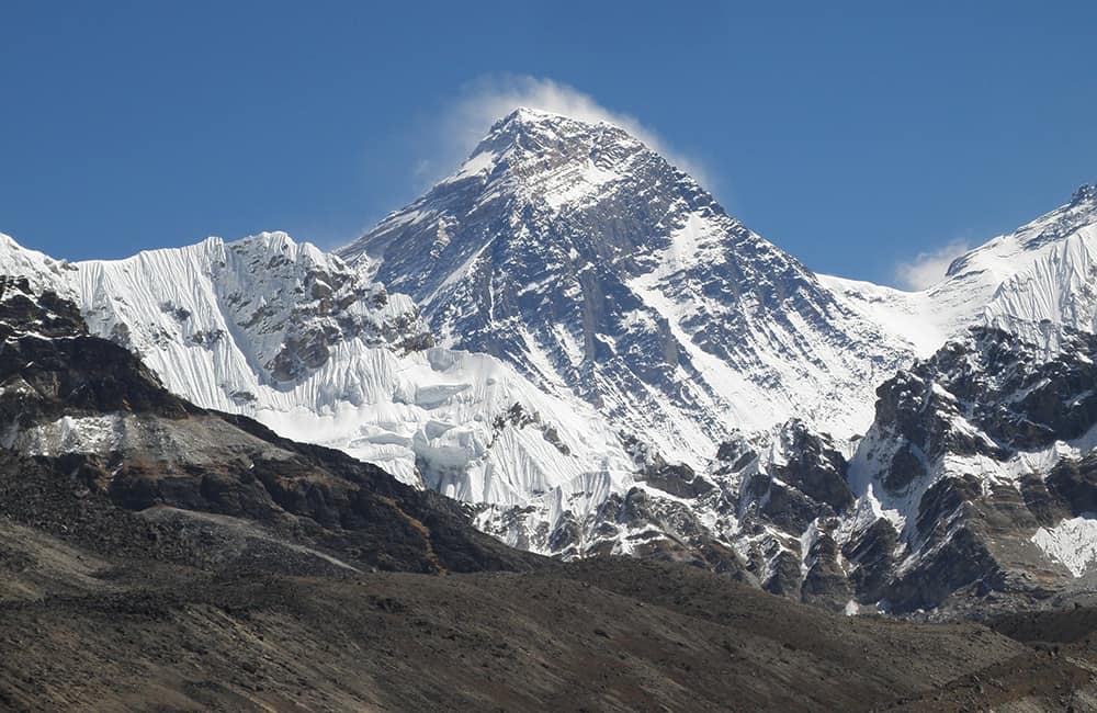
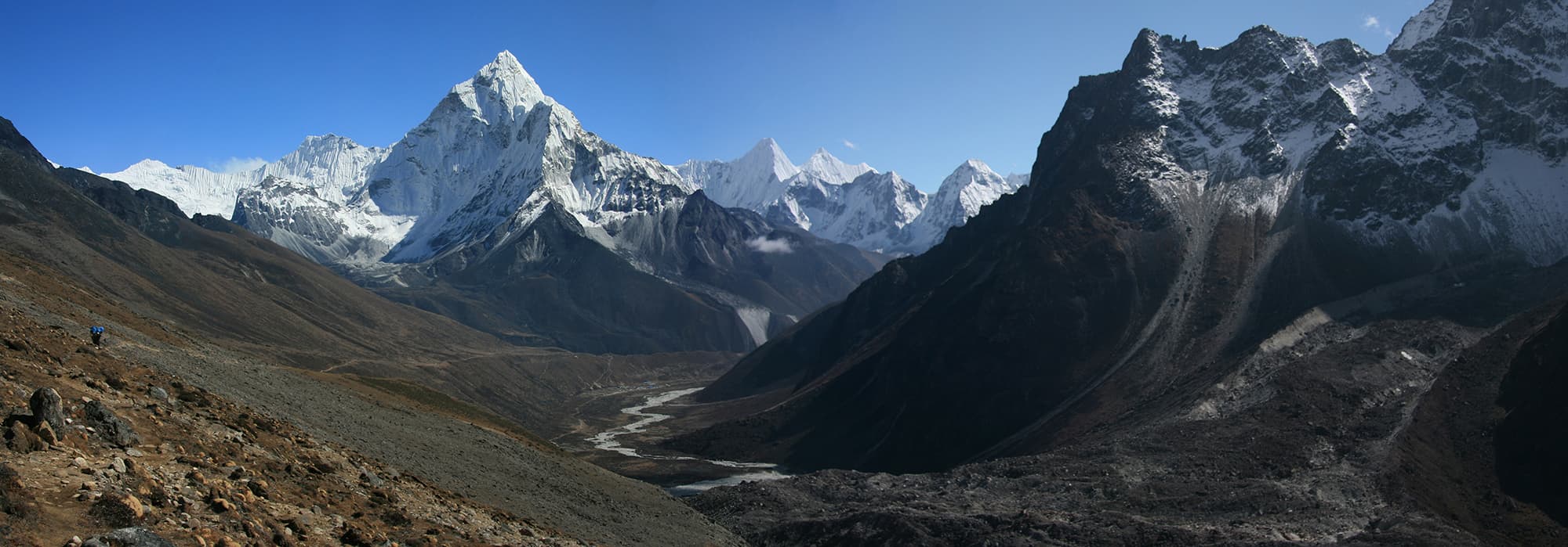
Everyone should see Mt Everest at least once in their life! This adventure has it all, the Everest Base Camp and Passes Trek includes the most famous base camp of the world’s highest mountain, the spectacular Kala Patthar viewpoint, and cross the Cho La and Renjo La! Plus you get to enjoy the natural open-hearted friendliness of the Sherpa people. If you only visit Nepal once, this is the trek to do!!
Key Points:
- Trekking Grade: Grade 4 Energetic
- Duration & distance: About 18-24 days total
- Gradient: Very steep sections with some arduous climbs
- Quality of path: Formed & rough tracks, some obstacles
- Quality of markings: Clear signs at beginning, end and during trek
- Experience required: Some walking experience required
- Walking times: Less than 6½ hours per day
- Steps: Many Steps
- Highest point: 5550m
- Best season: Mar-May and Oct-Jan
- Accommodation: Camping or a range of teahouse qualities
- Recommended map: NP103 GHT Series Solu-Khumbu (Everest) Region, Himalayan Map House, 2017
- Recommended Guide Book: Nepal Trekking and the Great Himalaya Trail, Trailblazer, 2020.

GRADE 4


When to trek to Everest Base Camp and Passes?
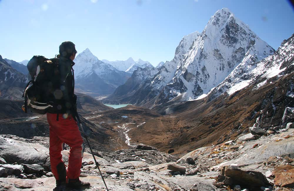
Many trekking groups who only visit Everest Base Camp do the return trek (Grade 3) to Lukla in about 14-18 days. But try to stay longer as the effort will pay dividends. Crossing Cho La and adding the viewpoints of the Ngozumba Glacier and Gokyo Ri increases your trek duration by a mere 4-6 days. Another great add-on is Renjo La and a trip to Thame, which takes just one more day than returning down the main Gokyo valley. In short, this is the most convenient place to experience the immensity of the Himalaya in Nepal and in less than three weeks!
There is almost no bad time of year to visit the Solu-Khumbu as there is always something going on. A major re-forestation programme in the 1980s and 1990s has once again given a bloom of colour to the lower slopes in the pre-monsoon. The most popular season is October to December, when the air is clear and offers the best shots of the highest mountain in the world. The popular passes of Cho La and Renjo La are open for most of the year except for a brief period from mid-February to March. All the main routes in the valleys are open year-round.
The region has received a big investment in trail maintenance, so it’s ideal for novices and experienced trekkers alike. Access is very easy with multiple daily flights to Lukla year-round. Just remember to reconfirm the day before you fly as waiting lists can be long in peak season.
For comprehensive trail, accommodation and local information see Jamie McGuinness’s, Trekking in the Everest Region, Trailblazer.

Everest Base Camp and Passes Trek: Accommodation and Permits
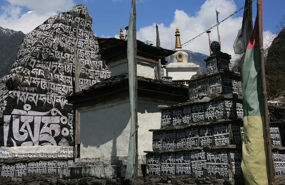
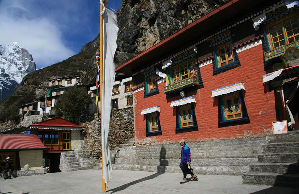
The ‘Khumbu’ in Solu-Khumbu refers to the higher-altitude areas of the Solu region, which actually extends far to the south. The ‘lower’ Solu is rich in Sherpa culture, sacred sites, fantastic viewpoints and not another tourist in sight! Dozens of trails are open for most, and sometimes all, of the year, and all are worth an unhurried exploration.
Sagarmatha National Park was declared a World Heritage Site in 1979 and has a comprehensive management structure. Use of firewood is prohibited and locals rigorously monitor environmental protocols.
As at August 2019, the trekking permit fees for the Solu Khumbu District are $10 for the first 4 weeks per week per person and $20 per week per person thereafter. Plus the Sagarmatha National Park entry fee of NRs 3000 per person (foreigners), NRs 1500 (SAARC nationals) and NRs 100 (Nepali nationals).
Everest Base Camp and Passes Trek: Route Options
GHT through-hikers tend to favour two routes through the Solu (Everest Region).
The first is for those coming from Makalu Base Camp over the high passes (Sherpani and West Cols, and Amphu Labsta). The most logical route is to continue following most of the Everest Base Camp and Passes route, even though the trail to EBC is a side trip. However, both Cho and Renjo La to Tashi Labsta (see Rolwaling and Tashi Labsta Trek) are almost ‘straight ahead’ from Chukhung so it makes sense.
The second route lies to the south of the main range and follows the Arun-Salpa Trail between Arun Nadi and Kharikhola (see the Arun-Salpa below) and then on to Jiri.
Before commercial flights to Lukla, trekkers would start from the road-head town of Jiri. Roads have now reached Kharikhola and are expected to reach Chaurikhola in 2022. The number of trekkers taking the 4- to 5-day Jiriroute is now so small that those who do often find it a major highlight of their trek. The contrast to the crowds and rush of the higher trails means you can enjoy the natural hospitality and friendliness of the Sherpa, Gurung and Rai communities you encounter.
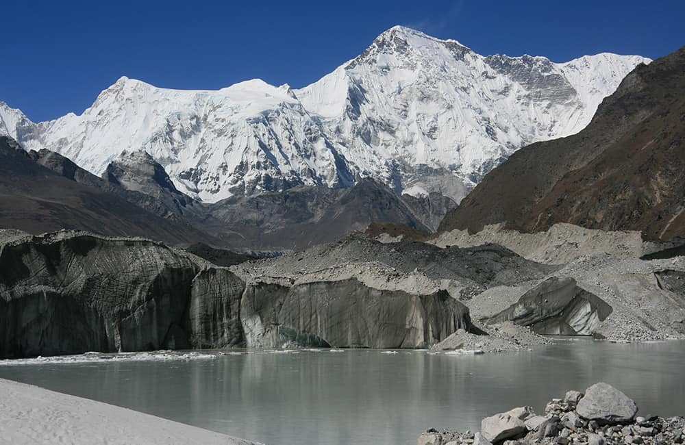
Nangpa La Side Trip
In 2007, the Nepali government removed trekking restrictions for Nangpa La (5716m) at the head of the Thame valley. Camping equipment is necessary as well as experience in glacier travel. This is a rough and wild route, and absolutely do not cross into Tibet from here!
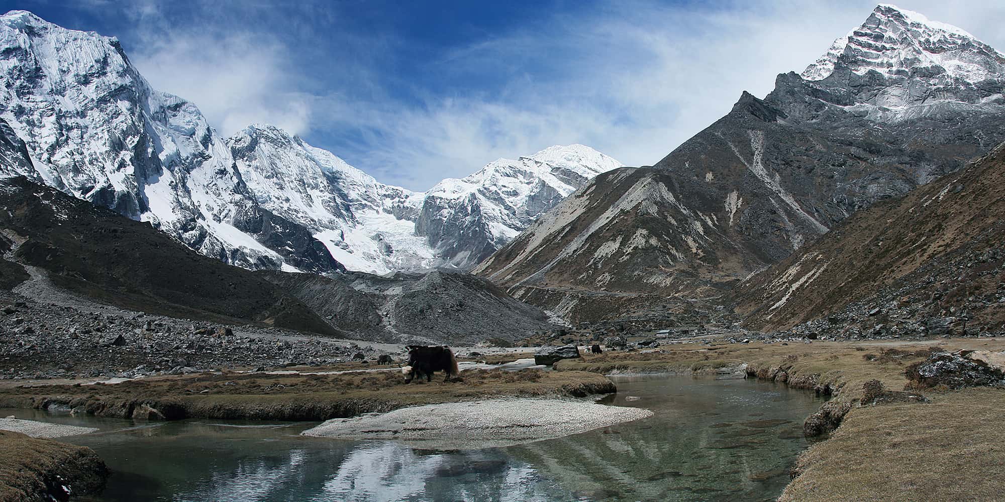
Around Chukhung
Perhaps the most popular trekking peaks in Nepal are Island Peak above Chukhung and Mera Peak above the Honku Khola. Access to both peaks follow established trekking routes, for Island Peak it is a simple day trip from Dingboche (5½hrs return). Whereas the Honku Khola and routes over Mera La and Amphu Labsta are much more committing and normally take about 30 days to and from Lukla. For more information about both routes, see Jamie McGuinness’s, Trekking in the Everest Region, Trailblazer.
Arun-Salpa Trail
In the lower Solu there are a number of community-based routes that have a combination of teahouses and homestays. These are excellent winter treks for those wanting to immerse themselves in hill cultures and enjoy the clear-air views of the Himalaya. In addition to the Arun-Salpa Trail, the most popular routes link Salpa Pokhari to Parma Ri and then to either Salleri or Halesi Maratika, where there are some important Buddhist pilgrimage caves. Each January many thousands of pilgrims visit the caves to perform a series of ‘tests’ passing through holes and crawling through narrow gaps as acts of devotion.
Pikey (PK) Peak Trail
One of the best Himalaya-panorama viewpoints is from Pikey Peak (4068m), near Salleri. There are teahouses and community lodges for a number of circuit-trek options of 7-10 days from Jiri. Although some trekkers use a flight and bus combination with Phaplu to reduce the trek to 5-6 days.
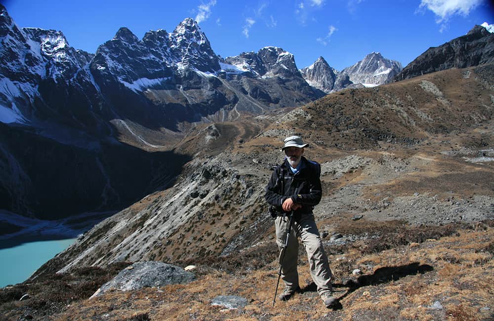
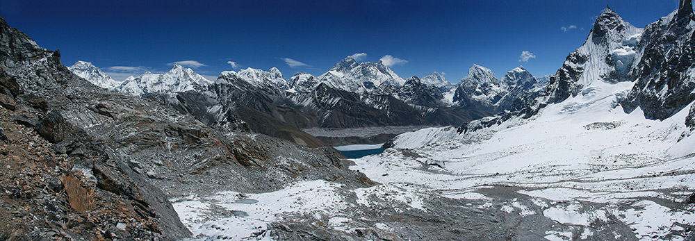
Another Amazing Viewpoint!

How Much does the Everest Base Camp and Passes Trek Cost?
To help you budget and plan, we’ve made a comprehensive costing explanation on How Much Does the GHT Cost? But here’s a simplified breakdown.
GHT Everest Base Camp and Passes Trek for 19-days estimated costs:
- Solo as much as possible US$1,565.
- Twin-share with minimum guiding US$1,575 per person.
- Twin-share fully supported US$4,025 per person.
Do you have any questions about costs? Please Get in Touch for more details.

Customisation is Normal
Want to do things a little differently? Maybe take some extra time, or go a bit faster? Or avoid technical sections or combine with other trails? Every GHT trek is different and that changes the price, but please feel free to Get in Touch to ask questions and how to customise your own trek.
Bookings
Please note that www.greathimalayatrail.com does not handle bookings for treks. We are here to inform you about the trails and logistics, but you will need to book through a registered trekking operator in Nepal. If you would like an operator recommendation or feedback on a company you are already talking to, then please Get in Touch.
Your Impacts on the Everest Base Camp and Passes Trek

Solo (Independent)
There are plenty of teahouses to choose from, which create good social impacts.
But you need to be careful to eat local produce as much as possible, and that means avoiding pasta and imported foods, to minimise GHG and waste impacts.


Twin Share (Independent)
There are plenty of teahouses to choose from, which create good social impacts.
But you need to be careful to eat local produce as much as possible, and that means avoiding pasta and imported foods, to minimise GHG and waste impacts.


Camping (supported)
Considering the convenience of the many teahouses and the high GHG and waste impacts of a camping crew, it is hard to justify camping on this trek.
However, camping would be an option if you want to explore some of the remoter corners of the Khumbu.

For more information about social, Green House Gas and waste impacts of treks, see The Impact of your Trek.
-
Destination
-
DepartureKathmandu
-
Dress CodeMid-altitude alpine clothing and camping equipment required
-
IncludedEverest Base Camp and Passes
-
GradeGrade 4
-
Idea Date Range15/10/2021
-
Style of TrekTeahouse or camping
FROM OUR GALLERY
This adventure has it all! The Everest Base Camp and Passes Trek includes amazing views, Sherpa culture, if you only visit Nepal once, this is the trek to do!!

Day 1: Kathmandu–Lukla– Phakding/Benkar ALL DAY
Day 2: Phakding/Benkar–Namche 5hrs
Day 3: Namche all day
Day 4: Namche–Deboche 5½hrs
Day 5: Deboche–Dingboche 3½hrs
Day 6: Dingboche all day
Day 7: Dingboche–Loboche 3½hrs
Day 8: Loboche all day
Day 9: Loboche–Kala Patthar– Gorak Shep 5hrs
Day 10: Gorak Shep–Everest Base Camp (EBC)–Loboche 4hrs
Day 11: Loboche–Dzongla 5hrs
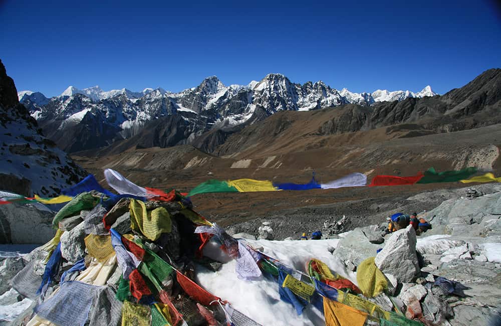
Day 12: Dzongla–Cho La–Dragnag (Thangnak) 5hrs
Day 13: Dragnag (Thangnak)–Gokyo Ri–Gokyo 5½hrs
Day 14: Gokyo all day
Day 15: Gokyo–Renjo La–Lumde 6½hrs
Day 16: Lumde–Thame 3hrs
Day 17: Thame–Namche 3½hrs
Days 18-20: Namche–Lukla–Kathmandu