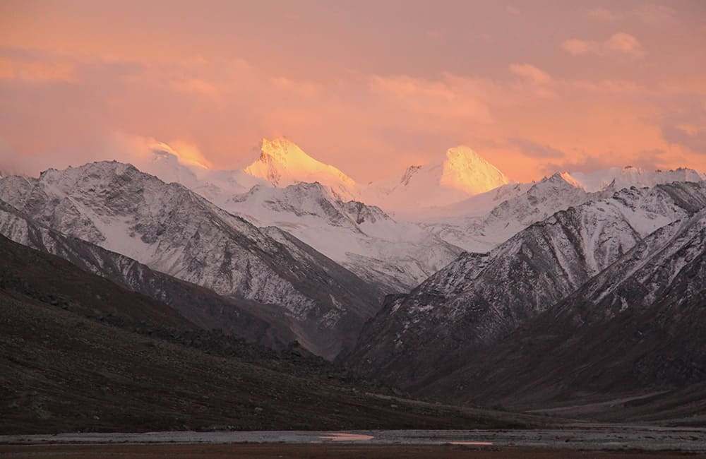
1
Sankri -hrs camp1940m Alt Var -
From the Govind National Park office at Naitwar, it is a 45 minute drive to Sankri (1940m, N31°04’40.87”, E78°11’03.44”) where there are some shops, a couple of dhabas, a meat shop and a convenient barber's shop if you’re doing the trek in reverse! The Garhwal Mandal Vikas Nigam (GMVN) tourist rest house is located above the shops and has a commanding view of the valley and on a clear day you can see Swargarohini. You have to book in advance if you have to stay for the night at GMVN (for details see
www.gmvnl.com) but most of the time it is empty. Alternatively, you can stay at Swargarohini Guest House run by Chain Singh Rawat who also runs Harkidun Protection and Mountaineering and Mountaineering Association (www.harkidun.com), a trekking company.
2
Seema 1hr drive + 6hrs trek camp 2355m Alt Var 300m
You can share a jeep ride with fellow travellers or with villagers going to Taluka (1 hour drive, 2110m, N31°04’42.45”, E78°14’44.98”), where there are a few shops, a dhaba, the forest rest house, the GMVN rest house and a few homes.
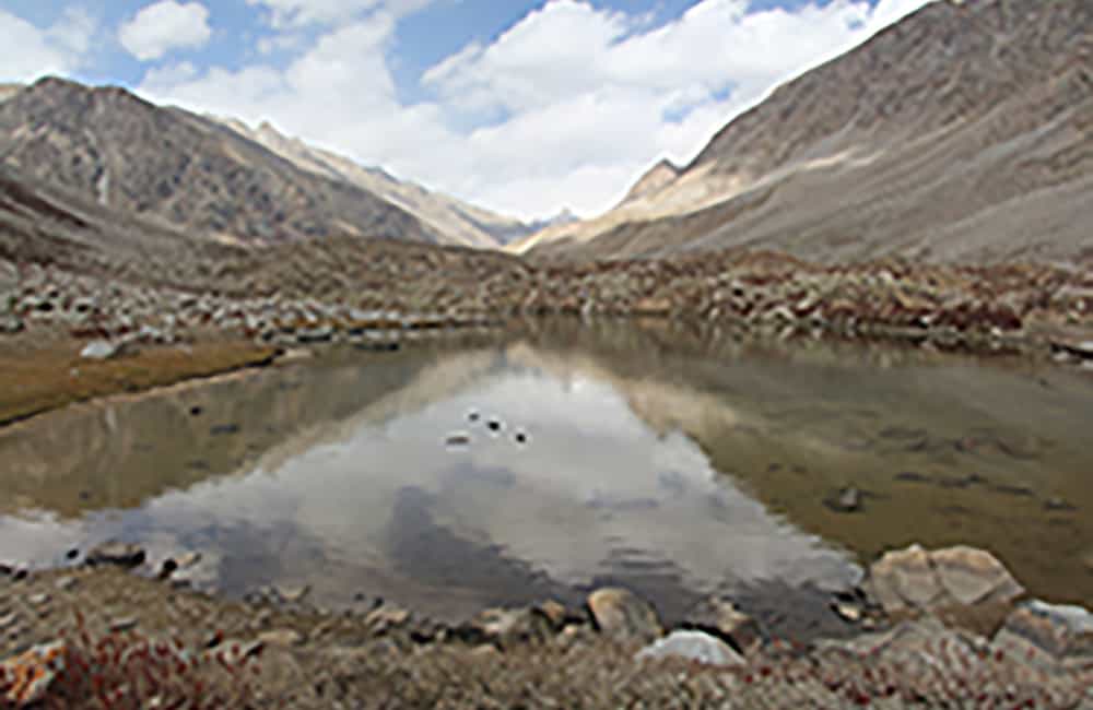
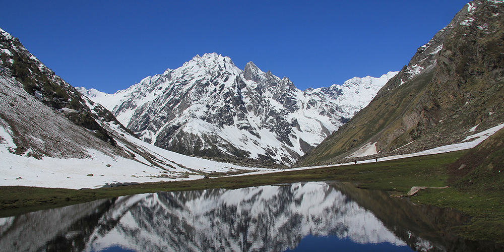
Take care on the first hundred metres of trail as it is covered in slush and dirt over cobblestones for most of the year. Then descend to a flat piece of ground and follow the true left (south bank) trail along the Tons River as it undulates mostly through patches of mixed forest and grassy hillside. After 1 hour cross a bridge to a campsite at Beda camp (2053m, N31°05’10.15”, E78°16’05.0”) with Datmir, a tiny village perched a few hundred metres above to the east. There are a number of trails from Datmir that head south (to Baradsar) and southeast (to Yamnotri). After another 3 hours, reach Gangar campsite (2355m, N31°06’21.67”, E78°18’50.52”), where traditional wooden houses sit prettily above the Tons river on the far bank. The trail continues on the true left (south) bank and after 2 hours, reach Seema beside the river (2622m, N31°07’01.44”, E78°20’59.78”) where there is a GMVN guest house and a few shops. You can camp in Seema or in a couple of sites just after the village. Osla village is on the far bank, about 100m above and where there are some small private lodges.
3
(after) Harkidun 6hrs camp 3788m Alt Var 1150m
Beyond Seema, cross the bridge over the Tons river (2718m, 1 hour, N31°07’26.0”, E78°22’00.5”) and first bear left (downstream) towards Osla. Meet the main trail junction after a slight climb and then turn right (upstream) towards Harkidun. It’s an easy gradient all the way as you wind through pastures, across hillsides and through mixed forest. Pass the examples of traditional Himachal buildings in the valley (alternate layers of stone and wooden beams with wooden shingle roofs), which look stunning surrounded by wildflowers and a background of snowy peaks.
Harkidun (3469m, 3 hours and 30 minutes, ref: N31°09’02.1”, E78°25’41.6”) sits in an ancient ablation valley carpeted with good grass and many wildflowers. Nearby on the moraine ridge are a number of huts owned by various government departments for the use of the staff. However, the main campsite area is in an appalling mess with much rubbish left to blow around in the wind and occupy swarms of flies. Some pretty poor efforts at toilet holes have been made about the camping area.
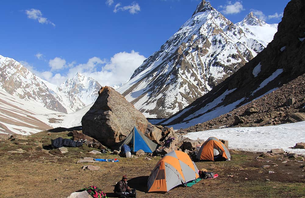
Just before the ‘stone bridge’ (a boulder causeway) that leads to the huts is a trail junction among boulders. Turn left here, do not cross the bridge, and climb an easy trail up and around to your left (north-north-west) passing some rhododendron (pale pink flowers) into a classic alpine U-shaped valley. There is a small campsite just beyond the rhododendrons (about 20 minutes from the ‘stone bridge’) but there are better sites further up valley, for example, a large boulder marks a popular shepherd’s shelter and campsite (3788m, 1 hour from stone bridge).
NOTE: From here the trail is very easy and rapid altitude gain becomes a risk. Ensure that all of the members of your group and crew are fully acclimatised.
4
High Camp 3.5hrs camp 4354m Alt Var 600m
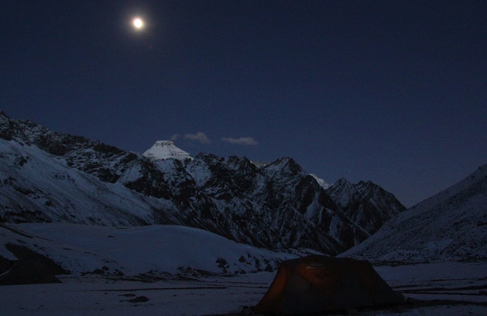
Stay on the true right side of the valley as you pass another couple of potential campsites in the first hour or so of trekking today. The gradient increases as you approach a large wall of terminal moraine that rises above a saturated flat-bottomed valley that was once a lake. Reach the base of the moraine wall (4067m, ref: N31°12’10.2”, E78°26’10.9”) in 1 hour and 45 minutes. From here there are two options; (1) climb the moraine wall to cairns and follow it before descending to camp on the farside, or (2) ascend the gully to the true right of the moraine formed by the outflow of glaciers above. The trail leads to a high section of flat valley that is often waterlogged but camping is possible around the edges. On the farside of the flat area from your ascending trail a rib of moraine climbs steeply upwards, heading roughly northwest. This rib is the route to the pass and at its base is the driest campsite (4354m, 1 hour and 15 minutes).
NOTE: There is a ‘pass camp’ about 1 hour above the High Camp but water is a problem and the site is only big enough for a small group.
5
Borasu Pass - Moraine Camp 6.5hrs camp 4508m Alt Var 1500m
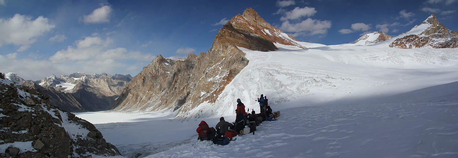
The popularity of this pass means there is a trail to follow up the moraine ridge, which is sometimes steep. Reach the ‘Pass Camp’ in 1 hour and 20 minutes, 4744m where you stay on the true left of the valley avoiding the small glacier. Easy rolling moraine leads up to a small basin that means turning a little to your right (northwards). From the entry of the basin you can clearly see the pass ridge, the pass being the lowest point next to a rocky outcrop to the left (west). Reach the base of the pass climb (5109m) in another 1 hour and 20 minutes and then a few easy switchbacks will get to Borasu Pass (5180m, ref: N31°13’50.9”, E78°27’57.4”) in 20 minutes. The pass is a narrow ridge with a steep descent for the first 50m or so and then bear a little to your right as you descend to the top of steep moraine next to the main glacier below (4739m, 45 minutes, ref: N31°13’58.2” E78°28’38.2”). Choose the safest point to descend onto the glacier where there are many potential campsites as this is where groups make their ‘high camp’ if doing the pass in reverse.
NOTE: If you continue from here you will either have to scratch out a camp from moraine or continue for another 3 hours.
Gradually cross the glacier to the true right side of the valley but do not climb the large moraine wall. If walking here after late morning you should be extremely careful of rockfall. Follow the base of the moraine wall until the glacier begins to drop away. You will then need to pick a route down to a large boulder field (to your left) where patches of open flat ground make good campsites (4099m, 2 hours and 45 minutes from ‘high camp’, ref: N31°17’06.4”, E78°29’16.9”).
6
Chitkul 5.75hrs camp 3437m Alt Var 1200m
You might think the moraine is over but there is more! Continue on moraine down the true right side of the valley for another 1 hour and 15 minutes until finally you reach a grassy trail at 3904m. An easy trail continues to descend and then after about 20 minutes it gradually climbs and traverses to the valley mouth. Some silver birch trees (25 minutes, 3811m, ref: N31°19’18.8”, E78°30’10.1”) mark where you then descend into the main Bhaspa valley, crossing grassy pastures to a point where you realise there isn’t a bridge.
A trail heads upstream (right) beside the Bhaspa river over some landslides and boulders to Rani Ganta (1 hour, 3718m, ref: N31°18’55.7”, E78°30’52.9”) where you cross a wooden bridge. Above rises the mighty west face of Lamkhaga peak but photography is ‘restricted’. Turn left and walk downstream on a very easy trail that undulates across alluvial fans for 2 hours where you reach the ITBP post. The roadhead village of Chitkul (3436m, ref: N31°21’04.0”, E78°26’12.9”) is then 45 minutes beyond and the market town of Sangla (start/end of Rupina La trek) a 90 minute drive.
Note: Chitkul hotel - Thakur Guesthouse, t: +91 (0)1786 244320, +91 (0)9459 270841, Dbl w/b Rs400 to Rs600.
Chitkul Devi, the Fairy Queen
The intriguing mix of Buddhism and Hinduism in Chitkul is an example of how cultures and customs can blend in harmony. The Buddhist chatta and lumdar prayer flags decorate most houses but so do traditional Hindu motifs; here the two religions are intertwined with ancient beliefs.
The highest spiritual authority in the village is the Nyingmapa-sect, Shakyastupa, at the top of the village. However, it is the animist-origin Hindu goddess, Chitkul Devi, who receives the greatest devotion. Her imposing and wonderfully carved new temple in the centre of the village is almost finished. Locals say they have worshipped the Queen of the Fairies for over 1000years and before both Hinduism and Buddhism were introduced. She is a Goddess to be feared as her wrath is legendary and is sometimes supplicated by animal sacrifice.
There are many festivals that honour Chitkul Devi, but the most important is Fulyaz, the five-day Festival of Flowers, in October before Diwali. One family has provided her high priest for generations and occasionally becomes her oracle when the villagers make a special request.
Families from Chitkul and the valleys over the Shinku, Kimalaya and Borasu passes regularly intermarry. Love marriages are permitted subject to following traditional customs.
7
Kafnoo to Mulling 3.75hrs camp 3285m Alt Var 850m
There are a few shops in Kafnoo (aka Kafnu) where basic supplies are available. If you want more than 10-litres of kerosene you may have to wait for a fuel delivery the following day. The only hotel in town is basic with poor service (Lake View Resort, t: +91 (0)8894 618384, Dbl w/b Rs500).
From the open parking area in front of the Lake View Resort follow the dirt service road around storage lake for a small hydro scheme and then head up-valley to a bridge (25 minutes). Cross the bridge and immediately turn left on good trail. The valley narrows quickly as you walk upstream on the true left bank. Pass the few homes of Musrang and enter forest that leads to a set of switchbacks in 45 minutes. Climb for 150m or so to a level trail in pleasant pine forest (2882m, 20 minutes, N31°39’03.6”, E78°00’58.5”) that leads to open pasture and then descends back to the river in another 30 minutes.
Once beside the river you begin climbing in thick pine forest and sometimes crossing tributary streams for 1 hour and 20 minutes. Cross another grassy pasture before winding through a large gully cut around an ancient terminal moraine, climbing on an easy gradient the entire time. At the end of the gully the trail climbs very slightly into a magnificent broad alpine valley, called Mulling, where there are many good campsites (3285m, 25 minutes, N31°41’53.2”, E77°59’48.9”).
8
Pushtirang Nala 5hrs camp 4163m Alt Var 900m
If you are unacclimatised before beginning this trek you may want to split today into two days.
Continue up the Mulling valley, which looks like the mountain Gods have landscaped it to make the most of surrounding mountain scenery. Beyond the pasture you enter a boulder field and then sparse forest. The valley narrows near the junction of the Yuchdiun river and after the confluence you cross a step-sided gully via a boulder-bridge (3371m, 1 hour and 20 minutes, N31°43’27.3”, E77’59’04.4”). Then climb steeply for about 180m before traversing to another stunning alpine valley and an extensive pasture popular with shepherds at Kara (3580m, 1 hour, N31°43’58.8”, E77°59’32.8”). There are many fine campsites here and you might be able to buy fresh goat milk.
The Pushtirang Nala heads northwest from Kara, and you will need to find a convenient crossing point near the confluence with the main valley before climbing the true left (north) bank. The trail climbs rapidly up a grassy spur before the gradient eases as you cross gently undulating pastures with many boulders. There are many herder shelters in the valley but the best campsites are at the base of the pass-climb. There are two main camps, a lower site, and after a short climb an upper site that offers an easier start for the following day (4163m, 2 hours and 30 minutes, N31°45’44.2”, E77°59’08.3”).
9
Tiya via Bhaba Pass 5.5hrs camp 4045m Alt Var 1650m
The trail climbs a scree-covered spur that heads steeply up the centre of pass-approach valley. After about 350m of ascent the trail crosses a melt-water stream and then climbs steeper ground for another 150m to reach a plateau, which some groups use as a high camp (4630m, 1 hour and 15 minutes, N31°46’11.6”, E77°59’30.2”). Traverse around a shallow basin to your north (right) and ascend a rocky moraine hillock to reach another, larger basin. The pass is the lowest point on the surrounding ridge to your north (not another point to your northeast) and is reached by crossing the basin and climbing directly to Bhaba Pass (4915m, 1 hour and 10 minutes, N31°46’49.0”, E77°59’48.6”).
If snow conditions permit, make a direct descent into the valley below, but if avalanche is a danger you will have to traverse left and take a less steep route. Reach the flat-bottomed valley and long lake (4325m) in less than 1 hour. The trail winds around the true right (north) side of the valley floor, which is mostly lake or wet ground, for 30 minutes. From the lip of the valley you look down on the confluence of three rivers at Tiya and a trail junction.
If you are heading for Mudh (aka Mud or Muth) do not descend all the way to the mouth of the valley. Instead, follow a trail that traverses north (right) before the last descent and wind around scree-covered hillside. Then descend a little before traversing above the Pin river to Boldar camp (3930m, 1 hour and 15 minutes, N31°51’55.1”, E78°00’13.7”).
If you are heading for Pin-Parvati Pass, descend to the end of the valley in another 30 minutes (4100m, N31°50’26.5”, E77°59’11.7”). Cross a medium sized river that flows down from the Shakarog Khango Pass to your south (left) but do not head up the valley. Instead, climb to some grass and boulder-covered ground and a rough trail that winds around into the next valley and the Pin river. There are a number of open grassy areas before crossing the Pin river that make a good campsite (4045m, 1 hour including river crossing, N31°51’02.2”, E77°58’51.5”). For details on crossing Pin-Parvati Pass see below.
10
Mudh 2hr drive or 6hrs camp 3803m Alt Var 200m
From here it is about 14km to Mudh (aka Mud or Muth and end of the road for public transport). Most groups organise a private jeep pick up from the road on the far bank, but take care when crossing the Pin river. Otherwise, you can walk to Mudh using the trail on the true right bank to Pharka, then cross to the roadhead at Mudh (3803m, 6 hours, N31°57’31.5”, E78°01’57.3”) to get a local jeep from there.
11
Mudh to Tiya 2hr drive or 7hrs camp 4045m Alt Var -
The roadhead for public vehicles is at Mudh (3803m, N31°57’31.5”, E78°01’57.3”) but the jeep road continues for another 14km up the valley to the confluence of three rivers at Tiya (4045m, 7 hours, N31°51’02.2”, E77°58’51.5”). You need to follow the jeep track either by jeep or foot and camp just before the confluence of three rivers; the Pin river that flows down from the west, another from the Shakarog Khango Pass to the south and the outflow from glaciers beneath the Bhaba Pass to the southeast.
12
Parvati Pass Base Camp 5.25hrs camp 4459m Alt Var 500m
Continue on the jeep track, which is broken by landslides in a few places, into the Pin valley.
NOTE: If you are coming from Bhaba Pass then cross the Pin river and climb up to the trail that extends from the end of the jeep track.
The valley soon broadens and the trail undulates across alluvial fans and scree slopes for almost the entire day. Craggy peaks soar above, while the Pin river maintains a relentless effort to pound them into submission. There are a few shepherd shelters and small campsites on the larger alluvial fans, and the bigger boulders will provide rest spots out of the wind. As you gradually near the end of the main Pin valley scan the ridge to your south for three craggy spires clustered together. These spires are right next to the Pin-Parvati Pass and although you can’t see them during the first part of the ascent they are a good marker for tomorrow.
Remain on the true left (north) bank until you reach a large flat area called Bedni Trach (4301m, 4 hours and 30 minutes, N3150’08.0”, E77°53’02.5”), which is often used by groups coming from Manali. However, there is another camp at the base of the pass climb in another 40 minutes (4459m, N31°50’20.6”, E77°52’27.6”) that if unoccupied is a better site.
13
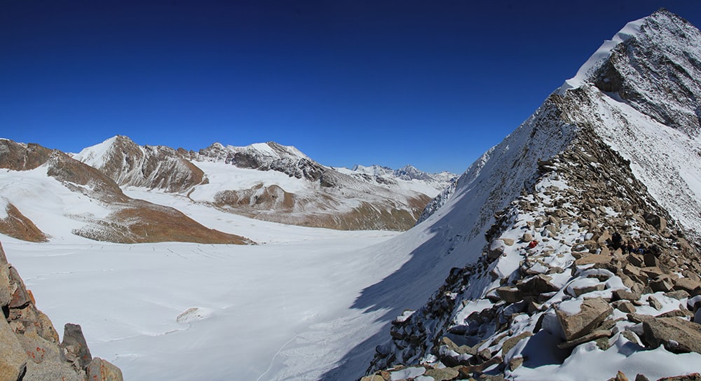
Uli Thach 8hrs camp 3962m Alt Var 2250m
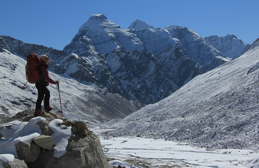
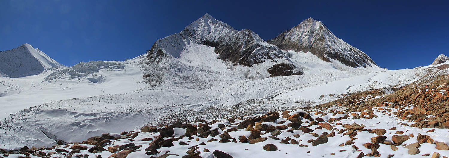
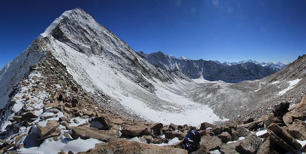
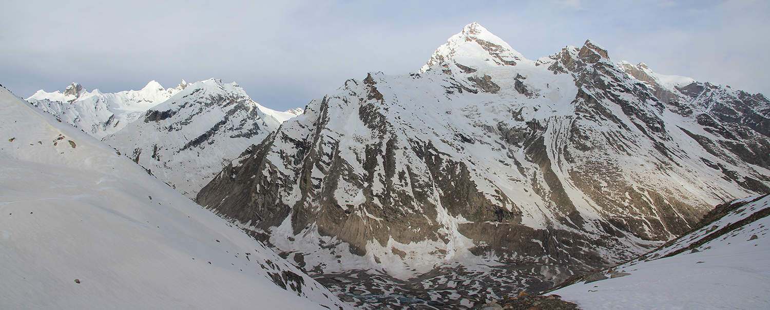
It is a steady climb up the gully above camp, then at 4750m (1 hour and 15 minutes) the gully forks. Take the left (more southerly and straight) gully that heads through some moraine lumps and then on to glacier (uncrevassed). Ahead you should be able to spot the three peak with craggy rock spires you saw yesterday, standing behind a lesser peak. Round the nearer (first) peak into a shallow basin, ahead you should be able to see the Pin-Parvati Pass (5316m, 2 hours, N31°50’08.1”, E77°50’39.6”), which lies on a saddle between the two peaks (craggy spires to your right) and is marked by a line of chorten. The most impressive peaks viewed from the pass are on the far-side of the Parvati valley; Snow Peak (6164m) and Pyramid Peak (6036m).
On the far side of the pass a very large glaciated valley stretches away beneath your feet. An old descent route headed straight down into this valley but it is now very heavily crevassed. Instead, descend and keep close (but not within rockfall range) to the base of the craggy peak to your right. You will have to walk on glacier and there are crevasses but it should be easy to avoid them. If snow conditions are bad you will need to rope up for this section.
Ahead a small rocky peak rears up from a spur that descends from the craggy peak on your right, forming a saddle (5147m, 30 minutes, N31°50’15.5”, E77°49’51.0”). You’ll need to zig-zag a bit between crevasses to reach it but once you reach the saddle the trail becomes easier. Descend steep slopes (beware of underlying ice) to a basin with a small lake sometimes used as a high camp for groups doing the reverse route. On the far side of the basin climb slightly over the rim and immediately begin descending again to a flat-bottomed valley, which is also a popular campsite (4681m, 1 hour, N31°50’21.8”, E77°48’34.2”).
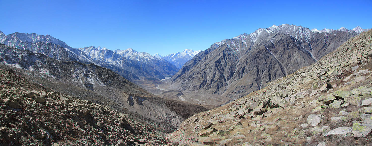
Head to the end of the valley but do not descend the steep slopes at its lip. Instead, head west (right) and follow a small trail that traverses and descends across steep grass and boulder slopes. Beware of icy sections! After 1 hour and 15 minutes you should reach the top of a steep ramp (4668m, N31°50’51.1”, E77°47’42.9”) beneath a cliff face – beware of rockfall! Descend the ramp to the Mantalai valley floor (4159m, 30 minutes, N31°51’03.9”, E77°47’31.8”) and enjoy an easy, flat walk down the valley. As you near a moraine wall that cuts across the valley you will probably have to wade some shallow rivers, but always stay on the true right side of the valley. In 45 minutes reach a small mandir and shepherd shelter that mark where the trail follows the watercourse around the moraine wall. A number of routes descend into a lower valley on the far side of the wall, all lead to a long flat-bottomed valley where the best campsites are not far away at Uli Thach (3962m, 45 minutes, N31°53’20.1”, E77°46’07.4”).
14
Thakur Kuan 5.25hrs camp 3502m Alt Var 500m
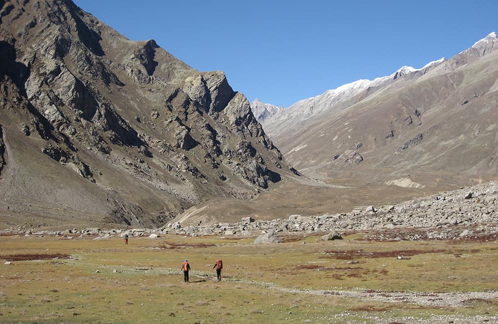
Today is a relaxing stroll after yesterday’s efforts! The Parvati glacier has carved through 35km of the Great Himalaya Range forming one of India’s most impressive alpine valleys. After the high reaches of yesterday, today begins with a 3-hour walk in an avenue of massive cliffs topped by snow-clad peaks. Remain on the true right side of the valley, crossing alluvial fans, grassy pastures and enjoy the seemingly never-ending mountain views. Note there are many campsites in this valley and those on a flexible itinerary may want to stop and explore some of the tributary valleys for a day or two.
The Parvati river slowly gains volume and after passing a major tributary flowing down from Parvati South Peak, reach a ‘stone bridge’ (3685m, 3 hours and 45 minutes, N31°56’29.8”, E77°40’15.4”). Here the trail forks, by remaining on the true right bank you’ll climb into the Dibibokri (aka Dibiganga) Nala valley and take a long detour back to the Parvati river. This route is ideal for those who want to avoid the rope-way or who want to visit Parvati North Peak and surrounding mountains. It is another 1 hour and 30 minutes to take this route if you camp at Thakur Kuan on the farside of the rope-way.
If you cross the stone bridge (really a mid-river boulder accessed by climbing a rock staircase) the trail winds downstream (true left bank) to the campsite at Thakur Kuan (3502m, 1 hour and 30 minutes, N31°57’40.2”, E77°37’55.5”) and a rope-way with a four-wheeled pulley chair.
15
Khirganga 4.25hrs camp 2758m Alt Var 1000m
Cross the rope-way to some shepherds shelters and a collapsed building probably used as a storage shed by the rope-way builders. A short 100m climb on the true right bank leads to a boulder-covered pasture and then an easy descent to a wooden bridge (3317m, 40 minutes, N31°58’10.7”, E77°36’01.3”), which you cross. The trail now remains on the true left bank for the rest of the day.
Waterfalls cascade on both sides of the valley and after a short climb, you soon enter forest of silver birch, pine and rhododendron (pink, lilac and white flowers). The trail undulates through the forest and in 35 minutes you reach an open pasture and dharamsala (3353m, N31°58’25.1”, E77°34’53.1”). The sometimes muddy trail continues in forest with many minor ups and some longer downs, and in 2 hours and 30 minutes reach the hotsprings at Khirganga (2758m, N31°59’37.5”, E77°30’34.2”). The land here is owned by the government so there are no permanent buildings except for mandirs, all visitor accommodation is either tented or made from bamboo. A relaxing dip in the hot pool here is a great reward for crossing the pass, but make sure you observe the conduct rules.
16
Barseni / Manali 2.5hrs plus 3hr drive camp 2000m Alt Var 600m
Follow the outflow from the hot springs down into a gully and the main trail, which descends through mixed forest. In about 45 minutes pass some dhabas and then a steeper switchback section leads to a wooden bridge (2396m, 1 hour from Khirganga, N32°00’03.9”, E77°29’09.4”), which you cross. The Parvati Nala has cut an impressive canyon beneath the bridge, but it may disappear thanks to a downstream hydro project.
The trail undulates to Naktan village (2400m, 45 minutes) and then descends to the Tos Nala and the hydro construction site. Climb up to the service road on the far bank and soon reach Barseni (2216m, 50 minutes, 32°00’02.4”, E77°26’31.3”) where there is a taxi stand, regular bus service to Manali and hotels.
The road down the Parvati valley passes thrugh the Shikh shrine town of Manikrama and then the hippy hangout of Chauki at the junction of the Malana valley. In about 1 hour and 45 minutes reach Kullu and cross the valley to the Manali highway. Manali is just over 1 hour further