Top
 

Annapurna Circuit, Naar, Phu

The Annapurna has much to offer those who want to explore.

Annapurna Circuit, Naar, Phu

$2730 per person

Annapurna Circuit, Naar and Phu Trek

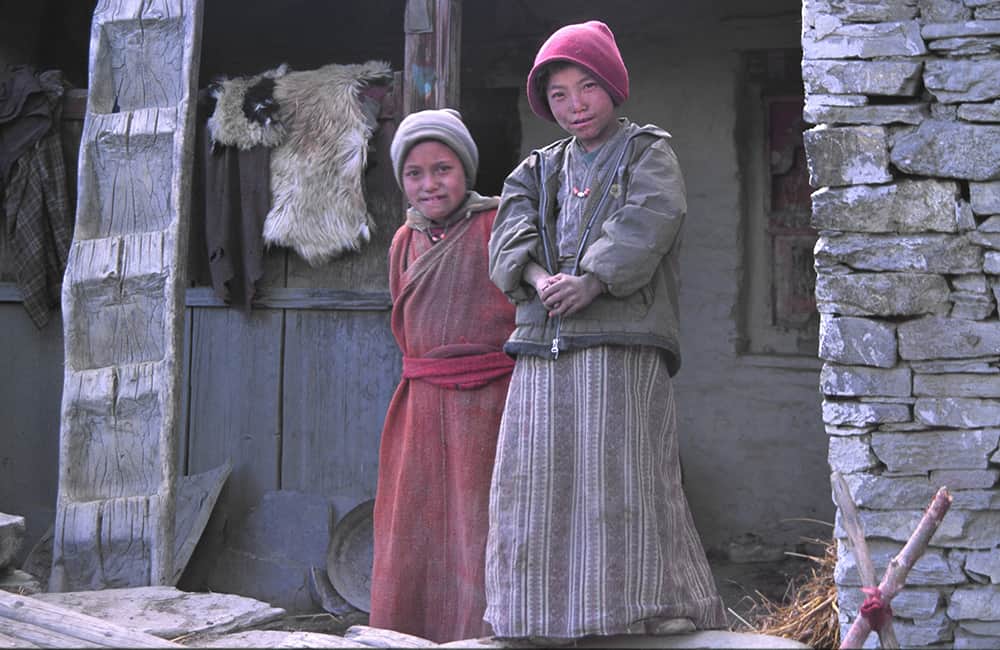
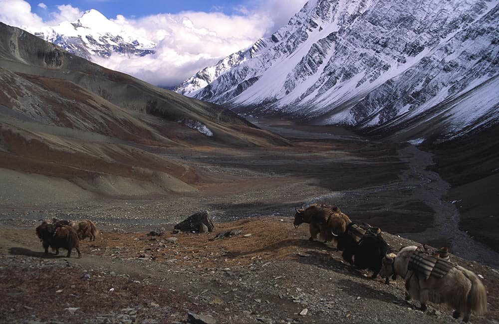
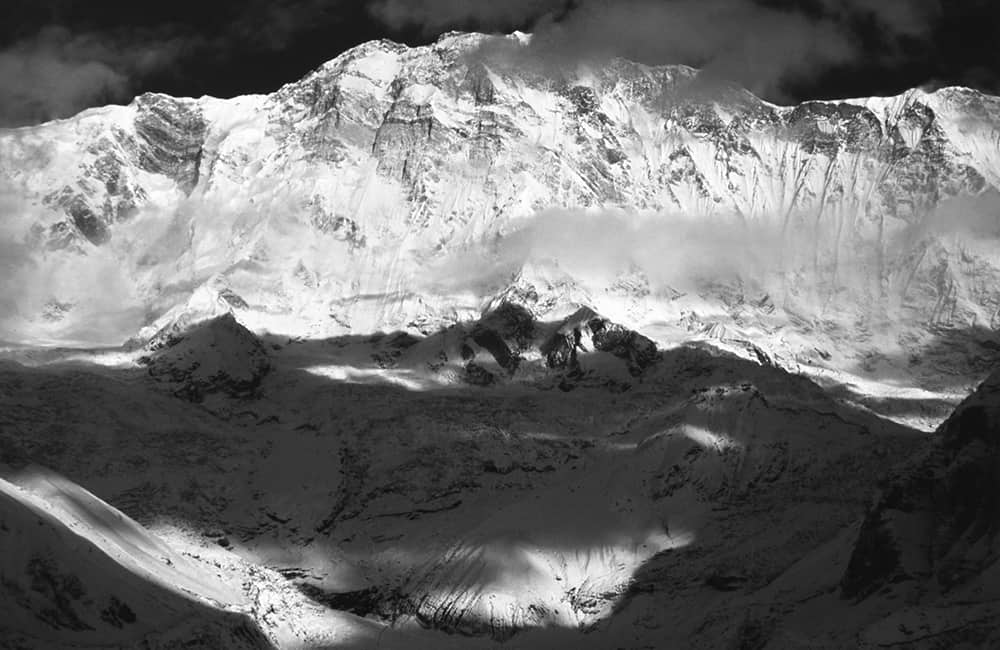
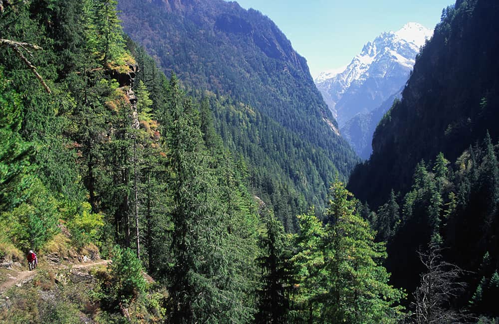
The trek to the Annapurna Circuit, Naar and Phu represents the future of trekking in the Annapurna region. Ancient Tibetan communities combine with the extraordinary alpine views from Kang La and Thorung La, and teahouses throughout. Without any doubt, the Annapurna Circuit, Naar and Phu trek is magnificent!

Key points:

  • Trekking Grade: Grade 3
  • Duration & distance: About 20 days total
  • Gradient: Short steep sections
  • Quality of path: Formed track, some obstacles
  • Quality of markings: Signs at beginning, end and major intersections
  • Experience required: Some walking experience required
  • Walking times: Less than 9 hours a day
  • Steps: Steps most days
  • Highest point: 5416m
  • Best season: Mar-May and Oct-Jan
  • Accommodation: Camping and teahouses
  • Recommended map: NP107 GHT Series Annapurna, Naar & Phu, Himalayan Map House, 2017
  • Recommended Guide Book: Nepal Trekking and the Great Himalaya Trail, Trailblazer, 2020.
Grade 3

GRADE 3

Annapurna, Naar and Phu

When to Trek Annapurna Circuit, Naar and Phu?

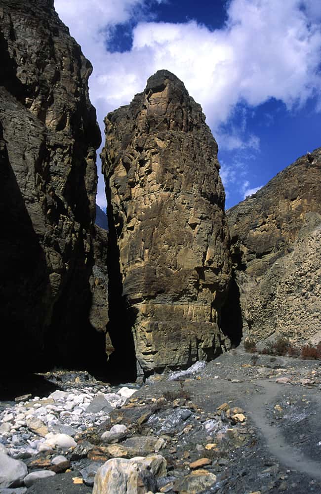
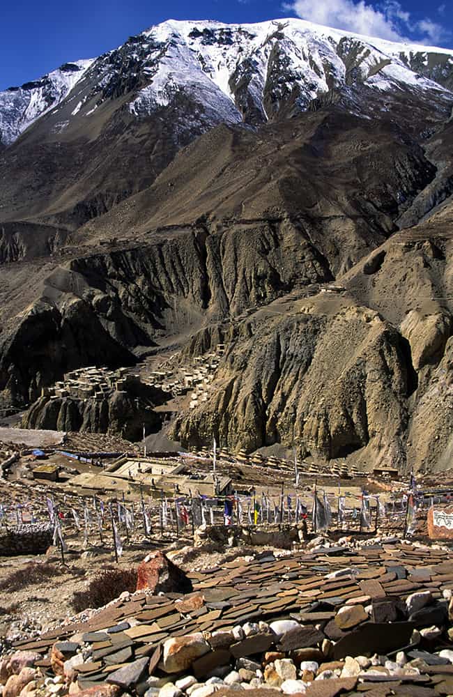
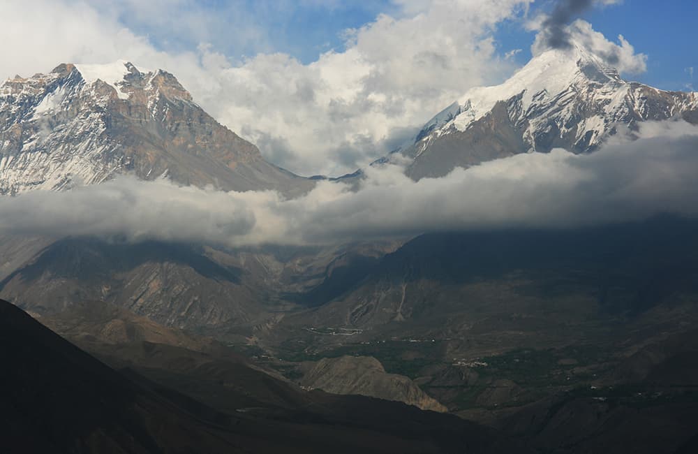
The valleys of the Annapurna Circuit, Naar and Phu are rarely closed to trekking. Only a period from February to mid-March could see the Thorung La blocked by snow. However, large amounts of snow can fall in intense storms throughout the year, so you should always be cautious of impending weather changes. Lying in the rain-shadow of the Annapurna Himal, beyond a steep-sided canyon to the north of Koto, the villages of Naar and Phu receive little rain throughout the year.

Annapurna Circuit, Naar and Phu Accommodation and Permits

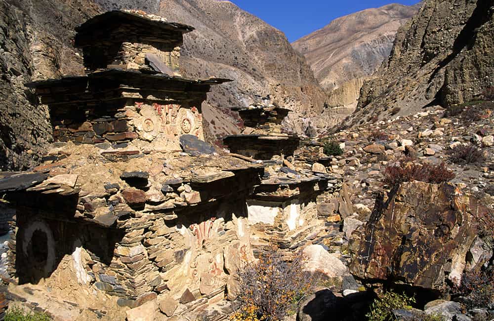
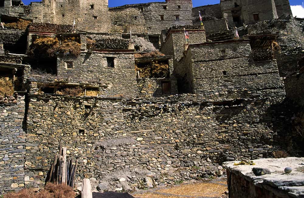
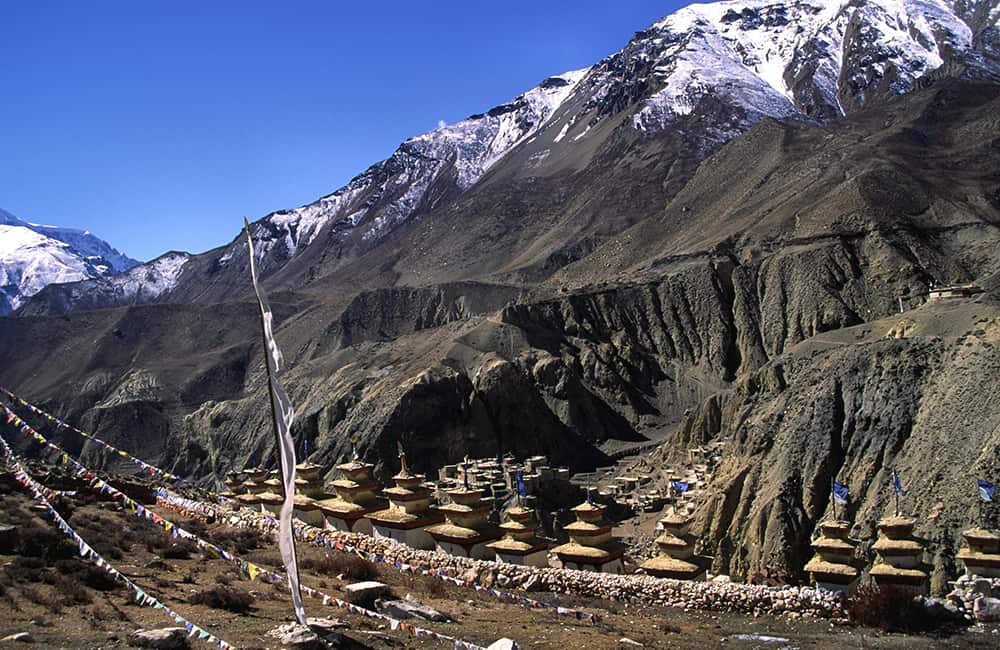
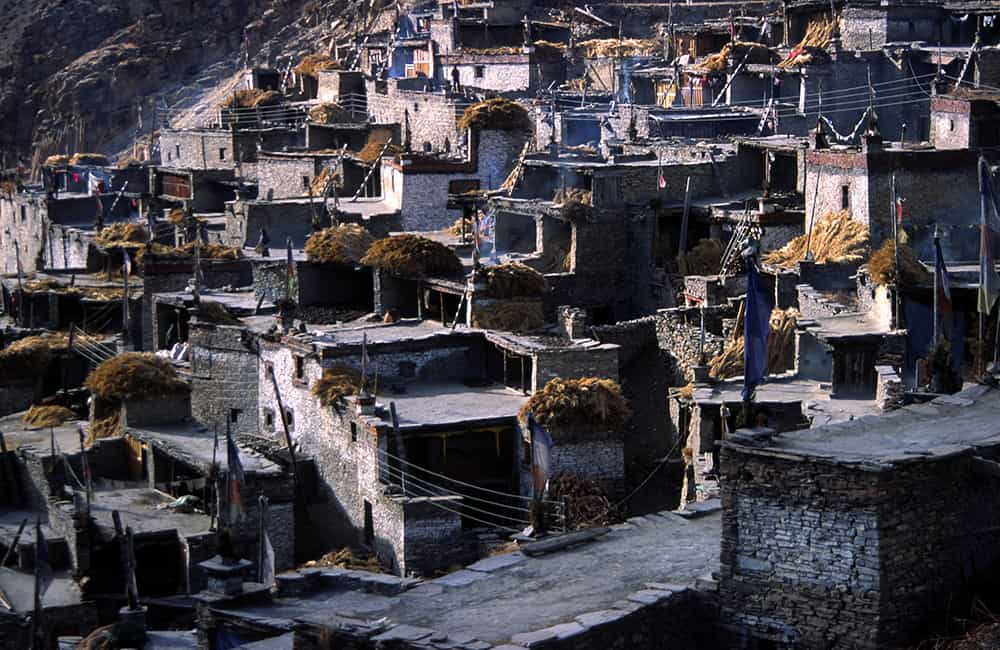
The entire Annapurna Circuit, Naar and Phu trails are well serviced by teahouses, some of which are quite luxurious with ensuite bathrooms! Phu, where there are simple teahouses, lies just a few kilometres from the Tibetan border. It’s a medieval stonewalled village that sits precariously on a rock spur overlooked by Tashi Gompa, and is also famous for the head Lama who is an expert in traditional medicine. Naar is to the south of Phu behind a popular trekking peak, Pisang Peak (6091m), and has teahouses and shops where you can purchase supplies.

The Annapurna Conservation Area Project (ACAP) is the largest protected biodiversity area in Nepal. Local community groups are pushing hard for improved services and support from Kathmandu, and have invested heavily in tourism facilities. The more tourists are attracted to the area, the more value local communities will feel their natural environment has to offer, and therefore, the more likely they will help to preserve their region. So use local facilities and services where you can and try to encourage sustainable practices at all times.

As of August 2019, you will require the ACAP entry fee of NRs 3000 per person (foreigners), NRs 1000 (SAARC nationals) and NRs 100 (Nepali nationals). Plus trekkers to the Manang District Areas of Naar, Phu, and northern area of Tilche Village and Thochhe will need the following permits:

  • From September to November US$90 per week per person.
  • From December to August US$75 per week per person.
Annapurna Circuit, Naar and Phu

Annapurna Circuit, Naar and Phu Route Options

This trek can be combined with trails to or from Mustang, or via Tilicho Lake to produce some exceptional and challenging itineraries. Most people walk in from Syange and then either fly or drive out of Jomsom. Or if you have the time, follow a new trail from Jomsom/Muktinath down the Kali Gandaki valley all the way back to Pokhara via Ghorepani (see Poon Hill and Khopra Ridge).


GHT and Other Trails in the Annapurna, Naar and Phu Region

GHT through-hikers have many trail options between Besisahar and Beni, which are the two major bus roadheads to the mountains. A few of the more popular options can be used in conjunction with the previous treks, but feel free to create your own trek. This is one of the few areas of Nepal where everywhere you go will welcome you with open arms and be able to provide good-quality tourist facilities.


Syange to Pokhara

For those returning from the Manaslu Circuit, or beginning the Annapurna Circuit, Naar and Phu trek or if you have a little extra time, this trek is a fabulous option. Often called the Royal Trek (Prince Charles from the UK once did a part of it) this trail is hardly trekked and offers a more complete Nepali experience when combined with the major tourist trails. This route description begins from below Syange and heads over to the famous picnic spot of Begnas Tal, which is a short bus ride from Pokhara.

Khudi is a 5-hour walk south from Syange (or a 60-minute jeep drive), and is where you cross the Khudi Khola on a suspension bridge. Next, take a right-hand trail that leads to Sera (870m, 30 mins). From here there is a long series of stone steps that rise above the Boran Khola to Baglungpani (1595m, 3hrs) where there are some great views of Manaslu, Lamjung Himal and the Annapurnas, with the distinctive Macchapuchhare (Fish Tail Peak) standing sentinel.

A long ridge descent via Nalma (1240m, 2hrs) brings you to the Midim Khola, a broad valley that leads down to Karputar (490m, 2½hrs). From here it is 1½ hours to Begnas Tal, which is one of Nepal’s favourite picnic spots. Catch a bus to Pokhara from here (less than an hour).
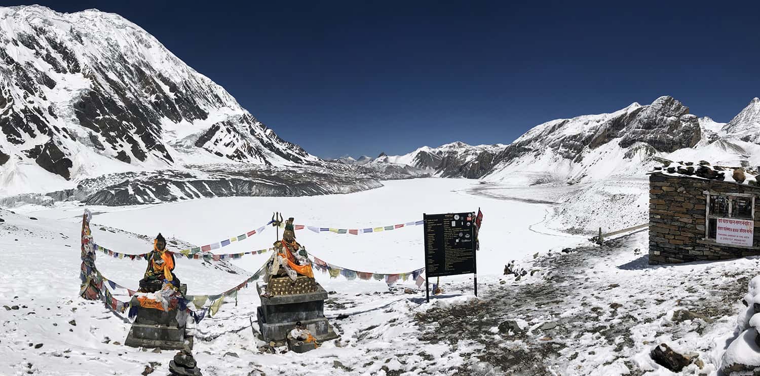
 

Tilicho Tal (Lake)

This is a wonderful side trip or route alternative to the Annapurna Circuit, Naar and Phu itinerary. For many years visiting Tilicho Tal (Tilicho Lake) was very hazardous because of dramatic/unpredictable changes in weather and potential rockfall. The potential weather danger still exists but trail improvement across both the rockfall area. The heavily iced Mesokanto La or Mandala La have made this stunning location far more accessible.

This camping-based itinerary takes 4-5 days (Manang to Jomsom) depending on prior acclimatisation and the time you want to spend enjoying Tilicho Tal views. There is a seasonal lodge at Tilicho Base Camp for those who are prepared to trek for a very long, challenging day to Jomsom, thus making a 3-day itinerary.

Take the main trail through Manang at turn left just after the mani wall outside the village. You soon join the road, which you follow until a small trail leads to a suspension bridge, which you cross (over the Marsyangdi Nadi). After a small climb and section through pine forest, the trail rejoins the road all the way to to Khangsar (3734m, 2hrs), where there are teahouses.

Walk through Khangsar and follow the road, which steadily climbs. There is a trail short-cut to the right but is hard to spot, so you might find yourself following the road all the way to Thare Gompa. Now the road ends and you climb switchbacks to Siri Kharka (4070m, 1½hrs), where there are two teahouses. About 20 minutes uphill, beyond the first teahouses, there is another, but this is only open in the main trekking season. It is now a very easy trail for about 1hr to the beginning of the main landslide and rockfall area. Care should be taken while crossing this section as rockfall is common!

It takes 30-40 minutes to cross the main landslide area to safe scrub-covered hillside, but then you round the corner of the valley to another landslide area, which only ends just before you reach Tilicho Base Camp (4150m, 2½hrs from Siri). There are three large teahouses here, which are often busy even out of season.


Up to Tilicho Lake

It’s about a 3hr climb to Tilicho Tal (4990m) on a well-formed path, and there are marker poles higher up if covered in snow. The teahouse at the lake viewpoint is very basic and only open for short periods during the main trekking season – you must check in Tilicho Base Camp if it is possible to stay.

If you want to continue to Jomsom, the safest and fastest route goes behind a minor peak to the north of the lake and crosses ‘Eastern Pass’ (5340m, 3hrs) before descending to a kharka at the northern end of the lake (4940m, 1hr). The views throughout the day are wonderful. Both Mandala Pass (aka Donkey pass, 5200m) and Mesokanto La (5350m) are 1½-hour climb away.

You should very carefully assess the descent from either pass before committing yourself!

From either pass, it is a very long descent on poorly formed trails that are often confused with animal tracks in patches of thorn bush. There are no rest or good camping sites before you reach Thinigaon (2840m, 5hrs) and then to Jomsom (2720m, 30 mins), where there are many good teahouses.


Teri La – from Naar to Lo Manthang [by Ade Summers]

This camping-only trek takes 8 days from Naar without acclimatisation time. As well as a Naar–Phu and ACAP permit, you will also require a Mustang controlled area permit; see Mustang.

From Naar, first ascend the Lapse Khola (aka Labse Khola) on a clear but undulating trail to a campsite in 6-7 hours. A good trail continues to follow the Lapse Khola to the next camp in 5 hours. You now cross back and forth over the Lapse Khola to approach the high camp (5225m, 3hrs) before the pass. Contour up the valley, then start gaining height. You can see Teri La on the left (eastern) skyline, and you’ll soon see the prayer flags.

It is a steep gully ascent to Teri La (5595m, 4hrs) where there are great views of the Dhamodhar Himal, Dhaulagiri, the Annpaurnas and many peaks in Mustang.

It is a steep descent (possibly in snow) into the next valley, where the gradient eases to a good lunch spot beside a river at 5050m (1hr). Follow the valley and then climb a rocky ridge with a small scramble section. Turn right (north) and traverse the ridge to reach a grassy and less rocky ridgeline. Another steep descent brings you to a camp beside the Yak Khola (4730m, 3hrs).


Once Over the Teri La

Remain on the true right side of the valley as you continue descending, crossing minor spurs and a landslide area to a possible lunch spot after 3 hours at 4470m. Continue descending to a confluence of two rivers where there is a steep drop on a zig-zag rocky path. Cross the interesting Dhakrung Khola and climb the far ridge. Contour around a second ridge to a minor pass and then turn sharp right and descend into the Samena Khola valley. Cross the river and a short climb to a big wash out area and campsite at Yakpa (4370m).

It’s a steep climb passing an old deserted village, Purano Kog. The trail can be a bit loose and exposed. Ascend a zigzag path up to a ridge for about 500m before the gradient eases across a flat-ish plateau, with amazing views of Dhaulagiri, Nilgiri and Tilicho. Cross a minor ridge at 4730m before traversing around two ridges and descending into the arid Tengga valley. Entering the village is an amazing sight, first crossing a long suspension bridge and then passing the village Kani and Mani walls.

There is a campsite beside the village (3240, 6hrs). Climb about 200m to the plateau behind Tengge, where there are some incredible eroded rock flutes. Descend to a lunch spot near the river, where there are more views of Dhaulagiri. After lunch cross the Dhechyang Khola, which can be tricky and ascend a steep moraine wall.

Once on top traverse across a plateau and then descend to Yara Gaon (3650m) via a good bridge. An easy walk takes you down the valley to the valley junction with the Kali Gandaki river, where you cross a good bridge at Dhi Gaon (3450m, 5hrs). It’s then a steep climb to the Lo Manthang trail (3809m, 6hrs, see South-east of Lo Manthang).

How Much does the Annapurna, Naar and Phuntsho Trek Cost?

To help you budget and plan, we’ve made a comprehensive costing explanation on How Much Does the GHT Cost? But here’s a simplified breakdown.

GHT Annapurna, Naar and Phu Trek for 20-days estimated costs:

  • Solo as much as possible US$3,990.
  • Twin-share with minimum guiding US$2,730 per person.
  • Twin-share fully supported US$5,280 per person.

Do you have any questions about costs? Please Get in Touch for more details.

Annapurna Naar and Phuntsho Braga Village

Customisation is Normal

Want to do things a little differently? Maybe take some extra time, or go a bit faster? Or avoid technical sections or combine with other trails? Every GHT trek is different and that changes the price, but please feel free to Get in Touch to ask questions and how to customise your own trek.


Bookings

Please note that www.greathimalayatrail.com does not handle bookings for treks. We are here to inform you about the trails and logistics, but you will need to book through a registered trekking operator in Nepal. If you would like an operator recommendation or feedback on a company you are already talking to, then please Get in Touch.

Your Impacts on the Annapurna, Naar and Phu Trek

Annapurna Naar and Phu Social Impact SOLO

Solo (Independent)

Social, GHG and waste impacts are all not bad compared to other treks.

The long wilderness section means you will have a heavy load of food and fuel, so we expect you’ll try to minimise waste as much as possible.

Annapurna Naar and Phu GHG and Waste Impact SOLO
Annapurna Naar and Phu Social Impact TWIN

Twin Share (Independent)

Social, GHG and waste impacts are all not bad compared to other treks.

The long wilderness section means you will have a heavy load of food and fuel, so we expect you’ll try to minimise waste as much as possible.

Annapurna Naar and Phu GHG and Waste Impact TWIN
Annapurna Naar and Phu Social Impact CAMPING

Camping (supported)

The social impact is not high due to the wilderness section. But GHG and waste impacts are high.

Consider using fuel efficient stoves and using teahouse kitchens for cooking where possible as both will reduce your GHG footprint.

Annapurna Naar and Phu GHG and Waste Impact CAMPING

For more information about social, Green House Gas and waste impacts of treks, see The Impact of your Trek.

  • Destination
  • Departure
    Kathmandu
  • Dress Code
    Mid-altitude alpine clothing and camping equipment required
  • Included
    Annapurna Circuit, Naar, Phu
  • Grade
    Grade 3
  • Idea Date Range
    15/10/2021
  • Style of Trek
    Camping and some teahouses
1
Day 1: Pokhara–Besisahar–Chyamche 10hrs’ drive
A new road has been built to Manang however, most trekkers start walking from Syange through the impressive Kali Gandaki gorge as there are some wonderful trail sections to help get you trail-fit.The village of Chyamche (1430m) is a popular jeep-stop for commercial vehicles and there are many teahouses to choose from. Getting here takes about 10 hours from Kathmandu or 6 hours from Pokhara. The drive follows the Marsyangdi river, which you will continue to follow in the days to come. Almost all the villages in this region are Gurung communities, which are noted for their friendliness, jovial spirit and excellent work ethic. Syange to ChyamcheSome public transport stops at Syange and you should check before purchasing the ticket. So, if you are dropped at Syange or prefer to begin the trek here, the following covers the trail section to Chyamche.From Syange the Marsyangdi river has cut a gorge, which becomes steeper and steeper as the day goes on. Follow the road out of the village on the true right (west) bank, heading north; like every riverside route, it has lots of up and downs and you will have to sesarch for sections of where the old trail breaks away from the road. It takes 1½ hours to reach Jagat (1300m), which was once a customs post for the salt trade with Tibet. The trail continues to undulate beside the river, which causes frequent landslides during the monsoon. Beyond the village, cliffs form the far bank and the valley becomes noticeably narrower. About 45 minutes after Jagat, the walking trail branches left after a small collection of road-side homes, it now feels like you are really on a trekking route! In another 30 minutes you enter Chyamche (1430m) where there are some pleasant teahouses.
2
Day 2: Chyamche–Tal–Bagarchhap 4hrs
At the end of the community, take the path that descends from the road to your right to a suspension bridge to the true left (east) bank of the gorge. Climb about 200m to Sattale (1680m), which marks the narrowest section of the valley. A landslide-prone trail then climbs a little to a broad flat-bottom valley and the village of Tal (1700m, 1½hrs), which marks the official entry to Manang District.Beyond Tal the trail is mostly very easy with some small up and downs and after about 1 hour you come to a fork where the left trail clearly drops to a suspension bridge – do not descend! – take the right fork, which climbs a little and then undulates to Khotro (aka Karte, 1 hour, 1850m). Continue through the village to a suspension bridge that leads to Dharapani (30 minutes, 1860m), a Gurung commun ity where there are many teahouses spread along the road for nearly 1km.Next, follow the route of the new road to the outskirts of Bagarchhap (2160m, 1hr), which you cut through to rejoin the road on the far side of the village. There was a devastating landslide here in 1995; a memorial in the centre of the village only mentions the tourists who died. At the far end of the village there are good views of the Annapurnas and sections of the Lamjung Himal.
3
Day 3: Bagarchhap–Koto 4hrs
From Bagarchhap, continue along the route of the new road to Danakyu (2300m, 35 mins). This is also the main workers site for a Chinese-funded hydro project, so the character of the place has deteriorated in recent years. Beyond the sprawling village, the trail climbs steeply for about 400m through thick pine and fir forest – make sure to turn around regularly to check for views of the Manaslu Himal – before arriving at Timang (2750m, 1 hour and 20 minutes). There are a few teahouses in Timang, any of which make an ideal rest stop with great views of the Lamjung Himal.Continue along a flat-ish trail to Latamro (2695m, 45 mins), where you descend to and then climb away from a gushing tributary before arriving at Thanchok (2670m, 20 mins). This is a large and often dirty village, but there is a nice teahouse beyond the main settlement, just before re-joining the road for a long and easy descent to Koto (2600m, 50 mins), where there are teahouses and campsites. Annapurna Circuit Trail from Koto to NgawalTo continue on the Annapurna Circuit from Koto takes 1½ days to reach Ngawal if you want to avoid Naar and Phu.Follow the road to Chame (2675m, 20 minutes) where there are many teahouses and tourist services. Walk through the village on stone paving and cross a suspension bridge to the true left (north) bank of the Marsyangdi Nadi and there are another couple of teahouses near some hot springs. Continue to follow the road route to Talekhu (40 mins), where the valley narrows to steep cliffs on either side. In the middle of the next gorge section is a large apple juice factory and luxury lodge at Bratang (2850m, 1 hour), but there is no other accommodation.Continue following the road and cross a suspension bridge to the true right bank (south) of the Marsyangdi Nadi ion 45 minutes. The trekking trail switchbacks up about 200m through forest, which is badly littered with rubbish, before the trail straightens and you then rejoin the road to Dhikur Pokhari (3060m, 1 hour). You have now walked through a massive bend in the Marsyangdi river and an enormous concave rock wall rises to your right.At the end of the community there is a broken mani wall and a sign indicating to the right, the trekking route to Upper Pisang (3300m, 1 hour), which is on the true left (north) side of the river. There is lots of teahouses here but chek the water quality as the local source isn’t good quality for much of the year.From Upper Pisang, follow a very easy trail through pine forest to the bootom of a steep switchback climb to Ghyaru (3670m, 1½hrs), where there are some teahouses and excellent views of Annapurna II and IV.The trail is again easy all the way to Ngawal (3600m, 1½hrs) but consider stopping for a cup of tea at the viewpoint teashop – the earlier you arrive, the longer you will want to stay to soak-up the view! There are plenty of teahouses in Ngawal, including a luxury lodge!See Day 12: Ngawal/Humde–Manang, to continue to Manang and the remainder of the Annapurna Circuit.
4
Day 4: Koto–Singenge 6¼hrs
At the end of Koto village there is a traditional stone doorway and a police checkpost. After registering, descend and cross a suspension bridge to the true left bank and follow a trail into the Naar-Phu Khola gorge, which has been blasted from a sheer rock-face. The gorge quickly narrows and the surrounding pine and fir forest obscure any views.After 2½ hours, cross a bridge to the true left (east) bank of the Naar-Phu Khola and pass a broad grassy campsite. In less than 30 minutes you will cross a suspension bridge over the Seti Khola tributary. Huge boulders almost obscure the river, which you follow for another 1¼ hours to the second major river obstruction. The trail now becomes steeper and the gorge closes in to form a canyon. The river roars as it crashes against a third and then a fourth series of boulders deposited by ancient landslides. After the last series of boulders cross a wooden bridge (3180m, 30 mins) to the true right (west) bank and follow a trail gouged from a cliff-face. After another 30 minutes re-cross the river to the true left bank and climb through a forested section of trail, then around a cut-away formed by a waterfall over the path before a short final climb to the stone huts of Singenge dharamsala (3230m, 1hr), where there is a small campsite.
5
Day 5: Singenge–Kyang 5½hrs
The trail remains in the valley bottom for about 30 minutes then crosses a small bridge over a tributary and climbs for about 250m to the seasonal settlement of Meta (3560m, 1hr). As you reach the top of the climb there are good views back down the Naar-Phu Khola to Annapurna II and Lamjung Himal. You can also see a large chorten in the valley bottom near some bridges, which eventually lead to Naar village over a deep gorge – you will take this route on your return from Phu.The trail now makes an easy traverse of azalea-covered hillside to a broad clearing at Junam Goth (3690m, 2¼hrs). The trail dips down to the Junam Khola and then climbs to the twin villages of Chyako (3720m, 30 mins), which are seasonal settlements shared by both the Naar and Phu villagers. From Upper Chyako, the trail climbs a little before crossing the Mruju Khola, which is the outflow of the Lyapche Glacier above. The trail now climbs and crosses an eroded section of moraine which offers excellent views back down the valley to Pisang Peak and to the north of Kyang (3850m, 1¼hrs), where there is a good campsite.
6
Day 6: Kyang–Phu 4¾hrs
The trail enters a narrow gorge that runs due north from Kyang; follow a trail cut away from a large cliff-face before descending to the river. Do not cross a small wooden bridge over the river, instead continue heading north on the true left side of the river, which swings north-east after 2 hours. The valley now opens up and you pass some derelict chorten, the valley ahead looks completely uninhabitable. Keep watch for blue sheep on the cliff-faces on the far bank. The trail stays beside the river until you can see a large pinnacle of rock standing across the entrance of a gorge. With a little imagination you can see faces in the rock surface, which are said to be evil spirits that have been trapped by the valley guardian. A narrow and steep trail climbs to the right of the rock pinnacle to a doorway and mani wall (4020m, 2hrs), which offers views of the valley ahead.The trail winds around the eastern hillside above a deep gorge before descending slightly to a series of deserted buildings and large chorten. Cross the bridge to the true right bank to see the chorten, or continue on the true left (eastern) bank to a suspension bridge, which you must cross to reach the village of Phu (4100m, 45 mins).
7
Day 7: Phu all day
The locals say that the dry-stone walled village of Phu has been here for 800 years, which is easy to believe when you start exploring. Take your time and if you are lucky you might be invited into a home for some salt-butter tea. On the far side of the river above Phu is a peninsula of loose rock carved by two rivers. Climb to the top to visit Tashi Gompa and the inspiring amchi, traditional Tibetan medicine doctor, Lama Karma. The Lama has many stories to tell and may invite you for a puja ceremony.Note: A number of trekking/mountaineering groups have crossed from Upper Mustang to Phu via a series of snow plateaus and passes through the Damodhar Himal; it takes 8-10 days and is extremely challenging, involving mountaineering skills, difficult navigation and very high altitudes over 6000m.
8
Day 8: Phu–Junam Goth 4½hrs
As today is an easy trek, you might try to organise a morning puja ceremony with Lama Karma. Retrace your steps down the Phu Khola, through Kyang and Chyako to the campsite at Junam Goth.
9
Day 9: Junam Goth–Naar 5hrs
Continue down the same trail to a point where you can see the bridges to Naar. A loose and sometimes steep trail descends towards the bridges, marked by an ancient and derelict tower (3570m, 1¾hrs). You may prefer to cross the 80m deep gorge on the new suspension bridge rather than the original wooden and dry-stone version. From the bridge climb a broad trail, where there are good views of Pisang Peak and Kang Guru. After 2¼ hours you will reach a large chorten and long mani wall where the gradient eases. Continue for less than an hour to Naar village (4110m), built in a natural bowl with many terraced fields beneath. There is an excellent camping area above the village.Note: The valley behind (to the north) Naar is a route to Tengge in Upper Mustang, via Teri La, see Teri La – from Naar to Lo Manthang – by Ade Summers. This route doesn’t offer many water sources, especially in the pre-monsoon months of April and May. You also need a Mustang trekking permit to complete this route to Ghemi (5-6 days), for further information see the Mustang chapter introduction.
10
Day 10: Naar– Kang La Phedi/Glacial Lake 2½–5¾hrs
Leave the village on a trail that passes the small hydro plant and then climbs a little to a broad U-shaped valley to the west of Naar. An easy gradient climbs past yak herding pastures and kharka for 2 hours to Kang La Phedi (4530m), where there is a good campsite. This is the largest campsite before the pass and you should consider staying here if you are in a group of more than 8 trekkers. The trail climbs away from the pastures below and then steepens on a rocky trail, which is often icy. After 2½ hours you will reach a small flat area of loose scree (5020m), where the trail again steepens before arriving at a small glacial lake (5245m, 1¼hrs), where there is a small campsite on scree.
11
Day 11: Kang La Phedi/Glacial Lake – Ngawal/Humde 4¼-7¾hrs
If you camped at Kang La Phedi it will take less than 4 hours to reach the top of the pass. For those who camped at the glacial lake it will take less than 30 minutes to reach the summit of Kang La (5306m). The pass is about 3 metres wide and decorated with many prayer flags. There are good views from the summit but they improve when you descend a little and can see past the rock wall to your right. Peeking over the ridge joining Annapurna III and IV is the summit of Machhapuchhare (Fish Tail Peak). To the west you can spot Tilicho Peak and the entire Manang valley. The Annapurna Circuit trail lies about 2000m down in the valley below. From the pass, descend steep scree slopes while being careful not to cause rockfall, to roughly 4500m (1½hrs) where the trail becomes firmer underfoot. The trail is easy to follow all the way to azalea and rhododendron bushes, where it then descends a ridge to the village of Ngawal (3660m, 2¼hrs). If you are flying out from Humde (3280m, 1hr), continue down through the village and cross a suspension bridge to the west of the airstrip and the village, but only go there if you really have to!
12
Day 12: Ngawal/Humde–Manang 3hrs
Follow the main trail through the upper section of the Ngawal community, do not head down through the village. An easy trail leads to the Lopheling Monastry before descending steeply for about 200m into a pretty pine-forested valley. The very small commun ity of Julu (3500m, 1 hour) has two small teashops where you can also have a simple lunch if you had a late start.Head down the valley, first following a rough dirt road, but then on clearly marked trail into the main Marsyangdi valley. The trail gradually turns right (west) and joins the road that leads to Munchi (Mugji, 3330m, 1½hrs). The 600-year-old village of Braga (3467m, 30 mins), which is not far and has good teahouses and a fabulous gompa. Manang (3540m, 20 mins), is very close ahead, where there are many teahouses and campsites, as well as a maze-like village that dates back hundreds of years. For trekkers on the Annapurna Circuit, Manang is an acclimatisation stop so there are many more services, restaurants and teahouses than you will have come across so far!
13
Day 13: Manang–Thorung Phedi 5½hrs
Just beyond Manang is the village of Tangki (3530m, 20 mins), which overlooks the entire community. The trail now swings north and climbs gently to a stone wall with a gate that stops livestock from leaving the high pastures. Do not allow any animals to pass through the gate; if it is locked, use the stone steps to your right. Not much further is Ghusang (3950m, 1hr from Tangki), where you can enjoy some great views of the Chulu Himal, Annapurna III, Gangapurna, Tare Kang (Glacier Dome), Khangsar Kang (Roc Noir) and Tilicho Peak. An easy gradient leads to a suspension bridge over the Ghyanchang Khola, where there are a couple of small teashops (40 mins). In another hour you will reach Yak Kharka (4050m), where there are a few teahouses beneath a slight rise to another teahouse. The trail now climbs fairly constantly at an easy gradient to Ledar (4200m, 40 mins), where there are some simple teahouses, and continues across a hillside covered with many trails. At the first major trail junction take the right, straight route rather than descending to the river. At the next trail junction, take the left-hand straight route, rather than climbing. After 50 minutes from Ledar the trail descends to a wooden bridge over the Kone Khola, which you cross before climbing to a teashop that is expensive (20 mins). It’s now an easy 35 minutes to Thorung Phedi (4450m) where there are extensive teahouses and services.
14
Day 14: Thorung Phedi– Muktinath 9hrs
It is a good idea to get a pre-dawn start from Thorung Phedi to avoid the strong winds that often affect the pass after 11am. There are 4 large ‘steps’ up to Thorung La (5415m); the first is a steep climb up scree to Thorung ‘Base Camp’, a decrepit and expensive teahouse and dirty campsite (4830m, 1hr). The trail now winds through a watercourse before climbing through another, larger gully formed by the melt from a glacier on the eastern side of Thorung Peak. In one hour from ‘Base Camp’ you reach a well-built dharamsala at 5100m, which also offers a campsite for those wanting a genuine high camp (ensure you are well acclimatised). From here it’s 1½ hours across undulating moraine to the top of Thorung La, where there is a teashop in peak trekking season, but expect to pay handsomely for a drink! On a clear day you should be able to see some of the Annapurna range to the south and Mukut Himal bordering Dolpo to the west.From the pass the trail descends steeply over scree, which gives way to grassy meadows before reaching Muktinath (3760m, 3hrs). This large village is a very important pilgrimage site for Hindus and Buddhists, who live in a sacred compound around an eternal flame-from-water. Take some time to visit the famous Hindu temple with 108 carved spouts from which holy water flows, making a cold shower for the brave!Note: Muktinath is also a major trail junction to Dhi in Upper Mustang, see South-east of Lo Manthang.
15
Days 15-16: Muktinath–Kagbeni–Jomsom–Pokhara 4¼hrs
The valley around and beneath Muktinath has five Buddhist gompas and many Hindu shrines. The trail is broad and busy with four-wheel-drive cars and motorcycles ferrying Hindu pilgrims from Jomsom. From Muktinath, take a trail that descends towards and then through Jharkot (3550m, 30 mins). From here you can avoid the motor road (a 60-min jeep trip to Jomsom, or 40 mins to Kagbeni) by following a small irrigation stream to Khingar (3280m, 20 mins) but from here you will have to take the road route. Make sure you have a scarf or similar to cover your face against dust kicked up by jeeps, or the fierce afternoon wind. Once you reach a broad, flat plateau as you enter the main Kali Gandaki valley there is a shortcut track to Kagbeni (2810m, 70 mins), which avoids the road.Note: to avoid Kagbeni you can continue on the road route to Jomsom (1½hrs).Kagbeni is a delightful village that used to be the Nepal/Tibet border, see Mustang Circuit, day 2, pp000-00. Kagbeni lies in the bottom of the windswept valley floor of the Kali Gandaki, said to be the deepest river gorge in the world because of the twin 8000m peaks of Annapurna and Dhaulagiri above. The gompa in the middle of the old village is in good condition, and look for the male and female protectors at either end of old boundary wall. The airstrip at Jomsom is 2½ hours (or a 20-minute drive by jeep) to the south, where there are many teahouses and services. There are regular morning flights from Jomsom to Pokhara; the later flights have more potential to be delayed.Note: If you are delayed because of bad weather in Jomsom, there is an excellent and easy day trip down to Marpha village and back to Jomsom (4hr round trip). Marpha is the centre of the Thakali community and site of a good-quality apple brandy distillery. The locals also make cider and apple pie, both of which are very popular with trekkers!